jsonp({"type":"FeatureCollection",
"features":[
{
"type":"Feature",
"geometry":
{
"type":"Point",
"coordinates":[11.536520,63.993970]
},
"properties":
{
"markerid":"13",
"layers":["2"],
"requested_layer":["2"],
"markername":"Oftenåsen",
"basemap":"custom_basemap",
"lat":"63.993970",
"lon":"11.536520",
"icon":"shootingrange.png",
"zoom":"14",
"iconUrl":"http://verdalsportalen.no/wp-content/uploads/leaflet-maps-marker-icons/shootingrange.png",
"address":"",
"text":"Gps-posisjon: 63.993970 / 11.536520
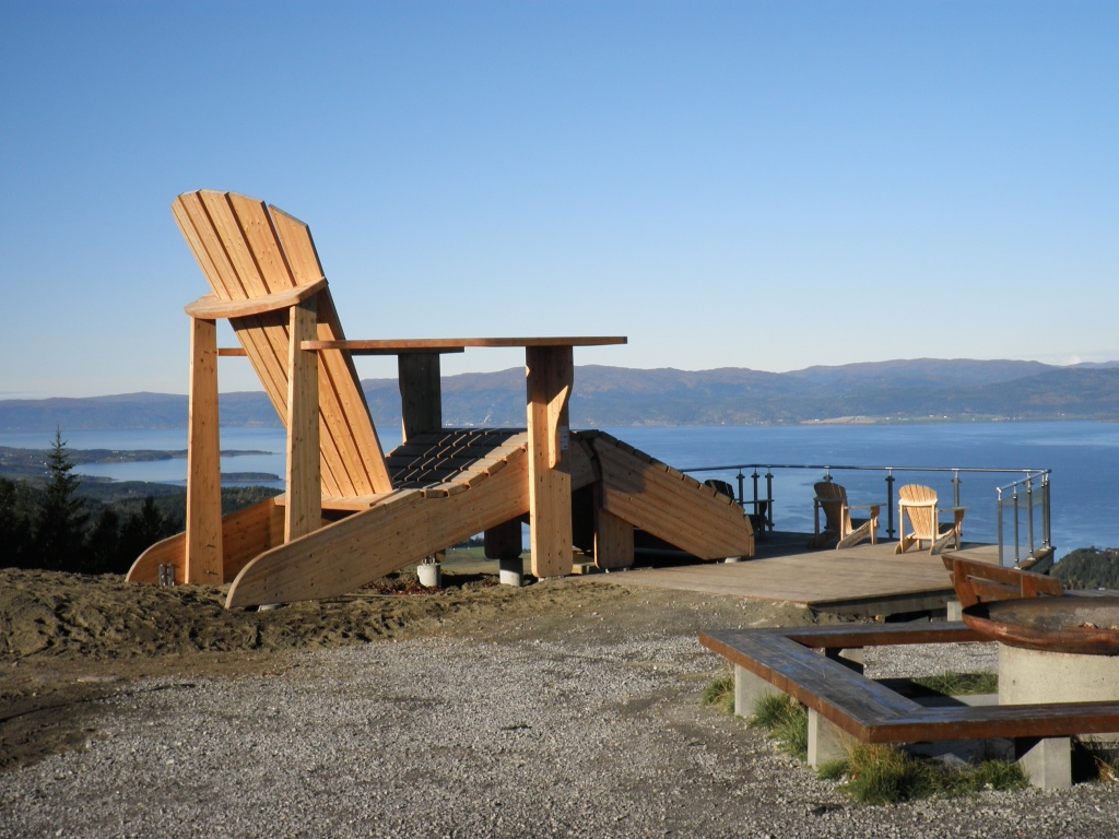
Oftenåsen med peilehytta er et naturlig utfartsted i Steinkjer. På toppen ligger Peilehytta med servering (søndager 11-15) og det er fantastisk utsikt over Steinkjer by, fjorden, Ogndalen og sørover mot Leksdalsvatnet og med Hermannssnasa tronende i bakgrunnen. På toppen finner du også verdens største hagestol.
",
"dlink":"http://maps.google.com/maps?daddr=63.993970,11.536520&t=m&layer=1&doflg=ptk&hl=no&om=0",
"openpopup":"0",
"mapwidth":"640",
"mapwidthunit":"px",
"mapheight":"480",
"marker-createdby":"omlarsen",
"marker-createdon":"2017-05-26 00:00:00",
"marker-updatedby":"omlarsen",
"marker-updatedon":"2017-05-27 00:00:00",
"layerid":["2"],
"layername":"Andre turforslag",
"layer-createdby":"omlarsen",
"layer-createdon":"2017-05-20 00:00:00",
"layer-updatedby":"omlarsen",
"layer-updatedon":"2017-05-20 00:00:00",
"controlbox":"1",
"overlays_custom":"0",
"overlays_custom2":"0",
"overlays_custom3":"0",
"overlays_custom4":"0",
"wms":"0",
"wms2":"0",
"wms3":"0",
"wms4":"0",
"wms5":"0",
"wms6":"0",
"wms7":"0",
"wms8":"0",
"wms9":"0",
"wms10":"0",
"kml_timestamp":"",
"gpx_url":"",
"gpx_panel":"0",
"mlm_filter":"1",
"mlm_filter_details":""
}},
{
"type":"Feature",
"geometry":
{
"type":"Point",
"coordinates":[12.434980,63.852550]
},
"properties":
{
"markerid":"42",
"layers":["1"],
"requested_layer":["1"],
"markername":"Seterfjellet hitre 24",
"basemap":"custom_basemap",
"lat":"63.852550",
"lon":"12.434980",
"icon":"markerR.png",
"zoom":"11",
"iconUrl":"http://verdalsportalen.no/wp-content/uploads/leaflet-maps-marker-icons/markerR.png",
"address":"",
"text":"
",
"dlink":"http://maps.google.com/maps?daddr=63.852550,12.434980&t=m&layer=1&doflg=ptk&hl=no&om=0",
"openpopup":"0",
"mapwidth":"640",
"mapwidthunit":"px",
"mapheight":"480",
"marker-createdby":"omlarsen",
"marker-createdon":"2017-05-02 00:00:00",
"marker-updatedby":"omlarsen",
"marker-updatedon":"2017-05-02 00:00:00",
"layerid":["1"],
"layername":"Kjentmannstopper",
"layer-createdby":"omlarsen",
"layer-createdon":"2017-03-28 01:23:49",
"layer-updatedby":"omlarsen",
"layer-updatedon":"2021-06-29 23:09:58",
"controlbox":"1",
"overlays_custom":"0",
"overlays_custom2":"0",
"overlays_custom3":"0",
"overlays_custom4":"0",
"wms":"0",
"wms2":"0",
"wms3":"0",
"wms4":"0",
"wms5":"0",
"wms6":"0",
"wms7":"0",
"wms8":"0",
"wms9":"0",
"wms10":"0",
"kml_timestamp":"",
"gpx_url":"",
"gpx_panel":"0",
"mlm_filter":"1",
"mlm_filter_details":""
}},
{
"type":"Feature",
"geometry":
{
"type":"Point",
"coordinates":[11.428910,63.838060]
},
"properties":
{
"markerid":"43",
"layers":["1"],
"requested_layer":["1"],
"markername":"Høgkammen 30",
"basemap":"custom_basemap",
"lat":"63.838060",
"lon":"11.428910",
"icon":"markerR.png",
"zoom":"11",
"iconUrl":"http://verdalsportalen.no/wp-content/uploads/leaflet-maps-marker-icons/markerR.png",
"address":"",
"text":"
",
"dlink":"http://maps.google.com/maps?daddr=63.838060,11.428910&t=m&layer=1&doflg=ptk&hl=no&om=0",
"openpopup":"0",
"mapwidth":"640",
"mapwidthunit":"px",
"mapheight":"480",
"marker-createdby":"omlarsen",
"marker-createdon":"2017-05-02 00:00:00",
"marker-updatedby":"omlarsen",
"marker-updatedon":"2017-05-02 00:00:00",
"layerid":["1"],
"layername":"Kjentmannstopper",
"layer-createdby":"omlarsen",
"layer-createdon":"2017-03-28 01:23:49",
"layer-updatedby":"omlarsen",
"layer-updatedon":"2021-06-29 23:09:58",
"controlbox":"1",
"overlays_custom":"0",
"overlays_custom2":"0",
"overlays_custom3":"0",
"overlays_custom4":"0",
"wms":"0",
"wms2":"0",
"wms3":"0",
"wms4":"0",
"wms5":"0",
"wms6":"0",
"wms7":"0",
"wms8":"0",
"wms9":"0",
"wms10":"0",
"kml_timestamp":"",
"gpx_url":"",
"gpx_panel":"0",
"mlm_filter":"1",
"mlm_filter_details":""
}},
{
"type":"Feature",
"geometry":
{
"type":"Point",
"coordinates":[11.403330,63.821900]
},
"properties":
{
"markerid":"44",
"layers":["1"],
"requested_layer":["1"],
"markername":"Blåberga (33)",
"basemap":"custom_basemap",
"lat":"63.821900",
"lon":"11.403330",
"icon":"",
"zoom":"14",
"iconUrl":"http://verdalsportalen.no/wp-content/plugins/leaflet-maps-marker-pro/leaflet-dist/images/marker.png",
"address":"",
"text":"",
"dlink":"http://maps.google.com/maps?daddr=63.821900,11.403330&t=m&layer=1&doflg=ptk&hl=no&om=0",
"openpopup":"0",
"mapwidth":"640",
"mapwidthunit":"px",
"mapheight":"480",
"marker-createdby":"omlarsen",
"marker-createdon":"2017-05-02 00:00:00",
"marker-updatedby":"omlarsen",
"marker-updatedon":"2017-05-02 00:00:00",
"layerid":["1"],
"layername":"Kjentmannstopper",
"layer-createdby":"omlarsen",
"layer-createdon":"2017-03-28 01:23:49",
"layer-updatedby":"omlarsen",
"layer-updatedon":"2021-06-29 23:09:58",
"controlbox":"1",
"overlays_custom":"0",
"overlays_custom2":"0",
"overlays_custom3":"0",
"overlays_custom4":"0",
"wms":"0",
"wms2":"0",
"wms3":"0",
"wms4":"0",
"wms5":"0",
"wms6":"0",
"wms7":"0",
"wms8":"0",
"wms9":"0",
"wms10":"0",
"kml_timestamp":"",
"gpx_url":"",
"gpx_panel":"0",
"mlm_filter":"1",
"mlm_filter_details":""
}},
{
"type":"Feature",
"geometry":
{
"type":"Point",
"coordinates":[11.630851,63.710782]
},
"properties":
{
"markerid":"24",
"layers":["7"],
"requested_layer":["7"],
"markername":"Tufter HilmarBuran",
"basemap":"custom_basemap",
"lat":"63.710782",
"lon":"11.630851",
"icon":"blank_black.png ",
"zoom":"16",
"iconUrl":"http://verdalsportalen.no/wp-content/uploads/leaflet-maps-marker-icons/blank_black.png ",
"address":"",
"text":"Gps-posisjon: 63.710782 / 11.630851
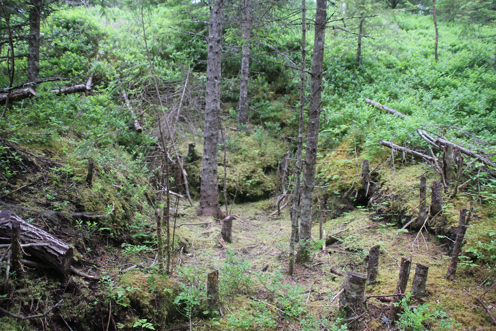
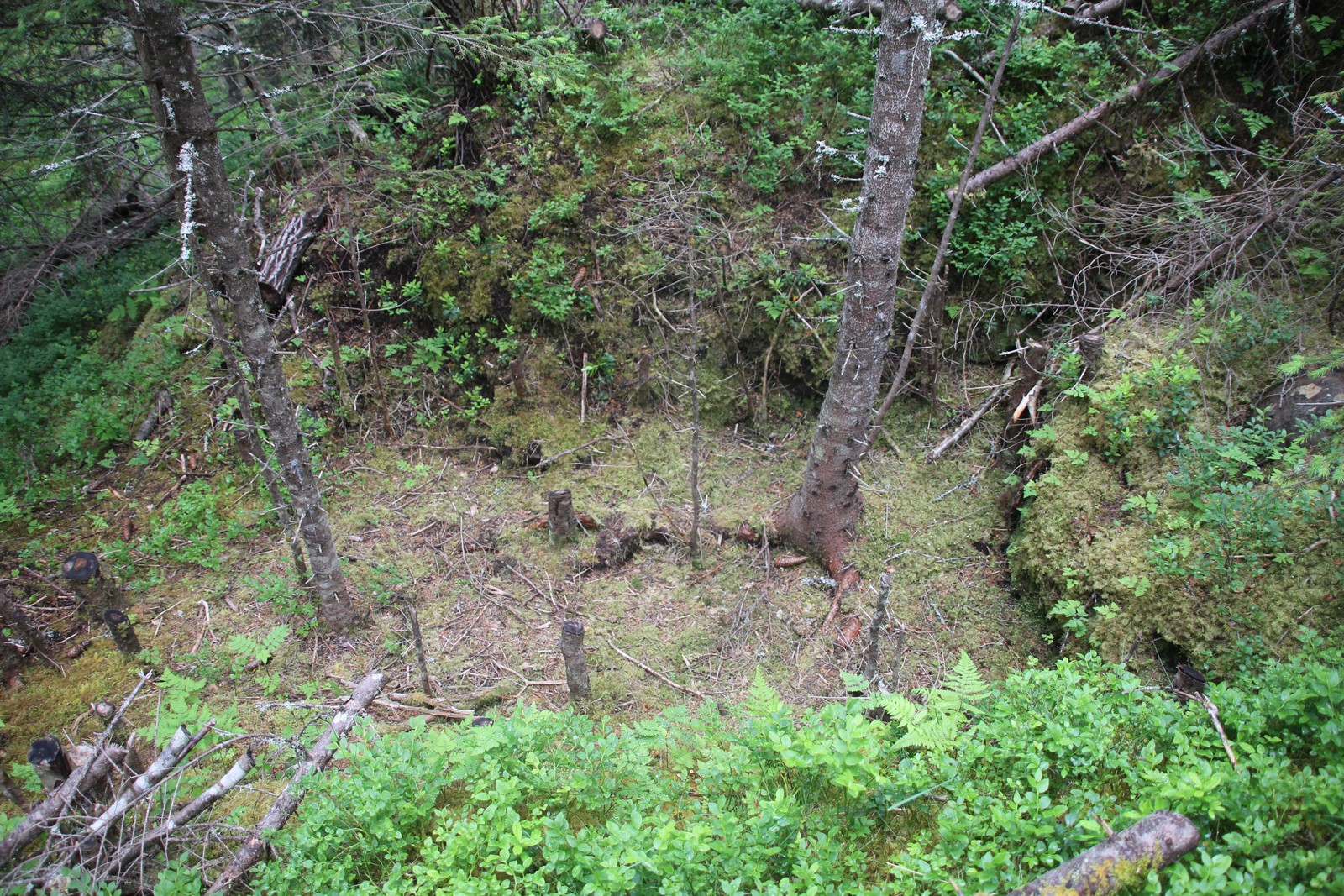
Tufter etter boligen som Hilmar Buran (1893-1988) bodde i da han hogg tømmer her like etter siste verdenskrig.
",
"dlink":"http://maps.google.com/maps?daddr=63.710782,11.630851&t=m&layer=1&doflg=ptk&hl=no&om=0",
"openpopup":"0",
"mapwidth":"640",
"mapwidthunit":"px",
"mapheight":"480",
"marker-createdby":"omlarsen",
"marker-createdon":"2017-05-30 00:00:00",
"marker-updatedby":"omlarsen",
"marker-updatedon":"2017-05-30 00:00:00",
"layerid":["7"],
"layername":"Steiner / varder",
"layer-createdby":"omlarsen",
"layer-createdon":"2017-05-26 00:00:00",
"layer-updatedby":"omlarsen",
"layer-updatedon":"2017-11-09 00:44:02",
"controlbox":"1",
"overlays_custom":"0",
"overlays_custom2":"0",
"overlays_custom3":"0",
"overlays_custom4":"0",
"wms":"0",
"wms2":"0",
"wms3":"0",
"wms4":"0",
"wms5":"0",
"wms6":"0",
"wms7":"0",
"wms8":"0",
"wms9":"0",
"wms10":"0",
"kml_timestamp":"2017-05-30 00:00:00",
"gpx_url":"",
"gpx_panel":"0",
"mlm_filter":"1",
"mlm_filter_details":""
}},
{
"type":"Feature",
"geometry":
{
"type":"Point",
"coordinates":[11.524480,63.860920]
},
"properties":
{
"markerid":"101",
"layers":["1"],
"requested_layer":["1"],
"markername":"Marsteinsvola 1",
"basemap":"custom_basemap",
"lat":"63.860920",
"lon":"11.524480",
"icon":"",
"zoom":"16",
"iconUrl":"http://verdalsportalen.no/wp-content/plugins/leaflet-maps-marker-pro/leaflet-dist/images/marker.png",
"address":"",
"text":"Marsteinsvola er et trigonometrisk punkt.
Toppen ble brukt som en våttåplass. Et ildsignal ble tent for å varsle at det kom ufredsfolk.
Les mer om toppen
Tillerknoppen er et trigonometrisk punkt.
Toppen ble brukt som en våttåplass. Et ildsignal ble tent for å varsle at det kom ufredsfolk.
Les mer om toppen
Gps-posisjon: 63.893830 / 11.979550
",
"dlink":"http://maps.google.com/maps?daddr=63.893830,11.979550&t=m&layer=1&doflg=ptk&hl=no&om=0",
"openpopup":"0",
"mapwidth":"640",
"mapwidthunit":"px",
"mapheight":"480",
"marker-createdby":"omlarsen",
"marker-createdon":"2017-05-05 00:00:00",
"marker-updatedby":"omlarsen",
"marker-updatedon":"2017-05-05 00:00:00",
"layerid":["1"],
"layername":"Kjentmannstopper",
"layer-createdby":"omlarsen",
"layer-createdon":"2017-03-28 01:23:49",
"layer-updatedby":"omlarsen",
"layer-updatedon":"2021-06-29 23:09:58",
"controlbox":"1",
"overlays_custom":"0",
"overlays_custom2":"0",
"overlays_custom3":"0",
"overlays_custom4":"0",
"wms":"0",
"wms2":"0",
"wms3":"0",
"wms4":"0",
"wms5":"0",
"wms6":"0",
"wms7":"0",
"wms8":"0",
"wms9":"0",
"wms10":"0",
"kml_timestamp":"2017-05-05 00:00:00",
"gpx_url":"",
"gpx_panel":"0",
"mlm_filter":"1",
"mlm_filter_details":""
}},
{
"type":"Feature",
"geometry":
{
"type":"Point",
"coordinates":[12.068870,63.904990]
},
"properties":
{
"markerid":"105",
"layers":["1"],
"requested_layer":["1"],
"markername":" Malså kobberverk 5",
"basemap":"custom_basemap",
"lat":"63.904990",
"lon":"12.068870",
"icon":"",
"zoom":"15",
"iconUrl":"http://verdalsportalen.no/wp-content/plugins/leaflet-maps-marker-pro/leaflet-dist/images/marker.png",
"address":"",
"text":"",
"dlink":"http://maps.google.com/maps?daddr=63.904990,12.068870&t=m&layer=1&doflg=ptk&hl=no&om=0",
"openpopup":"0",
"mapwidth":"640",
"mapwidthunit":"px",
"mapheight":"480",
"marker-createdby":"omlarsen",
"marker-createdon":"2017-05-05 00:00:00",
"marker-updatedby":"omlarsen",
"marker-updatedon":"2017-05-05 00:00:00",
"layerid":["1"],
"layername":"Kjentmannstopper",
"layer-createdby":"omlarsen",
"layer-createdon":"2017-03-28 01:23:49",
"layer-updatedby":"omlarsen",
"layer-updatedon":"2021-06-29 23:09:58",
"controlbox":"1",
"overlays_custom":"0",
"overlays_custom2":"0",
"overlays_custom3":"0",
"overlays_custom4":"0",
"wms":"0",
"wms2":"0",
"wms3":"0",
"wms4":"0",
"wms5":"0",
"wms6":"0",
"wms7":"0",
"wms8":"0",
"wms9":"0",
"wms10":"0",
"kml_timestamp":"2017-05-05 13:41:44",
"gpx_url":"",
"gpx_panel":"0",
"mlm_filter":"1",
"mlm_filter_details":""
}},
{
"type":"Feature",
"geometry":
{
"type":"Point",
"coordinates":[11.943330,63.790920]
},
"properties":
{
"markerid":"107",
"layers":["1"],
"requested_layer":["1"],
"markername":" Rautun 7",
"basemap":"custom_basemap",
"lat":"63.790920",
"lon":"11.943330",
"icon":"",
"zoom":"15",
"iconUrl":"http://verdalsportalen.no/wp-content/plugins/leaflet-maps-marker-pro/leaflet-dist/images/marker.png",
"address":"",
"text":"
",
"dlink":"http://maps.google.com/maps?daddr=63.790920,11.943330&t=m&layer=1&doflg=ptk&hl=no&om=0",
"openpopup":"0",
"mapwidth":"640",
"mapwidthunit":"px",
"mapheight":"480",
"marker-createdby":"omlarsen",
"marker-createdon":"2017-05-05 00:00:00",
"marker-updatedby":"omlarsen",
"marker-updatedon":"2017-05-05 00:00:00",
"layerid":["1"],
"layername":"Kjentmannstopper",
"layer-createdby":"omlarsen",
"layer-createdon":"2017-03-28 01:23:49",
"layer-updatedby":"omlarsen",
"layer-updatedon":"2021-06-29 23:09:58",
"controlbox":"1",
"overlays_custom":"0",
"overlays_custom2":"0",
"overlays_custom3":"0",
"overlays_custom4":"0",
"wms":"0",
"wms2":"0",
"wms3":"0",
"wms4":"0",
"wms5":"0",
"wms6":"0",
"wms7":"0",
"wms8":"0",
"wms9":"0",
"wms10":"0",
"kml_timestamp":"2017-05-05 00:00:00",
"gpx_url":"",
"gpx_panel":"0",
"mlm_filter":"1",
"mlm_filter_details":""
}},
{
"type":"Feature",
"geometry":
{
"type":"Point",
"coordinates":[11.848730,63.772200]
},
"properties":
{
"markerid":"108",
"layers":["1"],
"requested_layer":["1"],
"markername":"Guddingsskallen 8",
"basemap":"custom_basemap",
"lat":"63.772200",
"lon":"11.848730",
"icon":"",
"zoom":"15",
"iconUrl":"http://verdalsportalen.no/wp-content/plugins/leaflet-maps-marker-pro/leaflet-dist/images/marker.png",
"address":"",
"text":"
",
"dlink":"http://maps.google.com/maps?daddr=63.772200,11.848730&t=m&layer=1&doflg=ptk&hl=no&om=0",
"openpopup":"0",
"mapwidth":"640",
"mapwidthunit":"px",
"mapheight":"480",
"marker-createdby":"omlarsen",
"marker-createdon":"2017-05-05 00:00:00",
"marker-updatedby":"omlarsen",
"marker-updatedon":"2017-05-05 00:00:00",
"layerid":["1"],
"layername":"Kjentmannstopper",
"layer-createdby":"omlarsen",
"layer-createdon":"2017-03-28 01:23:49",
"layer-updatedby":"omlarsen",
"layer-updatedon":"2021-06-29 23:09:58",
"controlbox":"1",
"overlays_custom":"0",
"overlays_custom2":"0",
"overlays_custom3":"0",
"overlays_custom4":"0",
"wms":"0",
"wms2":"0",
"wms3":"0",
"wms4":"0",
"wms5":"0",
"wms6":"0",
"wms7":"0",
"wms8":"0",
"wms9":"0",
"wms10":"0",
"kml_timestamp":"2017-05-05 00:00:00",
"gpx_url":"",
"gpx_panel":"0",
"mlm_filter":"1",
"mlm_filter_details":""
}},
{
"type":"Feature",
"geometry":
{
"type":"Point",
"coordinates":[12.034280,63.698800]
},
"properties":
{
"markerid":"109",
"layers":["1"],
"requested_layer":["1"],
"markername":" Spjeldberget 9 ",
"basemap":"custom_basemap",
"lat":"63.698800",
"lon":"12.034280",
"icon":"",
"zoom":"15",
"iconUrl":"http://verdalsportalen.no/wp-content/plugins/leaflet-maps-marker-pro/leaflet-dist/images/marker.png",
"address":"",
"text":"",
"dlink":"http://maps.google.com/maps?daddr=63.698800,12.034280&t=m&layer=1&doflg=ptk&hl=no&om=0",
"openpopup":"0",
"mapwidth":"640",
"mapwidthunit":"px",
"mapheight":"480",
"marker-createdby":"omlarsen",
"marker-createdon":"2017-05-05 00:00:00",
"marker-updatedby":"omlarsen",
"marker-updatedon":"2017-05-05 00:00:00",
"layerid":["1"],
"layername":"Kjentmannstopper",
"layer-createdby":"omlarsen",
"layer-createdon":"2017-03-28 01:23:49",
"layer-updatedby":"omlarsen",
"layer-updatedon":"2021-06-29 23:09:58",
"controlbox":"1",
"overlays_custom":"0",
"overlays_custom2":"0",
"overlays_custom3":"0",
"overlays_custom4":"0",
"wms":"0",
"wms2":"0",
"wms3":"0",
"wms4":"0",
"wms5":"0",
"wms6":"0",
"wms7":"0",
"wms8":"0",
"wms9":"0",
"wms10":"0",
"kml_timestamp":"2017-05-05 13:41:44",
"gpx_url":"",
"gpx_panel":"0",
"mlm_filter":"1",
"mlm_filter_details":""
}},
{
"type":"Feature",
"geometry":
{
"type":"Point",
"coordinates":[12.170940,63.626500]
},
"properties":
{
"markerid":"110",
"layers":["1"],
"requested_layer":["1"],
"markername":" Høgfjellstøtta 10",
"basemap":"custom_basemap",
"lat":"63.626500",
"lon":"12.170940",
"icon":"",
"zoom":"15",
"iconUrl":"http://verdalsportalen.no/wp-content/plugins/leaflet-maps-marker-pro/leaflet-dist/images/marker.png",
"address":"",
"text":"",
"dlink":"http://maps.google.com/maps?daddr=63.626500,12.170940&t=m&layer=1&doflg=ptk&hl=no&om=0",
"openpopup":"0",
"mapwidth":"640",
"mapwidthunit":"px",
"mapheight":"480",
"marker-createdby":"omlarsen",
"marker-createdon":"2017-05-05 00:00:00",
"marker-updatedby":"omlarsen",
"marker-updatedon":"2017-05-05 00:00:00",
"layerid":["1"],
"layername":"Kjentmannstopper",
"layer-createdby":"omlarsen",
"layer-createdon":"2017-03-28 01:23:49",
"layer-updatedby":"omlarsen",
"layer-updatedon":"2021-06-29 23:09:58",
"controlbox":"1",
"overlays_custom":"0",
"overlays_custom2":"0",
"overlays_custom3":"0",
"overlays_custom4":"0",
"wms":"0",
"wms2":"0",
"wms3":"0",
"wms4":"0",
"wms5":"0",
"wms6":"0",
"wms7":"0",
"wms8":"0",
"wms9":"0",
"wms10":"0",
"kml_timestamp":"2017-05-05 00:00:00",
"gpx_url":"",
"gpx_panel":"0",
"mlm_filter":"1",
"mlm_filter_details":""
}},
{
"type":"Feature",
"geometry":
{
"type":"Point",
"coordinates":[12.087980,63.630810]
},
"properties":
{
"markerid":"111",
"layers":["1"],
"requested_layer":["1"],
"markername":" Kråksjøen 11",
"basemap":"custom_basemap",
"lat":"63.630810",
"lon":"12.087980",
"icon":"",
"zoom":"15",
"iconUrl":"http://verdalsportalen.no/wp-content/plugins/leaflet-maps-marker-pro/leaflet-dist/images/marker.png",
"address":"",
"text":"",
"dlink":"http://maps.google.com/maps?daddr=63.630810,12.087980&t=m&layer=1&doflg=ptk&hl=no&om=0",
"openpopup":"0",
"mapwidth":"640",
"mapwidthunit":"px",
"mapheight":"480",
"marker-createdby":"omlarsen",
"marker-createdon":"2017-05-05 00:00:00",
"marker-updatedby":"omlarsen",
"marker-updatedon":"2017-05-05 00:00:00",
"layerid":["1"],
"layername":"Kjentmannstopper",
"layer-createdby":"omlarsen",
"layer-createdon":"2017-03-28 01:23:49",
"layer-updatedby":"omlarsen",
"layer-updatedon":"2021-06-29 23:09:58",
"controlbox":"1",
"overlays_custom":"0",
"overlays_custom2":"0",
"overlays_custom3":"0",
"overlays_custom4":"0",
"wms":"0",
"wms2":"0",
"wms3":"0",
"wms4":"0",
"wms5":"0",
"wms6":"0",
"wms7":"0",
"wms8":"0",
"wms9":"0",
"wms10":"0",
"kml_timestamp":"2017-05-05 13:41:44",
"gpx_url":"",
"gpx_panel":"0",
"mlm_filter":"1",
"mlm_filter_details":""
}},
{
"type":"Feature",
"geometry":
{
"type":"Point",
"coordinates":[11.844010,63.682840]
},
"properties":
{
"markerid":"112",
"layers":["1"],
"requested_layer":["1"],
"markername":"Stor-havren 12",
"basemap":"custom_basemap",
"lat":"63.682840",
"lon":"11.844010",
"icon":"",
"zoom":"15",
"iconUrl":"http://verdalsportalen.no/wp-content/plugins/leaflet-maps-marker-pro/leaflet-dist/images/marker.png",
"address":"",
"text":"
",
"dlink":"http://maps.google.com/maps?daddr=63.682840,11.844010&t=m&layer=1&doflg=ptk&hl=no&om=0",
"openpopup":"0",
"mapwidth":"640",
"mapwidthunit":"px",
"mapheight":"480",
"marker-createdby":"omlarsen",
"marker-createdon":"2017-05-05 00:00:00",
"marker-updatedby":"omlarsen",
"marker-updatedon":"2017-05-05 00:00:00",
"layerid":["1"],
"layername":"Kjentmannstopper",
"layer-createdby":"omlarsen",
"layer-createdon":"2017-03-28 01:23:49",
"layer-updatedby":"omlarsen",
"layer-updatedon":"2021-06-29 23:09:58",
"controlbox":"1",
"overlays_custom":"0",
"overlays_custom2":"0",
"overlays_custom3":"0",
"overlays_custom4":"0",
"wms":"0",
"wms2":"0",
"wms3":"0",
"wms4":"0",
"wms5":"0",
"wms6":"0",
"wms7":"0",
"wms8":"0",
"wms9":"0",
"wms10":"0",
"kml_timestamp":"2017-05-05 00:00:00",
"gpx_url":"",
"gpx_panel":"0",
"mlm_filter":"1",
"mlm_filter_details":""
}},
{
"type":"Feature",
"geometry":
{
"type":"Point",
"coordinates":[11.736740,63.756110]
},
"properties":
{
"markerid":"113",
"layers":["1","6"],
"requested_layer":["1"],
"markername":"Steinsvåttån 13",
"basemap":"custom_basemap",
"lat":"63.756110",
"lon":"11.736740",
"icon":"",
"zoom":"17",
"iconUrl":"http://verdalsportalen.no/wp-content/plugins/leaflet-maps-marker-pro/leaflet-dist/images/marker.png",
"address":"",
"text":"Steinsvåttån et Trigonometrisk punkt.
I folkevandingstiden var dette er bygdeborg. Senere ble toppen brukt som en våttåplass. Et ildsignal ble tent for å varsle at det kom ufredsfolk.Les mer om toppen
",
"dlink":"http://maps.google.com/maps?daddr=63.756110,11.736740&t=m&layer=1&doflg=ptk&hl=no&om=0",
"openpopup":"0",
"mapwidth":"640",
"mapwidthunit":"px",
"mapheight":"480",
"marker-createdby":"omlarsen",
"marker-createdon":"2017-05-05 00:00:00",
"marker-updatedby":"omlarsen",
"marker-updatedon":"2017-05-05 00:00:00",
"layerid":["1", "6"],
"layername":"Utsiktspunkt",
"layer-createdby":"oml",
"layer-createdon":"2017-06-01 00:00:00",
"layer-updatedby":"omlarsen",
"layer-updatedon":"2017-06-01 00:00:00",
"controlbox":"1",
"overlays_custom":"0",
"overlays_custom2":"0",
"overlays_custom3":"0",
"overlays_custom4":"0",
"wms":"0",
"wms2":"0",
"wms3":"0",
"wms4":"0",
"wms5":"0",
"wms6":"0",
"wms7":"0",
"wms8":"0",
"wms9":"0",
"wms10":"0",
"kml_timestamp":"2017-05-05 00:00:00",
"gpx_url":"",
"gpx_panel":"0",
"mlm_filter":"1",
"mlm_filter_details":""
}},
{
"type":"Feature",
"geometry":
{
"type":"Point",
"coordinates":[11.629690,63.744600]
},
"properties":
{
"markerid":"114",
"layers":["1"],
"requested_layer":["1"],
"markername":" Kvindfjellet 14",
"basemap":"custom_basemap",
"lat":"63.744600",
"lon":"11.629690",
"icon":"",
"zoom":"15",
"iconUrl":"http://verdalsportalen.no/wp-content/plugins/leaflet-maps-marker-pro/leaflet-dist/images/marker.png",
"address":"",
"text":"",
"dlink":"http://maps.google.com/maps?daddr=63.744600,11.629690&t=m&layer=1&doflg=ptk&hl=no&om=0",
"openpopup":"0",
"mapwidth":"640",
"mapwidthunit":"px",
"mapheight":"480",
"marker-createdby":"omlarsen",
"marker-createdon":"2017-05-05 00:00:00",
"marker-updatedby":"omlarsen",
"marker-updatedon":"2017-05-05 00:00:00",
"layerid":["1"],
"layername":"Kjentmannstopper",
"layer-createdby":"omlarsen",
"layer-createdon":"2017-03-28 01:23:49",
"layer-updatedby":"omlarsen",
"layer-updatedon":"2021-06-29 23:09:58",
"controlbox":"1",
"overlays_custom":"0",
"overlays_custom2":"0",
"overlays_custom3":"0",
"overlays_custom4":"0",
"wms":"0",
"wms2":"0",
"wms3":"0",
"wms4":"0",
"wms5":"0",
"wms6":"0",
"wms7":"0",
"wms8":"0",
"wms9":"0",
"wms10":"0",
"kml_timestamp":"2017-05-05 13:41:44",
"gpx_url":"",
"gpx_panel":"0",
"mlm_filter":"1",
"mlm_filter_details":""
}},
{
"type":"Feature",
"geometry":
{
"type":"Point",
"coordinates":[11.543310,63.750400]
},
"properties":
{
"markerid":"116",
"layers":["1"],
"requested_layer":["1"],
"markername":" Helloporten 16",
"basemap":"custom_basemap",
"lat":"63.750400",
"lon":"11.543310",
"icon":"",
"zoom":"15",
"iconUrl":"http://verdalsportalen.no/wp-content/plugins/leaflet-maps-marker-pro/leaflet-dist/images/marker.png",
"address":"",
"text":"",
"dlink":"http://maps.google.com/maps?daddr=63.750400,11.543310&t=m&layer=1&doflg=ptk&hl=no&om=0",
"openpopup":"0",
"mapwidth":"640",
"mapwidthunit":"px",
"mapheight":"480",
"marker-createdby":"omlarsen",
"marker-createdon":"2017-05-05 00:00:00",
"marker-updatedby":"omlarsen",
"marker-updatedon":"2017-05-05 00:00:00",
"layerid":["1"],
"layername":"Kjentmannstopper",
"layer-createdby":"omlarsen",
"layer-createdon":"2017-03-28 01:23:49",
"layer-updatedby":"omlarsen",
"layer-updatedon":"2021-06-29 23:09:58",
"controlbox":"1",
"overlays_custom":"0",
"overlays_custom2":"0",
"overlays_custom3":"0",
"overlays_custom4":"0",
"wms":"0",
"wms2":"0",
"wms3":"0",
"wms4":"0",
"wms5":"0",
"wms6":"0",
"wms7":"0",
"wms8":"0",
"wms9":"0",
"wms10":"0",
"kml_timestamp":"2017-05-05 13:41:44",
"gpx_url":"",
"gpx_panel":"0",
"mlm_filter":"1",
"mlm_filter_details":""
}},
{
"type":"Feature",
"geometry":
{
"type":"Point",
"coordinates":[11.716220,63.657910]
},
"properties":
{
"markerid":"117",
"layers":["1"],
"requested_layer":["1"],
"markername":" Grønningen 17",
"basemap":"custom_basemap",
"lat":"63.657910",
"lon":"11.716220",
"icon":"",
"zoom":"15",
"iconUrl":"http://verdalsportalen.no/wp-content/plugins/leaflet-maps-marker-pro/leaflet-dist/images/marker.png",
"address":"",
"text":"",
"dlink":"http://maps.google.com/maps?daddr=63.657910,11.716220&t=m&layer=1&doflg=ptk&hl=no&om=0",
"openpopup":"0",
"mapwidth":"640",
"mapwidthunit":"px",
"mapheight":"480",
"marker-createdby":"omlarsen",
"marker-createdon":"2017-05-05 00:00:00",
"marker-updatedby":"omlarsen",
"marker-updatedon":"2017-05-05 00:00:00",
"layerid":["1"],
"layername":"Kjentmannstopper",
"layer-createdby":"omlarsen",
"layer-createdon":"2017-03-28 01:23:49",
"layer-updatedby":"omlarsen",
"layer-updatedon":"2021-06-29 23:09:58",
"controlbox":"1",
"overlays_custom":"0",
"overlays_custom2":"0",
"overlays_custom3":"0",
"overlays_custom4":"0",
"wms":"0",
"wms2":"0",
"wms3":"0",
"wms4":"0",
"wms5":"0",
"wms6":"0",
"wms7":"0",
"wms8":"0",
"wms9":"0",
"wms10":"0",
"kml_timestamp":"2017-05-05 13:41:44",
"gpx_url":"",
"gpx_panel":"0",
"mlm_filter":"1",
"mlm_filter_details":""
}},
{
"type":"Feature",
"geometry":
{
"type":"Point",
"coordinates":[11.813010,63.633140]
},
"properties":
{
"markerid":"118",
"layers":["1"],
"requested_layer":["1"],
"markername":" Hermannssnasa 18",
"basemap":"custom_basemap",
"lat":"63.633140",
"lon":"11.813010",
"icon":"",
"zoom":"15",
"iconUrl":"http://verdalsportalen.no/wp-content/plugins/leaflet-maps-marker-pro/leaflet-dist/images/marker.png",
"address":"",
"text":"",
"dlink":"http://maps.google.com/maps?daddr=63.633140,11.813010&t=m&layer=1&doflg=ptk&hl=no&om=0",
"openpopup":"0",
"mapwidth":"640",
"mapwidthunit":"px",
"mapheight":"480",
"marker-createdby":"omlarsen",
"marker-createdon":"2017-05-05 00:00:00",
"marker-updatedby":"omlarsen",
"marker-updatedon":"2017-05-05 00:00:00",
"layerid":["1"],
"layername":"Kjentmannstopper",
"layer-createdby":"omlarsen",
"layer-createdon":"2017-03-28 01:23:49",
"layer-updatedby":"omlarsen",
"layer-updatedon":"2021-06-29 23:09:58",
"controlbox":"1",
"overlays_custom":"0",
"overlays_custom2":"0",
"overlays_custom3":"0",
"overlays_custom4":"0",
"wms":"0",
"wms2":"0",
"wms3":"0",
"wms4":"0",
"wms5":"0",
"wms6":"0",
"wms7":"0",
"wms8":"0",
"wms9":"0",
"wms10":"0",
"kml_timestamp":"2017-05-05 13:41:44",
"gpx_url":"",
"gpx_panel":"0",
"mlm_filter":"1",
"mlm_filter_details":""
}},
{
"type":"Feature",
"geometry":
{
"type":"Point",
"coordinates":[11.980590,63.602870]
},
"properties":
{
"markerid":"119",
"layers":["1"],
"requested_layer":["1"],
"markername":" Tuva 19",
"basemap":"custom_basemap",
"lat":"63.602870",
"lon":"11.980590",
"icon":"",
"zoom":"15",
"iconUrl":"http://verdalsportalen.no/wp-content/plugins/leaflet-maps-marker-pro/leaflet-dist/images/marker.png",
"address":"",
"text":"",
"dlink":"http://maps.google.com/maps?daddr=63.602870,11.980590&t=m&layer=1&doflg=ptk&hl=no&om=0",
"openpopup":"0",
"mapwidth":"640",
"mapwidthunit":"px",
"mapheight":"480",
"marker-createdby":"omlarsen",
"marker-createdon":"2017-05-05 00:00:00",
"marker-updatedby":"omlarsen",
"marker-updatedon":"2017-05-05 00:00:00",
"layerid":["1"],
"layername":"Kjentmannstopper",
"layer-createdby":"omlarsen",
"layer-createdon":"2017-03-28 01:23:49",
"layer-updatedby":"omlarsen",
"layer-updatedon":"2021-06-29 23:09:58",
"controlbox":"1",
"overlays_custom":"0",
"overlays_custom2":"0",
"overlays_custom3":"0",
"overlays_custom4":"0",
"wms":"0",
"wms2":"0",
"wms3":"0",
"wms4":"0",
"wms5":"0",
"wms6":"0",
"wms7":"0",
"wms8":"0",
"wms9":"0",
"wms10":"0",
"kml_timestamp":"2017-05-05 13:41:44",
"gpx_url":"",
"gpx_panel":"0",
"mlm_filter":"1",
"mlm_filter_details":""
}},
{
"type":"Feature",
"geometry":
{
"type":"Point",
"coordinates":[12.050480,63.646970]
},
"properties":
{
"markerid":"120",
"layers":["1"],
"requested_layer":["1"],
"markername":" Stongbakkvåttån 20",
"basemap":"custom_basemap",
"lat":"63.646970",
"lon":"12.050480",
"icon":"",
"zoom":"15",
"iconUrl":"http://verdalsportalen.no/wp-content/plugins/leaflet-maps-marker-pro/leaflet-dist/images/marker.png",
"address":"",
"text":"",
"dlink":"http://maps.google.com/maps?daddr=63.646970,12.050480&t=m&layer=1&doflg=ptk&hl=no&om=0",
"openpopup":"0",
"mapwidth":"640",
"mapwidthunit":"px",
"mapheight":"480",
"marker-createdby":"omlarsen",
"marker-createdon":"2017-05-05 00:00:00",
"marker-updatedby":"omlarsen",
"marker-updatedon":"2017-05-05 00:00:00",
"layerid":["1"],
"layername":"Kjentmannstopper",
"layer-createdby":"omlarsen",
"layer-createdon":"2017-03-28 01:23:49",
"layer-updatedby":"omlarsen",
"layer-updatedon":"2021-06-29 23:09:58",
"controlbox":"1",
"overlays_custom":"0",
"overlays_custom2":"0",
"overlays_custom3":"0",
"overlays_custom4":"0",
"wms":"0",
"wms2":"0",
"wms3":"0",
"wms4":"0",
"wms5":"0",
"wms6":"0",
"wms7":"0",
"wms8":"0",
"wms9":"0",
"wms10":"0",
"kml_timestamp":"2017-05-05 13:41:44",
"gpx_url":"",
"gpx_panel":"0",
"mlm_filter":"1",
"mlm_filter_details":""
}},
{
"type":"Feature",
"geometry":
{
"type":"Point",
"coordinates":[12.013030,63.775430]
},
"properties":
{
"markerid":"121",
"layers":["1"],
"requested_layer":["1"],
"markername":"Hyllfjellet 21",
"basemap":"custom_basemap",
"lat":"63.775430",
"lon":"12.013030",
"icon":"",
"zoom":"11",
"iconUrl":"http://verdalsportalen.no/wp-content/plugins/leaflet-maps-marker-pro/leaflet-dist/images/marker.png",
"address":"",
"text":"",
"dlink":"http://maps.google.com/maps?daddr=63.775430,12.013030&t=m&layer=1&doflg=ptk&hl=no&om=0",
"openpopup":"0",
"mapwidth":"640",
"mapwidthunit":"px",
"mapheight":"480",
"marker-createdby":"omlarsen",
"marker-createdon":"2017-05-05 00:00:00",
"marker-updatedby":"omlarsen",
"marker-updatedon":"2017-05-13 00:00:00",
"layerid":["1"],
"layername":"Kjentmannstopper",
"layer-createdby":"omlarsen",
"layer-createdon":"2017-03-28 01:23:49",
"layer-updatedby":"omlarsen",
"layer-updatedon":"2021-06-29 23:09:58",
"controlbox":"1",
"overlays_custom":"0",
"overlays_custom2":"0",
"overlays_custom3":"0",
"overlays_custom4":"0",
"wms":"0",
"wms2":"0",
"wms3":"0",
"wms4":"0",
"wms5":"0",
"wms6":"0",
"wms7":"0",
"wms8":"0",
"wms9":"0",
"wms10":"0",
"kml_timestamp":"2017-05-05 00:00:00",
"gpx_url":"http://verdalsportalen.no/Gps_spor/Hyllfjellet.gpx",
"gpx_panel":"1",
"mlm_filter":"1",
"mlm_filter_details":""
}},
{
"type":"Feature",
"geometry":
{
"type":"Point",
"coordinates":[12.381420,63.750500]
},
"properties":
{
"markerid":"122",
"layers":["1"],
"requested_layer":["1"],
"markername":" Ørvillhøgda 22",
"basemap":"custom_basemap",
"lat":"63.750500",
"lon":"12.381420",
"icon":"",
"zoom":"15",
"iconUrl":"http://verdalsportalen.no/wp-content/plugins/leaflet-maps-marker-pro/leaflet-dist/images/marker.png",
"address":"",
"text":"",
"dlink":"http://maps.google.com/maps?daddr=63.750500,12.381420&t=m&layer=1&doflg=ptk&hl=no&om=0",
"openpopup":"0",
"mapwidth":"640",
"mapwidthunit":"px",
"mapheight":"480",
"marker-createdby":"omlarsen",
"marker-createdon":"2017-05-05 00:00:00",
"marker-updatedby":"omlarsen",
"marker-updatedon":"2017-05-05 00:00:00",
"layerid":["1"],
"layername":"Kjentmannstopper",
"layer-createdby":"omlarsen",
"layer-createdon":"2017-03-28 01:23:49",
"layer-updatedby":"omlarsen",
"layer-updatedon":"2021-06-29 23:09:58",
"controlbox":"1",
"overlays_custom":"0",
"overlays_custom2":"0",
"overlays_custom3":"0",
"overlays_custom4":"0",
"wms":"0",
"wms2":"0",
"wms3":"0",
"wms4":"0",
"wms5":"0",
"wms6":"0",
"wms7":"0",
"wms8":"0",
"wms9":"0",
"wms10":"0",
"kml_timestamp":"2017-05-05 13:41:44",
"gpx_url":"",
"gpx_panel":"0",
"mlm_filter":"1",
"mlm_filter_details":""
}},
{
"type":"Feature",
"geometry":
{
"type":"Point",
"coordinates":[12.193020,63.778690]
},
"properties":
{
"markerid":"123",
"layers":["1"],
"requested_layer":["1"],
"markername":"Tørrgranvola 23",
"basemap":"custom_basemap",
"lat":"63.778690",
"lon":"12.193020",
"icon":"",
"zoom":"15",
"iconUrl":"http://verdalsportalen.no/wp-content/plugins/leaflet-maps-marker-pro/leaflet-dist/images/marker.png",
"address":"",
"text":"
",
"dlink":"http://maps.google.com/maps?daddr=63.778690,12.193020&t=m&layer=1&doflg=ptk&hl=no&om=0",
"openpopup":"0",
"mapwidth":"640",
"mapwidthunit":"px",
"mapheight":"480",
"marker-createdby":"omlarsen",
"marker-createdon":"2017-05-05 00:00:00",
"marker-updatedby":"omlarsen",
"marker-updatedon":"2017-05-05 00:00:00",
"layerid":["1"],
"layername":"Kjentmannstopper",
"layer-createdby":"omlarsen",
"layer-createdon":"2017-03-28 01:23:49",
"layer-updatedby":"omlarsen",
"layer-updatedon":"2021-06-29 23:09:58",
"controlbox":"1",
"overlays_custom":"0",
"overlays_custom2":"0",
"overlays_custom3":"0",
"overlays_custom4":"0",
"wms":"0",
"wms2":"0",
"wms3":"0",
"wms4":"0",
"wms5":"0",
"wms6":"0",
"wms7":"0",
"wms8":"0",
"wms9":"0",
"wms10":"0",
"kml_timestamp":"2017-05-05 00:00:00",
"gpx_url":"",
"gpx_panel":"0",
"mlm_filter":"1",
"mlm_filter_details":""
}},
{
"type":"Feature",
"geometry":
{
"type":"Point",
"coordinates":[12.434980,63.852550]
},
"properties":
{
"markerid":"124",
"layers":["1"],
"requested_layer":["1"],
"markername":"Seterfjellet hitre 24",
"basemap":"custom_basemap",
"lat":"63.852550",
"lon":"12.434980",
"icon":"",
"zoom":"15",
"iconUrl":"http://verdalsportalen.no/wp-content/plugins/leaflet-maps-marker-pro/leaflet-dist/images/marker.png",
"address":"",
"text":"
",
"dlink":"http://maps.google.com/maps?daddr=63.852550,12.434980&t=m&layer=1&doflg=ptk&hl=no&om=0",
"openpopup":"0",
"mapwidth":"640",
"mapwidthunit":"px",
"mapheight":"480",
"marker-createdby":"omlarsen",
"marker-createdon":"2017-05-05 00:00:00",
"marker-updatedby":"omlarsen",
"marker-updatedon":"2017-05-05 00:00:00",
"layerid":["1"],
"layername":"Kjentmannstopper",
"layer-createdby":"omlarsen",
"layer-createdon":"2017-03-28 01:23:49",
"layer-updatedby":"omlarsen",
"layer-updatedon":"2021-06-29 23:09:58",
"controlbox":"1",
"overlays_custom":"0",
"overlays_custom2":"0",
"overlays_custom3":"0",
"overlays_custom4":"0",
"wms":"0",
"wms2":"0",
"wms3":"0",
"wms4":"0",
"wms5":"0",
"wms6":"0",
"wms7":"0",
"wms8":"0",
"wms9":"0",
"wms10":"0",
"kml_timestamp":"2017-05-05 00:00:00",
"gpx_url":"",
"gpx_panel":"0",
"mlm_filter":"1",
"mlm_filter_details":""
}},
{
"type":"Feature",
"geometry":
{
"type":"Point",
"coordinates":[12.386400,63.859620]
},
"properties":
{
"markerid":"125",
"layers":["1"],
"requested_layer":["1"],
"markername":" Tverråholman 25",
"basemap":"custom_basemap",
"lat":"63.859620",
"lon":"12.386400",
"icon":"",
"zoom":"15",
"iconUrl":"http://verdalsportalen.no/wp-content/plugins/leaflet-maps-marker-pro/leaflet-dist/images/marker.png",
"address":"",
"text":"",
"dlink":"http://maps.google.com/maps?daddr=63.859620,12.386400&t=m&layer=1&doflg=ptk&hl=no&om=0",
"openpopup":"0",
"mapwidth":"640",
"mapwidthunit":"px",
"mapheight":"480",
"marker-createdby":"omlarsen",
"marker-createdon":"2017-05-05 00:00:00",
"marker-updatedby":"omlarsen",
"marker-updatedon":"2017-05-05 00:00:00",
"layerid":["1"],
"layername":"Kjentmannstopper",
"layer-createdby":"omlarsen",
"layer-createdon":"2017-03-28 01:23:49",
"layer-updatedby":"omlarsen",
"layer-updatedon":"2021-06-29 23:09:58",
"controlbox":"1",
"overlays_custom":"0",
"overlays_custom2":"0",
"overlays_custom3":"0",
"overlays_custom4":"0",
"wms":"0",
"wms2":"0",
"wms3":"0",
"wms4":"0",
"wms5":"0",
"wms6":"0",
"wms7":"0",
"wms8":"0",
"wms9":"0",
"wms10":"0",
"kml_timestamp":"2017-05-05 13:41:44",
"gpx_url":"",
"gpx_panel":"0",
"mlm_filter":"1",
"mlm_filter_details":""
}},
{
"type":"Feature",
"geometry":
{
"type":"Point",
"coordinates":[12.265720,63.834350]
},
"properties":
{
"markerid":"126",
"layers":["1"],
"requested_layer":["1"],
"markername":" Flysetra 26",
"basemap":"custom_basemap",
"lat":"63.834350",
"lon":"12.265720",
"icon":"",
"zoom":"15",
"iconUrl":"http://verdalsportalen.no/wp-content/plugins/leaflet-maps-marker-pro/leaflet-dist/images/marker.png",
"address":"",
"text":"",
"dlink":"http://maps.google.com/maps?daddr=63.834350,12.265720&t=m&layer=1&doflg=ptk&hl=no&om=0",
"openpopup":"0",
"mapwidth":"640",
"mapwidthunit":"px",
"mapheight":"480",
"marker-createdby":"omlarsen",
"marker-createdon":"2017-05-05 00:00:00",
"marker-updatedby":"omlarsen",
"marker-updatedon":"2017-05-05 00:00:00",
"layerid":["1"],
"layername":"Kjentmannstopper",
"layer-createdby":"omlarsen",
"layer-createdon":"2017-03-28 01:23:49",
"layer-updatedby":"omlarsen",
"layer-updatedon":"2021-06-29 23:09:58",
"controlbox":"1",
"overlays_custom":"0",
"overlays_custom2":"0",
"overlays_custom3":"0",
"overlays_custom4":"0",
"wms":"0",
"wms2":"0",
"wms3":"0",
"wms4":"0",
"wms5":"0",
"wms6":"0",
"wms7":"0",
"wms8":"0",
"wms9":"0",
"wms10":"0",
"kml_timestamp":"2017-05-05 13:41:44",
"gpx_url":"",
"gpx_panel":"0",
"mlm_filter":"1",
"mlm_filter_details":""
}},
{
"type":"Feature",
"geometry":
{
"type":"Point",
"coordinates":[12.093310,63.855070]
},
"properties":
{
"markerid":"127",
"layers":["1"],
"requested_layer":["1"],
"markername":" Skjækerdalsgruvan 27",
"basemap":"custom_basemap",
"lat":"63.855070",
"lon":"12.093310",
"icon":"",
"zoom":"15",
"iconUrl":"http://verdalsportalen.no/wp-content/plugins/leaflet-maps-marker-pro/leaflet-dist/images/marker.png",
"address":"",
"text":"",
"dlink":"http://maps.google.com/maps?daddr=63.855070,12.093310&t=m&layer=1&doflg=ptk&hl=no&om=0",
"openpopup":"0",
"mapwidth":"640",
"mapwidthunit":"px",
"mapheight":"480",
"marker-createdby":"omlarsen",
"marker-createdon":"2017-05-05 00:00:00",
"marker-updatedby":"omlarsen",
"marker-updatedon":"2017-05-05 00:00:00",
"layerid":["1"],
"layername":"Kjentmannstopper",
"layer-createdby":"omlarsen",
"layer-createdon":"2017-03-28 01:23:49",
"layer-updatedby":"omlarsen",
"layer-updatedon":"2021-06-29 23:09:58",
"controlbox":"1",
"overlays_custom":"0",
"overlays_custom2":"0",
"overlays_custom3":"0",
"overlays_custom4":"0",
"wms":"0",
"wms2":"0",
"wms3":"0",
"wms4":"0",
"wms5":"0",
"wms6":"0",
"wms7":"0",
"wms8":"0",
"wms9":"0",
"wms10":"0",
"kml_timestamp":"2017-05-05 13:41:44",
"gpx_url":"",
"gpx_panel":"0",
"mlm_filter":"1",
"mlm_filter_details":""
}},
{
"type":"Feature",
"geometry":
{
"type":"Point",
"coordinates":[11.991410,63.852250]
},
"properties":
{
"markerid":"128",
"layers":["1"],
"requested_layer":["1"],
"markername":"Åkervoldgruva 28",
"basemap":"custom_basemap",
"lat":"63.852250",
"lon":"11.991410",
"icon":"",
"zoom":"15",
"iconUrl":"http://verdalsportalen.no/wp-content/plugins/leaflet-maps-marker-pro/leaflet-dist/images/marker.png",
"address":"",
"text":"",
"dlink":"http://maps.google.com/maps?daddr=63.852250,11.991410&t=m&layer=1&doflg=ptk&hl=no&om=0",
"openpopup":"0",
"mapwidth":"640",
"mapwidthunit":"px",
"mapheight":"480",
"marker-createdby":"omlarsen",
"marker-createdon":"2017-05-05 00:00:00",
"marker-updatedby":"omlarsen",
"marker-updatedon":"2017-05-05 00:00:00",
"layerid":["1"],
"layername":"Kjentmannstopper",
"layer-createdby":"omlarsen",
"layer-createdon":"2017-03-28 01:23:49",
"layer-updatedby":"omlarsen",
"layer-updatedon":"2021-06-29 23:09:58",
"controlbox":"1",
"overlays_custom":"0",
"overlays_custom2":"0",
"overlays_custom3":"0",
"overlays_custom4":"0",
"wms":"0",
"wms2":"0",
"wms3":"0",
"wms4":"0",
"wms5":"0",
"wms6":"0",
"wms7":"0",
"wms8":"0",
"wms9":"0",
"wms10":"0",
"kml_timestamp":"2017-05-05 13:41:44",
"gpx_url":"",
"gpx_panel":"0",
"mlm_filter":"1",
"mlm_filter_details":""
}},
{
"type":"Feature",
"geometry":
{
"type":"Point",
"coordinates":[11.936730,63.817690]
},
"properties":
{
"markerid":"129",
"layers":["1"],
"requested_layer":["1"],
"markername":" Elnesberget 29",
"basemap":"custom_basemap",
"lat":"63.817690",
"lon":"11.936730",
"icon":"",
"zoom":"15",
"iconUrl":"http://verdalsportalen.no/wp-content/plugins/leaflet-maps-marker-pro/leaflet-dist/images/marker.png",
"address":"",
"text":"",
"dlink":"http://maps.google.com/maps?daddr=63.817690,11.936730&t=m&layer=1&doflg=ptk&hl=no&om=0",
"openpopup":"0",
"mapwidth":"640",
"mapwidthunit":"px",
"mapheight":"480",
"marker-createdby":"omlarsen",
"marker-createdon":"2017-05-05 00:00:00",
"marker-updatedby":"omlarsen",
"marker-updatedon":"2017-05-05 00:00:00",
"layerid":["1"],
"layername":"Kjentmannstopper",
"layer-createdby":"omlarsen",
"layer-createdon":"2017-03-28 01:23:49",
"layer-updatedby":"omlarsen",
"layer-updatedon":"2021-06-29 23:09:58",
"controlbox":"1",
"overlays_custom":"0",
"overlays_custom2":"0",
"overlays_custom3":"0",
"overlays_custom4":"0",
"wms":"0",
"wms2":"0",
"wms3":"0",
"wms4":"0",
"wms5":"0",
"wms6":"0",
"wms7":"0",
"wms8":"0",
"wms9":"0",
"wms10":"0",
"kml_timestamp":"2017-05-05 13:41:44",
"gpx_url":"",
"gpx_panel":"0",
"mlm_filter":"1",
"mlm_filter_details":""
}},
{
"type":"Feature",
"geometry":
{
"type":"Point",
"coordinates":[11.428910,63.838060]
},
"properties":
{
"markerid":"130",
"layers":["1"],
"requested_layer":["1"],
"markername":"Høgkammen 30",
"basemap":"custom_basemap",
"lat":"63.838060",
"lon":"11.428910",
"icon":"",
"zoom":"15",
"iconUrl":"http://verdalsportalen.no/wp-content/plugins/leaflet-maps-marker-pro/leaflet-dist/images/marker.png",
"address":"",
"text":"
",
"dlink":"http://maps.google.com/maps?daddr=63.838060,11.428910&t=m&layer=1&doflg=ptk&hl=no&om=0",
"openpopup":"0",
"mapwidth":"640",
"mapwidthunit":"px",
"mapheight":"480",
"marker-createdby":"omlarsen",
"marker-createdon":"2017-05-05 00:00:00",
"marker-updatedby":"omlarsen",
"marker-updatedon":"2017-05-05 00:00:00",
"layerid":["1"],
"layername":"Kjentmannstopper",
"layer-createdby":"omlarsen",
"layer-createdon":"2017-03-28 01:23:49",
"layer-updatedby":"omlarsen",
"layer-updatedon":"2021-06-29 23:09:58",
"controlbox":"1",
"overlays_custom":"0",
"overlays_custom2":"0",
"overlays_custom3":"0",
"overlays_custom4":"0",
"wms":"0",
"wms2":"0",
"wms3":"0",
"wms4":"0",
"wms5":"0",
"wms6":"0",
"wms7":"0",
"wms8":"0",
"wms9":"0",
"wms10":"0",
"kml_timestamp":"2017-05-05 00:00:00",
"gpx_url":"",
"gpx_panel":"0",
"mlm_filter":"1",
"mlm_filter_details":""
}},
{
"type":"Feature",
"geometry":
{
"type":"Point",
"coordinates":[11.800440,63.859580]
},
"properties":
{
"markerid":"131",
"layers":["1"],
"requested_layer":["1"],
"markername":" Fånettvatnet 31",
"basemap":"custom_basemap",
"lat":"63.859580",
"lon":"11.800440",
"icon":"",
"zoom":"15",
"iconUrl":"http://verdalsportalen.no/wp-content/plugins/leaflet-maps-marker-pro/leaflet-dist/images/marker.png",
"address":"",
"text":"",
"dlink":"http://maps.google.com/maps?daddr=63.859580,11.800440&t=m&layer=1&doflg=ptk&hl=no&om=0",
"openpopup":"0",
"mapwidth":"640",
"mapwidthunit":"px",
"mapheight":"480",
"marker-createdby":"omlarsen",
"marker-createdon":"2017-05-05 00:00:00",
"marker-updatedby":"omlarsen",
"marker-updatedon":"2017-05-05 00:00:00",
"layerid":["1"],
"layername":"Kjentmannstopper",
"layer-createdby":"omlarsen",
"layer-createdon":"2017-03-28 01:23:49",
"layer-updatedby":"omlarsen",
"layer-updatedon":"2021-06-29 23:09:58",
"controlbox":"1",
"overlays_custom":"0",
"overlays_custom2":"0",
"overlays_custom3":"0",
"overlays_custom4":"0",
"wms":"0",
"wms2":"0",
"wms3":"0",
"wms4":"0",
"wms5":"0",
"wms6":"0",
"wms7":"0",
"wms8":"0",
"wms9":"0",
"wms10":"0",
"kml_timestamp":"2017-05-05 13:41:44",
"gpx_url":"",
"gpx_panel":"0",
"mlm_filter":"1",
"mlm_filter_details":""
}},
{
"type":"Feature",
"geometry":
{
"type":"Point",
"coordinates":[11.403330,63.821900]
},
"properties":
{
"markerid":"133",
"layers":["1"],
"requested_layer":["1"],
"markername":" Blåberga 33",
"basemap":"custom_basemap",
"lat":"63.821900",
"lon":"11.403330",
"icon":"",
"zoom":"15",
"iconUrl":"http://verdalsportalen.no/wp-content/plugins/leaflet-maps-marker-pro/leaflet-dist/images/marker.png",
"address":"",
"text":"",
"dlink":"http://maps.google.com/maps?daddr=63.821900,11.403330&t=m&layer=1&doflg=ptk&hl=no&om=0",
"openpopup":"0",
"mapwidth":"640",
"mapwidthunit":"px",
"mapheight":"480",
"marker-createdby":"omlarsen",
"marker-createdon":"2017-05-05 00:00:00",
"marker-updatedby":"omlarsen",
"marker-updatedon":"2017-05-05 00:00:00",
"layerid":["1"],
"layername":"Kjentmannstopper",
"layer-createdby":"omlarsen",
"layer-createdon":"2017-03-28 01:23:49",
"layer-updatedby":"omlarsen",
"layer-updatedon":"2021-06-29 23:09:58",
"controlbox":"1",
"overlays_custom":"0",
"overlays_custom2":"0",
"overlays_custom3":"0",
"overlays_custom4":"0",
"wms":"0",
"wms2":"0",
"wms3":"0",
"wms4":"0",
"wms5":"0",
"wms6":"0",
"wms7":"0",
"wms8":"0",
"wms9":"0",
"wms10":"0",
"kml_timestamp":"2017-05-05 13:41:44",
"gpx_url":"",
"gpx_panel":"0",
"mlm_filter":"1",
"mlm_filter_details":""
}},
{
"type":"Feature",
"geometry":
{
"type":"Point",
"coordinates":[11.612720,63.744870]
},
"properties":
{
"markerid":"134",
"layers":["1"],
"requested_layer":["1"],
"markername":" Bjørkvatnet 34",
"basemap":"custom_basemap",
"lat":"63.744870",
"lon":"11.612720",
"icon":"",
"zoom":"15",
"iconUrl":"http://verdalsportalen.no/wp-content/plugins/leaflet-maps-marker-pro/leaflet-dist/images/marker.png",
"address":"",
"text":"",
"dlink":"http://maps.google.com/maps?daddr=63.744870,11.612720&t=m&layer=1&doflg=ptk&hl=no&om=0",
"openpopup":"0",
"mapwidth":"640",
"mapwidthunit":"px",
"mapheight":"480",
"marker-createdby":"omlarsen",
"marker-createdon":"2017-05-05 00:00:00",
"marker-updatedby":"omlarsen",
"marker-updatedon":"2017-05-05 00:00:00",
"layerid":["1"],
"layername":"Kjentmannstopper",
"layer-createdby":"omlarsen",
"layer-createdon":"2017-03-28 01:23:49",
"layer-updatedby":"omlarsen",
"layer-updatedon":"2021-06-29 23:09:58",
"controlbox":"1",
"overlays_custom":"0",
"overlays_custom2":"0",
"overlays_custom3":"0",
"overlays_custom4":"0",
"wms":"0",
"wms2":"0",
"wms3":"0",
"wms4":"0",
"wms5":"0",
"wms6":"0",
"wms7":"0",
"wms8":"0",
"wms9":"0",
"wms10":"0",
"kml_timestamp":"2017-05-05 13:41:44",
"gpx_url":"",
"gpx_panel":"0",
"mlm_filter":"1",
"mlm_filter_details":""
}},
{
"type":"Feature",
"geometry":
{
"type":"Point",
"coordinates":[11.607460,63.804890]
},
"properties":
{
"markerid":"135",
"layers":["1"],
"requested_layer":["1"],
"markername":" Lyngåsen 35",
"basemap":"custom_basemap",
"lat":"63.804890",
"lon":"11.607460",
"icon":"",
"zoom":"15",
"iconUrl":"http://verdalsportalen.no/wp-content/plugins/leaflet-maps-marker-pro/leaflet-dist/images/marker.png",
"address":"",
"text":"",
"dlink":"http://maps.google.com/maps?daddr=63.804890,11.607460&t=m&layer=1&doflg=ptk&hl=no&om=0",
"openpopup":"0",
"mapwidth":"640",
"mapwidthunit":"px",
"mapheight":"480",
"marker-createdby":"omlarsen",
"marker-createdon":"2017-05-05 00:00:00",
"marker-updatedby":"omlarsen",
"marker-updatedon":"2017-05-05 00:00:00",
"layerid":["1"],
"layername":"Kjentmannstopper",
"layer-createdby":"omlarsen",
"layer-createdon":"2017-03-28 01:23:49",
"layer-updatedby":"omlarsen",
"layer-updatedon":"2021-06-29 23:09:58",
"controlbox":"1",
"overlays_custom":"0",
"overlays_custom2":"0",
"overlays_custom3":"0",
"overlays_custom4":"0",
"wms":"0",
"wms2":"0",
"wms3":"0",
"wms4":"0",
"wms5":"0",
"wms6":"0",
"wms7":"0",
"wms8":"0",
"wms9":"0",
"wms10":"0",
"kml_timestamp":"2017-05-05 13:41:44",
"gpx_url":"",
"gpx_panel":"0",
"mlm_filter":"1",
"mlm_filter_details":""
}},
{
"type":"Feature",
"geometry":
{
"type":"Point",
"coordinates":[11.709490,63.745030]
},
"properties":
{
"markerid":"136",
"layers":["1"],
"requested_layer":["1"],
"markername":" Bergugleberget 36",
"basemap":"custom_basemap",
"lat":"63.745030",
"lon":"11.709490",
"icon":"",
"zoom":"15",
"iconUrl":"http://verdalsportalen.no/wp-content/plugins/leaflet-maps-marker-pro/leaflet-dist/images/marker.png",
"address":"",
"text":"",
"dlink":"http://maps.google.com/maps?daddr=63.745030,11.709490&t=m&layer=1&doflg=ptk&hl=no&om=0",
"openpopup":"0",
"mapwidth":"640",
"mapwidthunit":"px",
"mapheight":"480",
"marker-createdby":"omlarsen",
"marker-createdon":"2017-05-05 00:00:00",
"marker-updatedby":"omlarsen",
"marker-updatedon":"2017-05-05 00:00:00",
"layerid":["1"],
"layername":"Kjentmannstopper",
"layer-createdby":"omlarsen",
"layer-createdon":"2017-03-28 01:23:49",
"layer-updatedby":"omlarsen",
"layer-updatedon":"2021-06-29 23:09:58",
"controlbox":"1",
"overlays_custom":"0",
"overlays_custom2":"0",
"overlays_custom3":"0",
"overlays_custom4":"0",
"wms":"0",
"wms2":"0",
"wms3":"0",
"wms4":"0",
"wms5":"0",
"wms6":"0",
"wms7":"0",
"wms8":"0",
"wms9":"0",
"wms10":"0",
"kml_timestamp":"2017-05-05 00:00:00",
"gpx_url":"",
"gpx_panel":"0",
"mlm_filter":"1",
"mlm_filter_details":""
}},
{
"type":"Feature",
"geometry":
{
"type":"Point",
"coordinates":[11.509265,63.851911]
},
"properties":
{
"markerid":"137",
"layers":["1"],
"requested_layer":["1"],
"markername":" Hestgreivollen 37",
"basemap":"custom_basemap",
"lat":"63.851911",
"lon":"11.509265",
"icon":"",
"zoom":"17",
"iconUrl":"http://verdalsportalen.no/wp-content/plugins/leaflet-maps-marker-pro/leaflet-dist/images/marker.png",
"address":"",
"text":"",
"dlink":"http://maps.google.com/maps?daddr=63.851911,11.509265&t=m&layer=1&doflg=ptk&hl=no&om=0",
"openpopup":"0",
"mapwidth":"640",
"mapwidthunit":"px",
"mapheight":"480",
"marker-createdby":"omlarsen",
"marker-createdon":"2017-05-05 00:00:00",
"marker-updatedby":"omlarsen",
"marker-updatedon":"2017-05-05 00:00:00",
"layerid":["1"],
"layername":"Kjentmannstopper",
"layer-createdby":"omlarsen",
"layer-createdon":"2017-03-28 01:23:49",
"layer-updatedby":"omlarsen",
"layer-updatedon":"2021-06-29 23:09:58",
"controlbox":"1",
"overlays_custom":"0",
"overlays_custom2":"0",
"overlays_custom3":"0",
"overlays_custom4":"0",
"wms":"0",
"wms2":"0",
"wms3":"0",
"wms4":"0",
"wms5":"0",
"wms6":"0",
"wms7":"0",
"wms8":"0",
"wms9":"0",
"wms10":"0",
"kml_timestamp":"2017-05-05 00:00:00",
"gpx_url":"",
"gpx_panel":"0",
"mlm_filter":"1",
"mlm_filter_details":""
}},
{
"type":"Feature",
"geometry":
{
"type":"Point",
"coordinates":[11.801290,63.840150]
},
"properties":
{
"markerid":"138",
"layers":["1"],
"requested_layer":["1"],
"markername":" Rollsjøan 38",
"basemap":"custom_basemap",
"lat":"63.840150",
"lon":"11.801290",
"icon":"",
"zoom":"15",
"iconUrl":"http://verdalsportalen.no/wp-content/plugins/leaflet-maps-marker-pro/leaflet-dist/images/marker.png",
"address":"",
"text":"",
"dlink":"http://maps.google.com/maps?daddr=63.840150,11.801290&t=m&layer=1&doflg=ptk&hl=no&om=0",
"openpopup":"0",
"mapwidth":"640",
"mapwidthunit":"px",
"mapheight":"480",
"marker-createdby":"omlarsen",
"marker-createdon":"2017-05-05 00:00:00",
"marker-updatedby":"omlarsen",
"marker-updatedon":"2017-05-05 00:00:00",
"layerid":["1"],
"layername":"Kjentmannstopper",
"layer-createdby":"omlarsen",
"layer-createdon":"2017-03-28 01:23:49",
"layer-updatedby":"omlarsen",
"layer-updatedon":"2021-06-29 23:09:58",
"controlbox":"1",
"overlays_custom":"0",
"overlays_custom2":"0",
"overlays_custom3":"0",
"overlays_custom4":"0",
"wms":"0",
"wms2":"0",
"wms3":"0",
"wms4":"0",
"wms5":"0",
"wms6":"0",
"wms7":"0",
"wms8":"0",
"wms9":"0",
"wms10":"0",
"kml_timestamp":"2017-05-05 13:41:44",
"gpx_url":"",
"gpx_panel":"0",
"mlm_filter":"1",
"mlm_filter_details":""
}},
{
"type":"Feature",
"geometry":
{
"type":"Point",
"coordinates":[11.983170,63.630900]
},
"properties":
{
"markerid":"139",
"layers":["1"],
"requested_layer":["1"],
"markername":" Brenntjøinna 39",
"basemap":"custom_basemap",
"lat":"63.630900",
"lon":"11.983170",
"icon":"",
"zoom":"15",
"iconUrl":"http://verdalsportalen.no/wp-content/plugins/leaflet-maps-marker-pro/leaflet-dist/images/marker.png",
"address":"",
"text":"",
"dlink":"http://maps.google.com/maps?daddr=63.630900,11.983170&t=m&layer=1&doflg=ptk&hl=no&om=0",
"openpopup":"0",
"mapwidth":"640",
"mapwidthunit":"px",
"mapheight":"480",
"marker-createdby":"omlarsen",
"marker-createdon":"2017-05-05 00:00:00",
"marker-updatedby":"omlarsen",
"marker-updatedon":"2017-05-05 00:00:00",
"layerid":["1"],
"layername":"Kjentmannstopper",
"layer-createdby":"omlarsen",
"layer-createdon":"2017-03-28 01:23:49",
"layer-updatedby":"omlarsen",
"layer-updatedon":"2021-06-29 23:09:58",
"controlbox":"1",
"overlays_custom":"0",
"overlays_custom2":"0",
"overlays_custom3":"0",
"overlays_custom4":"0",
"wms":"0",
"wms2":"0",
"wms3":"0",
"wms4":"0",
"wms5":"0",
"wms6":"0",
"wms7":"0",
"wms8":"0",
"wms9":"0",
"wms10":"0",
"kml_timestamp":"2017-05-05 13:41:44",
"gpx_url":"",
"gpx_panel":"0",
"mlm_filter":"1",
"mlm_filter_details":""
}},
{
"type":"Feature",
"geometry":
{
"type":"Point",
"coordinates":[11.587570,63.713090]
},
"properties":
{
"markerid":"140",
"layers":["1"],
"requested_layer":["1"],
"markername":"Ramsåsen 40",
"basemap":"custom_basemap",
"lat":"63.713090",
"lon":"11.587570",
"icon":"",
"zoom":"15",
"iconUrl":"http://verdalsportalen.no/wp-content/plugins/leaflet-maps-marker-pro/leaflet-dist/images/marker.png",
"address":"",
"text":"
",
"dlink":"http://maps.google.com/maps?daddr=63.713090,11.587570&t=m&layer=1&doflg=ptk&hl=no&om=0",
"openpopup":"0",
"mapwidth":"640",
"mapwidthunit":"px",
"mapheight":"480",
"marker-createdby":"omlarsen",
"marker-createdon":"2017-05-05 00:00:00",
"marker-updatedby":"omlarsen",
"marker-updatedon":"2017-05-06 00:00:00",
"layerid":["1"],
"layername":"Kjentmannstopper",
"layer-createdby":"omlarsen",
"layer-createdon":"2017-03-28 01:23:49",
"layer-updatedby":"omlarsen",
"layer-updatedon":"2021-06-29 23:09:58",
"controlbox":"1",
"overlays_custom":"0",
"overlays_custom2":"0",
"overlays_custom3":"0",
"overlays_custom4":"0",
"wms":"0",
"wms2":"0",
"wms3":"0",
"wms4":"0",
"wms5":"0",
"wms6":"0",
"wms7":"0",
"wms8":"0",
"wms9":"0",
"wms10":"0",
"kml_timestamp":"2017-05-05 00:00:00",
"gpx_url":"",
"gpx_panel":"0",
"mlm_filter":"1",
"mlm_filter_details":""
}},
{
"type":"Feature",
"geometry":
{
"type":"Point",
"coordinates":[12.058350,63.705440]
},
"properties":
{
"markerid":"143",
"layers":["3"],
"requested_layer":["3"],
"markername":"Kvernsjøhøgda (tpt 4)",
"basemap":"custom_basemap",
"lat":"63.705440",
"lon":"12.058350",
"icon":"letter_t.png",
"zoom":"11",
"iconUrl":"http://verdalsportalen.no/wp-content/uploads/leaflet-maps-marker-icons/letter_t.png",
"address":"",
"text":"Kvernsjøhøgda (667 moh) 9km t/rGå langs kjørevei til det gamle skiferbruddet (Spjeldberget,
kjentmannspost) Videre fra bruddet etter marka sti til Kvernsjøhøgda. På kartet står der Sjeldberget på toppen det er feil.
",
"dlink":"http://maps.google.com/maps?daddr=63.705440,12.058350&t=m&layer=1&doflg=ptk&hl=no&om=0",
"openpopup":"0",
"mapwidth":"640",
"mapwidthunit":"px",
"mapheight":"480",
"marker-createdby":"omlarsen",
"marker-createdon":"2017-05-06 00:00:00",
"marker-updatedby":"omlarsen",
"marker-updatedon":"2017-05-27 00:00:00",
"layerid":["3"],
"layername":"Ti på topp 2018",
"layer-createdby":"",
"layer-createdon":"2017-03-28 02:05:54",
"layer-updatedby":"omlarsen",
"layer-updatedon":"2018-08-13 11:44:34",
"controlbox":"1",
"overlays_custom":"0",
"overlays_custom2":"0",
"overlays_custom3":"0",
"overlays_custom4":"0",
"wms":"0",
"wms2":"0",
"wms3":"0",
"wms4":"0",
"wms5":"0",
"wms6":"0",
"wms7":"0",
"wms8":"0",
"wms9":"0",
"wms10":"0",
"kml_timestamp":"",
"gpx_url":"",
"gpx_panel":"0",
"mlm_filter":"1",
"mlm_filter_details":""
}},
{
"type":"Feature",
"geometry":
{
"type":"Point",
"coordinates":[12.194953,63.739929]
},
"properties":
{
"markerid":"106",
"layers":["1"],
"requested_layer":["1"],
"markername":"Juldalsvollen Østre 6",
"basemap":"custom_basemap",
"lat":"63.739929",
"lon":"12.194953",
"icon":"",
"zoom":"14",
"iconUrl":"http://verdalsportalen.no/wp-content/plugins/leaflet-maps-marker-pro/leaflet-dist/images/marker.png",
"address":"",
"text":"Gps-posisjon: 63.739929 / 12.194953
Seter til Stiklestad nordre, Halset og Halset vestre, samt Østgrunnan.
Her var det tre seterlag med hver sine hus. Grunnan skal ha kommet hit i 1784.
Siste året det har vært ordinær seterdrift skal ha vært 1934 av Grunnan. Halset skal ha slutta i 1917. Har i senere år vært brukt til ungfehamn og unghesthamn. Grunnan har velholdte
seterhus på vollen, kjelsjul og 2 fjøs, og Halset har ei hytte.
",
"dlink":"http://maps.google.com/maps?daddr=63.739929,12.194953&t=m&layer=1&doflg=ptk&hl=no&om=0",
"openpopup":"0",
"mapwidth":"640",
"mapwidthunit":"px",
"mapheight":"480",
"marker-createdby":"omlarsen",
"marker-createdon":"2017-05-07 00:00:00",
"marker-updatedby":"omlarsen",
"marker-updatedon":"2018-08-13 00:00:00",
"layerid":["1"],
"layername":"Kjentmannstopper",
"layer-createdby":"omlarsen",
"layer-createdon":"2017-03-28 01:23:49",
"layer-updatedby":"omlarsen",
"layer-updatedon":"2021-06-29 23:09:58",
"controlbox":"1",
"overlays_custom":"0",
"overlays_custom2":"0",
"overlays_custom3":"0",
"overlays_custom4":"0",
"wms":"0",
"wms2":"0",
"wms3":"0",
"wms4":"0",
"wms5":"0",
"wms6":"0",
"wms7":"0",
"wms8":"0",
"wms9":"0",
"wms10":"0",
"kml_timestamp":"2017-05-07 00:00:00",
"gpx_url":"",
"gpx_panel":"0",
"mlm_filter":"1",
"mlm_filter_details":""
}},
{
"type":"Feature",
"geometry":
{
"type":"Point",
"coordinates":[11.142433,63.800825]
},
"properties":
{
"markerid":"918",
"layers":["7"],
"requested_layer":["7"],
"markername":"Klokkesteinen på Ytterøya.",
"basemap":"custom_basemap",
"lat":"63.800825",
"lon":"11.142433",
"icon":"blank_black.png",
"zoom":"17",
"iconUrl":"http://verdalsportalen.no/wp-content/uploads/leaflet-maps-marker-icons/blank_black.png",
"address":"",
"text":"Gps-posisjon: 63.796010 / 11.086000
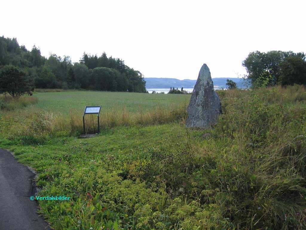
Bautasteinen på Eide står i dag på en gravrøys, like ved veien. Deler av røysa er forsvunnet, sikkert ved bygging av veien. En del av haugens opprinnelig byggemateriale er nok også blitt en del av åkeren rundt. Men på dette høydedraget har det tidligere ligget flere gravanlegg – til dels store, om vi skal tro de skriftlige kildene. Om steinen på Eide sier
Gerhard Schøning (1774) at den står «på en liten Høi«, og at steinen var flyttet fra en annen haug og til det sted den da hadde. Men det er nok mer sannsynlig at steinen står på sin opprinnelige plass.
Lorentz D. Klüwer beskrev samme område vel førti år senere han nevner en kjempehaug som folk lokalt kaller «Påssåhaugen«.
Les merLes enda mer
",
"dlink":"http://maps.google.com/maps?daddr=63.800825,11.142433&t=m&layer=1&doflg=ptk&hl=no&om=0",
"openpopup":"0",
"mapwidth":"640",
"mapwidthunit":"px",
"mapheight":"480",
"marker-createdby":"omlarsen",
"marker-createdon":"2017-08-11 00:00:00",
"marker-updatedby":"omlarsen",
"marker-updatedon":"2017-08-11 00:00:00",
"layerid":["7"],
"layername":"Steiner / varder",
"layer-createdby":"omlarsen",
"layer-createdon":"2017-05-26 00:00:00",
"layer-updatedby":"omlarsen",
"layer-updatedon":"2017-11-09 00:44:02",
"controlbox":"1",
"overlays_custom":"0",
"overlays_custom2":"0",
"overlays_custom3":"0",
"overlays_custom4":"0",
"wms":"0",
"wms2":"0",
"wms3":"0",
"wms4":"0",
"wms5":"0",
"wms6":"0",
"wms7":"0",
"wms8":"0",
"wms9":"0",
"wms10":"0",
"kml_timestamp":"2017-08-11 00:00:00",
"gpx_url":"",
"gpx_panel":"0",
"mlm_filter":"1",
"mlm_filter_details":""
}},
{
"type":"Feature",
"geometry":
{
"type":"Point",
"coordinates":[11.639773,63.683180]
},
"properties":
{
"markerid":"317",
"layers":["1"],
"requested_layer":["1"],
"markername":"Lyngsvollen 15",
"basemap":"custom_basemap",
"lat":"63.683180",
"lon":"11.639773",
"icon":"",
"zoom":"15",
"iconUrl":"http://verdalsportalen.no/wp-content/plugins/leaflet-maps-marker-pro/leaflet-dist/images/marker.png",
"address":"",
"text":"Gps-posisjon: 63.683180 / 11.639773
Her har det vært 3 seterlag.
Se i SETERBOKA. Var brukt som seter sist fra 1937 til 1947 av Stiklestad småbrukerlag/seterlag.
Les om kjentmannsmerket.Under legges det nytt tak i 1941.
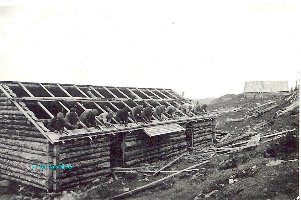
",
"dlink":"http://maps.google.com/maps?daddr=63.683180,11.639773&t=m&layer=1&doflg=ptk&hl=no&om=0",
"openpopup":"0",
"mapwidth":"640",
"mapwidthunit":"px",
"mapheight":"480",
"marker-createdby":"omlarsen",
"marker-createdon":"2017-05-07 00:00:00",
"marker-updatedby":"omlarsen",
"marker-updatedon":"2017-08-21 00:00:00",
"layerid":["1"],
"layername":"Kjentmannstopper",
"layer-createdby":"omlarsen",
"layer-createdon":"2017-03-28 01:23:49",
"layer-updatedby":"omlarsen",
"layer-updatedon":"2021-06-29 23:09:58",
"controlbox":"1",
"overlays_custom":"0",
"overlays_custom2":"0",
"overlays_custom3":"0",
"overlays_custom4":"0",
"wms":"0",
"wms2":"0",
"wms3":"0",
"wms4":"0",
"wms5":"0",
"wms6":"0",
"wms7":"0",
"wms8":"0",
"wms9":"0",
"wms10":"0",
"kml_timestamp":"2017-05-07 00:00:00",
"gpx_url":"",
"gpx_panel":"0",
"mlm_filter":"1",
"mlm_filter_details":""
}},
{
"type":"Feature",
"geometry":
{
"type":"Point",
"coordinates":[12.174315,63.625248]
},
"properties":
{
"markerid":"741",
"layers":["7"],
"requested_layer":["7"],
"markername":"Høgfjellstøtta",
"basemap":"custom_basemap",
"lat":"63.625248",
"lon":"12.174315",
"icon":"blank_black.png",
"zoom":"16",
"iconUrl":"http://verdalsportalen.no/wp-content/uploads/leaflet-maps-marker-icons/blank_black.png",
"address":"",
"text":"
Høgfjellstøtta
Gps-posisjon: 63.625248 / 12.174315
Høgste punkt på vegen.
",
"dlink":"http://maps.google.com/maps?daddr=63.625248,12.174315&t=m&layer=1&doflg=ptk&hl=no&om=0",
"openpopup":"0",
"mapwidth":"640",
"mapwidthunit":"px",
"mapheight":"480",
"marker-createdby":"Kadil",
"marker-createdon":"2017-05-30 00:00:00",
"marker-updatedby":"Kadil",
"marker-updatedon":"2017-05-30 00:00:00",
"layerid":["7"],
"layername":"Steiner / varder",
"layer-createdby":"omlarsen",
"layer-createdon":"2017-05-26 00:00:00",
"layer-updatedby":"omlarsen",
"layer-updatedon":"2017-11-09 00:44:02",
"controlbox":"1",
"overlays_custom":"0",
"overlays_custom2":"0",
"overlays_custom3":"0",
"overlays_custom4":"0",
"wms":"0",
"wms2":"0",
"wms3":"0",
"wms4":"0",
"wms5":"0",
"wms6":"0",
"wms7":"0",
"wms8":"0",
"wms9":"0",
"wms10":"0",
"kml_timestamp":"2017-05-30 00:00:00",
"gpx_url":"",
"gpx_panel":"0",
"mlm_filter":"1",
"mlm_filter_details":""
}},
{
"type":"Feature",
"geometry":
{
"type":"Point",
"coordinates":[12.193020,63.778690]
},
"properties":
{
"markerid":"3",
"layers":["1"],
"requested_layer":["1"],
"markername":"Tørrgranvola 23",
"basemap":"custom_basemap",
"lat":"63.778690",
"lon":"12.193020",
"icon":"",
"zoom":"14",
"iconUrl":"http://verdalsportalen.no/wp-content/plugins/leaflet-maps-marker-pro/leaflet-dist/images/marker.png",
"address":"",
"text":"
",
"dlink":"http://maps.google.com/maps?daddr=63.778690,12.193020&t=m&layer=1&doflg=ptk&hl=no&om=0",
"openpopup":"0",
"mapwidth":"640",
"mapwidthunit":"px",
"mapheight":"480",
"marker-createdby":"omlarsen",
"marker-createdon":"2017-05-13 00:00:00",
"marker-updatedby":"omlarsen",
"marker-updatedon":"2019-02-12 00:00:00",
"layerid":["1"],
"layername":"Kjentmannstopper",
"layer-createdby":"omlarsen",
"layer-createdon":"2017-03-28 01:23:49",
"layer-updatedby":"omlarsen",
"layer-updatedon":"2021-06-29 23:09:58",
"controlbox":"1",
"overlays_custom":"0",
"overlays_custom2":"0",
"overlays_custom3":"0",
"overlays_custom4":"0",
"wms":"0",
"wms2":"0",
"wms3":"0",
"wms4":"0",
"wms5":"0",
"wms6":"0",
"wms7":"0",
"wms8":"0",
"wms9":"0",
"wms10":"0",
"kml_timestamp":"",
"gpx_url":"",
"gpx_panel":"0",
"mlm_filter":"1",
"mlm_filter_details":""
}},
{
"type":"Feature",
"geometry":
{
"type":"Point",
"coordinates":[11.848730,63.772200]
},
"properties":
{
"markerid":"4",
"layers":["1"],
"requested_layer":["1"],
"markername":"Guddingsskallen 8",
"basemap":"custom_basemap",
"lat":"63.772200",
"lon":"11.848730",
"icon":"",
"zoom":"15",
"iconUrl":"http://verdalsportalen.no/wp-content/plugins/leaflet-maps-marker-pro/leaflet-dist/images/marker.png",
"address":"",
"text":"
",
"dlink":"http://maps.google.com/maps?daddr=63.772200,11.848730&t=m&layer=1&doflg=ptk&hl=no&om=0",
"openpopup":"0",
"mapwidth":"640",
"mapwidthunit":"px",
"mapheight":"480",
"marker-createdby":"omlarsen",
"marker-createdon":"2017-05-13 00:00:00",
"marker-updatedby":"omlarsen",
"marker-updatedon":"2017-05-13 00:00:00",
"layerid":["1"],
"layername":"Kjentmannstopper",
"layer-createdby":"omlarsen",
"layer-createdon":"2017-03-28 01:23:49",
"layer-updatedby":"omlarsen",
"layer-updatedon":"2021-06-29 23:09:58",
"controlbox":"1",
"overlays_custom":"0",
"overlays_custom2":"0",
"overlays_custom3":"0",
"overlays_custom4":"0",
"wms":"0",
"wms2":"0",
"wms3":"0",
"wms4":"0",
"wms5":"0",
"wms6":"0",
"wms7":"0",
"wms8":"0",
"wms9":"0",
"wms10":"0",
"kml_timestamp":"",
"gpx_url":"",
"gpx_panel":"0",
"mlm_filter":"1",
"mlm_filter_details":""
}},
{
"type":"Feature",
"geometry":
{
"type":"Point",
"coordinates":[11.979550,63.893830]
},
"properties":
{
"markerid":"6",
"layers":["1"],
"requested_layer":["1"],
"markername":"Hærvola 4",
"basemap":"custom_basemap",
"lat":"63.893830",
"lon":"11.979550",
"icon":"",
"zoom":"15",
"iconUrl":"http://verdalsportalen.no/wp-content/plugins/leaflet-maps-marker-pro/leaflet-dist/images/marker.png",
"address":"",
"text":"
",
"dlink":"http://maps.google.com/maps?daddr=63.893830,11.979550&t=m&layer=1&doflg=ptk&hl=no&om=0",
"openpopup":"0",
"mapwidth":"640",
"mapwidthunit":"px",
"mapheight":"480",
"marker-createdby":"omlarsen",
"marker-createdon":"2017-05-13 00:00:00",
"marker-updatedby":"omlarsen",
"marker-updatedon":"2017-05-13 00:00:00",
"layerid":["1"],
"layername":"Kjentmannstopper",
"layer-createdby":"omlarsen",
"layer-createdon":"2017-03-28 01:23:49",
"layer-updatedby":"omlarsen",
"layer-updatedon":"2021-06-29 23:09:58",
"controlbox":"1",
"overlays_custom":"0",
"overlays_custom2":"0",
"overlays_custom3":"0",
"overlays_custom4":"0",
"wms":"0",
"wms2":"0",
"wms3":"0",
"wms4":"0",
"wms5":"0",
"wms6":"0",
"wms7":"0",
"wms8":"0",
"wms9":"0",
"wms10":"0",
"kml_timestamp":"",
"gpx_url":"",
"gpx_panel":"0",
"mlm_filter":"1",
"mlm_filter_details":""
}},
{
"type":"Feature",
"geometry":
{
"type":"Point",
"coordinates":[12.058350,63.705440]
},
"properties":
{
"markerid":"10",
"layers":["3"],
"requested_layer":["3"],
"markername":"Kvernsjøhøgda",
"basemap":"custom_basemap",
"lat":"63.705440",
"lon":"12.058350",
"icon":"letter_t.png",
"zoom":"9",
"iconUrl":"http://verdalsportalen.no/wp-content/uploads/leaflet-maps-marker-icons/letter_t.png",
"address":"",
"text":" Kvernsjøhøgda (667 moh) 9km t/r
Gå langs kjørevei til det gamle skiferbruddet (Spjeldberget, kjentmannspost) Videre fra bruddet etter marka sti til Kvernsjøhøgda. På kartet står det Sjeldberget på toppen - det er feil.
",
"dlink":"http://maps.google.com/maps?daddr=63.705440,12.058350&t=m&layer=1&doflg=ptk&hl=no&om=0",
"openpopup":"0",
"mapwidth":"100",
"mapwidthunit":"%",
"mapheight":"480",
"marker-createdby":"omlarsen",
"marker-createdon":"2017-05-13 00:00:00",
"marker-updatedby":"Techsila",
"marker-updatedon":"2017-06-01 00:00:00",
"layerid":["3"],
"layername":"Ti på topp 2018",
"layer-createdby":"",
"layer-createdon":"2017-03-28 02:05:54",
"layer-updatedby":"omlarsen",
"layer-updatedon":"2018-08-13 11:44:34",
"controlbox":"1",
"overlays_custom":"0",
"overlays_custom2":"0",
"overlays_custom3":"0",
"overlays_custom4":"0",
"wms":"0",
"wms2":"0",
"wms3":"0",
"wms4":"0",
"wms5":"0",
"wms6":"0",
"wms7":"0",
"wms8":"0",
"wms9":"0",
"wms10":"0",
"kml_timestamp":"",
"gpx_url":"",
"gpx_panel":"0",
"mlm_filter":"1",
"mlm_filter_details":""
}},
{
"type":"Feature",
"geometry":
{
"type":"Point",
"coordinates":[11.064780,63.590500]
},
"properties":
{
"markerid":"12",
"layers":["2"],
"requested_layer":["2"],
"markername":"infinoAidep",
"basemap":"custom_basemap",
"lat":"63.590500",
"lon":"11.064780",
"icon":"shootingrange.png",
"zoom":"14",
"iconUrl":"http://verdalsportalen.no/wp-content/uploads/leaflet-maps-marker-icons/shootingrange.png",
"address":"http:\/\/creditscorewww.com\/",
"text":"play slots online real casino slots free slots casino slots https://casinoonlineww.com/ ",
"dlink":"http://maps.google.com/maps?daddr=http%3A%2F%2Fcreditscorewww.com%2F%0D%0A&t=m&layer=1&doflg=ptk&hl=no&om=0",
"openpopup":"0",
"mapwidth":"640",
"mapwidthunit":"px",
"mapheight":"480",
"marker-createdby":"omlarsen",
"marker-createdon":"2017-05-26 00:00:00",
"marker-updatedby":"omlarsen",
"marker-updatedon":"2017-05-27 00:00:00",
"layerid":["2"],
"layername":"Andre turforslag",
"layer-createdby":"omlarsen",
"layer-createdon":"2017-05-20 00:00:00",
"layer-updatedby":"omlarsen",
"layer-updatedon":"2017-05-20 00:00:00",
"controlbox":"1",
"overlays_custom":"0",
"overlays_custom2":"0",
"overlays_custom3":"0",
"overlays_custom4":"0",
"wms":"0",
"wms2":"0",
"wms3":"0",
"wms4":"0",
"wms5":"0",
"wms6":"0",
"wms7":"0",
"wms8":"0",
"wms9":"0",
"wms10":"0",
"kml_timestamp":"",
"gpx_url":"http://creditscorewww.com/",
"gpx_panel":"0",
"mlm_filter":"1",
"mlm_filter_details":""
}},
{
"type":"Feature",
"geometry":
{
"type":"Point",
"coordinates":[12.171750,63.674040]
},
"properties":
{
"markerid":"734",
"layers":["7"],
"requested_layer":["7"],
"markername":"Geilen med Geilsteinen ",
"basemap":"custom_basemap",
"lat":"63.674040",
"lon":"12.171750",
"icon":"blank_black.png",
"zoom":"16",
"iconUrl":"http://verdalsportalen.no/wp-content/uploads/leaflet-maps-marker-icons/blank_black.png",
"address":"",
"text":"Gps-posisjon: 63.674040 / 12.171750
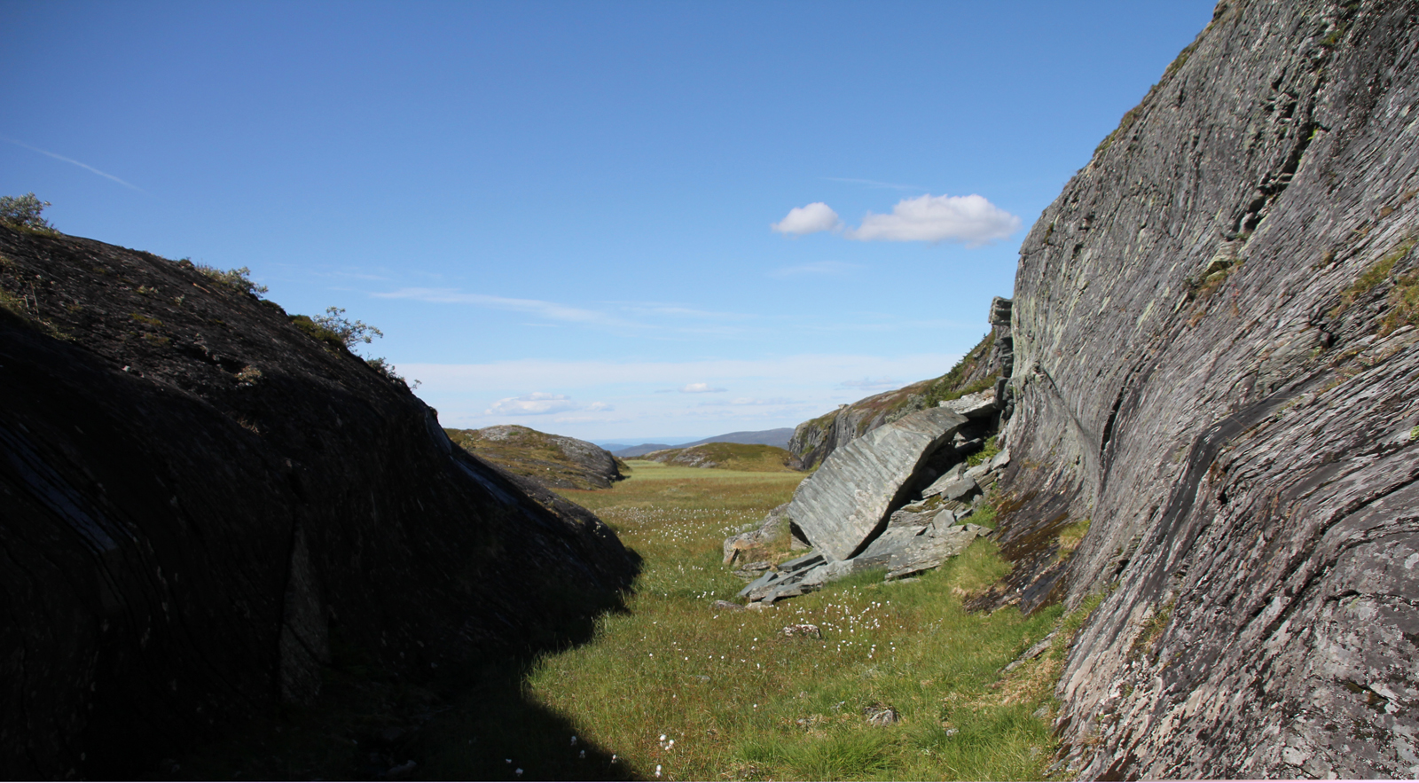
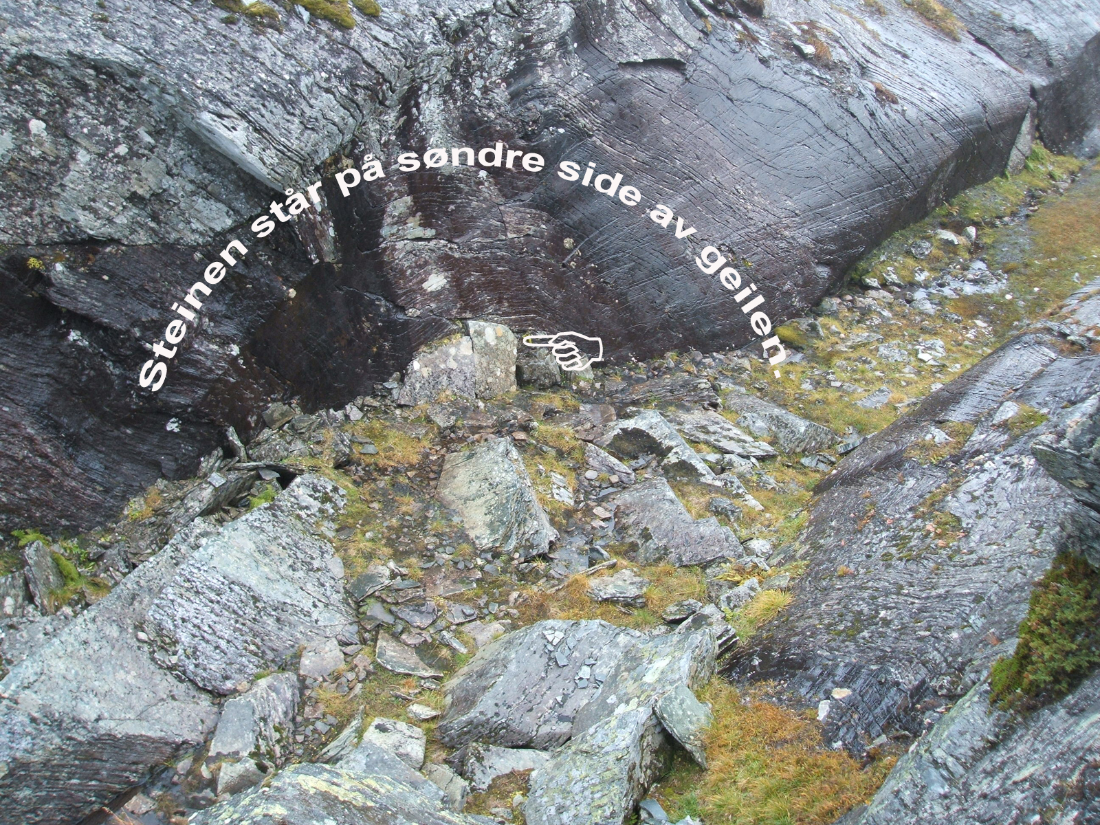

Øverst ser vi Geilen, mot vest.
I midten ser vi handa som peker på steinen med inskripsjon.
Neders ser vi steinen med inskripsjonen, forsterket med rødt i Photoshop. Som vi ser, er det en "morosamgut" som laget en ny i 1996. 200 år etter den første.
",
"dlink":"http://maps.google.com/maps?daddr=63.674040,12.171750&t=m&layer=1&doflg=ptk&hl=no&om=0",
"openpopup":"0",
"mapwidth":"100",
"mapwidthunit":"%",
"mapheight":"700",
"marker-createdby":"omlarsen",
"marker-createdon":"2017-05-27 00:00:00",
"marker-updatedby":"omlarsen",
"marker-updatedon":"2017-05-27 00:00:00",
"layerid":["7"],
"layername":"Steiner / varder",
"layer-createdby":"omlarsen",
"layer-createdon":"2017-05-26 00:00:00",
"layer-updatedby":"omlarsen",
"layer-updatedon":"2017-11-09 00:44:02",
"controlbox":"1",
"overlays_custom":"0",
"overlays_custom2":"0",
"overlays_custom3":"0",
"overlays_custom4":"0",
"wms":"0",
"wms2":"0",
"wms3":"0",
"wms4":"0",
"wms5":"0",
"wms6":"0",
"wms7":"0",
"wms8":"0",
"wms9":"0",
"wms10":"0",
"kml_timestamp":"",
"gpx_url":"",
"gpx_panel":"0",
"mlm_filter":"1",
"mlm_filter_details":""
}},
{
"type":"Feature",
"geometry":
{
"type":"Point",
"coordinates":[11.498210,63.782590]
},
"properties":
{
"markerid":"735",
"layers":["2"],
"requested_layer":["2"],
"markername":"Storøra (Doppeland)",
"basemap":"custom_basemap",
"lat":"63.782590",
"lon":"11.498210",
"icon":"shootingrange.png",
"zoom":"14",
"iconUrl":"http://verdalsportalen.no/wp-content/uploads/leaflet-maps-marker-icons/shootingrange.png",
"address":"",
"text":"Storøra (Doppeland)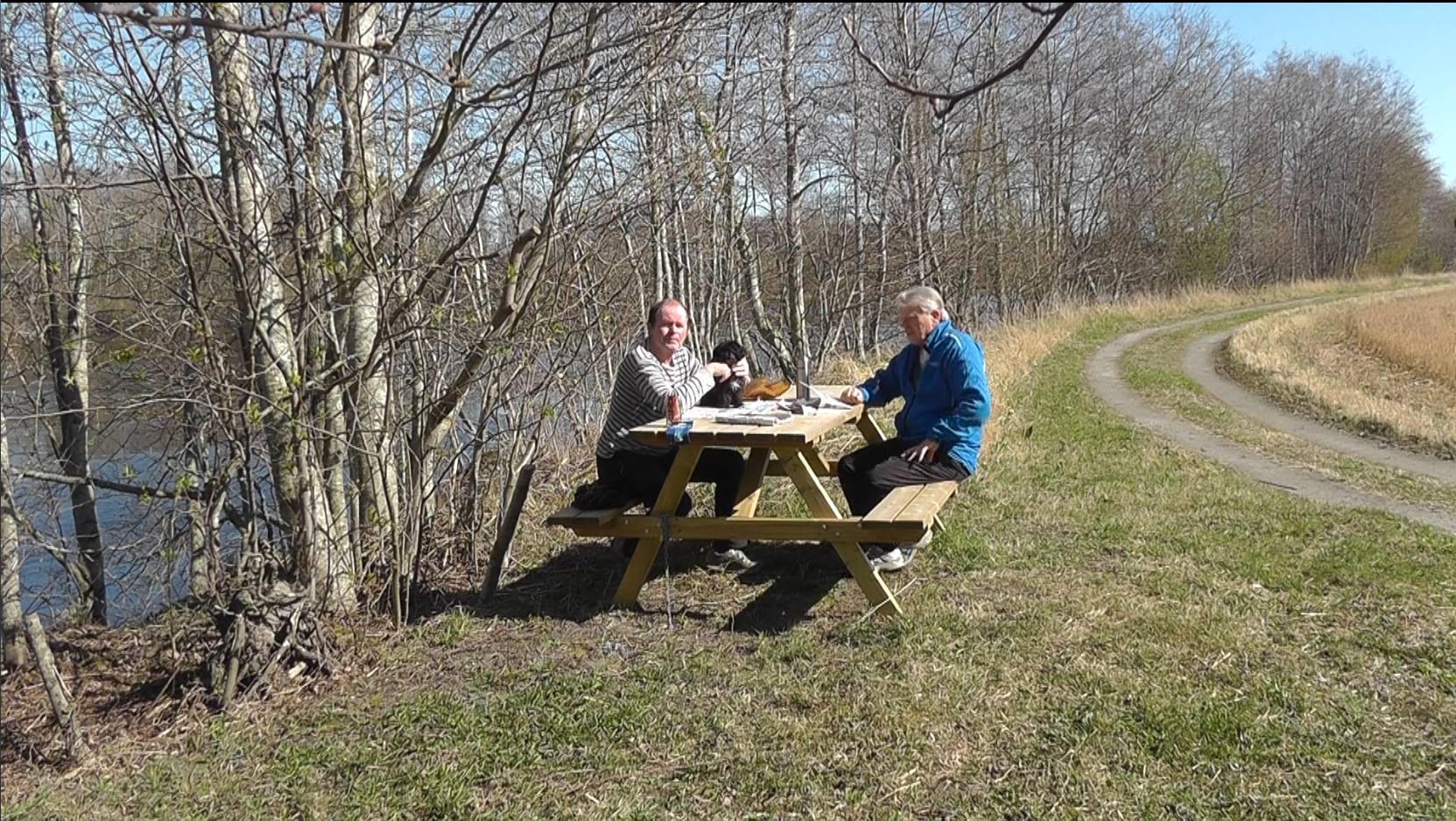
Dette stedet finner du på 'Vinnesiden' av elva - 200 øst for Asfaltverket. Gå Kjæran tursti gjennom Folkeparken, under Jernbanebrua og til bru over Kjærankila. Her går du rett fram langs avlingsvei og svinger etterhvert til venstre ned mot elva. Følg elva ca 200 meter oppstrøms og ta retning mot asfaltverket. Sving inn på skogssti til venstre like før asfaltverket. Når du kommer til en gammel elvemel tar du av til venstre. Etter ytterligere 3-400 meter kommer du til et åpent område, en plen med benker og bord. Her er også bademuligheter. Ikke rør bregnene!
",
"dlink":"http://maps.google.com/maps?daddr=63.782590,11.498210&t=m&layer=1&doflg=ptk&hl=no&om=0",
"openpopup":"0",
"mapwidth":"640",
"mapwidthunit":"px",
"mapheight":"480",
"marker-createdby":"omlarsen",
"marker-createdon":"2017-05-27 00:00:00",
"marker-updatedby":"omlarsen",
"marker-updatedon":"2017-05-29 00:00:00",
"layerid":["2"],
"layername":"Andre turforslag",
"layer-createdby":"omlarsen",
"layer-createdon":"2017-05-20 00:00:00",
"layer-updatedby":"omlarsen",
"layer-updatedon":"2017-05-20 00:00:00",
"controlbox":"1",
"overlays_custom":"0",
"overlays_custom2":"0",
"overlays_custom3":"0",
"overlays_custom4":"0",
"wms":"0",
"wms2":"0",
"wms3":"0",
"wms4":"0",
"wms5":"0",
"wms6":"0",
"wms7":"0",
"wms8":"0",
"wms9":"0",
"wms10":"0",
"kml_timestamp":"",
"gpx_url":"",
"gpx_panel":"0",
"mlm_filter":"1",
"mlm_filter_details":""
}},
{
"type":"Feature",
"geometry":
{
"type":"Point",
"coordinates":[11.808867,63.732095]
},
"properties":
{
"markerid":"736",
"layers":["7"] ,
"requested_layer":["7"],
"markername":"Bumerkerstein",
"basemap":"custom_basemap",
"lat":"63.732095",
"lon":"11.808867",
"icon":"blank_black.png ",
"zoom":"16",
"iconUrl":"http://verdalsportalen.no/wp-content/uploads/leaflet-maps-marker-icons/blank_black.png ",
"address":"",
"text":"3 Steiner med runer og bumerker.
",
"dlink":"http://maps.google.com/maps?daddr=63.732095,11.808867&t=m&layer=1&doflg=ptk&hl=no&om=0",
"openpopup":"0",
"mapwidth":"640",
"mapwidthunit":"px",
"mapheight":"480",
"marker-createdby":"omlarsen",
"marker-createdon":"2017-05-29 00:00:00",
"marker-updatedby":"omlarsen",
"marker-updatedon":"2017-05-29 00:00:00",
"layerid":["7"],
"layername":"Steiner / varder",
"layer-createdby":"omlarsen",
"layer-createdon":"2017-05-26 00:00:00",
"layer-updatedby":"omlarsen",
"layer-updatedon":"2017-11-09 00:44:02",
"controlbox":"0",
"overlays_custom":"0",
"overlays_custom2":"0",
"overlays_custom3":"0",
"overlays_custom4":"0",
"wms":"0",
"wms2":"0",
"wms3":"0",
"wms4":"0",
"wms5":"0",
"wms6":"0",
"wms7":"0",
"wms8":"0",
"wms9":"0",
"wms10":"0",
"kml_timestamp":"2017-05-29 00:00:00",
"gpx_url":"",
"gpx_panel":"0",
"mlm_filter":"1",
"mlm_filter_details":""
}},
{
"type":"Feature",
"geometry":
{
"type":"Point",
"coordinates":[12.093459,63.651017]
},
"properties":
{
"markerid":"737",
"layers":["7"] ,
"requested_layer":["7"],
"markername":"Inskripsjon Kråksjøvegen",
"basemap":"custom_basemap",
"lat":"63.651017",
"lon":"12.093459",
"icon":"blank_black.png ",
"zoom":"16",
"iconUrl":"http://verdalsportalen.no/wp-content/uploads/leaflet-maps-marker-icons/blank_black.png ",
"address":"",
"text":"
Innskripsjon i fjellet, navna på de som bygde vegen.
",
"dlink":"http://maps.google.com/maps?daddr=63.651017,12.093459&t=m&layer=1&doflg=ptk&hl=no&om=0",
"openpopup":"0",
"mapwidth":"640",
"mapwidthunit":"px",
"mapheight":"480",
"marker-createdby":"omlarsen",
"marker-createdon":"2017-05-29 00:00:00",
"marker-updatedby":"omlarsen",
"marker-updatedon":"2017-05-29 00:00:00",
"layerid":["7"],
"layername":"Steiner / varder",
"layer-createdby":"omlarsen",
"layer-createdon":"2017-05-26 00:00:00",
"layer-updatedby":"omlarsen",
"layer-updatedon":"2017-11-09 00:44:02",
"controlbox":"1",
"overlays_custom":"0",
"overlays_custom2":"0",
"overlays_custom3":"0",
"overlays_custom4":"0",
"wms":"0",
"wms2":"0",
"wms3":"0",
"wms4":"0",
"wms5":"0",
"wms6":"0",
"wms7":"0",
"wms8":"0",
"wms9":"0",
"wms10":"0",
"kml_timestamp":"2017-05-29 00:00:00",
"gpx_url":"",
"gpx_panel":"0",
"mlm_filter":"1",
"mlm_filter_details":""
}},
{
"type":"Feature",
"geometry":
{
"type":"Point",
"coordinates":[12.136233,63.654546]
},
"properties":
{
"markerid":"738",
"layers":["7"] ,
"requested_layer":["7"],
"markername":"SkriftKongsstuggu",
"basemap":"custom_basemap",
"lat":"63.654546",
"lon":"12.136233",
"icon":"blank_black.png ",
"zoom":"16",
"iconUrl":"http://verdalsportalen.no/wp-content/uploads/leaflet-maps-marker-icons/blank_black.png ",
"address":" ",
"text":"Inskripsjon i fjellsida.
",
"dlink":"http://maps.google.com/maps?daddr=+&t=m&layer=1&doflg=ptk&hl=no&om=0",
"openpopup":"0",
"mapwidth":"640",
"mapwidthunit":"px",
"mapheight":"480",
"marker-createdby":"omlarsen",
"marker-createdon":"2017-05-29 00:00:00",
"marker-updatedby":"omlarsen",
"marker-updatedon":"2017-05-29 00:00:00",
"layerid":["7"],
"layername":"Steiner / varder",
"layer-createdby":"omlarsen",
"layer-createdon":"2017-05-26 00:00:00",
"layer-updatedby":"omlarsen",
"layer-updatedon":"2017-11-09 00:44:02",
"controlbox":"1",
"overlays_custom":"0",
"overlays_custom2":"0",
"overlays_custom3":"0",
"overlays_custom4":"0",
"wms":"0",
"wms2":"0",
"wms3":"0",
"wms4":"0",
"wms5":"0",
"wms6":"0",
"wms7":"0",
"wms8":"0",
"wms9":"0",
"wms10":"0",
"kml_timestamp":"2017-05-29 00:00:00",
"gpx_url":"",
"gpx_panel":"0",
"mlm_filter":"1",
"mlm_filter_details":""
}},
{
"type":"Feature",
"geometry":
{
"type":"Point",
"coordinates":[11.709510,63.728287]
},
"properties":
{
"markerid":"16",
"layers":["7"],
"requested_layer":["7"],
"markername":"Krona",
"basemap":"custom_basemap",
"lat":"63.728287",
"lon":"11.709510",
"icon":"blank_black.png",
"zoom":"17",
"iconUrl":"http://verdalsportalen.no/wp-content/uploads/leaflet-maps-marker-icons/blank_black.png",
"address":"",
"text":"Grensemerke
'Krone' hugget i fjellet, grense mellom almenninger. Merket med skilt like ved.
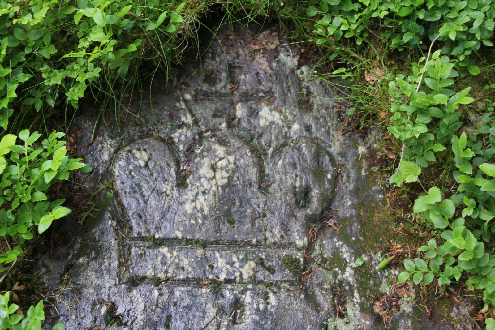
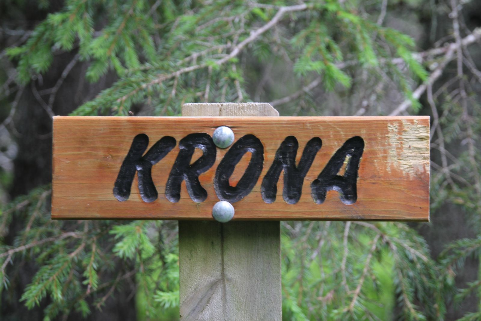
",
"dlink":"http://maps.google.com/maps?daddr=63.728287,11.709510&t=m&layer=1&doflg=ptk&hl=no&om=0",
"openpopup":"1",
"mapwidth":"640",
"mapwidthunit":"px",
"mapheight":"480",
"marker-createdby":"omlarsen",
"marker-createdon":"2017-05-30 00:00:00",
"marker-updatedby":"omlarsen",
"marker-updatedon":"2017-08-04 00:00:00",
"layerid":["7"],
"layername":"Steiner / varder",
"layer-createdby":"omlarsen",
"layer-createdon":"2017-05-26 00:00:00",
"layer-updatedby":"omlarsen",
"layer-updatedon":"2017-11-09 00:44:02",
"controlbox":"1",
"overlays_custom":"0",
"overlays_custom2":"0",
"overlays_custom3":"0",
"overlays_custom4":"0",
"wms":"0",
"wms2":"0",
"wms3":"0",
"wms4":"0",
"wms5":"0",
"wms6":"0",
"wms7":"0",
"wms8":"0",
"wms9":"0",
"wms10":"0",
"kml_timestamp":"2017-05-30 00:00:00",
"gpx_url":"",
"gpx_panel":"0",
"mlm_filter":"1",
"mlm_filter_details":""
}},
{
"type":"Feature",
"geometry":
{
"type":"Point",
"coordinates":[11.946531,63.813215]
},
"properties":
{
"markerid":"14",
"layers":["7"],
"requested_layer":["7"],
"markername":"Inskripsjon Skansbakkan",
"basemap":"custom_basemap",
"lat":"63.813215",
"lon":"11.946531",
"icon":"blank_black.png",
"zoom":"15",
"iconUrl":"http://verdalsportalen.no/wp-content/uploads/leaflet-maps-marker-icons/blank_black.png",
"address":"",
"text":"Initialer hugget i en stein i muren i Skansbakken. Vegbyggernes initialer.
",
"dlink":"http://maps.google.com/maps?daddr=63.813215,11.946531&t=m&layer=1&doflg=ptk&hl=no&om=0",
"openpopup":"0",
"mapwidth":"640",
"mapwidthunit":"px",
"mapheight":"480",
"marker-createdby":"omlarsen",
"marker-createdon":"2017-05-30 00:00:00",
"marker-updatedby":"omlarsen",
"marker-updatedon":"2019-07-02 02:05:25",
"layerid":["7"],
"layername":"Steiner / varder",
"layer-createdby":"omlarsen",
"layer-createdon":"2017-05-26 00:00:00",
"layer-updatedby":"omlarsen",
"layer-updatedon":"2017-11-09 00:44:02",
"controlbox":"1",
"overlays_custom":"0",
"overlays_custom2":"0",
"overlays_custom3":"0",
"overlays_custom4":"0",
"wms":"0",
"wms2":"0",
"wms3":"0",
"wms4":"0",
"wms5":"0",
"wms6":"0",
"wms7":"0",
"wms8":"0",
"wms9":"0",
"wms10":"0",
"kml_timestamp":"2017-05-30 00:00:00",
"gpx_url":"http://%20",
"gpx_panel":"0",
"mlm_filter":"1",
"mlm_filter_details":""
}},
{
"type":"Feature",
"geometry":
{
"type":"Point",
"coordinates":[11.808558,63.685460]
},
"properties":
{
"markerid":"739",
"layers":["7"],
"requested_layer":["7"],
"markername":"Merkestein Tverrå",
"basemap":"custom_basemap",
"lat":"63.685460",
"lon":"11.808558",
"icon":"blank_black.png ",
"zoom":"16",
"iconUrl":"http://verdalsportalen.no/wp-content/uploads/leaflet-maps-marker-icons/blank_black.png ",
"address":"",
"text":"Merkestein Tverrå
Gps-posisjon: 63.685459988 / 11.808558208
Grensemerke mellom Verdalsbuket og Staten.
",
"dlink":"http://maps.google.com/maps?daddr=63.685460,11.808558&t=m&layer=1&doflg=ptk&hl=no&om=0",
"openpopup":"0",
"mapwidth":"640",
"mapwidthunit":"px",
"mapheight":"480",
"marker-createdby":"omlarsen",
"marker-createdon":"2017-05-30 00:00:00",
"marker-updatedby":"omlarsen",
"marker-updatedon":"2017-05-30 00:00:00",
"layerid":["7"],
"layername":"Steiner / varder",
"layer-createdby":"omlarsen",
"layer-createdon":"2017-05-26 00:00:00",
"layer-updatedby":"omlarsen",
"layer-updatedon":"2017-11-09 00:44:02",
"controlbox":"1",
"overlays_custom":"0",
"overlays_custom2":"0",
"overlays_custom3":"0",
"overlays_custom4":"0",
"wms":"0",
"wms2":"0",
"wms3":"0",
"wms4":"0",
"wms5":"0",
"wms6":"0",
"wms7":"0",
"wms8":"0",
"wms9":"0",
"wms10":"0",
"kml_timestamp":"2017-05-30 00:00:00",
"gpx_url":"",
"gpx_panel":"0",
"mlm_filter":"1",
"mlm_filter_details":""
}},
{
"type":"Feature",
"geometry":
{
"type":"Point",
"coordinates":[12.254643,63.841479]
},
"properties":
{
"markerid":"20",
"layers":["7"],
"requested_layer":["7"],
"markername":"Parnasstuggu",
"basemap":"custom_basemap",
"lat":"63.841479",
"lon":"12.254643",
"icon":"blank_black.png",
"zoom":"16",
"iconUrl":"http://verdalsportalen.no/wp-content/uploads/leaflet-maps-marker-icons/blank_black.png",
"address":"",
"text":"Parnasstuggu
Gps-posisjon: 63.841479392/11.254642928
Hustufter, helt attmed tuftene finnes en stein 'Denne bæk kældes Storbækken i Færlandet'
",
"dlink":"http://maps.google.com/maps?daddr=63.841479,12.254643&t=m&layer=1&doflg=ptk&hl=no&om=0",
"openpopup":"0",
"mapwidth":"640",
"mapwidthunit":"px",
"mapheight":"480",
"marker-createdby":"omlarsen",
"marker-createdon":"2017-05-30 00:00:00",
"marker-updatedby":"omlarsen",
"marker-updatedon":"2017-05-30 00:00:00",
"layerid":["7"],
"layername":"Steiner / varder",
"layer-createdby":"omlarsen",
"layer-createdon":"2017-05-26 00:00:00",
"layer-updatedby":"omlarsen",
"layer-updatedon":"2017-11-09 00:44:02",
"controlbox":"1",
"overlays_custom":"0",
"overlays_custom2":"0",
"overlays_custom3":"0",
"overlays_custom4":"0",
"wms":"0",
"wms2":"0",
"wms3":"0",
"wms4":"0",
"wms5":"0",
"wms6":"0",
"wms7":"0",
"wms8":"0",
"wms9":"0",
"wms10":"0",
"kml_timestamp":"2017-05-30 00:00:00",
"gpx_url":"",
"gpx_panel":"0",
"mlm_filter":"1",
"mlm_filter_details":""
}},
{
"type":"Feature",
"geometry":
{
"type":"Point",
"coordinates":[12.033355,63.698467]
},
"properties":
{
"markerid":"23",
"layers":["7"],
"requested_layer":["7"],
"markername":"Spjeldberget",
"basemap":"custom_basemap",
"lat":"63.698467",
"lon":"12.033355",
"icon":"blank_black.png",
"zoom":"16",
"iconUrl":"http://verdalsportalen.no/wp-content/uploads/leaflet-maps-marker-icons/blank_black.png",
"address":"",
"text":"Spjeldberget
Gps-posisjon: 63.69846/12.03335
Husrester og skiferbrudd.
",
"dlink":"http://maps.google.com/maps?daddr=63.698467,12.033355&t=m&layer=1&doflg=ptk&hl=no&om=0",
"openpopup":"0",
"mapwidth":"640",
"mapwidthunit":"px",
"mapheight":"480",
"marker-createdby":"omlarsen",
"marker-createdon":"2017-05-30 00:00:00",
"marker-updatedby":"omlarsen",
"marker-updatedon":"2017-05-30 00:00:00",
"layerid":["7"],
"layername":"Steiner / varder",
"layer-createdby":"omlarsen",
"layer-createdon":"2017-05-26 00:00:00",
"layer-updatedby":"omlarsen",
"layer-updatedon":"2017-11-09 00:44:02",
"controlbox":"1",
"overlays_custom":"0",
"overlays_custom2":"0",
"overlays_custom3":"0",
"overlays_custom4":"0",
"wms":"0",
"wms2":"0",
"wms3":"0",
"wms4":"0",
"wms5":"0",
"wms6":"0",
"wms7":"0",
"wms8":"0",
"wms9":"0",
"wms10":"0",
"kml_timestamp":"2017-05-30 00:00:00",
"gpx_url":"",
"gpx_panel":"0",
"mlm_filter":"1",
"mlm_filter_details":""
}},
{
"type":"Feature",
"geometry":
{
"type":"Point",
"coordinates":[12.207399,63.719298]
},
"properties":
{
"markerid":"25",
"layers":["7"],
"requested_layer":["7"],
"markername":"Gustav Olsa Koia",
"basemap":"custom_basemap",
"lat":"63.719298",
"lon":"12.207399",
"icon":"blank_black.png ",
"zoom":"16",
"iconUrl":"http://verdalsportalen.no/wp-content/uploads/leaflet-maps-marker-icons/blank_black.png ",
"address":"",
"text":"Gustav Olsa KoiaGps-posisjon: 63.719297982/ 12.207399001
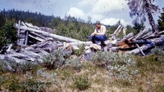
Rester av boligen til Gustav Olsa da han var her på tømmerhogst.
",
"dlink":"http://maps.google.com/maps?daddr=63.719298,12.207399&t=m&layer=1&doflg=ptk&hl=no&om=0",
"openpopup":"0",
"mapwidth":"640",
"mapwidthunit":"px",
"mapheight":"480",
"marker-createdby":"omlarsen",
"marker-createdon":"2017-05-30 00:00:00",
"marker-updatedby":"omlarsen",
"marker-updatedon":"2017-05-30 00:00:00",
"layerid":["7"],
"layername":"Steiner / varder",
"layer-createdby":"omlarsen",
"layer-createdon":"2017-05-26 00:00:00",
"layer-updatedby":"omlarsen",
"layer-updatedon":"2017-11-09 00:44:02",
"controlbox":"1",
"overlays_custom":"0",
"overlays_custom2":"0",
"overlays_custom3":"0",
"overlays_custom4":"0",
"wms":"0",
"wms2":"0",
"wms3":"0",
"wms4":"0",
"wms5":"0",
"wms6":"0",
"wms7":"0",
"wms8":"0",
"wms9":"0",
"wms10":"0",
"kml_timestamp":"2017-05-30 00:00:00",
"gpx_url":"",
"gpx_panel":"0",
"mlm_filter":"1",
"mlm_filter_details":""
}},
{
"type":"Feature",
"geometry":
{
"type":"Point",
"coordinates":[11.530302,63.862843]
},
"properties":
{
"markerid":"740",
"layers":["7"],
"requested_layer":["7"],
"markername":"Gjeterstenen Marsteinvola",
"basemap":"custom_basemap",
"lat":"63.862843",
"lon":"11.530302",
"icon":"blank_black.png ",
"zoom":"11",
"iconUrl":"http://verdalsportalen.no/wp-content/uploads/leaflet-maps-marker-icons/blank_black.png ",
"address":"",
"text":"
",
"dlink":"http://maps.google.com/maps?daddr=63.862843,11.530302&t=m&layer=1&doflg=ptk&hl=no&om=0",
"openpopup":"0",
"mapwidth":"640",
"mapwidthunit":"px",
"mapheight":"480",
"marker-createdby":"omlarsen",
"marker-createdon":"2017-05-30 00:00:00",
"marker-updatedby":"omlarsen",
"marker-updatedon":"2017-05-30 00:00:00",
"layerid":["7"],
"layername":"Steiner / varder",
"layer-createdby":"omlarsen",
"layer-createdon":"2017-05-26 00:00:00",
"layer-updatedby":"omlarsen",
"layer-updatedon":"2017-11-09 00:44:02",
"controlbox":"1",
"overlays_custom":"0",
"overlays_custom2":"0",
"overlays_custom3":"0",
"overlays_custom4":"0",
"wms":"0",
"wms2":"0",
"wms3":"0",
"wms4":"0",
"wms5":"0",
"wms6":"0",
"wms7":"0",
"wms8":"0",
"wms9":"0",
"wms10":"0",
"kml_timestamp":"2017-05-30 00:00:00",
"gpx_url":"http://x",
"gpx_panel":"0",
"mlm_filter":"1",
"mlm_filter_details":""
}},
{
"type":"Feature",
"geometry":
{
"type":"Point",
"coordinates":[11.526274,63.772873]
},
"properties":
{
"markerid":"759",
"layers":["7"],
"requested_layer":["7"],
"markername":"Bauta Vinne kirke",
"basemap":"custom_basemap",
"lat":"63.772873",
"lon":"11.526274",
"icon":"blank_black.png",
"zoom":"17",
"iconUrl":"http://verdalsportalen.no/wp-content/uploads/leaflet-maps-marker-icons/blank_black.png",
"address":"",
"text":"
Bauta Vinne kirke
Gpspunkt: 63.7728732/11.5262744
",
"dlink":"http://maps.google.com/maps?daddr=63.772873,11.526274&t=m&layer=1&doflg=ptk&hl=no&om=0",
"openpopup":"0",
"mapwidth":"640",
"mapwidthunit":"px",
"mapheight":"480",
"marker-createdby":"omlarsen",
"marker-createdon":"2017-06-14 00:00:00",
"marker-updatedby":"omlarsen",
"marker-updatedon":"2017-06-20 00:00:00",
"layerid":["7"],
"layername":"Steiner / varder",
"layer-createdby":"omlarsen",
"layer-createdon":"2017-05-26 00:00:00",
"layer-updatedby":"omlarsen",
"layer-updatedon":"2017-11-09 00:44:02",
"controlbox":"1",
"overlays_custom":"0",
"overlays_custom2":"0",
"overlays_custom3":"0",
"overlays_custom4":"0",
"wms":"0",
"wms2":"0",
"wms3":"0",
"wms4":"0",
"wms5":"0",
"wms6":"0",
"wms7":"0",
"wms8":"0",
"wms9":"0",
"wms10":"0",
"kml_timestamp":"",
"gpx_url":"",
"gpx_panel":"0",
"mlm_filter":"1",
"mlm_filter_details":""
}},
{
"type":"Feature",
"geometry":
{
"type":"Point",
"coordinates":[11.716014,63.751520]
},
"properties":
{
"markerid":"760",
"layers":["7"],
"requested_layer":["7"],
"markername":"Visborgstøtta",
"basemap":"custom_basemap",
"lat":"63.751520",
"lon":"11.716014",
"icon":"blank_black.png",
"zoom":"18",
"iconUrl":"http://verdalsportalen.no/wp-content/uploads/leaflet-maps-marker-icons/blank_black.png",
"address":"",
"text":"Gps-posisjon: 63.751520 / 11.716014
",
"dlink":"http://maps.google.com/maps?daddr=63.751520,11.716014&t=m&layer=1&doflg=ptk&hl=no&om=0",
"openpopup":"0",
"mapwidth":"640",
"mapwidthunit":"px",
"mapheight":"480",
"marker-createdby":"omlarsen",
"marker-createdon":"2017-06-14 00:00:00",
"marker-updatedby":"kadillan",
"marker-updatedon":"2017-08-10 00:00:00",
"layerid":["7"],
"layername":"Steiner / varder",
"layer-createdby":"omlarsen",
"layer-createdon":"2017-05-26 00:00:00",
"layer-updatedby":"omlarsen",
"layer-updatedon":"2017-11-09 00:44:02",
"controlbox":"1",
"overlays_custom":"0",
"overlays_custom2":"0",
"overlays_custom3":"0",
"overlays_custom4":"0",
"wms":"0",
"wms2":"0",
"wms3":"0",
"wms4":"0",
"wms5":"0",
"wms6":"0",
"wms7":"0",
"wms8":"0",
"wms9":"0",
"wms10":"0",
"kml_timestamp":"",
"gpx_url":"",
"gpx_panel":"0",
"mlm_filter":"1",
"mlm_filter_details":""
}},
{
"type":"Feature",
"geometry":
{
"type":"Point",
"coordinates":[11.630851,63.710782]
},
"properties":
{
"markerid":"761",
"layers":["2"],
"requested_layer":["2"],
"markername":"Hustufter Hilmar Buran",
"basemap":"custom_basemap",
"lat":"63.710782",
"lon":"11.630851",
"icon":"shootingrange.png",
"zoom":"11",
"iconUrl":"http://verdalsportalen.no/wp-content/uploads/leaflet-maps-marker-icons/shootingrange.png",
"address":"",
"text":"
Gps-posisjon: 63.710782 / 11.630851
Tufter etter boligen som Hilmar Buran (1893-1988) bodde i da han hogg tømmer her like etter siste verdenskrig.
",
"dlink":"http://maps.google.com/maps?daddr=63.710782,11.630851&t=m&layer=1&doflg=ptk&hl=no&om=0",
"openpopup":"0",
"mapwidth":"640",
"mapwidthunit":"px",
"mapheight":"480",
"marker-createdby":"omlarsen",
"marker-createdon":"2017-06-14 00:00:00",
"marker-updatedby":"omlarsen",
"marker-updatedon":"2017-06-14 00:00:00",
"layerid":["2"],
"layername":"Andre turforslag",
"layer-createdby":"omlarsen",
"layer-createdon":"2017-05-20 00:00:00",
"layer-updatedby":"omlarsen",
"layer-updatedon":"2017-05-20 00:00:00",
"controlbox":"1",
"overlays_custom":"0",
"overlays_custom2":"0",
"overlays_custom3":"0",
"overlays_custom4":"0",
"wms":"0",
"wms2":"0",
"wms3":"0",
"wms4":"0",
"wms5":"0",
"wms6":"0",
"wms7":"0",
"wms8":"0",
"wms9":"0",
"wms10":"0",
"kml_timestamp":"",
"gpx_url":"",
"gpx_panel":"0",
"mlm_filter":"1",
"mlm_filter_details":""
}},
{
"type":"Feature",
"geometry":
{
"type":"Point",
"coordinates":[11.524600,63.792575]
},
"properties":
{
"markerid":"769",
"layers":["7"],
"requested_layer":["7"],
"markername":"Klüversteinen på Bjartnes",
"basemap":"custom_basemap",
"lat":"63.792575",
"lon":"11.524600",
"icon":"blank_black.png",
"zoom":"18",
"iconUrl":"http://verdalsportalen.no/wp-content/uploads/leaflet-maps-marker-icons/blank_black.png",
"address":"",
"text":"
",
"dlink":"http://maps.google.com/maps?daddr=63.792575,11.524600&t=m&layer=1&doflg=ptk&hl=no&om=0",
"openpopup":"0",
"mapwidth":"640",
"mapwidthunit":"px",
"mapheight":"480",
"marker-createdby":"omlarsen",
"marker-createdon":"2017-06-18 00:00:00",
"marker-updatedby":"omlarsen",
"marker-updatedon":"2017-06-18 00:00:00",
"layerid":["7"],
"layername":"Steiner / varder",
"layer-createdby":"omlarsen",
"layer-createdon":"2017-05-26 00:00:00",
"layer-updatedby":"omlarsen",
"layer-updatedon":"2017-11-09 00:44:02",
"controlbox":"1",
"overlays_custom":"0",
"overlays_custom2":"0",
"overlays_custom3":"0",
"overlays_custom4":"0",
"wms":"0",
"wms2":"0",
"wms3":"0",
"wms4":"0",
"wms5":"0",
"wms6":"0",
"wms7":"0",
"wms8":"0",
"wms9":"0",
"wms10":"0",
"kml_timestamp":"",
"gpx_url":"",
"gpx_panel":"0",
"mlm_filter":"1",
"mlm_filter_details":""
}},
{
"type":"Feature",
"geometry":
{
"type":"Point",
"coordinates":[11.641391,63.838063]
},
"properties":
{
"markerid":"770",
"layers":["7"],
"requested_layer":["7"],
"markername":"Gravlund for Klüver på Bunes.",
"basemap":"custom_basemap",
"lat":"63.838063",
"lon":"11.641391",
"icon":"blank_black.png",
"zoom":"18",
"iconUrl":"http://verdalsportalen.no/wp-content/uploads/leaflet-maps-marker-icons/blank_black.png",
"address":"",
"text":"
",
"dlink":"http://maps.google.com/maps?daddr=63.838063,11.641391&t=m&layer=1&doflg=ptk&hl=no&om=0",
"openpopup":"1",
"mapwidth":"640",
"mapwidthunit":"px",
"mapheight":"480",
"marker-createdby":"omlarsen",
"marker-createdon":"2017-06-18 00:00:00",
"marker-updatedby":"omlarsen",
"marker-updatedon":"2017-06-18 00:00:00",
"layerid":["7"],
"layername":"Steiner / varder",
"layer-createdby":"omlarsen",
"layer-createdon":"2017-05-26 00:00:00",
"layer-updatedby":"omlarsen",
"layer-updatedon":"2017-11-09 00:44:02",
"controlbox":"1",
"overlays_custom":"0",
"overlays_custom2":"0",
"overlays_custom3":"0",
"overlays_custom4":"0",
"wms":"0",
"wms2":"0",
"wms3":"0",
"wms4":"0",
"wms5":"0",
"wms6":"0",
"wms7":"0",
"wms8":"0",
"wms9":"0",
"wms10":"0",
"kml_timestamp":"",
"gpx_url":"",
"gpx_panel":"0",
"mlm_filter":"1",
"mlm_filter_details":""
}},
{
"type":"Feature",
"geometry":
{
"type":"Point",
"coordinates":[11.480270,63.759200]
},
"properties":
{
"markerid":"848",
"layers":["7"],
"requested_layer":["7"],
"markername":"Rambowski-steinen",
"basemap":"googleLayer_satellite",
"lat":"63.759200",
"lon":"11.480270",
"icon":"blank_black.png",
"zoom":"18",
"iconUrl":"http://verdalsportalen.no/wp-content/uploads/leaflet-maps-marker-icons/blank_black.png",
"address":"",
"text":"
Rambowskisteinen.
Gps-posisjon: 63.759200 / 11.480270
",
"dlink":"http://maps.google.com/maps?daddr=63.759200,11.480270&t=m&layer=1&doflg=ptk&hl=no&om=0",
"openpopup":"1",
"mapwidth":"800",
"mapwidthunit":"px",
"mapheight":"600",
"marker-createdby":"omlarsen",
"marker-createdon":"2017-07-08 00:00:00",
"marker-updatedby":"omlarsen",
"marker-updatedon":"2017-07-09 00:00:00",
"layerid":["7"],
"layername":"Steiner / varder",
"layer-createdby":"omlarsen",
"layer-createdon":"2017-05-26 00:00:00",
"layer-updatedby":"omlarsen",
"layer-updatedon":"2017-11-09 00:44:02",
"controlbox":"1",
"overlays_custom":"0",
"overlays_custom2":"0",
"overlays_custom3":"0",
"overlays_custom4":"0",
"wms":"0",
"wms2":"0",
"wms3":"0",
"wms4":"0",
"wms5":"0",
"wms6":"0",
"wms7":"0",
"wms8":"0",
"wms9":"0",
"wms10":"0",
"kml_timestamp":"",
"gpx_url":"http://verdalsportalen.no/Gps_spor/Rambowski-steinen.gpx",
"gpx_panel":"1",
"mlm_filter":"1",
"mlm_filter_details":""
}},
{
"type":"Feature",
"geometry":
{
"type":"Point",
"coordinates":[11.526310,63.772853]
},
"properties":
{
"markerid":"902",
"layers":["47","7"],
"requested_layer":["7"],
"markername":"Gravhaug og stein i Vinne.",
"basemap":"custom_basemap",
"lat":"63.772853",
"lon":"11.526310",
"icon":"letter_g.png",
"zoom":"14",
"iconUrl":"http://verdalsportalen.no/wp-content/uploads/leaflet-maps-marker-icons/letter_g.png",
"address":"",
"text":"
Gps-posisjon: 63.772853 / 11.526310
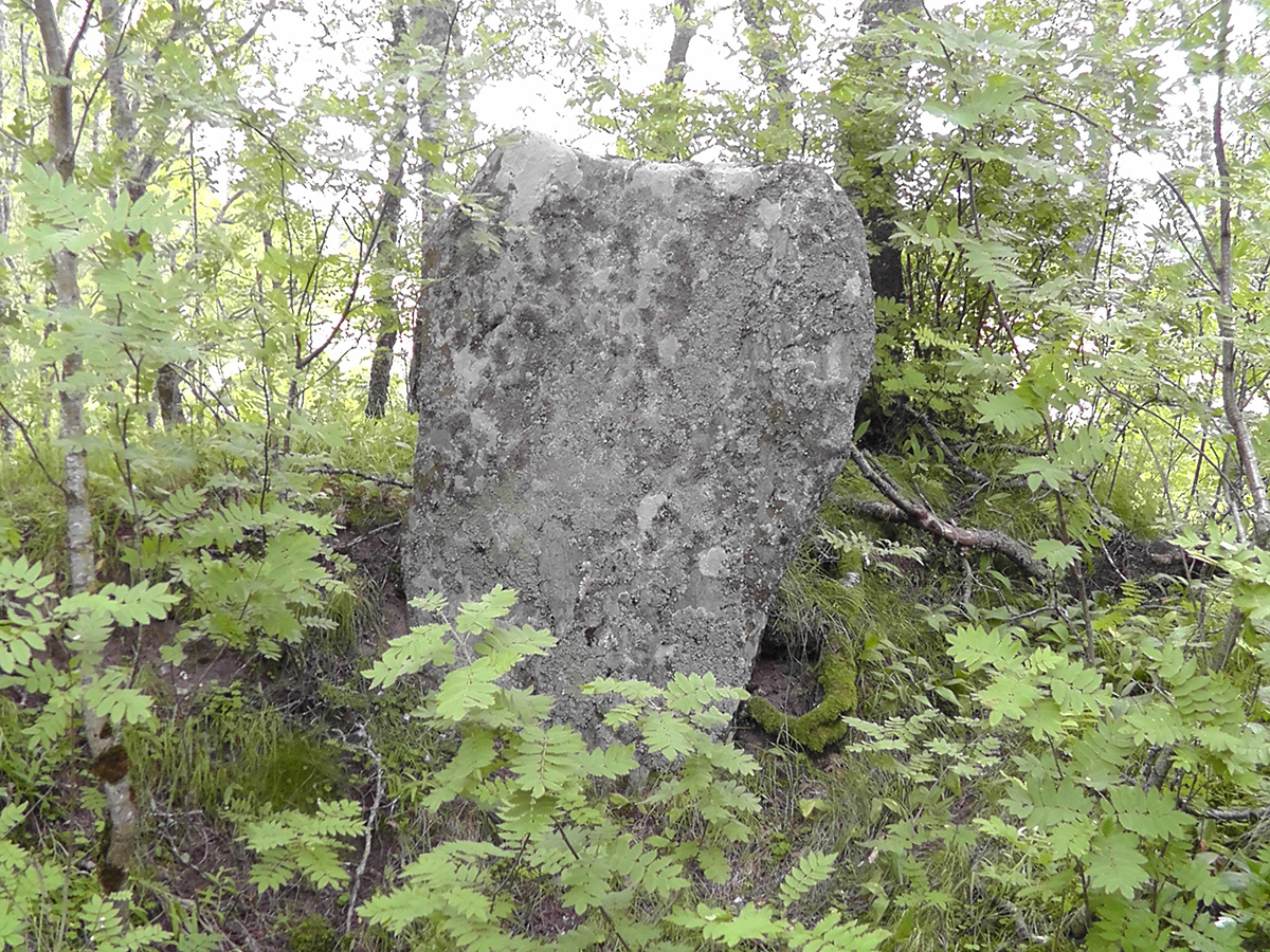
",
"dlink":"http://maps.google.com/maps?daddr=63.772853,11.526310&t=m&layer=1&doflg=ptk&hl=no&om=0",
"openpopup":"0",
"mapwidth":"800",
"mapwidthunit":"px",
"mapheight":"600",
"marker-createdby":"omlarsen",
"marker-createdon":"2017-07-29 00:00:00",
"marker-updatedby":"omlarsen",
"marker-updatedon":"2017-07-30 00:00:00",
"layerid":["47", "7"],
"layername":"Steiner / varder",
"layer-createdby":"omlarsen",
"layer-createdon":"2017-05-26 00:00:00",
"layer-updatedby":"omlarsen",
"layer-updatedon":"2017-11-09 00:44:02",
"controlbox":"1",
"overlays_custom":"0",
"overlays_custom2":"0",
"overlays_custom3":"0",
"overlays_custom4":"0",
"wms":"0",
"wms2":"0",
"wms3":"0",
"wms4":"0",
"wms5":"0",
"wms6":"0",
"wms7":"0",
"wms8":"0",
"wms9":"0",
"wms10":"0",
"kml_timestamp":"",
"gpx_url":"",
"gpx_panel":"0",
"mlm_filter":"1",
"mlm_filter_details":""
}},
{
"type":"Feature",
"geometry":
{
"type":"Point",
"coordinates":[11.526310,63.772853]
},
"properties":
{
"markerid":"902",
"layers":["47","7"],
"requested_layer":["7"],
"markername":"Gravhaug og stein i Vinne.",
"basemap":"custom_basemap",
"lat":"63.772853",
"lon":"11.526310",
"icon":"letter_g.png",
"zoom":"14",
"iconUrl":"http://verdalsportalen.no/wp-content/uploads/leaflet-maps-marker-icons/letter_g.png",
"address":"",
"text":"
Gps-posisjon: 63.772853 / 11.526310

",
"dlink":"http://maps.google.com/maps?daddr=63.772853,11.526310&t=m&layer=1&doflg=ptk&hl=no&om=0",
"openpopup":"0",
"mapwidth":"800",
"mapwidthunit":"px",
"mapheight":"600",
"marker-createdby":"omlarsen",
"marker-createdon":"2017-07-29 00:00:00",
"marker-updatedby":"omlarsen",
"marker-updatedon":"2017-07-30 00:00:00",
"layerid":["47", "7"],
"layername":"Gravhauger",
"layer-createdby":"omlarsen",
"layer-createdon":"2017-07-29 13:32:01",
"layer-updatedby":"omlarsen",
"layer-updatedon":"2017-07-29 18:29:10",
"controlbox":"1",
"overlays_custom":"0",
"overlays_custom2":"0",
"overlays_custom3":"0",
"overlays_custom4":"0",
"wms":"0",
"wms2":"0",
"wms3":"0",
"wms4":"0",
"wms5":"0",
"wms6":"0",
"wms7":"0",
"wms8":"0",
"wms9":"0",
"wms10":"0",
"kml_timestamp":"",
"gpx_url":"",
"gpx_panel":"0",
"mlm_filter":"1",
"mlm_filter_details":""
}},
{
"type":"Feature",
"geometry":
{
"type":"Point",
"coordinates":[11.571180,63.636320]
},
"properties":
{
"markerid":"910",
"layers":["7"],
"requested_layer":["7"],
"markername":"Sofiesteinen",
"basemap":"custom_basemap ",
"lat":"63.636320",
"lon":"11.571180",
"icon":"blank_black.png ",
"zoom":"16",
"iconUrl":"http://verdalsportalen.no/wp-content/uploads/leaflet-maps-marker-icons/blank_black.png ",
"address":"",
"text":"
",
"dlink":"http://maps.google.com/maps?daddr=63.636320,11.571180&t=m&layer=1&doflg=ptk&hl=no&om=0",
"openpopup":"0",
"mapwidth":"640",
"mapwidthunit":"px",
"mapheight":"480",
"marker-createdby":"kadillan",
"marker-createdon":"2017-07-30 00:00:00",
"marker-updatedby":"kadillan",
"marker-updatedon":"2017-07-31 00:00:00",
"layerid":["7"],
"layername":"Steiner / varder",
"layer-createdby":"omlarsen",
"layer-createdon":"2017-05-26 00:00:00",
"layer-updatedby":"omlarsen",
"layer-updatedon":"2017-11-09 00:44:02",
"controlbox":"1",
"overlays_custom":"0",
"overlays_custom2":"0",
"overlays_custom3":"0",
"overlays_custom4":"0",
"wms":"0",
"wms2":"0",
"wms3":"0",
"wms4":"0",
"wms5":"0",
"wms6":"0",
"wms7":"0",
"wms8":"0",
"wms9":"0",
"wms10":"0",
"kml_timestamp":"2017-07-30 00:00:00",
"gpx_url":"",
"gpx_panel":"0",
"mlm_filter":"1",
"mlm_filter_details":""
}},
{
"type":"Feature",
"geometry":
{
"type":"Point",
"coordinates":[11.608569,63.638530]
},
"properties":
{
"markerid":"911",
"layers":["7"],
"requested_layer":["7"],
"markername":"Sigurdsteinen",
"basemap":"custom_basemap",
"lat":"63.638530",
"lon":"11.608569",
"icon":"blank_black.png",
"zoom":"16",
"iconUrl":"http://verdalsportalen.no/wp-content/uploads/leaflet-maps-marker-icons/blank_black.png",
"address":"",
"text":"
Gps-posisjon: 63.638530 / 11.608569
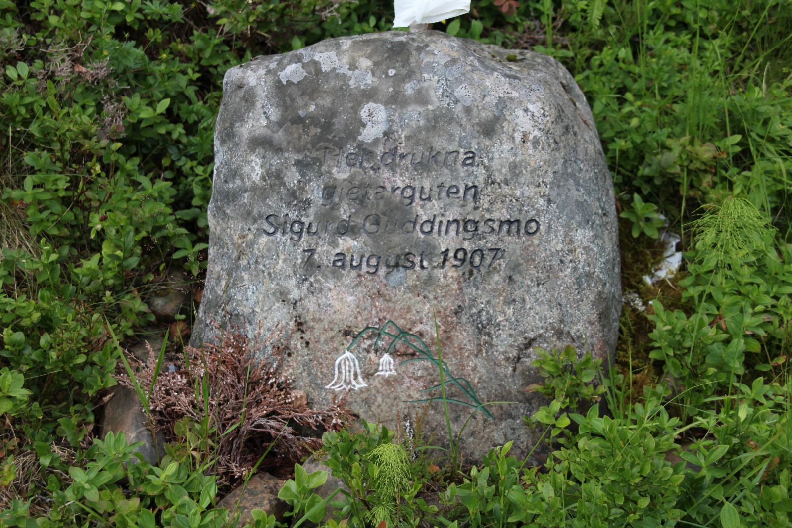
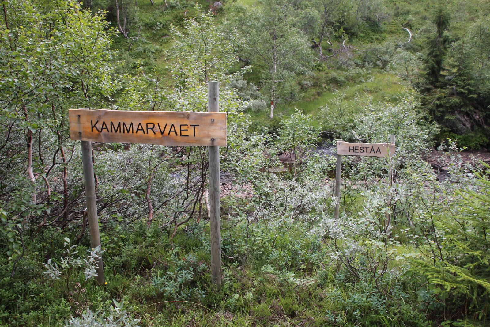 Minnestein over gjetergutten Sigurd Guddingsmo.
 Sigurd Sefaniasen Guddingsmo (1892-1907) var gjeter på Leirfall-fera. Denne sommeren gikk han også for presten i Stiklestad kirke og skulle konfirmeres samme høst. Den turen en gang per uke tok ca 17 timer! Da ulykken skjedde hadde det regnet kraftig i området i 2 døgn og elver og bekker var flomstore. På veg innover var han innom i Buran hvor han ble advart mot å fortsette turen. Sigurd trosset advarslene og fortsatte mot Leirfall-fera. Da han skulle krysse Heståa ved Kammarvaet, har det gått galt og Sigurd ble tatt av vannmassene og ført med strømmen nedover Salthammerfossan og ble funnet noen dager senere ute på myrene mot Reinssjøen.
I Nordre Trondhjems Amtstidende av 12. august 1907 kan en lese: "Liget var sterkt forslaaet da hele elvebunden nedover er opfyldt af store stene. Liget var ført med strømmen en temmelig lang strekning".
Les om avdukinga av steinen her. ",
"dlink":"http://maps.google.com/maps?daddr=63.638530,11.608569&t=m&layer=1&doflg=ptk&hl=no&om=0",
"openpopup":"0",
"mapwidth":"640",
"mapwidthunit":"px",
"mapheight":"480",
"marker-createdby":"kadillan",
"marker-createdon":"2017-07-30 00:00:00",
"marker-updatedby":"omlarsen",
"marker-updatedon":"2018-06-20 00:00:00",
"layerid":["7"],
"layername":"Steiner / varder",
"layer-createdby":"omlarsen",
"layer-createdon":"2017-05-26 00:00:00",
"layer-updatedby":"omlarsen",
"layer-updatedon":"2017-11-09 00:44:02",
"controlbox":"1",
"overlays_custom":"0",
"overlays_custom2":"0",
"overlays_custom3":"0",
"overlays_custom4":"0",
"wms":"0",
"wms2":"0",
"wms3":"0",
"wms4":"0",
"wms5":"0",
"wms6":"0",
"wms7":"0",
"wms8":"0",
"wms9":"0",
"wms10":"0",
"kml_timestamp":"2017-07-30 00:00:00",
"gpx_url":"",
"gpx_panel":"0",
"mlm_filter":"1",
"mlm_filter_details":""
}},
{
"type":"Feature",
"geometry":
{
"type":"Point",
"coordinates":[11.696440,63.753590]
},
"properties":
{
"markerid":"912",
"layers":["7"],
"requested_layer":["7"],
"markername":"Dragonen på Levring",
"basemap":"custom_basemap ",
"lat":"63.753590",
"lon":"11.696440",
"icon":"blank_black.png",
"zoom":"16",
"iconUrl":"http://verdalsportalen.no/wp-content/uploads/leaflet-maps-marker-icons/blank_black.png",
"address":"",
"text":"

br />
Minnestein etter Stor-Ingvald, som falt her i slaget mot Karolinerne i 1718. Gps-posisjon: 63.75359 / 11.69644
Minnesmerke.
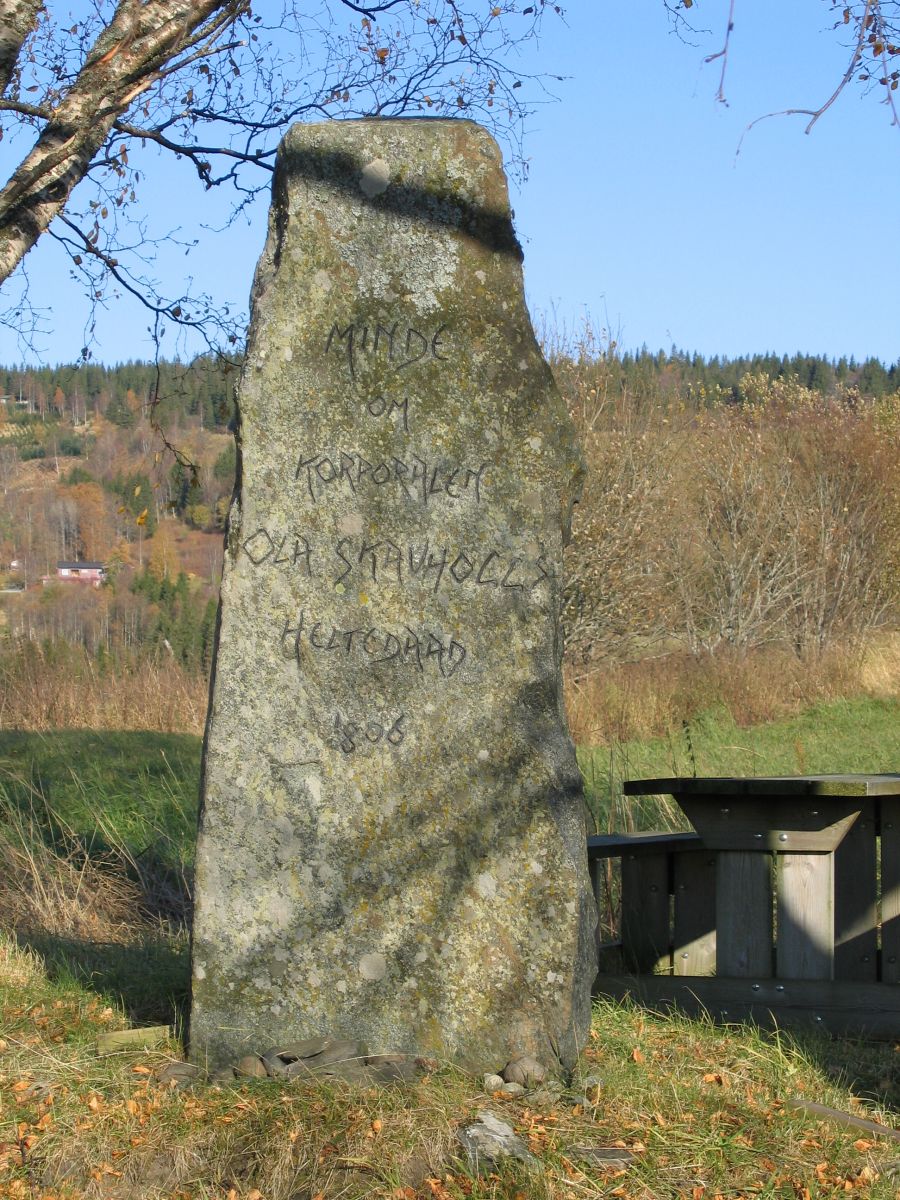
br />
Minne om Ole Skavhaugs heltedåd i 1806Gps-posisjon: 63.73606 / 11.76913
Heltedåden besto i å fange de to svenske morderne som drepte nesten en hel familie på gården Garnes. Han nådde dem igjen inni Hammardal nord for Østersund og brakte dem tilbake til Verdal sånn at de ble stilt for retten og dømt til døden.
Minnestein, Reist av Inndal ungdomslag i 1906.
",
"dlink":"http://maps.google.com/maps?daddr=63.736060,11.769130&t=m&layer=1&doflg=ptk&hl=no&om=0",
"openpopup":"0",
"mapwidth":"640",
"mapwidthunit":"px",
"mapheight":"480",
"marker-createdby":"kadillan",
"marker-createdon":"2017-07-30 00:00:00",
"marker-updatedby":"kadillan",
"marker-updatedon":"2017-07-31 00:00:00",
"layerid":["7"],
"layername":"Steiner / varder",
"layer-createdby":"omlarsen",
"layer-createdon":"2017-05-26 00:00:00",
"layer-updatedby":"omlarsen",
"layer-updatedon":"2017-11-09 00:44:02",
"controlbox":"1",
"overlays_custom":"0",
"overlays_custom2":"0",
"overlays_custom3":"0",
"overlays_custom4":"0",
"wms":"0",
"wms2":"0",
"wms3":"0",
"wms4":"0",
"wms5":"0",
"wms6":"0",
"wms7":"0",
"wms8":"0",
"wms9":"0",
"wms10":"0",
"kml_timestamp":"2017-07-30 00:00:00",
"gpx_url":"",
"gpx_panel":"0",
"mlm_filter":"1",
"mlm_filter_details":""
}},
{
"type":"Feature",
"geometry":
{
"type":"Point",
"coordinates":[11.877230,63.709030]
},
"properties":
{
"markerid":"914",
"layers":["7"],
"requested_layer":["7"],
"markername":"Tacksamhet 1825",
"basemap":"custom_basemap",
"lat":"63.709030",
"lon":"11.877230",
"icon":"blank_black.png",
"zoom":"13",
"iconUrl":"http://verdalsportalen.no/wp-content/uploads/leaflet-maps-marker-icons/blank_black.png",
"address":"",
"text":"Gps-posisjon: 63.709030 / 11.877230
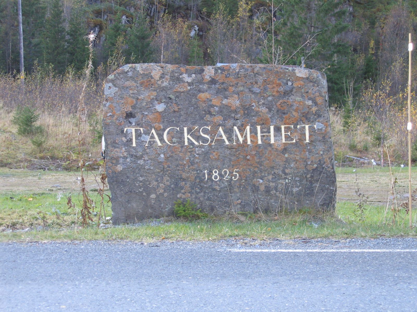
Minnestein etter at Jämtlands regiment var på fredsmessig manøver på Stjørdalshalsen i 1825. Dette skal ha vært første gang av svenske soldater kryssa grensa mot norge uten å ha fientlige hensikter.
'Da dette Regiment drog tilbage over Riksgrændsen opreiste det en meget stor Sten paa en Grundmuur ved Siden af Carl Johans-Veien hvor Fjeldet begynder, og anbragte paa dens flade Side: TACKSAMHET 1825'.
",
"dlink":"http://maps.google.com/maps?daddr=63.709030,11.877230&t=m&layer=1&doflg=ptk&hl=no&om=0",
"openpopup":"0",
"mapwidth":"640",
"mapwidthunit":"px",
"mapheight":"480",
"marker-createdby":"kadillan",
"marker-createdon":"2017-07-30 00:00:00",
"marker-updatedby":"omlarsen",
"marker-updatedon":"2017-08-04 00:00:00",
"layerid":["7"],
"layername":"Steiner / varder",
"layer-createdby":"omlarsen",
"layer-createdon":"2017-05-26 00:00:00",
"layer-updatedby":"omlarsen",
"layer-updatedon":"2017-11-09 00:44:02",
"controlbox":"1",
"overlays_custom":"0",
"overlays_custom2":"0",
"overlays_custom3":"0",
"overlays_custom4":"0",
"wms":"0",
"wms2":"0",
"wms3":"0",
"wms4":"0",
"wms5":"0",
"wms6":"0",
"wms7":"0",
"wms8":"0",
"wms9":"0",
"wms10":"0",
"kml_timestamp":"2017-07-30 00:00:00",
"gpx_url":"",
"gpx_panel":"0",
"mlm_filter":"1",
"mlm_filter_details":""
}},
{
"type":"Feature",
"geometry":
{
"type":"Point",
"coordinates":[12.148991,63.660673]
},
"properties":
{
"markerid":"915",
"layers":["7"],
"requested_layer":["7"],
"markername":"Frukoststeinen",
"basemap":"custom_basemap",
"lat":"63.660673",
"lon":"12.148991",
"icon":"blank_black.png",
"zoom":"15",
"iconUrl":"http://verdalsportalen.no/wp-content/uploads/leaflet-maps-marker-icons/blank_black.png",
"address":"",
"text":"Gps-posisjon: 63.660673 / 12.148991
",
"dlink":"http://maps.google.com/maps?daddr=63.660673,12.148991&t=m&layer=1&doflg=ptk&hl=no&om=0",
"openpopup":"1",
"mapwidth":"640",
"mapwidthunit":"px",
"mapheight":"480",
"marker-createdby":"kadillan",
"marker-createdon":"2017-07-30 00:00:00",
"marker-updatedby":"omlarsen",
"marker-updatedon":"2017-08-03 00:00:00",
"layerid":["7"],
"layername":"Steiner / varder",
"layer-createdby":"omlarsen",
"layer-createdon":"2017-05-26 00:00:00",
"layer-updatedby":"omlarsen",
"layer-updatedon":"2017-11-09 00:44:02",
"controlbox":"1",
"overlays_custom":"0",
"overlays_custom2":"0",
"overlays_custom3":"0",
"overlays_custom4":"0",
"wms":"0",
"wms2":"0",
"wms3":"0",
"wms4":"0",
"wms5":"0",
"wms6":"0",
"wms7":"0",
"wms8":"0",
"wms9":"0",
"wms10":"0",
"kml_timestamp":"2017-07-30 00:00:00",
"gpx_url":"",
"gpx_panel":"0",
"mlm_filter":"1",
"mlm_filter_details":""
}},
{
"type":"Feature",
"geometry":
{
"type":"Point",
"coordinates":[12.152720,63.658990]
},
"properties":
{
"markerid":"944",
"layers":["7"],
"requested_layer":["7"],
"markername":"Takk til Grenselosene (Innsvatnet)",
"basemap":"custom_basemap ",
"lat":"63.658990",
"lon":"12.152720",
"icon":"blank_black.png",
"zoom":"16",
"iconUrl":"http://verdalsportalen.no/wp-content/uploads/leaflet-maps-marker-icons/blank_black.png",
"address":"",
"text":"
Gps-posisjon: 63.658990 / 12.152720
Til minne om grenselosenes enestående arbeid med å hjelpe flyktninger over til Sverige under krigen. Tilsvarende minnestein står ved Skjækerfossen.
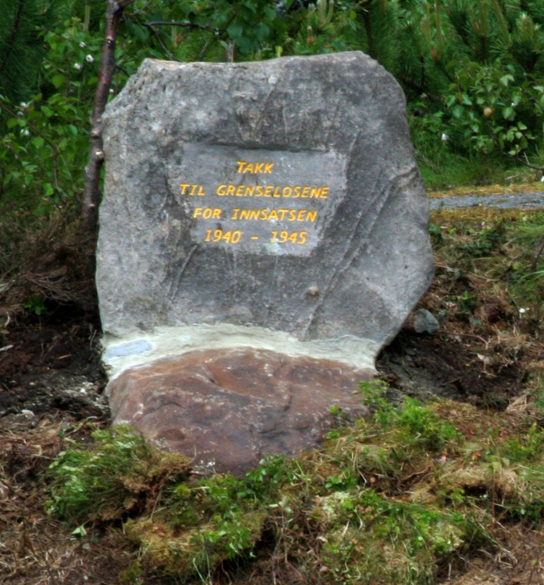
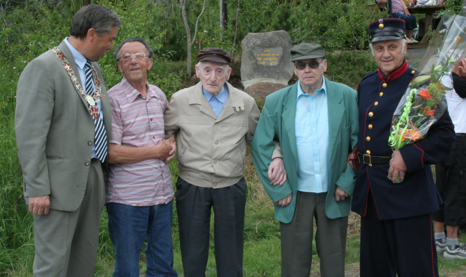
Her er 3 tidligere grensloser omkranset av ordfører Iversen og Øystein Walberg under avdukinga.
",
"dlink":"http://maps.google.com/maps?daddr=63.658990,12.152720&t=m&layer=1&doflg=ptk&hl=no&om=0",
"openpopup":"0",
"mapwidth":"640",
"mapwidthunit":"px",
"mapheight":"480",
"marker-createdby":"omlarsen",
"marker-createdon":"2017-08-23 00:00:00",
"marker-updatedby":"omlarsen",
"marker-updatedon":"2017-08-23 00:00:00",
"layerid":["7"],
"layername":"Steiner / varder",
"layer-createdby":"omlarsen",
"layer-createdon":"2017-05-26 00:00:00",
"layer-updatedby":"omlarsen",
"layer-updatedon":"2017-11-09 00:44:02",
"controlbox":"1",
"overlays_custom":"0",
"overlays_custom2":"0",
"overlays_custom3":"0",
"overlays_custom4":"0",
"wms":"0",
"wms2":"0",
"wms3":"0",
"wms4":"0",
"wms5":"0",
"wms6":"0",
"wms7":"0",
"wms8":"0",
"wms9":"0",
"wms10":"0",
"kml_timestamp":"2017-08-23 00:00:00",
"gpx_url":"",
"gpx_panel":"0",
"mlm_filter":"1",
"mlm_filter_details":""
}},
{
"type":"Feature",
"geometry":
{
"type":"Point",
"coordinates":[11.429569,63.817397]
},
"properties":
{
"markerid":"916",
"layers":["7"],
"requested_layer":["7"],
"markername":"Bautaene på Trones",
"basemap":"googleLayer_satellite",
"lat":"63.817397",
"lon":"11.429569",
"icon":"blank_black.png",
"zoom":"19",
"iconUrl":"http://verdalsportalen.no/wp-content/uploads/leaflet-maps-marker-icons/blank_black.png",
"address":"",
"text":"
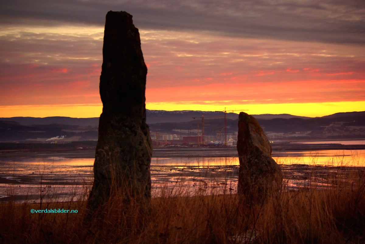 |
Bautaene på Trones. |
",
"dlink":"http://maps.google.com/maps?daddr=63.817397,11.429569&t=m&layer=1&doflg=ptk&hl=no&om=0",
"openpopup":"0",
"mapwidth":"800",
"mapwidthunit":"px",
"mapheight":"600",
"marker-createdby":"omlarsen",
"marker-createdon":"2017-08-01 00:00:00",
"marker-updatedby":"omlarsen",
"marker-updatedon":"2017-08-02 00:00:00",
"layerid":["7"],
"layername":"Steiner / varder",
"layer-createdby":"omlarsen",
"layer-createdon":"2017-05-26 00:00:00",
"layer-updatedby":"omlarsen",
"layer-updatedon":"2017-11-09 00:44:02",
"controlbox":"1",
"overlays_custom":"0",
"overlays_custom2":"0",
"overlays_custom3":"0",
"overlays_custom4":"0",
"wms":"0",
"wms2":"0",
"wms3":"0",
"wms4":"0",
"wms5":"0",
"wms6":"0",
"wms7":"0",
"wms8":"0",
"wms9":"0",
"wms10":"0",
"kml_timestamp":"",
"gpx_url":"",
"gpx_panel":"0",
"mlm_filter":"1",
"mlm_filter_details":""
}},
{
"type":"Feature",
"geometry":
{
"type":"Point",
"coordinates":[11.504040,63.783780]
},
"properties":
{
"markerid":"917",
"layers":["2"],
"requested_layer":["2"],
"markername":"Langnesskogen",
"basemap":"custom_basemap ",
"lat":"63.783780",
"lon":"11.504040",
"icon":"shootingrange.png",
"zoom":"16",
"iconUrl":"http://verdalsportalen.no/wp-content/uploads/leaflet-maps-marker-icons/shootingrange.png",
"address":"x",
"text":"",
"dlink":"http://maps.google.com/maps?daddr=x&t=m&layer=1&doflg=ptk&hl=no&om=0",
"openpopup":"0",
"mapwidth":"640",
"mapwidthunit":"px",
"mapheight":"480",
"marker-createdby":"omlarsen",
"marker-createdon":"2017-08-07 00:00:00",
"marker-updatedby":"omlarsen",
"marker-updatedon":"2017-08-07 00:00:00",
"layerid":["2"],
"layername":"Andre turforslag",
"layer-createdby":"omlarsen",
"layer-createdon":"2017-05-20 00:00:00",
"layer-updatedby":"omlarsen",
"layer-updatedon":"2017-05-20 00:00:00",
"controlbox":"1",
"overlays_custom":"0",
"overlays_custom2":"0",
"overlays_custom3":"0",
"overlays_custom4":"0",
"wms":"0",
"wms2":"0",
"wms3":"0",
"wms4":"0",
"wms5":"0",
"wms6":"0",
"wms7":"0",
"wms8":"0",
"wms9":"0",
"wms10":"0",
"kml_timestamp":"2017-08-07 00:00:00",
"gpx_url":"http://x",
"gpx_panel":"0",
"mlm_filter":"1",
"mlm_filter_details":""
}},
{
"type":"Feature",
"geometry":
{
"type":"Point",
"coordinates":[11.294420,63.871580]
},
"properties":
{
"markerid":"921",
"layers":["7"],
"requested_layer":["7"],
"markername":"Muustrøbrua på Inderøy",
"basemap":"custom_basemap ",
"lat":"63.871580",
"lon":"11.294420",
"icon":"blank_black.png",
"zoom":"16",
"iconUrl":"http://verdalsportalen.no/wp-content/uploads/leaflet-maps-marker-icons/blank_black.png",
"address":"",
"text":"
",
"dlink":"http://maps.google.com/maps?daddr=63.871580,11.294420&t=m&layer=1&doflg=ptk&hl=no&om=0",
"openpopup":"0",
"mapwidth":"640",
"mapwidthunit":"px",
"mapheight":"480",
"marker-createdby":"omlarsen",
"marker-createdon":"2017-08-17 00:00:00",
"marker-updatedby":"omlarsen",
"marker-updatedon":"2017-08-17 00:00:00",
"layerid":["7"],
"layername":"Steiner / varder",
"layer-createdby":"omlarsen",
"layer-createdon":"2017-05-26 00:00:00",
"layer-updatedby":"omlarsen",
"layer-updatedon":"2017-11-09 00:44:02",
"controlbox":"1",
"overlays_custom":"0",
"overlays_custom2":"0",
"overlays_custom3":"0",
"overlays_custom4":"0",
"wms":"0",
"wms2":"0",
"wms3":"0",
"wms4":"0",
"wms5":"0",
"wms6":"0",
"wms7":"0",
"wms8":"0",
"wms9":"0",
"wms10":"0",
"kml_timestamp":"2017-08-17 00:00:00",
"gpx_url":"",
"gpx_panel":"0",
"mlm_filter":"1",
"mlm_filter_details":""
}},
{
"type":"Feature",
"geometry":
{
"type":"Point",
"coordinates":[12.024770,63.836960]
},
"properties":
{
"markerid":"945",
"layers":["7"],
"requested_layer":["7"],
"markername":"Takk til Grenselosene (Skjækerfossen)",
"basemap":"custom_basemap ",
"lat":"63.836960",
"lon":"12.024770",
"icon":"blank_black.png",
"zoom":"16",
"iconUrl":"http://verdalsportalen.no/wp-content/uploads/leaflet-maps-marker-icons/blank_black.png",
"address":"",
"text":"
Gps-posisjon: 63.836960 / 12.024770
Til minne om grenselosenes enestående arbeid med å hjelpe flyktninger over til Sverige under krigen. Tilsvarende minnestein står ved Innsvatnet.
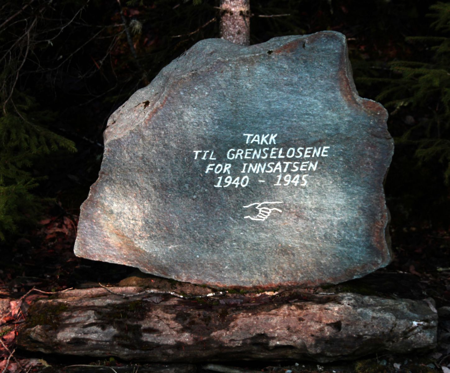
",
"dlink":"http://maps.google.com/maps?daddr=63.836960,12.024770&t=m&layer=1&doflg=ptk&hl=no&om=0",
"openpopup":"0",
"mapwidth":"640",
"mapwidthunit":"px",
"mapheight":"480",
"marker-createdby":"omlarsen",
"marker-createdon":"2017-08-23 00:00:00",
"marker-updatedby":"omlarsen",
"marker-updatedon":"2017-08-23 00:00:00",
"layerid":["7"],
"layername":"Steiner / varder",
"layer-createdby":"omlarsen",
"layer-createdon":"2017-05-26 00:00:00",
"layer-updatedby":"omlarsen",
"layer-updatedon":"2017-11-09 00:44:02",
"controlbox":"1",
"overlays_custom":"0",
"overlays_custom2":"0",
"overlays_custom3":"0",
"overlays_custom4":"0",
"wms":"0",
"wms2":"0",
"wms3":"0",
"wms4":"0",
"wms5":"0",
"wms6":"0",
"wms7":"0",
"wms8":"0",
"wms9":"0",
"wms10":"0",
"kml_timestamp":"2017-08-23 00:00:00",
"gpx_url":"",
"gpx_panel":"0",
"mlm_filter":"1",
"mlm_filter_details":""
}}]});
 Oftenåsen med peilehytta er et naturlig utfartsted i Steinkjer. På toppen ligger Peilehytta med servering (søndager 11-15) og det er fantastisk utsikt over Steinkjer by, fjorden, Ogndalen og sørover mot Leksdalsvatnet og med Hermannssnasa tronende i bakgrunnen. På toppen finner du også verdens største hagestol.


