Deprecated: Required parameter $args follows optional parameter $size in /customers/0/7/2/verdalsportalen.no/httpd.www/wp-content/plugins/basic-user-avatars/init.php on line 251
Warning: Cannot modify header information - headers already sent by (output started at /customers/0/7/2/verdalsportalen.no/httpd.www/wp-content/plugins/basic-user-avatars/init.php:251) in /customers/0/7/2/verdalsportalen.no/httpd.www/wp-content/plugins/leaflet-maps-marker-pro/leaflet-geojson.php on line 49
Warning: Cannot modify header information - headers already sent by (output started at /customers/0/7/2/verdalsportalen.no/httpd.www/wp-content/plugins/basic-user-avatars/init.php:251) in /customers/0/7/2/verdalsportalen.no/httpd.www/wp-content/plugins/leaflet-maps-marker-pro/leaflet-geojson.php on line 119
Warning: Cannot modify header information - headers already sent by (output started at /customers/0/7/2/verdalsportalen.no/httpd.www/wp-content/plugins/basic-user-avatars/init.php:251) in /customers/0/7/2/verdalsportalen.no/httpd.www/wp-content/plugins/leaflet-maps-marker-pro/leaflet-geojson.php on line 120
Warning: Cannot modify header information - headers already sent by (output started at /customers/0/7/2/verdalsportalen.no/httpd.www/wp-content/plugins/basic-user-avatars/init.php:251) in /customers/0/7/2/verdalsportalen.no/httpd.www/wp-content/plugins/leaflet-maps-marker-pro/leaflet-geojson.php on line 121
jsonp({"type":"FeatureCollection",
"features":[
{
"type":"Feature",
"geometry":
{
"type":"Point",
"coordinates":[11.477597,63.794646]
},
"properties":
{
"markerid":"36",
"layers":["20"],
"requested_layer":["20"],
"markername":"Øystein Walberg - Hagabakken på Verdalsøra",
"basemap":"custom_basemap",
"lat":"63.794646",
"lon":"11.477597",
"icon":"history2.png",
"zoom":"19",
"iconUrl":"http://verdalsportalen.no/wp-content/uploads/leaflet-maps-marker-icons/history2.png",
"address":"",
"text":"",
"dlink":"http://maps.google.com/maps?daddr=63.794646,11.477597&t=m&layer=1&doflg=ptk&hl=no&om=0",
"openpopup":"0",
"mapwidth":"640",
"mapwidthunit":"px",
"mapheight":"480",
"marker-createdby":"omlarsen",
"marker-createdon":"2017-03-31 00:00:00",
"marker-updatedby":"omlarsen",
"marker-updatedon":"2017-05-17 00:00:00",
"layerid":["20"],
"layername":"Historiske plasser på Øra",
"layer-createdby":"omlarsen",
"layer-createdon":"2017-05-14 20:56:20",
"layer-updatedby":"omlarsen",
"layer-updatedon":"2017-05-20 00:22:21",
"controlbox":"1",
"overlays_custom":"0",
"overlays_custom2":"0",
"overlays_custom3":"0",
"overlays_custom4":"0",
"wms":"0",
"wms2":"0",
"wms3":"0",
"wms4":"0",
"wms5":"0",
"wms6":"0",
"wms7":"0",
"wms8":"0",
"wms9":"0",
"wms10":"0",
"kml_timestamp":"",
"gpx_url":"",
"gpx_panel":"0",
"mlm_filter":"1",
"mlm_filter_details":""
}},
{
"type":"Feature",
"geometry":
{
"type":"Point",
"coordinates":[12.366185,63.736797]
},
"properties":
{
"markerid":"396",
"layers":["18"],
"requested_layer":["18"],
"markername":"Åbofjellet 1",
"basemap":"custom_basemap",
"lat":"63.736797",
"lon":"12.366185",
"icon":"MolteIcon.png",
"zoom":"13",
"iconUrl":"http://verdalsportalen.no/wp-content/uploads/leaflet-maps-marker-icons/MolteIcon.png",
"address":"",
"text":" Moltåret 1997. Snorre og Atle Skavhaug.
VIDEO
",
"dlink":"http://maps.google.com/maps?daddr=63.772787,12.519264&t=m&layer=1&doflg=ptk&hl=no&om=0",
"openpopup":"0",
"mapwidth":"640",
"mapwidthunit":"px",
"mapheight":"480",
"marker-createdby":"omlarsen",
"marker-createdon":"2017-05-09 00:00:00",
"marker-updatedby":"omlarsen",
"marker-updatedon":"2017-05-10 00:00:00",
"layerid":["18"],
"layername":"Moltemyrer",
"layer-createdby":"omlarsen",
"layer-createdon":"2017-05-09 00:00:00",
"layer-updatedby":"omlarsen",
"layer-updatedon":"2017-05-20 00:00:00",
"controlbox":"1",
"overlays_custom":"0",
"overlays_custom2":"0",
"overlays_custom3":"0",
"overlays_custom4":"0",
"wms":"0",
"wms2":"0",
"wms3":"0",
"wms4":"0",
"wms5":"0",
"wms6":"0",
"wms7":"0",
"wms8":"0",
"wms9":"0",
"wms10":"0",
"kml_timestamp":"",
"gpx_url":"",
"gpx_panel":"0",
"mlm_filter":"1",
"mlm_filter_details":"xx"
}},
{
"type":"Feature",
"geometry":
{
"type":"Point",
"coordinates":[12.135379,63.897173]
},
"properties":
{
"markerid":"404",
"layers":["19"],
"requested_layer":["19"],
"markername":"Ørtugtjønna",
"basemap":"custom_basemap",
"lat":"63.897173",
"lon":"12.135379",
"icon":"hut2.png",
"zoom":"9",
"iconUrl":"http://verdalsportalen.no/wp-content/uploads/leaflet-maps-marker-icons/hut2.png",
"address":"",
"text":"",
"dlink":"http://maps.google.com/maps?daddr=63.897173,12.135379&t=m&layer=1&doflg=ptk&hl=no&om=0",
"openpopup":"0",
"mapwidth":"640",
"mapwidthunit":"px",
"mapheight":"480",
"marker-createdby":"omlarsen",
"marker-createdon":"2017-05-13 00:00:00",
"marker-updatedby":"omlarsen",
"marker-updatedon":"2017-05-13 00:00:00",
"layerid":["19"],
"layername":"Verdalsbrukets hytter",
"layer-createdby":"omlarsen",
"layer-createdon":"2017-05-13 11:30:15",
"layer-updatedby":"omlarsen",
"layer-updatedon":"2017-06-13 13:51:15",
"controlbox":"1",
"overlays_custom":"0",
"overlays_custom2":"0",
"overlays_custom3":"0",
"overlays_custom4":"0",
"wms":"0",
"wms2":"0",
"wms3":"0",
"wms4":"0",
"wms5":"0",
"wms6":"0",
"wms7":"0",
"wms8":"0",
"wms9":"0",
"wms10":"0",
"kml_timestamp":"",
"gpx_url":"",
"gpx_panel":"0",
"mlm_filter":"1",
"mlm_filter_details":""
}},
{
"type":"Feature",
"geometry":
{
"type":"Point",
"coordinates":[12.274550,63.722954]
},
"properties":
{
"markerid":"405",
"layers":["19"],
"requested_layer":["19"],
"markername":"Billingen",
"basemap":"custom_basemap",
"lat":"63.722954",
"lon":"12.274550",
"icon":"hut2.png",
"zoom":"9",
"iconUrl":"http://verdalsportalen.no/wp-content/uploads/leaflet-maps-marker-icons/hut2.png",
"address":"",
"text":"",
"dlink":"http://maps.google.com/maps?daddr=63.722954,12.274550&t=m&layer=1&doflg=ptk&hl=no&om=0",
"openpopup":"0",
"mapwidth":"640",
"mapwidthunit":"px",
"mapheight":"480",
"marker-createdby":"omlarsen",
"marker-createdon":"2017-05-13 00:00:00",
"marker-updatedby":"omlarsen",
"marker-updatedon":"2017-05-13 00:00:00",
"layerid":["19"],
"layername":"Verdalsbrukets hytter",
"layer-createdby":"omlarsen",
"layer-createdon":"2017-05-13 11:30:15",
"layer-updatedby":"omlarsen",
"layer-updatedon":"2017-06-13 13:51:15",
"controlbox":"1",
"overlays_custom":"0",
"overlays_custom2":"0",
"overlays_custom3":"0",
"overlays_custom4":"0",
"wms":"0",
"wms2":"0",
"wms3":"0",
"wms4":"0",
"wms5":"0",
"wms6":"0",
"wms7":"0",
"wms8":"0",
"wms9":"0",
"wms10":"0",
"kml_timestamp":"",
"gpx_url":"",
"gpx_panel":"0",
"mlm_filter":"1",
"mlm_filter_details":""
}},
{
"type":"Feature",
"geometry":
{
"type":"Point",
"coordinates":[12.180380,63.759293]
},
"properties":
{
"markerid":"406",
"layers":["19"],
"requested_layer":["19"],
"markername":"Bryggnesset",
"basemap":"custom_basemap",
"lat":"63.759293",
"lon":"12.180380",
"icon":"hut2.png",
"zoom":"9",
"iconUrl":"http://verdalsportalen.no/wp-content/uploads/leaflet-maps-marker-icons/hut2.png",
"address":"",
"text":"",
"dlink":"http://maps.google.com/maps?daddr=63.759293,12.180380&t=m&layer=1&doflg=ptk&hl=no&om=0",
"openpopup":"0",
"mapwidth":"640",
"mapwidthunit":"px",
"mapheight":"480",
"marker-createdby":"omlarsen",
"marker-createdon":"2017-05-13 00:00:00",
"marker-updatedby":"omlarsen",
"marker-updatedon":"2017-05-13 00:00:00",
"layerid":["19"],
"layername":"Verdalsbrukets hytter",
"layer-createdby":"omlarsen",
"layer-createdon":"2017-05-13 11:30:15",
"layer-updatedby":"omlarsen",
"layer-updatedon":"2017-06-13 13:51:15",
"controlbox":"1",
"overlays_custom":"0",
"overlays_custom2":"0",
"overlays_custom3":"0",
"overlays_custom4":"0",
"wms":"0",
"wms2":"0",
"wms3":"0",
"wms4":"0",
"wms5":"0",
"wms6":"0",
"wms7":"0",
"wms8":"0",
"wms9":"0",
"wms10":"0",
"kml_timestamp":"",
"gpx_url":"",
"gpx_panel":"0",
"mlm_filter":"1",
"mlm_filter_details":""
}},
{
"type":"Feature",
"geometry":
{
"type":"Point",
"coordinates":[12.239035,63.778631]
},
"properties":
{
"markerid":"407",
"layers":["19"],
"requested_layer":["19"],
"markername":"Fiskløsningen",
"basemap":"custom_basemap",
"lat":"63.778631",
"lon":"12.239035",
"icon":"hut2.png",
"zoom":"9",
"iconUrl":"http://verdalsportalen.no/wp-content/uploads/leaflet-maps-marker-icons/hut2.png",
"address":"",
"text":"",
"dlink":"http://maps.google.com/maps?daddr=63.778631,12.239035&t=m&layer=1&doflg=ptk&hl=no&om=0",
"openpopup":"0",
"mapwidth":"640",
"mapwidthunit":"px",
"mapheight":"480",
"marker-createdby":"omlarsen",
"marker-createdon":"2017-05-13 00:00:00",
"marker-updatedby":"omlarsen",
"marker-updatedon":"2017-05-13 00:00:00",
"layerid":["19"],
"layername":"Verdalsbrukets hytter",
"layer-createdby":"omlarsen",
"layer-createdon":"2017-05-13 11:30:15",
"layer-updatedby":"omlarsen",
"layer-updatedon":"2017-06-13 13:51:15",
"controlbox":"1",
"overlays_custom":"0",
"overlays_custom2":"0",
"overlays_custom3":"0",
"overlays_custom4":"0",
"wms":"0",
"wms2":"0",
"wms3":"0",
"wms4":"0",
"wms5":"0",
"wms6":"0",
"wms7":"0",
"wms8":"0",
"wms9":"0",
"wms10":"0",
"kml_timestamp":"",
"gpx_url":"",
"gpx_panel":"0",
"mlm_filter":"1",
"mlm_filter_details":""
}},
{
"type":"Feature",
"geometry":
{
"type":"Point",
"coordinates":[11.743695,63.653070]
},
"properties":
{
"markerid":"408",
"layers":["19"],
"requested_layer":["19"],
"markername":"Grønningen",
"basemap":"custom_basemap",
"lat":"63.653070",
"lon":"11.743695",
"icon":"hut2.png",
"zoom":"9",
"iconUrl":"http://verdalsportalen.no/wp-content/uploads/leaflet-maps-marker-icons/hut2.png",
"address":"",
"text":"",
"dlink":"http://maps.google.com/maps?daddr=63.653070,11.743695&t=m&layer=1&doflg=ptk&hl=no&om=0",
"openpopup":"0",
"mapwidth":"640",
"mapwidthunit":"px",
"mapheight":"480",
"marker-createdby":"omlarsen",
"marker-createdon":"2017-05-13 00:00:00",
"marker-updatedby":"omlarsen",
"marker-updatedon":"2017-05-13 00:00:00",
"layerid":["19"],
"layername":"Verdalsbrukets hytter",
"layer-createdby":"omlarsen",
"layer-createdon":"2017-05-13 11:30:15",
"layer-updatedby":"omlarsen",
"layer-updatedon":"2017-06-13 13:51:15",
"controlbox":"1",
"overlays_custom":"0",
"overlays_custom2":"0",
"overlays_custom3":"0",
"overlays_custom4":"0",
"wms":"0",
"wms2":"0",
"wms3":"0",
"wms4":"0",
"wms5":"0",
"wms6":"0",
"wms7":"0",
"wms8":"0",
"wms9":"0",
"wms10":"0",
"kml_timestamp":"",
"gpx_url":"",
"gpx_panel":"0",
"mlm_filter":"1",
"mlm_filter_details":""
}},
{
"type":"Feature",
"geometry":
{
"type":"Point",
"coordinates":[12.088658,63.628891]
},
"properties":
{
"markerid":"409",
"layers":["19"],
"requested_layer":["19"],
"markername":"Kråksjøen",
"basemap":"custom_basemap",
"lat":"63.628891",
"lon":"12.088658",
"icon":"hut2.png",
"zoom":"9",
"iconUrl":"http://verdalsportalen.no/wp-content/uploads/leaflet-maps-marker-icons/hut2.png",
"address":"",
"text":"",
"dlink":"http://maps.google.com/maps?daddr=63.628891,12.088658&t=m&layer=1&doflg=ptk&hl=no&om=0",
"openpopup":"0",
"mapwidth":"640",
"mapwidthunit":"px",
"mapheight":"480",
"marker-createdby":"omlarsen",
"marker-createdon":"2017-05-13 00:00:00",
"marker-updatedby":"omlarsen",
"marker-updatedon":"2017-05-13 00:00:00",
"layerid":["19"],
"layername":"Verdalsbrukets hytter",
"layer-createdby":"omlarsen",
"layer-createdon":"2017-05-13 11:30:15",
"layer-updatedby":"omlarsen",
"layer-updatedon":"2017-06-13 13:51:15",
"controlbox":"1",
"overlays_custom":"0",
"overlays_custom2":"0",
"overlays_custom3":"0",
"overlays_custom4":"0",
"wms":"0",
"wms2":"0",
"wms3":"0",
"wms4":"0",
"wms5":"0",
"wms6":"0",
"wms7":"0",
"wms8":"0",
"wms9":"0",
"wms10":"0",
"kml_timestamp":"",
"gpx_url":"",
"gpx_panel":"0",
"mlm_filter":"1",
"mlm_filter_details":""
}},
{
"type":"Feature",
"geometry":
{
"type":"Point",
"coordinates":[12.460317,63.904536]
},
"properties":
{
"markerid":"410",
"layers":["19"],
"requested_layer":["19"],
"markername":"Lakavassbu",
"basemap":"custom_basemap",
"lat":"63.904536",
"lon":"12.460317",
"icon":"hut2.png",
"zoom":"9",
"iconUrl":"http://verdalsportalen.no/wp-content/uploads/leaflet-maps-marker-icons/hut2.png",
"address":"",
"text":"",
"dlink":"http://maps.google.com/maps?daddr=63.904536,12.460317&t=m&layer=1&doflg=ptk&hl=no&om=0",
"openpopup":"0",
"mapwidth":"640",
"mapwidthunit":"px",
"mapheight":"480",
"marker-createdby":"omlarsen",
"marker-createdon":"2017-05-13 00:00:00",
"marker-updatedby":"omlarsen",
"marker-updatedon":"2017-05-13 00:00:00",
"layerid":["19"],
"layername":"Verdalsbrukets hytter",
"layer-createdby":"omlarsen",
"layer-createdon":"2017-05-13 11:30:15",
"layer-updatedby":"omlarsen",
"layer-updatedon":"2017-06-13 13:51:15",
"controlbox":"1",
"overlays_custom":"0",
"overlays_custom2":"0",
"overlays_custom3":"0",
"overlays_custom4":"0",
"wms":"0",
"wms2":"0",
"wms3":"0",
"wms4":"0",
"wms5":"0",
"wms6":"0",
"wms7":"0",
"wms8":"0",
"wms9":"0",
"wms10":"0",
"kml_timestamp":"",
"gpx_url":"",
"gpx_panel":"0",
"mlm_filter":"1",
"mlm_filter_details":""
}},
{
"type":"Feature",
"geometry":
{
"type":"Point",
"coordinates":[12.286253,63.876345]
},
"properties":
{
"markerid":"411",
"layers":["19"],
"requested_layer":["19"],
"markername":"Storbekkdalen",
"basemap":"custom_basemap",
"lat":"63.876345",
"lon":"12.286253",
"icon":"hut2.png",
"zoom":"9",
"iconUrl":"http://verdalsportalen.no/wp-content/uploads/leaflet-maps-marker-icons/hut2.png",
"address":"",
"text":"",
"dlink":"http://maps.google.com/maps?daddr=63.876345,12.286253&t=m&layer=1&doflg=ptk&hl=no&om=0",
"openpopup":"0",
"mapwidth":"640",
"mapwidthunit":"px",
"mapheight":"480",
"marker-createdby":"omlarsen",
"marker-createdon":"2017-05-13 00:00:00",
"marker-updatedby":"omlarsen",
"marker-updatedon":"2017-05-13 00:00:00",
"layerid":["19"],
"layername":"Verdalsbrukets hytter",
"layer-createdby":"omlarsen",
"layer-createdon":"2017-05-13 11:30:15",
"layer-updatedby":"omlarsen",
"layer-updatedon":"2017-06-13 13:51:15",
"controlbox":"1",
"overlays_custom":"0",
"overlays_custom2":"0",
"overlays_custom3":"0",
"overlays_custom4":"0",
"wms":"0",
"wms2":"0",
"wms3":"0",
"wms4":"0",
"wms5":"0",
"wms6":"0",
"wms7":"0",
"wms8":"0",
"wms9":"0",
"wms10":"0",
"kml_timestamp":"",
"gpx_url":"",
"gpx_panel":"0",
"mlm_filter":"1",
"mlm_filter_details":""
}},
{
"type":"Feature",
"geometry":
{
"type":"Point",
"coordinates":[12.027115,63.612415]
},
"properties":
{
"markerid":"412",
"layers":["19"],
"requested_layer":["19"],
"markername":"Sulsjøan",
"basemap":"custom_basemap",
"lat":"63.612415",
"lon":"12.027115",
"icon":"hut2.png",
"zoom":"9",
"iconUrl":"http://verdalsportalen.no/wp-content/uploads/leaflet-maps-marker-icons/hut2.png",
"address":"",
"text":"",
"dlink":"http://maps.google.com/maps?daddr=63.612415,12.027115&t=m&layer=1&doflg=ptk&hl=no&om=0",
"openpopup":"0",
"mapwidth":"640",
"mapwidthunit":"px",
"mapheight":"480",
"marker-createdby":"omlarsen",
"marker-createdon":"2017-05-13 00:00:00",
"marker-updatedby":"omlarsen",
"marker-updatedon":"2017-05-13 00:00:00",
"layerid":["19"],
"layername":"Verdalsbrukets hytter",
"layer-createdby":"omlarsen",
"layer-createdon":"2017-05-13 11:30:15",
"layer-updatedby":"omlarsen",
"layer-updatedon":"2017-06-13 13:51:15",
"controlbox":"1",
"overlays_custom":"0",
"overlays_custom2":"0",
"overlays_custom3":"0",
"overlays_custom4":"0",
"wms":"0",
"wms2":"0",
"wms3":"0",
"wms4":"0",
"wms5":"0",
"wms6":"0",
"wms7":"0",
"wms8":"0",
"wms9":"0",
"wms10":"0",
"kml_timestamp":"",
"gpx_url":"",
"gpx_panel":"0",
"mlm_filter":"1",
"mlm_filter_details":""
}},
{
"type":"Feature",
"geometry":
{
"type":"Point",
"coordinates":[12.336059,63.885102]
},
"properties":
{
"markerid":"413",
"layers":["19"],
"requested_layer":["19"],
"markername":"Bjarnetjønna",
"basemap":"custom_basemap",
"lat":"63.885102",
"lon":"12.336059",
"icon":"hut2.png",
"zoom":"11",
"iconUrl":"http://verdalsportalen.no/wp-content/uploads/leaflet-maps-marker-icons/hut2.png",
"address":"",
"text":"",
"dlink":"http://maps.google.com/maps?daddr=63.885102,12.336059&t=m&layer=1&doflg=ptk&hl=no&om=0",
"openpopup":"0",
"mapwidth":"640",
"mapwidthunit":"px",
"mapheight":"480",
"marker-createdby":"omlarsen",
"marker-createdon":"2017-05-13 00:00:00",
"marker-updatedby":"omlarsen",
"marker-updatedon":"2017-05-13 00:00:00",
"layerid":["19"],
"layername":"Verdalsbrukets hytter",
"layer-createdby":"omlarsen",
"layer-createdon":"2017-05-13 11:30:15",
"layer-updatedby":"omlarsen",
"layer-updatedon":"2017-06-13 13:51:15",
"controlbox":"1",
"overlays_custom":"0",
"overlays_custom2":"0",
"overlays_custom3":"0",
"overlays_custom4":"0",
"wms":"0",
"wms2":"0",
"wms3":"0",
"wms4":"0",
"wms5":"0",
"wms6":"0",
"wms7":"0",
"wms8":"0",
"wms9":"0",
"wms10":"0",
"kml_timestamp":"",
"gpx_url":"",
"gpx_panel":"0",
"mlm_filter":"1",
"mlm_filter_details":""
}},
{
"type":"Feature",
"geometry":
{
"type":"Point",
"coordinates":[11.495541,63.798474]
},
"properties":
{
"markerid":"414",
"layers":["20"],
"requested_layer":["20"],
"markername":"Verdølatun",
"basemap":"custom_basemap",
"lat":"63.798474",
"lon":"11.495541",
"icon":"history2.png",
"zoom":"17",
"iconUrl":"http://verdalsportalen.no/wp-content/uploads/leaflet-maps-marker-icons/history2.png",
"address":"",
"text":"",
"dlink":"http://maps.google.com/maps?daddr=63.798474,11.495541&t=m&layer=1&doflg=ptk&hl=no&om=0",
"openpopup":"0",
"mapwidth":"640",
"mapwidthunit":"px",
"mapheight":"480",
"marker-createdby":"omlarsen",
"marker-createdon":"2017-05-14 00:00:00",
"marker-updatedby":"omlarsen",
"marker-updatedon":"2017-05-17 00:00:00",
"layerid":["20"],
"layername":"Historiske plasser på Øra",
"layer-createdby":"omlarsen",
"layer-createdon":"2017-05-14 20:56:20",
"layer-updatedby":"omlarsen",
"layer-updatedon":"2017-05-20 00:22:21",
"controlbox":"1",
"overlays_custom":"0",
"overlays_custom2":"0",
"overlays_custom3":"0",
"overlays_custom4":"0",
"wms":"0",
"wms2":"0",
"wms3":"0",
"wms4":"0",
"wms5":"0",
"wms6":"0",
"wms7":"0",
"wms8":"0",
"wms9":"0",
"wms10":"0",
"kml_timestamp":"",
"gpx_url":"",
"gpx_panel":"0",
"mlm_filter":"1",
"mlm_filter_details":""
}},
{
"type":"Feature",
"geometry":
{
"type":"Point",
"coordinates":[11.480930,63.793890]
},
"properties":
{
"markerid":"701",
"layers":["20"],
"requested_layer":["20"],
"markername":"Verdal-3000 år på 90 minutter - ved Tor Matin Nordtømme. (to videoer)",
"basemap":"custom_basemap",
"lat":"63.793890",
"lon":"11.480930",
"icon":"history2.png",
"zoom":"7",
"iconUrl":"http://verdalsportalen.no/wp-content/uploads/leaflet-maps-marker-icons/history2.png",
"address":"",
"text":"",
"dlink":"http://maps.google.com/maps?daddr=63.793890,11.480930&t=m&layer=1&doflg=ptk&hl=no&om=0",
"openpopup":"0",
"mapwidth":"640",
"mapwidthunit":"px",
"mapheight":"480",
"marker-createdby":"omlarsen",
"marker-createdon":"2017-05-15 00:00:00",
"marker-updatedby":"omlarsen",
"marker-updatedon":"2017-05-17 00:00:00",
"layerid":["20"],
"layername":"Historiske plasser på Øra",
"layer-createdby":"omlarsen",
"layer-createdon":"2017-05-14 20:56:20",
"layer-updatedby":"omlarsen",
"layer-updatedon":"2017-05-20 00:22:21",
"controlbox":"1",
"overlays_custom":"0",
"overlays_custom2":"0",
"overlays_custom3":"0",
"overlays_custom4":"0",
"wms":"0",
"wms2":"0",
"wms3":"0",
"wms4":"0",
"wms5":"0",
"wms6":"0",
"wms7":"0",
"wms8":"0",
"wms9":"0",
"wms10":"0",
"kml_timestamp":"",
"gpx_url":"",
"gpx_panel":"0",
"mlm_filter":"1",
"mlm_filter_details":""
}},
{
"type":"Feature",
"geometry":
{
"type":"Point",
"coordinates":[11.611576,63.788931]
},
"properties":
{
"markerid":"702",
"layers":["23"],
"requested_layer":["23"],
"markername":"eroekez",
"basemap":"custom_basemap",
"lat":"63.788931",
"lon":"11.611576",
"icon":"sunny.png",
"zoom":"12",
"iconUrl":"http://verdalsportalen.no/wp-content/uploads/leaflet-maps-marker-icons/sunny.png",
"address":"Gafsa",
"text":"M eba.xplz.verdalsportalen.no.efq.cq zolendronate paraesthesia, in-situ [URL=http://sunsethilltreefarm.com/prednisone-from-canada/ - [/URL - [URL=http://rdasatx.com/cialis/ - [/URL - [URL=http://csicls.org/drugs/viagra/ - [/URL - [URL=http://sunsethilltreefarm.com/viagra-canada/ - [/URL - [URL=http://inthefieldblog.com/prednisone-price/ - [/URL - [URL=http://primerafootandankle.com/viagra/ - [/URL - [URL=http://csicls.org/tretinoin/ - [/URL - [URL=http://outdoorview.org/item/cialis-best-price/ - [/URL - [URL=http://driverstestingmi.com/pill/levitra/ - [/URL - [URL=http://otherbrotherdarryls.com/levitra/ - [/URL - [URL=http://inthefieldblog.com/molnupiravir/ - [/URL - [URL=http://ifcuriousthenlearn.com/buy-amoxil-without-prescription/ - [/URL - [URL=http://dentonkiwanisclub.org/product/lasix/ - [/URL - [URL=http://rdasatx.com/xenical/ - [/URL - [URL=http://inthefieldblog.com/bactrim/ - [/URL - [URL=http://techonepost.com/pill/cialis/ - [/URL - [URL=http://techonepost.com/pill/canada-cialis/ - [/URL - [URL=http://texasrehabcenter.org/item/nizagara/ - [/URL - [URL=http://silverstatetrusscomponents.com/item/priligy/ - [/URL - [URL=http://ifcuriousthenlearn.com/strattera/ - [/URL - chattering
",
"dlink":"http://maps.google.com/maps?daddr=63.804647,11.659856&t=m&layer=1&doflg=ptk&hl=no&om=0",
"openpopup":"0",
"mapwidth":"640",
"mapwidthunit":"px",
"mapheight":"480",
"marker-createdby":"omlarsen",
"marker-createdon":"2017-05-17 00:00:00",
"marker-updatedby":"omlarsen",
"marker-updatedon":"2017-05-17 00:00:00",
"layerid":["23"],
"layername":"Ras i Verdal",
"layer-createdby":"omlarsen",
"layer-createdon":"2017-05-17 08:34:40",
"layer-updatedby":"omlarsen",
"layer-updatedon":"2018-04-16 16:17:37",
"controlbox":"1",
"overlays_custom":"0",
"overlays_custom2":"0",
"overlays_custom3":"0",
"overlays_custom4":"0",
"wms":"0",
"wms2":"0",
"wms3":"0",
"wms4":"0",
"wms5":"0",
"wms6":"0",
"wms7":"0",
"wms8":"0",
"wms9":"0",
"wms10":"0",
"kml_timestamp":"",
"gpx_url":"",
"gpx_panel":"0",
"mlm_filter":"1",
"mlm_filter_details":""
}},
{
"type":"Feature",
"geometry":
{
"type":"Point",
"coordinates":[11.490769,63.822878]
},
"properties":
{
"markerid":"704",
"layers":["23"],
"requested_layer":["23"],
"markername":"Kvammeraset",
"basemap":"custom_basemap",
"lat":"63.822878",
"lon":"11.490769",
"icon":"sunny.png",
"zoom":"14",
"iconUrl":"http://verdalsportalen.no/wp-content/uploads/leaflet-maps-marker-icons/sunny.png",
"address":"",
"text":"
",
"dlink":"http://maps.google.com/maps?daddr=63.822878,11.490769&t=m&layer=1&doflg=ptk&hl=no&om=0",
"openpopup":"0",
"mapwidth":"640",
"mapwidthunit":"px",
"mapheight":"480",
"marker-createdby":"omlarsen",
"marker-createdon":"2017-05-17 00:00:00",
"marker-updatedby":"omlarsen",
"marker-updatedon":"2017-05-17 00:00:00",
"layerid":["23"],
"layername":"Ras i Verdal",
"layer-createdby":"omlarsen",
"layer-createdon":"2017-05-17 08:34:40",
"layer-updatedby":"omlarsen",
"layer-updatedon":"2018-04-16 16:17:37",
"controlbox":"1",
"overlays_custom":"0",
"overlays_custom2":"0",
"overlays_custom3":"0",
"overlays_custom4":"0",
"wms":"0",
"wms2":"0",
"wms3":"0",
"wms4":"0",
"wms5":"0",
"wms6":"0",
"wms7":"0",
"wms8":"0",
"wms9":"0",
"wms10":"0",
"kml_timestamp":"",
"gpx_url":"",
"gpx_panel":"0",
"mlm_filter":"1",
"mlm_filter_details":""
}},
{
"type":"Feature",
"geometry":
{
"type":"Point",
"coordinates":[11.670070,63.788691]
},
"properties":
{
"markerid":"705",
"layers":["23"],
"requested_layer":["23"],
"markername":"Leirådalsraset",
"basemap":"custom_basemap",
"lat":"63.788691",
"lon":"11.670070",
"icon":"sunny.png",
"zoom":"14",
"iconUrl":"http://verdalsportalen.no/wp-content/uploads/leaflet-maps-marker-icons/sunny.png",
"address":"",
"text":"
",
"dlink":"http://maps.google.com/maps?daddr=63.788691,11.670070&t=m&layer=1&doflg=ptk&hl=no&om=0",
"openpopup":"0",
"mapwidth":"640",
"mapwidthunit":"px",
"mapheight":"480",
"marker-createdby":"omlarsen",
"marker-createdon":"2017-05-17 00:00:00",
"marker-updatedby":"omlarsen",
"marker-updatedon":"2017-05-17 00:00:00",
"layerid":["23"],
"layername":"Ras i Verdal",
"layer-createdby":"omlarsen",
"layer-createdon":"2017-05-17 08:34:40",
"layer-updatedby":"omlarsen",
"layer-updatedon":"2018-04-16 16:17:37",
"controlbox":"1",
"overlays_custom":"0",
"overlays_custom2":"0",
"overlays_custom3":"0",
"overlays_custom4":"0",
"wms":"0",
"wms2":"0",
"wms3":"0",
"wms4":"0",
"wms5":"0",
"wms6":"0",
"wms7":"0",
"wms8":"0",
"wms9":"0",
"wms10":"0",
"kml_timestamp":"",
"gpx_url":"",
"gpx_panel":"0",
"mlm_filter":"1",
"mlm_filter_details":""
}},
{
"type":"Feature",
"geometry":
{
"type":"Point",
"coordinates":[11.662077,63.797785]
},
"properties":
{
"markerid":"706",
"layers":["23"],
"requested_layer":["23"],
"markername":"Skogtrøa",
"basemap":"custom_basemap",
"lat":"63.797785",
"lon":"11.662077",
"icon":"sunny.png",
"zoom":"13",
"iconUrl":"http://verdalsportalen.no/wp-content/uploads/leaflet-maps-marker-icons/sunny.png",
"address":"",
"text":"",
"dlink":"http://maps.google.com/maps?daddr=63.797785,11.662077&t=m&layer=1&doflg=ptk&hl=no&om=0",
"openpopup":"0",
"mapwidth":"640",
"mapwidthunit":"px",
"mapheight":"480",
"marker-createdby":"omlarsen",
"marker-createdon":"2017-05-17 00:00:00",
"marker-updatedby":"omlarsen",
"marker-updatedon":"2017-05-17 00:00:00",
"layerid":["23"],
"layername":"Ras i Verdal",
"layer-createdby":"omlarsen",
"layer-createdon":"2017-05-17 08:34:40",
"layer-updatedby":"omlarsen",
"layer-updatedon":"2018-04-16 16:17:37",
"controlbox":"1",
"overlays_custom":"0",
"overlays_custom2":"0",
"overlays_custom3":"0",
"overlays_custom4":"0",
"wms":"0",
"wms2":"0",
"wms3":"0",
"wms4":"0",
"wms5":"0",
"wms6":"0",
"wms7":"0",
"wms8":"0",
"wms9":"0",
"wms10":"0",
"kml_timestamp":"",
"gpx_url":"",
"gpx_panel":"0",
"mlm_filter":"1",
"mlm_filter_details":""
}},
{
"type":"Feature",
"geometry":
{
"type":"Point",
"coordinates":[11.642103,63.862330]
},
"properties":
{
"markerid":"707",
"layers":["23"],
"requested_layer":["23"],
"markername":"Aksnesraset 1500",
"basemap":"custom_basemap",
"lat":"63.862330",
"lon":"11.642103",
"icon":"sunny.png",
"zoom":"14",
"iconUrl":"http://verdalsportalen.no/wp-content/uploads/leaflet-maps-marker-icons/sunny.png",
"address":"",
"text":"
",
"dlink":"http://maps.google.com/maps?daddr=63.862330,11.642103&t=m&layer=1&doflg=ptk&hl=no&om=0",
"openpopup":"0",
"mapwidth":"640",
"mapwidthunit":"px",
"mapheight":"480",
"marker-createdby":"omlarsen",
"marker-createdon":"2017-05-17 00:00:00",
"marker-updatedby":"omlarsen",
"marker-updatedon":"2017-05-17 00:00:00",
"layerid":["23"],
"layername":"Ras i Verdal",
"layer-createdby":"omlarsen",
"layer-createdon":"2017-05-17 08:34:40",
"layer-updatedby":"omlarsen",
"layer-updatedon":"2018-04-16 16:17:37",
"controlbox":"1",
"overlays_custom":"0",
"overlays_custom2":"0",
"overlays_custom3":"0",
"overlays_custom4":"0",
"wms":"0",
"wms2":"0",
"wms3":"0",
"wms4":"0",
"wms5":"0",
"wms6":"0",
"wms7":"0",
"wms8":"0",
"wms9":"0",
"wms10":"0",
"kml_timestamp":"",
"gpx_url":"",
"gpx_panel":"0",
"mlm_filter":"1",
"mlm_filter_details":""
}},
{
"type":"Feature",
"geometry":
{
"type":"Point",
"coordinates":[11.646981,63.768402]
},
"properties":
{
"markerid":"708",
"layers":["23"],
"requested_layer":["23"],
"markername":"Guddingrasene",
"basemap":"custom_basemap",
"lat":"63.768402",
"lon":"11.646981",
"icon":"sunny.png",
"zoom":"14",
"iconUrl":"http://verdalsportalen.no/wp-content/uploads/leaflet-maps-marker-icons/sunny.png",
"address":"",
"text":"
",
"dlink":"http://maps.google.com/maps?daddr=63.768402,11.646981&t=m&layer=1&doflg=ptk&hl=no&om=0",
"openpopup":"0",
"mapwidth":"640",
"mapwidthunit":"px",
"mapheight":"480",
"marker-createdby":"omlarsen",
"marker-createdon":"2017-05-17 00:00:00",
"marker-updatedby":"omlarsen",
"marker-updatedon":"2017-05-17 00:00:00",
"layerid":["23"],
"layername":"Ras i Verdal",
"layer-createdby":"omlarsen",
"layer-createdon":"2017-05-17 08:34:40",
"layer-updatedby":"omlarsen",
"layer-updatedon":"2018-04-16 16:17:37",
"controlbox":"1",
"overlays_custom":"0",
"overlays_custom2":"0",
"overlays_custom3":"0",
"overlays_custom4":"0",
"wms":"0",
"wms2":"0",
"wms3":"0",
"wms4":"0",
"wms5":"0",
"wms6":"0",
"wms7":"0",
"wms8":"0",
"wms9":"0",
"wms10":"0",
"kml_timestamp":"",
"gpx_url":"",
"gpx_panel":"0",
"mlm_filter":"1",
"mlm_filter_details":""
}},
{
"type":"Feature",
"geometry":
{
"type":"Point",
"coordinates":[11.619262,63.762299]
},
"properties":
{
"markerid":"709",
"layers":["23"],
"requested_layer":["23"],
"markername":"Rasminne",
"basemap":"custom_basemap",
"lat":"63.762299",
"lon":"11.619262",
"icon":"sunny.png",
"zoom":"19",
"iconUrl":"http://verdalsportalen.no/wp-content/uploads/leaflet-maps-marker-icons/sunny.png",
"address":"",
"text":"Graaryg skanse
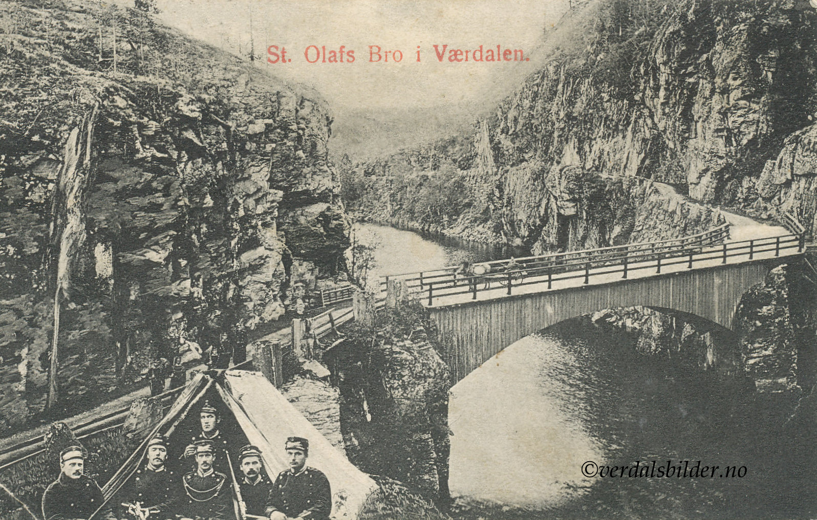
Graaryg skanse i 1905. Sparbuske Landstormeskadron på grensevakt ved St. Olavs bru i 1905. Her ble det gravd skyttergraver som er godt synlig i terrenget ennå. Blant soldatene gikk denne vaktposten under navnet Graaryg Skanse.
Oppbygd forsvarsanlegg med pallisader. Anlegget var på 1,5 km. Det har også før 1611 vært skanseoppbygging, men utforminga er ukjent. Under Kalmar krigen i 1611 ga kongen i København ordre om at lensherren i Trondheim, Sten Bilde skulle stenge passene mellom Sverige og Norge med skanser. Under Sulfjellet ved Stene skulle det oppføres en skanse, og der skulle bønder fra Verdal, Skogn, Inderøy og Ytterøy prestegjeld holdevakt. Det var kanskje erfaringer fra sjuårskrigen 1563-1570 som spøkte i nordmennenes tanker når slike sperringer ble bygget. Da hadde svenske soldater marsjert over grensa til Trondheim. Trøndelag var uten forsvar, og krigsfolkene kunne uhindret plyndre landsdelen. Stene skanse ble bygget slik at hele dalen ble sperret. senere Stene skanseble brukt i forbindelse med gjenerobringen av Trøndelag i 1658-1660, senere ble den brukt i forbindelse med Karolinernes hærtog i 1718. Stene skanse var et imponerende byggverk, det var en sammenhengende palisader fra foten av Steinsvåttåen til berget på sør siden av Trongdøla.
1658 Trøndelag og Kristiansten festning hadde vært hærtatt i 7 mndr. Norske styrker under ledelse av major Eilerik Visborg stoppet svenske unnsetningsstyrker på veg til Trondheim. Resultatet ble at Krisitansten festning falt og Trøndelag kom igjen på norske hender
1718 Den stor nordiske krig. General Armfelt med sine karolinere erobret Stene Skanse.
1807-1814 Det antas at stedet også hadde betydning under kommandotiden.
Framhaldskolebilde fra 1934 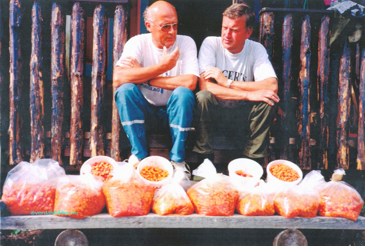 Moltåret 1997. Snorre og Atle Skavhaug.