jsonp({"type":"FeatureCollection",
"features":[
{
"type":"Feature",
"geometry":
{
"type":"Point",
"coordinates":[11.565599,63.798592]
},
"properties":
{
"markerid":"771",
"layers":["42"],
"requested_layer":["42"],
"markername":"Stiklastadir",
"basemap":"custom_basemap",
"lat":"63.798592",
"lon":"11.565599",
"icon":"Stekkstad.png",
"zoom":"16",
"iconUrl":"http://verdalsportalen.no/wp-content/uploads/leaflet-maps-marker-icons/Stekkstad.png",
"address":"",
"text":"",
"dlink":"http://maps.google.com/maps?daddr=63.798592,11.565599&t=m&layer=1&doflg=ptk&hl=no&om=0",
"openpopup":"0",
"mapwidth":"800",
"mapwidthunit":"px",
"mapheight":"600",
"marker-createdby":"omlarsen",
"marker-createdon":"2017-06-23 00:00:00",
"marker-updatedby":"omlarsen",
"marker-updatedon":"2017-06-28 00:00:00",
"layerid":["42"],
"layername":"Rundt om på Stiklestad",
"layer-createdby":"omlarsen",
"layer-createdon":"2017-06-22 00:59:44",
"layer-updatedby":"omlarsen",
"layer-updatedon":"2020-09-08 11:38:59",
"controlbox":"1",
"overlays_custom":"0",
"overlays_custom2":"0",
"overlays_custom3":"0",
"overlays_custom4":"0",
"wms":"0",
"wms2":"0",
"wms3":"0",
"wms4":"0",
"wms5":"0",
"wms6":"0",
"wms7":"0",
"wms8":"0",
"wms9":"0",
"wms10":"0",
"kml_timestamp":"",
"gpx_url":"",
"gpx_panel":"0",
"mlm_filter":"1",
"mlm_filter_details":""
}},
{
"type":"Feature",
"geometry":
{
"type":"Point",
"coordinates":[11.570299,63.796891]
},
"properties":
{
"markerid":"772",
"layers":["49","42"],
"requested_layer":["42"],
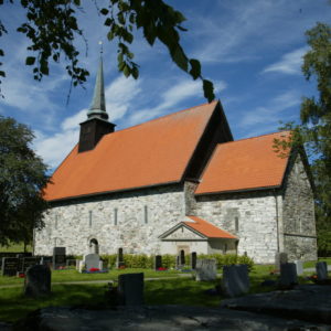
"markername":"Stiklestad kirke",
"basemap":"custom_basemap",
"lat":"63.796891",
"lon":"11.570299",
"icon":"Church.png ",
"zoom":"16",
"iconUrl":"http://verdalsportalen.no/wp-content/uploads/leaflet-maps-marker-icons/Church.png ",
"address":"",
"text":"
",
"dlink":"http://maps.google.com/maps?daddr=63.796891,11.570299&t=m&layer=1&doflg=ptk&hl=no&om=0",
"openpopup":"0",
"mapwidth":"800",
"mapwidthunit":"px",
"mapheight":"600",
"marker-createdby":"omlarsen",
"marker-createdon":"2017-06-23 00:00:00",
"marker-updatedby":"omlarsen",
"marker-updatedon":"2017-06-29 00:00:00",
"layerid":["49", "42"],
"layername":"Rundt om på Stiklestad",
"layer-createdby":"omlarsen",
"layer-createdon":"2017-06-22 00:59:44",
"layer-updatedby":"omlarsen",
"layer-updatedon":"2020-09-08 11:38:59",
"controlbox":"1",
"overlays_custom":"0",
"overlays_custom2":"0",
"overlays_custom3":"0",
"overlays_custom4":"0",
"wms":"0",
"wms2":"0",
"wms3":"0",
"wms4":"0",
"wms5":"0",
"wms6":"0",
"wms7":"0",
"wms8":"0",
"wms9":"0",
"wms10":"0",
"kml_timestamp":"",
"gpx_url":"",
"gpx_panel":"0",
"mlm_filter":"1",
"mlm_filter_details":""
}},
{
"type":"Feature",
"geometry":
{
"type":"Point",
"coordinates":[11.570299,63.796891]
},
"properties":
{
"markerid":"772",
"layers":["49","42"],
"requested_layer":["42"],
"markername":"Stiklestad kirke",
"basemap":"custom_basemap",
"lat":"63.796891",
"lon":"11.570299",
"icon":"Church.png ",
"zoom":"16",
"iconUrl":"http://verdalsportalen.no/wp-content/uploads/leaflet-maps-marker-icons/Church.png ",
"address":"",
"text":"
",
"dlink":"http://maps.google.com/maps?daddr=63.796891,11.570299&t=m&layer=1&doflg=ptk&hl=no&om=0",
"openpopup":"0",
"mapwidth":"800",
"mapwidthunit":"px",
"mapheight":"600",
"marker-createdby":"omlarsen",
"marker-createdon":"2017-06-23 00:00:00",
"marker-updatedby":"omlarsen",
"marker-updatedon":"2017-06-29 00:00:00",
"layerid":["49", "42"],
"layername":"Kirkene i Verdal",
"layer-createdby":"omlarsen",
"layer-createdon":"2017-09-14 12:15:38",
"layer-updatedby":"omlarsen",
"layer-updatedon":"2017-09-14 12:18:18",
"controlbox":"1",
"overlays_custom":"0",
"overlays_custom2":"0",
"overlays_custom3":"0",
"overlays_custom4":"0",
"wms":"0",
"wms2":"0",
"wms3":"0",
"wms4":"0",
"wms5":"0",
"wms6":"0",
"wms7":"0",
"wms8":"0",
"wms9":"0",
"wms10":"0",
"kml_timestamp":"",
"gpx_url":"",
"gpx_panel":"0",
"mlm_filter":"1",
"mlm_filter_details":""
}},
{
"type":"Feature",
"geometry":
{
"type":"Point",
"coordinates":[11.562574,63.795897]
},
"properties":
{
"markerid":"773",
"layers":["42"],
"requested_layer":["42"],
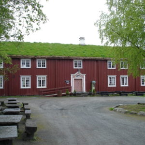
"markername":"Stiklestad nasjonale kultursenter",
"basemap":"custom_basemap",
"lat":"63.795897",
"lon":"11.562574",
"icon":"Stekkstad.png",
"zoom":"17",
"iconUrl":"http://verdalsportalen.no/wp-content/uploads/leaflet-maps-marker-icons/Stekkstad.png",
"address":"",
"text":"",
"dlink":"http://maps.google.com/maps?daddr=63.795897,11.562574&t=m&layer=1&doflg=ptk&hl=no&om=0",
"openpopup":"0",
"mapwidth":"800",
"mapwidthunit":"px",
"mapheight":"700",
"marker-createdby":"omlarsen",
"marker-createdon":"2017-06-23 00:00:00",
"marker-updatedby":"omlarsen",
"marker-updatedon":"2017-06-27 00:00:00",
"layerid":["42"],
"layername":"Rundt om på Stiklestad",
"layer-createdby":"omlarsen",
"layer-createdon":"2017-06-22 00:59:44",
"layer-updatedby":"omlarsen",
"layer-updatedon":"2020-09-08 11:38:59",
"controlbox":"1",
"overlays_custom":"0",
"overlays_custom2":"0",
"overlays_custom3":"0",
"overlays_custom4":"0",
"wms":"0",
"wms2":"0",
"wms3":"0",
"wms4":"0",
"wms5":"0",
"wms6":"0",
"wms7":"0",
"wms8":"0",
"wms9":"0",
"wms10":"0",
"kml_timestamp":"",
"gpx_url":"",
"gpx_panel":"0",
"mlm_filter":"1",
"mlm_filter_details":""
}},
{
"type":"Feature",
"geometry":
{
"type":"Point",
"coordinates":[11.563175,63.795295]
},
"properties":
{
"markerid":"774",
"layers":["42"],
"requested_layer":["42"],
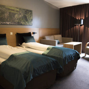
"markername":"Stiklestad hotell",
"basemap":"custom_basemap",
"lat":"63.795295",
"lon":"11.563175",
"icon":"Stekkstad.png",
"zoom":"17",
"iconUrl":"http://verdalsportalen.no/wp-content/uploads/leaflet-maps-marker-icons/Stekkstad.png",
"address":"",
"text":"",
"dlink":"http://maps.google.com/maps?daddr=63.795295,11.563175&t=m&layer=1&doflg=ptk&hl=no&om=0",
"openpopup":"0",
"mapwidth":"800",
"mapwidthunit":"px",
"mapheight":"700",
"marker-createdby":"omlarsen",
"marker-createdon":"2017-06-24 00:00:00",
"marker-updatedby":"omlarsen",
"marker-updatedon":"2017-06-24 00:00:00",
"layerid":["42"],
"layername":"Rundt om på Stiklestad",
"layer-createdby":"omlarsen",
"layer-createdon":"2017-06-22 00:59:44",
"layer-updatedby":"omlarsen",
"layer-updatedon":"2020-09-08 11:38:59",
"controlbox":"1",
"overlays_custom":"0",
"overlays_custom2":"0",
"overlays_custom3":"0",
"overlays_custom4":"0",
"wms":"0",
"wms2":"0",
"wms3":"0",
"wms4":"0",
"wms5":"0",
"wms6":"0",
"wms7":"0",
"wms8":"0",
"wms9":"0",
"wms10":"0",
"kml_timestamp":"",
"gpx_url":"",
"gpx_panel":"0",
"mlm_filter":"1",
"mlm_filter_details":""
}},
{
"type":"Feature",
"geometry":
{
"type":"Point",
"coordinates":[11.569655,63.798071]
},
"properties":
{
"markerid":"775",
"layers":["42"],
"requested_layer":["42"],
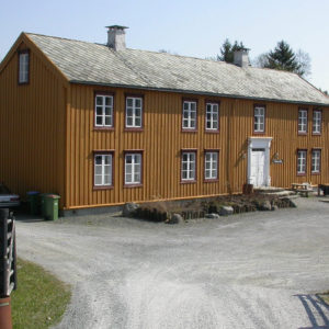
"markername":"Telthuset",
"basemap":"custom_basemap",
"lat":"63.798071",
"lon":"11.569655",
"icon":"Stekkstad.png",
"zoom":"17",
"iconUrl":"http://verdalsportalen.no/wp-content/uploads/leaflet-maps-marker-icons/Stekkstad.png",
"address":"",
"text":"",
"dlink":"http://maps.google.com/maps?daddr=63.798071,11.569655&t=m&layer=1&doflg=ptk&hl=no&om=0",
"openpopup":"0",
"mapwidth":"800",
"mapwidthunit":"px",
"mapheight":"700",
"marker-createdby":"omlarsen",
"marker-createdon":"2017-06-24 00:00:00",
"marker-updatedby":"omlarsen",
"marker-updatedon":"2017-06-28 00:00:00",
"layerid":["42"],
"layername":"Rundt om på Stiklestad",
"layer-createdby":"omlarsen",
"layer-createdon":"2017-06-22 00:59:44",
"layer-updatedby":"omlarsen",
"layer-updatedon":"2020-09-08 11:38:59",
"controlbox":"1",
"overlays_custom":"0",
"overlays_custom2":"0",
"overlays_custom3":"0",
"overlays_custom4":"0",
"wms":"0",
"wms2":"0",
"wms3":"0",
"wms4":"0",
"wms5":"0",
"wms6":"0",
"wms7":"0",
"wms8":"0",
"wms9":"0",
"wms10":"0",
"kml_timestamp":"",
"gpx_url":"",
"gpx_panel":"0",
"mlm_filter":"1",
"mlm_filter_details":""
}},
{
"type":"Feature",
"geometry":
{
"type":"Point",
"coordinates":[11.564645,63.797081]
},
"properties":
{
"markerid":"776",
"layers":["42"],
"requested_layer":["42"],
"markername":"Molåna",
"basemap":"custom_basemap",
"lat":"63.797081",
"lon":"11.564645",
"icon":"Stekkstad.png",
"zoom":"17",
"iconUrl":"http://verdalsportalen.no/wp-content/uploads/leaflet-maps-marker-icons/Stekkstad.png",
"address":"",
"text":"",
"dlink":"http://maps.google.com/maps?daddr=63.797081,11.564645&t=m&layer=1&doflg=ptk&hl=no&om=0",
"openpopup":"0",
"mapwidth":"800",
"mapwidthunit":"px",
"mapheight":"700",
"marker-createdby":"omlarsen",
"marker-createdon":"2017-06-24 00:00:00",
"marker-updatedby":"omlarsen",
"marker-updatedon":"2017-06-24 00:00:00",
"layerid":["42"],
"layername":"Rundt om på Stiklestad",
"layer-createdby":"omlarsen",
"layer-createdon":"2017-06-22 00:59:44",
"layer-updatedby":"omlarsen",
"layer-updatedon":"2020-09-08 11:38:59",
"controlbox":"1",
"overlays_custom":"0",
"overlays_custom2":"0",
"overlays_custom3":"0",
"overlays_custom4":"0",
"wms":"0",
"wms2":"0",
"wms3":"0",
"wms4":"0",
"wms5":"0",
"wms6":"0",
"wms7":"0",
"wms8":"0",
"wms9":"0",
"wms10":"0",
"kml_timestamp":"",
"gpx_url":"",
"gpx_panel":"0",
"mlm_filter":"1",
"mlm_filter_details":""
}},
{
"type":"Feature",
"geometry":
{
"type":"Point",
"coordinates":[11.583817,63.791121]
},
"properties":
{
"markerid":"777",
"layers":["42"],
"requested_layer":["42"],
"markername":"Hegstadmarka",
"basemap":"custom_basemap",
"lat":"63.791121",
"lon":"11.583817",
"icon":"sight-2.png",
"zoom":"16",
"iconUrl":"http://verdalsportalen.no/wp-content/uploads/leaflet-maps-marker-icons/sight-2.png",
"address":"",
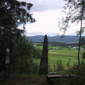
"text":"Hegstadmarka
I de sentrale delene av Verdalen er det registrert over 750 gravhauger.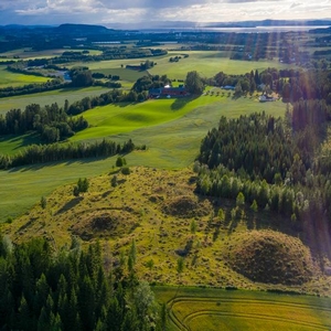
Mange av dem er uvanlig store, og fleire ligger i nærheten av Stiklestad. 2 km nord for Stiklestad ligger gravfeltet Hallemsmarka med til sammen 80 hauger, og 1,5 km østover ligger Hegstadmarka med monumentale storhauger og fem hustufter.
Øystein walberg forteller om Hegstad.
",
"dlink":"http://maps.google.com/maps?daddr=63.791121,11.583817&t=m&layer=1&doflg=ptk&hl=no&om=0",
"openpopup":"0",
"mapwidth":"800",
"mapwidthunit":"px",
"mapheight":"700",
"marker-createdby":"omlarsen",
"marker-createdon":"2017-06-24 00:00:00",
"marker-updatedby":"omlarsen",
"marker-updatedon":"2017-06-29 00:00:00",
"layerid":["42"],
"layername":"Rundt om på Stiklestad",
"layer-createdby":"omlarsen",
"layer-createdon":"2017-06-22 00:59:44",
"layer-updatedby":"omlarsen",
"layer-updatedon":"2020-09-08 11:38:59",
"controlbox":"1",
"overlays_custom":"0",
"overlays_custom2":"0",
"overlays_custom3":"0",
"overlays_custom4":"0",
"wms":"0",
"wms2":"0",
"wms3":"0",
"wms4":"0",
"wms5":"0",
"wms6":"0",
"wms7":"0",
"wms8":"0",
"wms9":"0",
"wms10":"0",
"kml_timestamp":"",
"gpx_url":"",
"gpx_panel":"0",
"mlm_filter":"1",
"mlm_filter_details":""
}},
{
"type":"Feature",
"geometry":
{
"type":"Point",
"coordinates":[11.567187,63.810193]
},
"properties":
{
"markerid":"778",
"layers":["42"],
"requested_layer":["42"],
"markername":"Hallemsmarka",
"basemap":"custom_basemap",
"lat":"63.810193",
"lon":"11.567187",
"icon":"sight-2.png",
"zoom":"15",
"iconUrl":"http://verdalsportalen.no/wp-content/uploads/leaflet-maps-marker-icons/sight-2.png",
"address":"",
"text":"
",
"dlink":"http://maps.google.com/maps?daddr=63.810193,11.567187&t=m&layer=1&doflg=ptk&hl=no&om=0",
"openpopup":"0",
"mapwidth":"800",
"mapwidthunit":"px",
"mapheight":"700",
"marker-createdby":"omlarsen",
"marker-createdon":"2017-06-24 00:00:00",
"marker-updatedby":"omlarsen",
"marker-updatedon":"2017-06-29 00:00:00",
"layerid":["42"],
"layername":"Rundt om på Stiklestad",
"layer-createdby":"omlarsen",
"layer-createdon":"2017-06-22 00:59:44",
"layer-updatedby":"omlarsen",
"layer-updatedon":"2020-09-08 11:38:59",
"controlbox":"1",
"overlays_custom":"0",
"overlays_custom2":"0",
"overlays_custom3":"0",
"overlays_custom4":"0",
"wms":"0",
"wms2":"0",
"wms3":"0",
"wms4":"0",
"wms5":"0",
"wms6":"0",
"wms7":"0",
"wms8":"0",
"wms9":"0",
"wms10":"0",
"kml_timestamp":"",
"gpx_url":"",
"gpx_panel":"0",
"mlm_filter":"1",
"mlm_filter_details":""
}},
{
"type":"Feature",
"geometry":
{
"type":"Point",
"coordinates":[11.601477,63.790717]
},
"properties":
{
"markerid":"779",
"layers":["42"],
"requested_layer":["42"],
"markername":"Verdalsraset",
"basemap":"custom_basemap",
"lat":"63.790717",
"lon":"11.601477",
"icon":"sight-2.png",
"zoom":"14",
"iconUrl":"http://verdalsportalen.no/wp-content/uploads/leaflet-maps-marker-icons/sight-2.png",
"address":"",
"text":"",
"dlink":"http://maps.google.com/maps?daddr=63.790717,11.601477&t=m&layer=1&doflg=ptk&hl=no&om=0",
"openpopup":"0",
"mapwidth":"800",
"mapwidthunit":"px",
"mapheight":"700",
"marker-createdby":"omlarsen",
"marker-createdon":"2017-06-24 00:00:00",
"marker-updatedby":"omlarsen",
"marker-updatedon":"2017-06-29 00:00:00",
"layerid":["42"],
"layername":"Rundt om på Stiklestad",
"layer-createdby":"omlarsen",
"layer-createdon":"2017-06-22 00:59:44",
"layer-updatedby":"omlarsen",
"layer-updatedon":"2020-09-08 11:38:59",
"controlbox":"1",
"overlays_custom":"0",
"overlays_custom2":"0",
"overlays_custom3":"0",
"overlays_custom4":"0",
"wms":"0",
"wms2":"0",
"wms3":"0",
"wms4":"0",
"wms5":"0",
"wms6":"0",
"wms7":"0",
"wms8":"0",
"wms9":"0",
"wms10":"0",
"kml_timestamp":"",
"gpx_url":"",
"gpx_panel":"0",
"mlm_filter":"1",
"mlm_filter_details":""
}},
{
"type":"Feature",
"geometry":
{
"type":"Point",
"coordinates":[11.564575,63.797308]
},
"properties":
{
"markerid":"811",
"layers":["42"],
"requested_layer":["42"],
"markername":"Lyngsburet",
"basemap":"custom_basemap",
"lat":"63.797308",
"lon":"11.564575",
"icon":"Stekkstad.png",
"zoom":"18",
"iconUrl":"http://verdalsportalen.no/wp-content/uploads/leaflet-maps-marker-icons/Stekkstad.png",
"address":"",
"text":"",
"dlink":"http://maps.google.com/maps?daddr=63.797308,11.564575&t=m&layer=1&doflg=ptk&hl=no&om=0",
"openpopup":"0",
"mapwidth":"800",
"mapwidthunit":"px",
"mapheight":"600",
"marker-createdby":"omlarsen",
"marker-createdon":"2017-06-28 00:00:00",
"marker-updatedby":"omlarsen",
"marker-updatedon":"2017-06-28 00:00:00",
"layerid":["42"],
"layername":"Rundt om på Stiklestad",
"layer-createdby":"omlarsen",
"layer-createdon":"2017-06-22 00:59:44",
"layer-updatedby":"omlarsen",
"layer-updatedon":"2020-09-08 11:38:59",
"controlbox":"1",
"overlays_custom":"0",
"overlays_custom2":"0",
"overlays_custom3":"0",
"overlays_custom4":"0",
"wms":"0",
"wms2":"0",
"wms3":"0",
"wms4":"0",
"wms5":"0",
"wms6":"0",
"wms7":"0",
"wms8":"0",
"wms9":"0",
"wms10":"0",
"kml_timestamp":"",
"gpx_url":"",
"gpx_panel":"0",
"mlm_filter":"1",
"mlm_filter_details":""
}},
{
"type":"Feature",
"geometry":
{
"type":"Point",
"coordinates":[11.564773,63.797398]
},
"properties":
{
"markerid":"812",
"layers":["42"],
"requested_layer":["42"],
"markername":"Kongsstuggu",
"basemap":"custom_basemap",
"lat":"63.797398",
"lon":"11.564773",
"icon":"Stekkstad.png",
"zoom":"17",
"iconUrl":"http://verdalsportalen.no/wp-content/uploads/leaflet-maps-marker-icons/Stekkstad.png",
"address":"",
"text":"",
"dlink":"http://maps.google.com/maps?daddr=63.797398,11.564773&t=m&layer=1&doflg=ptk&hl=no&om=0",
"openpopup":"0",
"mapwidth":"800",
"mapwidthunit":"px",
"mapheight":"600",
"marker-createdby":"omlarsen",
"marker-createdon":"2017-06-28 00:00:00",
"marker-updatedby":"omlarsen",
"marker-updatedon":"2017-06-28 00:00:00",
"layerid":["42"],
"layername":"Rundt om på Stiklestad",
"layer-createdby":"omlarsen",
"layer-createdon":"2017-06-22 00:59:44",
"layer-updatedby":"omlarsen",
"layer-updatedon":"2020-09-08 11:38:59",
"controlbox":"1",
"overlays_custom":"0",
"overlays_custom2":"0",
"overlays_custom3":"0",
"overlays_custom4":"0",
"wms":"0",
"wms2":"0",
"wms3":"0",
"wms4":"0",
"wms5":"0",
"wms6":"0",
"wms7":"0",
"wms8":"0",
"wms9":"0",
"wms10":"0",
"kml_timestamp":"",
"gpx_url":"",
"gpx_panel":"0",
"mlm_filter":"1",
"mlm_filter_details":""
}},
{
"type":"Feature",
"geometry":
{
"type":"Point",
"coordinates":[11.564189,63.797337]
},
"properties":
{
"markerid":"813",
"layers":["42"],
"requested_layer":["42"],
"markername":"Snekkarstuggu",
"basemap":"custom_basemap",
"lat":"63.797337",
"lon":"11.564189",
"icon":"Stekkstad.png",
"zoom":"18",
"iconUrl":"http://verdalsportalen.no/wp-content/uploads/leaflet-maps-marker-icons/Stekkstad.png",
"address":"",
"text":"",
"dlink":"http://maps.google.com/maps?daddr=63.797337,11.564189&t=m&layer=1&doflg=ptk&hl=no&om=0",
"openpopup":"0",
"mapwidth":"800",
"mapwidthunit":"px",
"mapheight":"600",
"marker-createdby":"omlarsen",
"marker-createdon":"2017-06-28 00:00:00",
"marker-updatedby":"omlarsen",
"marker-updatedon":"2017-06-28 00:00:00",
"layerid":["42"],
"layername":"Rundt om på Stiklestad",
"layer-createdby":"omlarsen",
"layer-createdon":"2017-06-22 00:59:44",
"layer-updatedby":"omlarsen",
"layer-updatedon":"2020-09-08 11:38:59",
"controlbox":"1",
"overlays_custom":"0",
"overlays_custom2":"0",
"overlays_custom3":"0",
"overlays_custom4":"0",
"wms":"0",
"wms2":"0",
"wms3":"0",
"wms4":"0",
"wms5":"0",
"wms6":"0",
"wms7":"0",
"wms8":"0",
"wms9":"0",
"wms10":"0",
"kml_timestamp":"",
"gpx_url":"",
"gpx_panel":"0",
"mlm_filter":"1",
"mlm_filter_details":""
}},
{
"type":"Feature",
"geometry":
{
"type":"Point",
"coordinates":[11.566562,63.797944]
},
"properties":
{
"markerid":"814",
"layers":["42"],
"requested_layer":["42"],
"markername":"Bjønnmelburet",
"basemap":"custom_basemap",
"lat":"63.797944",
"lon":"11.566562",
"icon":"Stekkstad.png",
"zoom":"20",
"iconUrl":"http://verdalsportalen.no/wp-content/uploads/leaflet-maps-marker-icons/Stekkstad.png",
"address":"",
"text":"",
"dlink":"http://maps.google.com/maps?daddr=63.797944,11.566562&t=m&layer=1&doflg=ptk&hl=no&om=0",
"openpopup":"0",
"mapwidth":"800",
"mapwidthunit":"px",
"mapheight":"600",
"marker-createdby":"omlarsen",
"marker-createdon":"2017-06-28 00:00:00",
"marker-updatedby":"omlarsen",
"marker-updatedon":"2017-06-28 00:00:00",
"layerid":["42"],
"layername":"Rundt om på Stiklestad",
"layer-createdby":"omlarsen",
"layer-createdon":"2017-06-22 00:59:44",
"layer-updatedby":"omlarsen",
"layer-updatedon":"2020-09-08 11:38:59",
"controlbox":"1",
"overlays_custom":"0",
"overlays_custom2":"0",
"overlays_custom3":"0",
"overlays_custom4":"0",
"wms":"0",
"wms2":"0",
"wms3":"0",
"wms4":"0",
"wms5":"0",
"wms6":"0",
"wms7":"0",
"wms8":"0",
"wms9":"0",
"wms10":"0",
"kml_timestamp":"",
"gpx_url":"",
"gpx_panel":"0",
"mlm_filter":"1",
"mlm_filter_details":""
}},
{
"type":"Feature",
"geometry":
{
"type":"Point",
"coordinates":[11.564870,63.797443]
},
"properties":
{
"markerid":"815",
"layers":["42"],
"requested_layer":["42"],
"markername":"Ådalsvollburet",
"basemap":"custom_basemap",
"lat":"63.797443",
"lon":"11.564870",
"icon":"Stekkstad.png",
"zoom":"18",
"iconUrl":"http://verdalsportalen.no/wp-content/uploads/leaflet-maps-marker-icons/Stekkstad.png",
"address":"",
"text":"",
"dlink":"http://maps.google.com/maps?daddr=63.797443,11.564870&t=m&layer=1&doflg=ptk&hl=no&om=0",
"openpopup":"0",
"mapwidth":"800",
"mapwidthunit":"px",
"mapheight":"600",
"marker-createdby":"omlarsen",
"marker-createdon":"2017-06-28 00:00:00",
"marker-updatedby":"omlarsen",
"marker-updatedon":"2017-06-28 00:00:00",
"layerid":["42"],
"layername":"Rundt om på Stiklestad",
"layer-createdby":"omlarsen",
"layer-createdon":"2017-06-22 00:59:44",
"layer-updatedby":"omlarsen",
"layer-updatedon":"2020-09-08 11:38:59",
"controlbox":"1",
"overlays_custom":"0",
"overlays_custom2":"0",
"overlays_custom3":"0",
"overlays_custom4":"0",
"wms":"0",
"wms2":"0",
"wms3":"0",
"wms4":"0",
"wms5":"0",
"wms6":"0",
"wms7":"0",
"wms8":"0",
"wms9":"0",
"wms10":"0",
"kml_timestamp":"",
"gpx_url":"",
"gpx_panel":"0",
"mlm_filter":"1",
"mlm_filter_details":""
}},
{
"type":"Feature",
"geometry":
{
"type":"Point",
"coordinates":[11.565224,63.797390]
},
"properties":
{
"markerid":"816",
"layers":["42"],
"requested_layer":["42"],
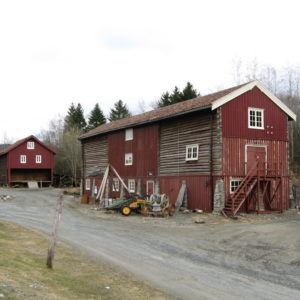
"markername":"Levringslåven",
"basemap":"custom_basemap",
"lat":"63.797390",
"lon":"11.565224",
"icon":"Stekkstad.png",
"zoom":"18",
"iconUrl":"http://verdalsportalen.no/wp-content/uploads/leaflet-maps-marker-icons/Stekkstad.png",
"address":"",
"text":"",
"dlink":"http://maps.google.com/maps?daddr=63.797390,11.565224&t=m&layer=1&doflg=ptk&hl=no&om=0",
"openpopup":"0",
"mapwidth":"800",
"mapwidthunit":"px",
"mapheight":"600",
"marker-createdby":"omlarsen",
"marker-createdon":"2017-06-28 00:00:00",
"marker-updatedby":"omlarsen",
"marker-updatedon":"2017-06-28 00:00:00",
"layerid":["42"],
"layername":"Rundt om på Stiklestad",
"layer-createdby":"omlarsen",
"layer-createdon":"2017-06-22 00:59:44",
"layer-updatedby":"omlarsen",
"layer-updatedon":"2020-09-08 11:38:59",
"controlbox":"1",
"overlays_custom":"0",
"overlays_custom2":"0",
"overlays_custom3":"0",
"overlays_custom4":"0",
"wms":"0",
"wms2":"0",
"wms3":"0",
"wms4":"0",
"wms5":"0",
"wms6":"0",
"wms7":"0",
"wms8":"0",
"wms9":"0",
"wms10":"0",
"kml_timestamp":"",
"gpx_url":"",
"gpx_panel":"0",
"mlm_filter":"1",
"mlm_filter_details":""
}},
{
"type":"Feature",
"geometry":
{
"type":"Point",
"coordinates":[11.567155,63.797528]
},
"properties":
{
"markerid":"817",
"layers":["42"],
"requested_layer":["42"],
"markername":"Smia og tørkhuset",
"basemap":"custom_basemap",
"lat":"63.797528",
"lon":"11.567155",
"icon":"Stekkstad.png",
"zoom":"18",
"iconUrl":"http://verdalsportalen.no/wp-content/uploads/leaflet-maps-marker-icons/Stekkstad.png",
"address":"",
"text":"",
"dlink":"http://maps.google.com/maps?daddr=63.797528,11.567155&t=m&layer=1&doflg=ptk&hl=no&om=0",
"openpopup":"0",
"mapwidth":"800",
"mapwidthunit":"px",
"mapheight":"600",
"marker-createdby":"omlarsen",
"marker-createdon":"2017-06-28 00:00:00",
"marker-updatedby":"omlarsen",
"marker-updatedon":"2017-06-28 00:00:00",
"layerid":["42"],
"layername":"Rundt om på Stiklestad",
"layer-createdby":"omlarsen",
"layer-createdon":"2017-06-22 00:59:44",
"layer-updatedby":"omlarsen",
"layer-updatedon":"2020-09-08 11:38:59",
"controlbox":"1",
"overlays_custom":"0",
"overlays_custom2":"0",
"overlays_custom3":"0",
"overlays_custom4":"0",
"wms":"0",
"wms2":"0",
"wms3":"0",
"wms4":"0",
"wms5":"0",
"wms6":"0",
"wms7":"0",
"wms8":"0",
"wms9":"0",
"wms10":"0",
"kml_timestamp":"",
"gpx_url":"",
"gpx_panel":"0",
"mlm_filter":"1",
"mlm_filter_details":""
}},
{
"type":"Feature",
"geometry":
{
"type":"Point",
"coordinates":[11.563974,63.797268]
},
"properties":
{
"markerid":"818",
"layers":["42"],
"requested_layer":["42"],
"markername":"Kverna",
"basemap":"custom_basemap",
"lat":"63.797268",
"lon":"11.563974",
"icon":"Stekkstad.png",
"zoom":"18",
"iconUrl":"http://verdalsportalen.no/wp-content/uploads/leaflet-maps-marker-icons/Stekkstad.png",
"address":"",
"text":"",
"dlink":"http://maps.google.com/maps?daddr=63.797268,11.563974&t=m&layer=1&doflg=ptk&hl=no&om=0",
"openpopup":"0",
"mapwidth":"800",
"mapwidthunit":"px",
"mapheight":"600",
"marker-createdby":"omlarsen",
"marker-createdon":"2017-06-28 00:00:00",
"marker-updatedby":"omlarsen",
"marker-updatedon":"2017-06-28 00:00:00",
"layerid":["42"],
"layername":"Rundt om på Stiklestad",
"layer-createdby":"omlarsen",
"layer-createdon":"2017-06-22 00:59:44",
"layer-updatedby":"omlarsen",
"layer-updatedon":"2020-09-08 11:38:59",
"controlbox":"1",
"overlays_custom":"0",
"overlays_custom2":"0",
"overlays_custom3":"0",
"overlays_custom4":"0",
"wms":"0",
"wms2":"0",
"wms3":"0",
"wms4":"0",
"wms5":"0",
"wms6":"0",
"wms7":"0",
"wms8":"0",
"wms9":"0",
"wms10":"0",
"kml_timestamp":"",
"gpx_url":"",
"gpx_panel":"0",
"mlm_filter":"1",
"mlm_filter_details":""
}},
{
"type":"Feature",
"geometry":
{
"type":"Point",
"coordinates":[11.567783,63.797626]
},
"properties":
{
"markerid":"819",
"layers":["42"],
"requested_layer":["42"],
"markername":"Husmannsplassen",
"basemap":"custom_basemap",
"lat":"63.797626",
"lon":"11.567783",
"icon":"Stekkstad.png",
"zoom":"18",
"iconUrl":"http://verdalsportalen.no/wp-content/uploads/leaflet-maps-marker-icons/Stekkstad.png",
"address":"",
"text":"",
"dlink":"http://maps.google.com/maps?daddr=63.797626,11.567783&t=m&layer=1&doflg=ptk&hl=no&om=0",
"openpopup":"0",
"mapwidth":"800",
"mapwidthunit":"px",
"mapheight":"600",
"marker-createdby":"omlarsen",
"marker-createdon":"2017-06-28 00:00:00",
"marker-updatedby":"omlarsen",
"marker-updatedon":"2017-06-28 00:00:00",
"layerid":["42"],
"layername":"Rundt om på Stiklestad",
"layer-createdby":"omlarsen",
"layer-createdon":"2017-06-22 00:59:44",
"layer-updatedby":"omlarsen",
"layer-updatedon":"2020-09-08 11:38:59",
"controlbox":"1",
"overlays_custom":"0",
"overlays_custom2":"0",
"overlays_custom3":"0",
"overlays_custom4":"0",
"wms":"0",
"wms2":"0",
"wms3":"0",
"wms4":"0",
"wms5":"0",
"wms6":"0",
"wms7":"0",
"wms8":"0",
"wms9":"0",
"wms10":"0",
"kml_timestamp":"",
"gpx_url":"",
"gpx_panel":"0",
"mlm_filter":"1",
"mlm_filter_details":""
}},
{
"type":"Feature",
"geometry":
{
"type":"Point",
"coordinates":[11.565696,63.797971]
},
"properties":
{
"markerid":"820",
"layers":["42"],
"requested_layer":["42"],
"markername":"Bakeri og krambu",
"basemap":"custom_basemap",
"lat":"63.797971",
"lon":"11.565696",
"icon":"Stekkstad.png",
"zoom":"18",
"iconUrl":"http://verdalsportalen.no/wp-content/uploads/leaflet-maps-marker-icons/Stekkstad.png",
"address":"",
"text":"",
"dlink":"http://maps.google.com/maps?daddr=63.797971,11.565696&t=m&layer=1&doflg=ptk&hl=no&om=0",
"openpopup":"0",
"mapwidth":"800",
"mapwidthunit":"px",
"mapheight":"600",
"marker-createdby":"omlarsen",
"marker-createdon":"2017-06-28 00:00:00",
"marker-updatedby":"omlarsen",
"marker-updatedon":"2017-06-28 00:00:00",
"layerid":["42"],
"layername":"Rundt om på Stiklestad",
"layer-createdby":"omlarsen",
"layer-createdon":"2017-06-22 00:59:44",
"layer-updatedby":"omlarsen",
"layer-updatedon":"2020-09-08 11:38:59",
"controlbox":"1",
"overlays_custom":"0",
"overlays_custom2":"0",
"overlays_custom3":"0",
"overlays_custom4":"0",
"wms":"0",
"wms2":"0",
"wms3":"0",
"wms4":"0",
"wms5":"0",
"wms6":"0",
"wms7":"0",
"wms8":"0",
"wms9":"0",
"wms10":"0",
"kml_timestamp":"",
"gpx_url":"",
"gpx_panel":"0",
"mlm_filter":"1",
"mlm_filter_details":""
}},
{
"type":"Feature",
"geometry":
{
"type":"Point",
"coordinates":[11.566930,63.797443]
},
"properties":
{
"markerid":"821",
"layers":["42"],
"requested_layer":["42"],
"markername":"Badstua",
"basemap":"custom_basemap",
"lat":"63.797443",
"lon":"11.566930",
"icon":"Stekkstad.png",
"zoom":"18",
"iconUrl":"http://verdalsportalen.no/wp-content/uploads/leaflet-maps-marker-icons/Stekkstad.png",
"address":"",
"text":"",
"dlink":"http://maps.google.com/maps?daddr=63.797443,11.566930&t=m&layer=1&doflg=ptk&hl=no&om=0",
"openpopup":"0",
"mapwidth":"800",
"mapwidthunit":"px",
"mapheight":"600",
"marker-createdby":"omlarsen",
"marker-createdon":"2017-06-28 00:00:00",
"marker-updatedby":"omlarsen",
"marker-updatedon":"2017-06-28 00:00:00",
"layerid":["42"],
"layername":"Rundt om på Stiklestad",
"layer-createdby":"omlarsen",
"layer-createdon":"2017-06-22 00:59:44",
"layer-updatedby":"omlarsen",
"layer-updatedon":"2020-09-08 11:38:59",
"controlbox":"1",
"overlays_custom":"0",
"overlays_custom2":"0",
"overlays_custom3":"0",
"overlays_custom4":"0",
"wms":"0",
"wms2":"0",
"wms3":"0",
"wms4":"0",
"wms5":"0",
"wms6":"0",
"wms7":"0",
"wms8":"0",
"wms9":"0",
"wms10":"0",
"kml_timestamp":"",
"gpx_url":"",
"gpx_panel":"0",
"mlm_filter":"1",
"mlm_filter_details":""
}},
{
"type":"Feature",
"geometry":
{
"type":"Point",
"coordinates":[11.565235,63.795754]
},
"properties":
{
"markerid":"822",
"layers":["42"],
"requested_layer":["42"],
"markername":"Olavshaugen",
"basemap":"custom_basemap",
"lat":"63.795754",
"lon":"11.565235",
"icon":"Stekkstad.png",
"zoom":"17",
"iconUrl":"http://verdalsportalen.no/wp-content/uploads/leaflet-maps-marker-icons/Stekkstad.png",
"address":"",
"text":"",
"dlink":"http://maps.google.com/maps?daddr=63.795754,11.565235&t=m&layer=1&doflg=ptk&hl=no&om=0",
"openpopup":"0",
"mapwidth":"800",
"mapwidthunit":"px",
"mapheight":"600",
"marker-createdby":"omlarsen",
"marker-createdon":"2017-06-28 00:00:00",
"marker-updatedby":"omlarsen",
"marker-updatedon":"2017-06-28 00:00:00",
"layerid":["42"],
"layername":"Rundt om på Stiklestad",
"layer-createdby":"omlarsen",
"layer-createdon":"2017-06-22 00:59:44",
"layer-updatedby":"omlarsen",
"layer-updatedon":"2020-09-08 11:38:59",
"controlbox":"1",
"overlays_custom":"0",
"overlays_custom2":"0",
"overlays_custom3":"0",
"overlays_custom4":"0",
"wms":"0",
"wms2":"0",
"wms3":"0",
"wms4":"0",
"wms5":"0",
"wms6":"0",
"wms7":"0",
"wms8":"0",
"wms9":"0",
"wms10":"0",
"kml_timestamp":"",
"gpx_url":"",
"gpx_panel":"0",
"mlm_filter":"1",
"mlm_filter_details":""
}},
{
"type":"Feature",
"geometry":
{
"type":"Point",
"coordinates":[11.564720,63.796593]
},
"properties":
{
"markerid":"823",
"layers":["42"],
"requested_layer":["42"],
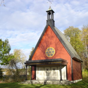
"markername":"St. Olavs kapell",
"basemap":"custom_basemap",
"lat":"63.796593",
"lon":"11.564720",
"icon":"Stekkstad.png",
"zoom":"17",
"iconUrl":"http://verdalsportalen.no/wp-content/uploads/leaflet-maps-marker-icons/Stekkstad.png",
"address":"",
"text":"",
"dlink":"http://maps.google.com/maps?daddr=63.796593,11.564720&t=m&layer=1&doflg=ptk&hl=no&om=0",
"openpopup":"0",
"mapwidth":"800",
"mapwidthunit":"px",
"mapheight":"600",
"marker-createdby":"omlarsen",
"marker-createdon":"2017-06-28 00:00:00",
"marker-updatedby":"omlarsen",
"marker-updatedon":"2017-06-29 00:00:00",
"layerid":["42"],
"layername":"Rundt om på Stiklestad",
"layer-createdby":"omlarsen",
"layer-createdon":"2017-06-22 00:59:44",
"layer-updatedby":"omlarsen",
"layer-updatedon":"2020-09-08 11:38:59",
"controlbox":"1",
"overlays_custom":"0",
"overlays_custom2":"0",
"overlays_custom3":"0",
"overlays_custom4":"0",
"wms":"0",
"wms2":"0",
"wms3":"0",
"wms4":"0",
"wms5":"0",
"wms6":"0",
"wms7":"0",
"wms8":"0",
"wms9":"0",
"wms10":"0",
"kml_timestamp":"",
"gpx_url":"",
"gpx_panel":"0",
"mlm_filter":"1",
"mlm_filter_details":""
}},
{
"type":"Feature",
"geometry":
{
"type":"Point",
"coordinates":[11.562145,63.797687]
},
"properties":
{
"markerid":"824",
"layers":["42"],
"requested_layer":["42"],
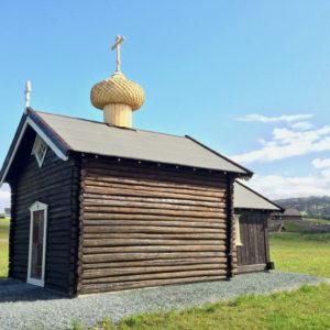
"markername":"Hellige Olavs kapell",
"basemap":"custom_basemap",
"lat":"63.797687",
"lon":"11.562145",
"icon":"Stekkstad.png",
"zoom":"17",
"iconUrl":"http://verdalsportalen.no/wp-content/uploads/leaflet-maps-marker-icons/Stekkstad.png",
"address":"",
"text":"",
"dlink":"http://maps.google.com/maps?daddr=63.797687,11.562145&t=m&layer=1&doflg=ptk&hl=no&om=0",
"openpopup":"0",
"mapwidth":"800",
"mapwidthunit":"px",
"mapheight":"600",
"marker-createdby":"omlarsen",
"marker-createdon":"2017-06-28 00:00:00",
"marker-updatedby":"omlarsen",
"marker-updatedon":"2017-06-29 00:00:00",
"layerid":["42"],
"layername":"Rundt om på Stiklestad",
"layer-createdby":"omlarsen",
"layer-createdon":"2017-06-22 00:59:44",
"layer-updatedby":"omlarsen",
"layer-updatedon":"2020-09-08 11:38:59",
"controlbox":"1",
"overlays_custom":"0",
"overlays_custom2":"0",
"overlays_custom3":"0",
"overlays_custom4":"0",
"wms":"0",
"wms2":"0",
"wms3":"0",
"wms4":"0",
"wms5":"0",
"wms6":"0",
"wms7":"0",
"wms8":"0",
"wms9":"0",
"wms10":"0",
"kml_timestamp":"",
"gpx_url":"",
"gpx_panel":"0",
"mlm_filter":"1",
"mlm_filter_details":""
}},
{
"type":"Feature",
"geometry":
{
"type":"Point",
"coordinates":[11.564199,63.796967]
},
"properties":
{
"markerid":"825",
"layers":["42"],
"requested_layer":["42"],
"markername":"Leikarstua",
"basemap":"custom_basemap",
"lat":"63.796967",
"lon":"11.564199",
"icon":"Stekkstad.png",
"zoom":"18",
"iconUrl":"http://verdalsportalen.no/wp-content/uploads/leaflet-maps-marker-icons/Stekkstad.png",
"address":"",
"text":"",
"dlink":"http://maps.google.com/maps?daddr=63.796967,11.564199&t=m&layer=1&doflg=ptk&hl=no&om=0",
"openpopup":"0",
"mapwidth":"800",
"mapwidthunit":"px",
"mapheight":"600",
"marker-createdby":"omlarsen",
"marker-createdon":"2017-06-28 00:00:00",
"marker-updatedby":"omlarsen",
"marker-updatedon":"2017-06-28 00:00:00",
"layerid":["42"],
"layername":"Rundt om på Stiklestad",
"layer-createdby":"omlarsen",
"layer-createdon":"2017-06-22 00:59:44",
"layer-updatedby":"omlarsen",
"layer-updatedon":"2020-09-08 11:38:59",
"controlbox":"1",
"overlays_custom":"0",
"overlays_custom2":"0",
"overlays_custom3":"0",
"overlays_custom4":"0",
"wms":"0",
"wms2":"0",
"wms3":"0",
"wms4":"0",
"wms5":"0",
"wms6":"0",
"wms7":"0",
"wms8":"0",
"wms9":"0",
"wms10":"0",
"kml_timestamp":"",
"gpx_url":"",
"gpx_panel":"0",
"mlm_filter":"1",
"mlm_filter_details":""
}},
{
"type":"Feature",
"geometry":
{
"type":"Point",
"coordinates":[11.565878,63.798327]
},
"properties":
{
"markerid":"826",
"layers":["42"],
"requested_layer":["42"],
"markername":"Gjesteloftet",
"basemap":"custom_basemap",
"lat":"63.798327",
"lon":"11.565878",
"icon":"Stekkstad.png",
"zoom":"17",
"iconUrl":"http://verdalsportalen.no/wp-content/uploads/leaflet-maps-marker-icons/Stekkstad.png",
"address":"",
"text":"",
"dlink":"http://maps.google.com/maps?daddr=63.798327,11.565878&t=m&layer=1&doflg=ptk&hl=no&om=0",
"openpopup":"0",
"mapwidth":"800",
"mapwidthunit":"px",
"mapheight":"600",
"marker-createdby":"omlarsen",
"marker-createdon":"2017-06-28 00:00:00",
"marker-updatedby":"omlarsen",
"marker-updatedon":"2017-06-28 00:00:00",
"layerid":["42"],
"layername":"Rundt om på Stiklestad",
"layer-createdby":"omlarsen",
"layer-createdon":"2017-06-22 00:59:44",
"layer-updatedby":"omlarsen",
"layer-updatedon":"2020-09-08 11:38:59",
"controlbox":"1",
"overlays_custom":"0",
"overlays_custom2":"0",
"overlays_custom3":"0",
"overlays_custom4":"0",
"wms":"0",
"wms2":"0",
"wms3":"0",
"wms4":"0",
"wms5":"0",
"wms6":"0",
"wms7":"0",
"wms8":"0",
"wms9":"0",
"wms10":"0",
"kml_timestamp":"",
"gpx_url":"",
"gpx_panel":"0",
"mlm_filter":"1",
"mlm_filter_details":""
}},
{
"type":"Feature",
"geometry":
{
"type":"Point",
"coordinates":[11.565750,63.796890]
},
"properties":
{
"markerid":"827",
"layers":["42"],
"requested_layer":["42"],
"markername":"Spelamfiet",
"basemap":"custom_basemap",
"lat":"63.796890",
"lon":"11.565750",
"icon":"Stekkstad.png",
"zoom":"17",
"iconUrl":"http://verdalsportalen.no/wp-content/uploads/leaflet-maps-marker-icons/Stekkstad.png",
"address":"",
"text":"",
"dlink":"http://maps.google.com/maps?daddr=63.796890,11.565750&t=m&layer=1&doflg=ptk&hl=no&om=0",
"openpopup":"0",
"mapwidth":"800",
"mapwidthunit":"px",
"mapheight":"600",
"marker-createdby":"omlarsen",
"marker-createdon":"2017-06-28 00:00:00",
"marker-updatedby":"omlarsen",
"marker-updatedon":"2017-06-28 00:00:00",
"layerid":["42"],
"layername":"Rundt om på Stiklestad",
"layer-createdby":"omlarsen",
"layer-createdon":"2017-06-22 00:59:44",
"layer-updatedby":"omlarsen",
"layer-updatedon":"2020-09-08 11:38:59",
"controlbox":"1",
"overlays_custom":"0",
"overlays_custom2":"0",
"overlays_custom3":"0",
"overlays_custom4":"0",
"wms":"0",
"wms2":"0",
"wms3":"0",
"wms4":"0",
"wms5":"0",
"wms6":"0",
"wms7":"0",
"wms8":"0",
"wms9":"0",
"wms10":"0",
"kml_timestamp":"",
"gpx_url":"",
"gpx_panel":"0",
"mlm_filter":"1",
"mlm_filter_details":""
}},
{
"type":"Feature",
"geometry":
{
"type":"Point",
"coordinates":[11.566887,63.797029]
},
"properties":
{
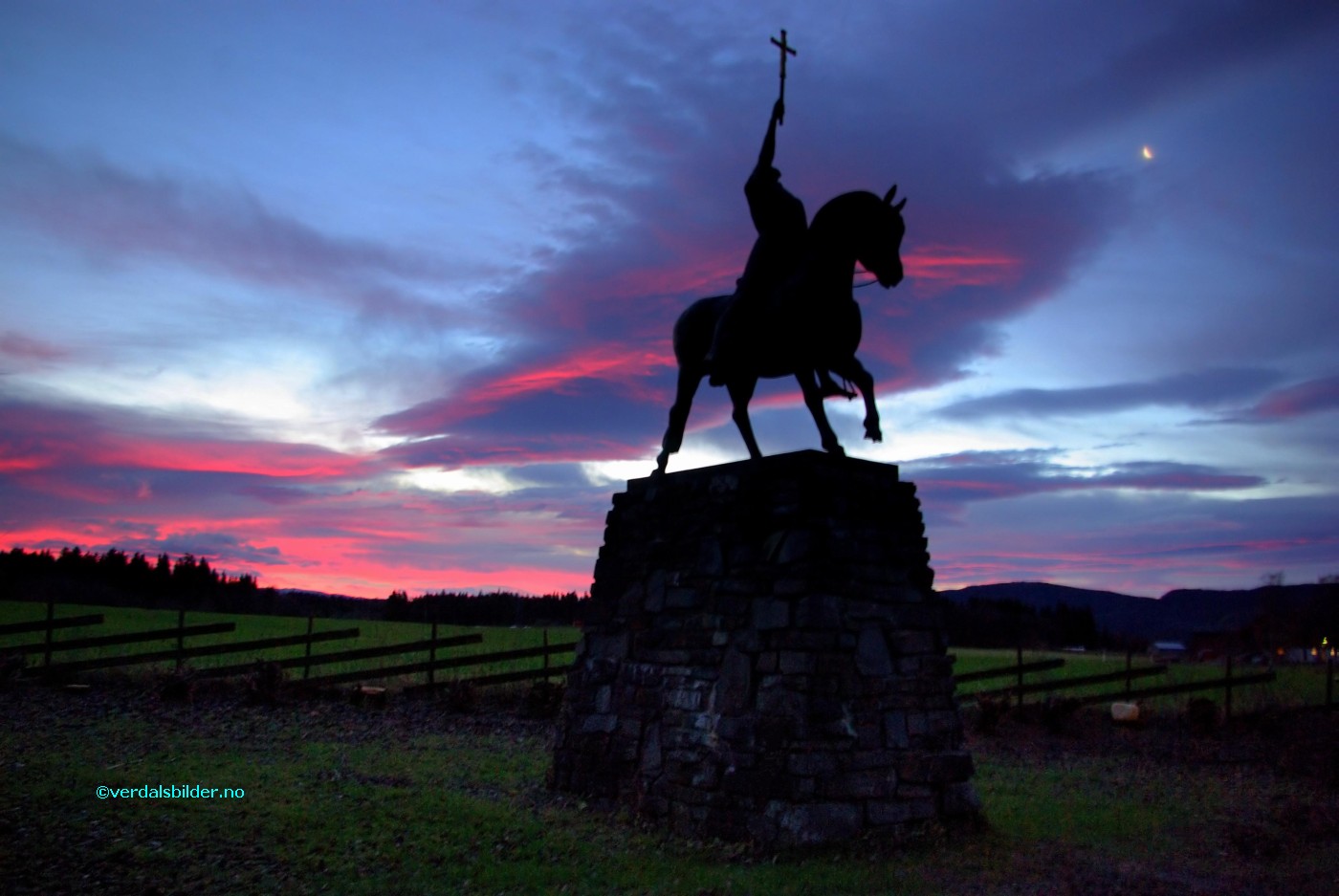
"markerid":"828",
"layers":["42"],
"requested_layer":["42"],
"markername":"Rytterstatuen",
"basemap":"custom_basemap",
"lat":"63.797029",
"lon":"11.566887",
"icon":"Stekkstad.png",
"zoom":"17",
"iconUrl":"http://verdalsportalen.no/wp-content/uploads/leaflet-maps-marker-icons/Stekkstad.png",
"address":"",
"text":"",
"dlink":"http://maps.google.com/maps?daddr=63.797029,11.566887&t=m&layer=1&doflg=ptk&hl=no&om=0",
"openpopup":"0",
"mapwidth":"800",
"mapwidthunit":"px",
"mapheight":"600",
"marker-createdby":"omlarsen",
"marker-createdon":"2017-06-28 00:00:00",
"marker-updatedby":"omlarsen",
"marker-updatedon":"2017-06-28 00:00:00",
"layerid":["42"],
"layername":"Rundt om på Stiklestad",
"layer-createdby":"omlarsen",
"layer-createdon":"2017-06-22 00:59:44",
"layer-updatedby":"omlarsen",
"layer-updatedon":"2020-09-08 11:38:59",
"controlbox":"1",
"overlays_custom":"0",
"overlays_custom2":"0",
"overlays_custom3":"0",
"overlays_custom4":"0",
"wms":"0",
"wms2":"0",
"wms3":"0",
"wms4":"0",
"wms5":"0",
"wms6":"0",
"wms7":"0",
"wms8":"0",
"wms9":"0",
"wms10":"0",
"kml_timestamp":"",
"gpx_url":"",
"gpx_panel":"0",
"mlm_filter":"1",
"mlm_filter_details":""
}},
{
"type":"Feature",
"geometry":
{
"type":"Point",
"coordinates":[11.567284,63.798137]
},
"properties":
{
"markerid":"829",
"layers":["42"],
"requested_layer":["42"],
"markername":"Gjersinghuset",
"basemap":"custom_basemap",
"lat":"63.798137",
"lon":"11.567284",
"icon":"Stekkstad.png",
"zoom":"16",
"iconUrl":"http://verdalsportalen.no/wp-content/uploads/leaflet-maps-marker-icons/Stekkstad.png",
"address":"",
"text":"
",
"dlink":"http://maps.google.com/maps?daddr=63.798137,11.567284&t=m&layer=1&doflg=ptk&hl=no&om=0",
"openpopup":"0",
"mapwidth":"800",
"mapwidthunit":"px",
"mapheight":"600",
"marker-createdby":"omlarsen",
"marker-createdon":"2017-06-28 00:00:00",
"marker-updatedby":"omlarsen",
"marker-updatedon":"2019-09-05 00:00:00",
"layerid":["42"],
"layername":"Rundt om på Stiklestad",
"layer-createdby":"omlarsen",
"layer-createdon":"2017-06-22 00:59:44",
"layer-updatedby":"omlarsen",
"layer-updatedon":"2020-09-08 11:38:59",
"controlbox":"1",
"overlays_custom":"0",
"overlays_custom2":"0",
"overlays_custom3":"0",
"overlays_custom4":"0",
"wms":"0",
"wms2":"0",
"wms3":"0",
"wms4":"0",
"wms5":"0",
"wms6":"0",
"wms7":"0",
"wms8":"0",
"wms9":"0",
"wms10":"0",
"kml_timestamp":"",
"gpx_url":"",
"gpx_panel":"0",
"mlm_filter":"1",
"mlm_filter_details":""
}},
{
"type":"Feature",
"geometry":
{
"type":"Point",
"coordinates":[11.565578,63.797607]
},
"properties":
{
"markerid":"830",
"layers":["42"],
"requested_layer":["42"],
"markername":"Hermannshuset",
"basemap":"custom_basemap",
"lat":"63.797607",
"lon":"11.565578",
"icon":"Stekkstad.png",
"zoom":"17",
"iconUrl":"http://verdalsportalen.no/wp-content/uploads/leaflet-maps-marker-icons/Stekkstad.png",
"address":"",
"text":"
Hermannshuset
Les om åpninga av Hermannshuset
",
"dlink":"http://maps.google.com/maps?daddr=63.797607,11.565578&t=m&layer=1&doflg=ptk&hl=no&om=0",
"openpopup":"0",
"mapwidth":"800",
"mapwidthunit":"px",
"mapheight":"600",
"marker-createdby":"omlarsen",
"marker-createdon":"2017-06-28 00:00:00",
"marker-updatedby":"omlarsen",
"marker-updatedon":"2017-06-28 00:00:00",
"layerid":["42"],
"layername":"Rundt om på Stiklestad",
"layer-createdby":"omlarsen",
"layer-createdon":"2017-06-22 00:59:44",
"layer-updatedby":"omlarsen",
"layer-updatedon":"2020-09-08 11:38:59",
"controlbox":"1",
"overlays_custom":"0",
"overlays_custom2":"0",
"overlays_custom3":"0",
"overlays_custom4":"0",
"wms":"0",
"wms2":"0",
"wms3":"0",
"wms4":"0",
"wms5":"0",
"wms6":"0",
"wms7":"0",
"wms8":"0",
"wms9":"0",
"wms10":"0",
"kml_timestamp":"",
"gpx_url":"",
"gpx_panel":"0",
"mlm_filter":"1",
"mlm_filter_details":""
}},
{
"type":"Feature",
"geometry":
{
"type":"Point",
"coordinates":[11.566308,63.798033]
},
"properties":
{
"markerid":"831",
"layers":["42"],
"requested_layer":["42"],
"markername":"Almoåsstuggu",
"basemap":"custom_basemap",
"lat":"63.798033",
"lon":"11.566308",
"icon":"Stekkstad.png",
"zoom":"17",
"iconUrl":"http://verdalsportalen.no/wp-content/uploads/leaflet-maps-marker-icons/Stekkstad.png",
"address":"",
"text":"",
"dlink":"http://maps.google.com/maps?daddr=63.798033,11.566308&t=m&layer=1&doflg=ptk&hl=no&om=0",
"openpopup":"0",
"mapwidth":"800",
"mapwidthunit":"px",
"mapheight":"600",
"marker-createdby":"omlarsen",
"marker-createdon":"2017-06-28 00:00:00",
"marker-updatedby":"omlarsen",
"marker-updatedon":"2017-06-28 00:00:00",
"layerid":["42"],
"layername":"Rundt om på Stiklestad",
"layer-createdby":"omlarsen",
"layer-createdon":"2017-06-22 00:59:44",
"layer-updatedby":"omlarsen",
"layer-updatedon":"2020-09-08 11:38:59",
"controlbox":"1",
"overlays_custom":"0",
"overlays_custom2":"0",
"overlays_custom3":"0",
"overlays_custom4":"0",
"wms":"0",
"wms2":"0",
"wms3":"0",
"wms4":"0",
"wms5":"0",
"wms6":"0",
"wms7":"0",
"wms8":"0",
"wms9":"0",
"wms10":"0",
"kml_timestamp":"",
"gpx_url":"",
"gpx_panel":"0",
"mlm_filter":"1",
"mlm_filter_details":""
}},
{
"type":"Feature",
"geometry":
{
"type":"Point",
"coordinates":[11.569730,63.798450]
},
"properties":
{
"markerid":"832",
"layers":["42"],
"requested_layer":["42"],
"markername":"Moksneslåna",
"basemap":"custom_basemap",
"lat":"63.798450",
"lon":"11.569730",
"icon":"Stekkstad.png",
"zoom":"17",
"iconUrl":"http://verdalsportalen.no/wp-content/uploads/leaflet-maps-marker-icons/Stekkstad.png",
"address":"",
"text":"",
"dlink":"http://maps.google.com/maps?daddr=63.798450,11.569730&t=m&layer=1&doflg=ptk&hl=no&om=0",
"openpopup":"0",
"mapwidth":"800",
"mapwidthunit":"px",
"mapheight":"600",
"marker-createdby":"omlarsen",
"marker-createdon":"2017-06-28 00:00:00",
"marker-updatedby":"omlarsen",
"marker-updatedon":"2017-06-29 00:00:00",
"layerid":["42"],
"layername":"Rundt om på Stiklestad",
"layer-createdby":"omlarsen",
"layer-createdon":"2017-06-22 00:59:44",
"layer-updatedby":"omlarsen",
"layer-updatedon":"2020-09-08 11:38:59",
"controlbox":"1",
"overlays_custom":"0",
"overlays_custom2":"0",
"overlays_custom3":"0",
"overlays_custom4":"0",
"wms":"0",
"wms2":"0",
"wms3":"0",
"wms4":"0",
"wms5":"0",
"wms6":"0",
"wms7":"0",
"wms8":"0",
"wms9":"0",
"wms10":"0",
"kml_timestamp":"",
"gpx_url":"",
"gpx_panel":"0",
"mlm_filter":"1",
"mlm_filter_details":""
}},
{
"type":"Feature",
"geometry":
{
"type":"Point",
"coordinates":[11.570224,63.798251]
},
"properties":
{
"markerid":"833",
"layers":["42"],
"requested_layer":["42"],
"markername":"Prestegårdsburet",
"basemap":"custom_basemap",
"lat":"63.798251",
"lon":"11.570224",
"icon":"Stekkstad.png",
"zoom":"17",
"iconUrl":"http://verdalsportalen.no/wp-content/uploads/leaflet-maps-marker-icons/Stekkstad.png",
"address":"",
"text":"
Prestegårdsburet
",
"dlink":"http://maps.google.com/maps?daddr=63.798251,11.570224&t=m&layer=1&doflg=ptk&hl=no&om=0",
"openpopup":"0",
"mapwidth":"800",
"mapwidthunit":"px",
"mapheight":"600",
"marker-createdby":"omlarsen",
"marker-createdon":"2017-06-28 00:00:00",
"marker-updatedby":"omlarsen",
"marker-updatedon":"2017-06-28 00:00:00",
"layerid":["42"],
"layername":"Rundt om på Stiklestad",
"layer-createdby":"omlarsen",
"layer-createdon":"2017-06-22 00:59:44",
"layer-updatedby":"omlarsen",
"layer-updatedon":"2020-09-08 11:38:59",
"controlbox":"1",
"overlays_custom":"0",
"overlays_custom2":"0",
"overlays_custom3":"0",
"overlays_custom4":"0",
"wms":"0",
"wms2":"0",
"wms3":"0",
"wms4":"0",
"wms5":"0",
"wms6":"0",
"wms7":"0",
"wms8":"0",
"wms9":"0",
"wms10":"0",
"kml_timestamp":"",
"gpx_url":"",
"gpx_panel":"0",
"mlm_filter":"1",
"mlm_filter_details":""
}},
{
"type":"Feature",
"geometry":
{
"type":"Point",
"coordinates":[11.566941,63.797832]
},
"properties":
{
"markerid":"834",
"layers":["42"],
"requested_layer":["42"],
"markername":"Vegvokterboligen",
"basemap":"custom_basemap",
"lat":"63.797832",
"lon":"11.566941",
"icon":"Stekkstad.png",
"zoom":"17",
"iconUrl":"http://verdalsportalen.no/wp-content/uploads/leaflet-maps-marker-icons/Stekkstad.png",
"address":"",
"text":"",
"dlink":"http://maps.google.com/maps?daddr=63.797832,11.566941&t=m&layer=1&doflg=ptk&hl=no&om=0",
"openpopup":"0",
"mapwidth":"800",
"mapwidthunit":"px",
"mapheight":"600",
"marker-createdby":"omlarsen",
"marker-createdon":"2017-06-28 00:00:00",
"marker-updatedby":"omlarsen",
"marker-updatedon":"2019-09-12 00:00:00",
"layerid":["42"],
"layername":"Rundt om på Stiklestad",
"layer-createdby":"omlarsen",
"layer-createdon":"2017-06-22 00:59:44",
"layer-updatedby":"omlarsen",
"layer-updatedon":"2020-09-08 11:38:59",
"controlbox":"1",
"overlays_custom":"0",
"overlays_custom2":"0",
"overlays_custom3":"0",
"overlays_custom4":"0",
"wms":"0",
"wms2":"0",
"wms3":"0",
"wms4":"0",
"wms5":"0",
"wms6":"0",
"wms7":"0",
"wms8":"0",
"wms9":"0",
"wms10":"0",
"kml_timestamp":"",
"gpx_url":"",
"gpx_panel":"0",
"mlm_filter":"1",
"mlm_filter_details":""
}},
{
"type":"Feature",
"geometry":
{
"type":"Point",
"coordinates":[11.568813,63.797817]
},
"properties":
{
"markerid":"835",
"layers":["42"],
"requested_layer":["42"],
"markername":"Strådalssaga",
"basemap":"custom_basemap",
"lat":"63.797817",
"lon":"11.568813",
"icon":"Stekkstad.png",
"zoom":"18",
"iconUrl":"http://verdalsportalen.no/wp-content/uploads/leaflet-maps-marker-icons/Stekkstad.png",
"address":"",
"text":"",
"dlink":"http://maps.google.com/maps?daddr=63.797817,11.568813&t=m&layer=1&doflg=ptk&hl=no&om=0",
"openpopup":"0",
"mapwidth":"800",
"mapwidthunit":"px",
"mapheight":"600",
"marker-createdby":"omlarsen",
"marker-createdon":"2017-06-28 00:00:00",
"marker-updatedby":"omlarsen",
"marker-updatedon":"2017-06-28 00:00:00",
"layerid":["42"],
"layername":"Rundt om på Stiklestad",
"layer-createdby":"omlarsen",
"layer-createdon":"2017-06-22 00:59:44",
"layer-updatedby":"omlarsen",
"layer-updatedon":"2020-09-08 11:38:59",
"controlbox":"1",
"overlays_custom":"0",
"overlays_custom2":"0",
"overlays_custom3":"0",
"overlays_custom4":"0",
"wms":"0",
"wms2":"0",
"wms3":"0",
"wms4":"0",
"wms5":"0",
"wms6":"0",
"wms7":"0",
"wms8":"0",
"wms9":"0",
"wms10":"0",
"kml_timestamp":"",
"gpx_url":"",
"gpx_panel":"0",
"mlm_filter":"1",
"mlm_filter_details":""
}},
{
"type":"Feature",
"geometry":
{
"type":"Point",
"coordinates":[11.568775,63.797964]
},
"properties":
{
"markerid":"836",
"layers":["42"],
"requested_layer":["42"],
"markername":"Jamtløene",
"basemap":"custom_basemap",
"lat":"63.797964",
"lon":"11.568775",
"icon":"Stekkstad.png",
"zoom":"18",
"iconUrl":"http://verdalsportalen.no/wp-content/uploads/leaflet-maps-marker-icons/Stekkstad.png",
"address":"",
"text":"",
"dlink":"http://maps.google.com/maps?daddr=63.797964,11.568775&t=m&layer=1&doflg=ptk&hl=no&om=0",
"openpopup":"0",
"mapwidth":"800",
"mapwidthunit":"px",
"mapheight":"600",
"marker-createdby":"omlarsen",
"marker-createdon":"2017-06-28 00:00:00",
"marker-updatedby":"omlarsen",
"marker-updatedon":"2017-06-28 00:00:00",
"layerid":["42"],
"layername":"Rundt om på Stiklestad",
"layer-createdby":"omlarsen",
"layer-createdon":"2017-06-22 00:59:44",
"layer-updatedby":"omlarsen",
"layer-updatedon":"2020-09-08 11:38:59",
"controlbox":"1",
"overlays_custom":"0",
"overlays_custom2":"0",
"overlays_custom3":"0",
"overlays_custom4":"0",
"wms":"0",
"wms2":"0",
"wms3":"0",
"wms4":"0",
"wms5":"0",
"wms6":"0",
"wms7":"0",
"wms8":"0",
"wms9":"0",
"wms10":"0",
"kml_timestamp":"",
"gpx_url":"",
"gpx_panel":"0",
"mlm_filter":"1",
"mlm_filter_details":""
}},
{
"type":"Feature",
"geometry":
{
"type":"Point",
"coordinates":[11.568459,63.797915]
},
"properties":
{
"markerid":"837",
"layers":["42"],
"requested_layer":["42"],
"markername":"Gapahukene",
"basemap":"custom_basemap",
"lat":"63.797915",
"lon":"11.568459",
"icon":"Stekkstad.png",
"zoom":"18",
"iconUrl":"http://verdalsportalen.no/wp-content/uploads/leaflet-maps-marker-icons/Stekkstad.png",
"address":"",
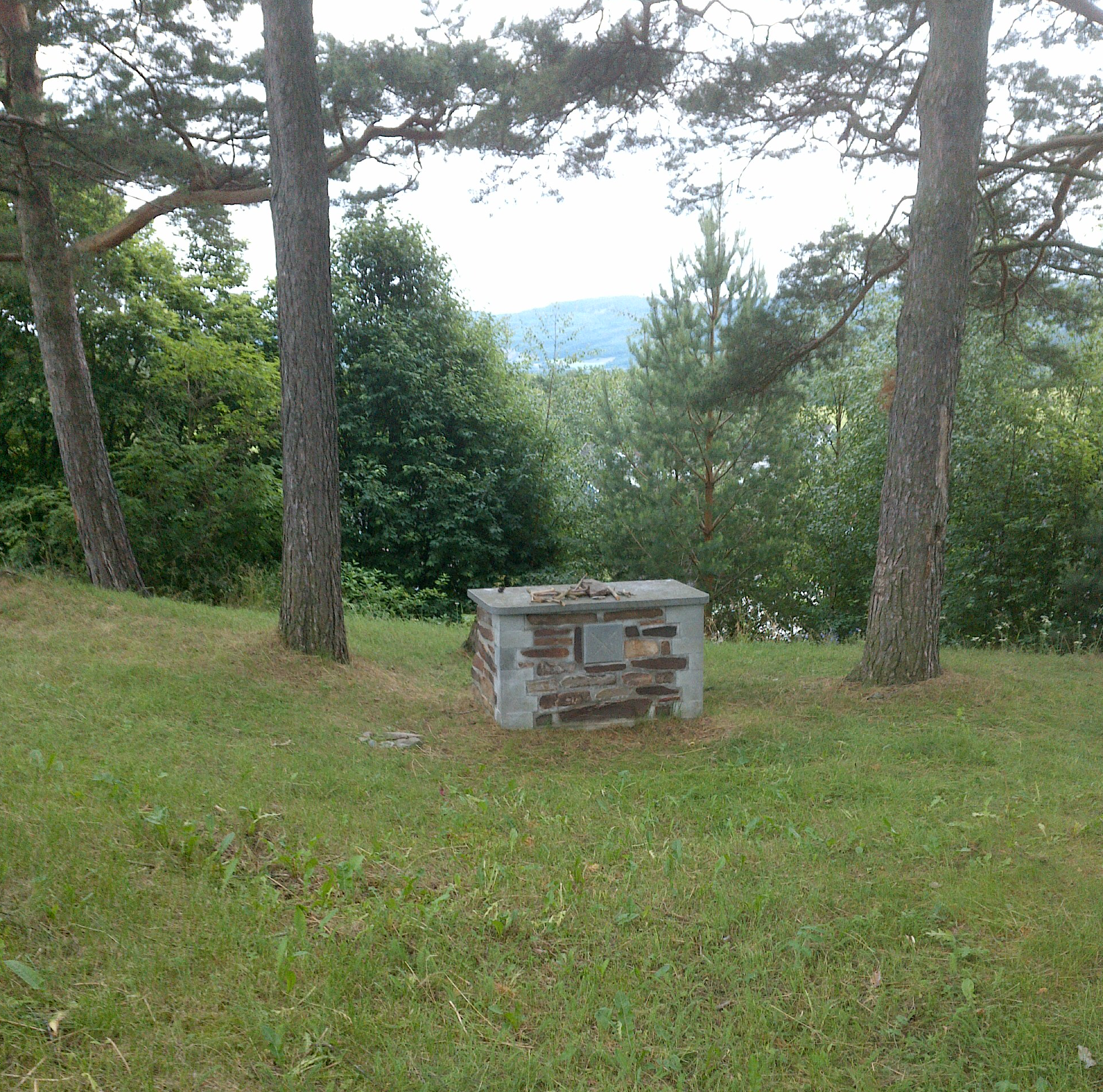
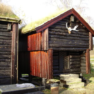
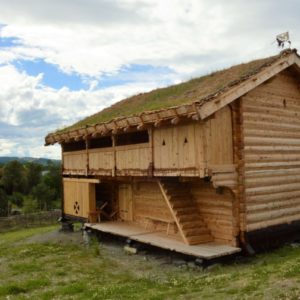
"text":"Gapahukene
Uthuset til vegvokterboligen
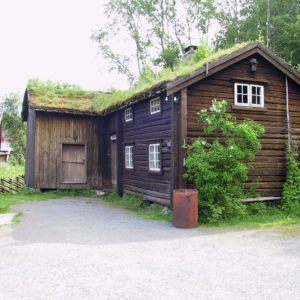
Uthuset er en rekonstruksjon av en gammel uthusbygning fra Vemundvik ved Namsos. Utvendige mål er 11,7×5,7m. Materialene er delvis fra uthuset på Vaterholmen og en gammel låve på Hallem ved Stiklestad. Taksteinen er fra den gamle prestegårdslåna i Vuku og ei gammel masstue fra Stuskin. I uthuset hadde vegvokterfamiliene buskapen sin, som oftest ei ku, en gris og noen høner. Tunet ved vegvokterboligen fikk litt ny form i 1999. Da vart det oppsatt gjerde med grinder og det vart laga en stokkbekk og ei vassbrye for hest.
",
"dlink":"http://maps.google.com/maps?daddr=63.797867,11.567268&t=m&layer=1&doflg=ptk&hl=no&om=0",
"openpopup":"0",
"mapwidth":"800",
"mapwidthunit":"px",
"mapheight":"600",
"marker-createdby":"omlarsen",
"marker-createdon":"2017-06-28 00:00:00",
"marker-updatedby":"omlarsen",
"marker-updatedon":"2017-06-28 00:00:00",
"layerid":["42"],
"layername":"Rundt om på Stiklestad",
"layer-createdby":"omlarsen",
"layer-createdon":"2017-06-22 00:59:44",
"layer-updatedby":"omlarsen",
"layer-updatedon":"2020-09-08 11:38:59",
"controlbox":"1",
"overlays_custom":"0",
"overlays_custom2":"0",
"overlays_custom3":"0",
"overlays_custom4":"0",
"wms":"0",
"wms2":"0",
"wms3":"0",
"wms4":"0",
"wms5":"0",
"wms6":"0",
"wms7":"0",
"wms8":"0",
"wms9":"0",
"wms10":"0",
"kml_timestamp":"",
"gpx_url":"",
"gpx_panel":"0",
"mlm_filter":"1",
"mlm_filter_details":""
}},
{
"type":"Feature",
"geometry":
{
"type":"Point",
"coordinates":[11.567971,63.797808]
},
"properties":
{
"markerid":"839",
"layers":["42"],
"requested_layer":["42"],
"markername":"Jernvinneanlegget",
"basemap":"custom_basemap",
"lat":"63.797808",
"lon":"11.567971",
"icon":"Stekkstad.png",
"zoom":"18",
"iconUrl":"http://verdalsportalen.no/wp-content/uploads/leaflet-maps-marker-icons/Stekkstad.png",
"address":"",
"text":"",
"dlink":"http://maps.google.com/maps?daddr=63.797808,11.567971&t=m&layer=1&doflg=ptk&hl=no&om=0",
"openpopup":"0",
"mapwidth":"800",
"mapwidthunit":"px",
"mapheight":"600",
"marker-createdby":"omlarsen",
"marker-createdon":"2017-06-28 00:00:00",
"marker-updatedby":"omlarsen",
"marker-updatedon":"2017-06-28 00:00:00",
"layerid":["42"],
"layername":"Rundt om på Stiklestad",
"layer-createdby":"omlarsen",
"layer-createdon":"2017-06-22 00:59:44",
"layer-updatedby":"omlarsen",
"layer-updatedon":"2020-09-08 11:38:59",
"controlbox":"1",
"overlays_custom":"0",
"overlays_custom2":"0",
"overlays_custom3":"0",
"overlays_custom4":"0",
"wms":"0",
"wms2":"0",
"wms3":"0",
"wms4":"0",
"wms5":"0",
"wms6":"0",
"wms7":"0",
"wms8":"0",
"wms9":"0",
"wms10":"0",
"kml_timestamp":"",
"gpx_url":"",
"gpx_panel":"0",
"mlm_filter":"1",
"mlm_filter_details":""
}},
{
"type":"Feature",
"geometry":
{
"type":"Point",
"coordinates":[11.566013,63.797979]
},
"properties":
{
"markerid":"840",
"layers":["42"],
"requested_layer":["42"],
"markername":"Melkrampa",
"basemap":"custom_basemap",
"lat":"63.797979",
"lon":"11.566013",
"icon":"Stekkstad.png",
"zoom":"18",
"iconUrl":"http://verdalsportalen.no/wp-content/uploads/leaflet-maps-marker-icons/Stekkstad.png",
"address":"",
"text":"Vegvesengarasjen
Uthuset
Masstua
Lager / utstilling
",
"dlink":"http://maps.google.com/maps?daddr=63.797943,11.569194&t=m&layer=1&doflg=ptk&hl=no&om=0",
"openpopup":"0",
"mapwidth":"800",
"mapwidthunit":"px",
"mapheight":"600",
"marker-createdby":"omlarsen",
"marker-createdon":"2017-06-28 00:00:00",
"marker-updatedby":"omlarsen",
"marker-updatedon":"2017-06-28 00:00:00",
"layerid":["42"],
"layername":"Rundt om på Stiklestad",
"layer-createdby":"omlarsen",
"layer-createdon":"2017-06-22 00:59:44",
"layer-updatedby":"omlarsen",
"layer-updatedon":"2020-09-08 11:38:59",
"controlbox":"1",
"overlays_custom":"0",
"overlays_custom2":"0",
"overlays_custom3":"0",
"overlays_custom4":"0",
"wms":"0",
"wms2":"0",
"wms3":"0",
"wms4":"0",
"wms5":"0",
"wms6":"0",
"wms7":"0",
"wms8":"0",
"wms9":"0",
"wms10":"0",
"kml_timestamp":"",
"gpx_url":"",
"gpx_panel":"0",
"mlm_filter":"1",
"mlm_filter_details":""
}},
{
"type":"Feature",
"geometry":
{
"type":"Point",
"coordinates":[11.566705,63.797900]
},
"properties":
{
"markerid":"844",
"layers":["42"],
"requested_layer":["42"],
"markername":"Stabburet til vegvokterboligen",
"basemap":"custom_basemap",
"lat":"63.797900",
"lon":"11.566705",
"icon":"Stekkstad.png",
"zoom":"18",
"iconUrl":"http://verdalsportalen.no/wp-content/uploads/leaflet-maps-marker-icons/Stekkstad.png",
"address":"",
"text":"
LStabburet til vegvokterboligen
",
"dlink":"http://maps.google.com/maps?daddr=63.797900,11.566705&t=m&layer=1&doflg=ptk&hl=no&om=0",
"openpopup":"0",
"mapwidth":"800",
"mapwidthunit":"px",
"mapheight":"600",
"marker-createdby":"omlarsen",
"marker-createdon":"2017-06-28 00:00:00",
"marker-updatedby":"omlarsen",
"marker-updatedon":"2017-06-28 00:00:00",
"layerid":["42"],
"layername":"Rundt om på Stiklestad",
"layer-createdby":"omlarsen",
"layer-createdon":"2017-06-22 00:59:44",
"layer-updatedby":"omlarsen",
"layer-updatedon":"2020-09-08 11:38:59",
"controlbox":"1",
"overlays_custom":"0",
"overlays_custom2":"0",
"overlays_custom3":"0",
"overlays_custom4":"0",
"wms":"0",
"wms2":"0",
"wms3":"0",
"wms4":"0",
"wms5":"0",
"wms6":"0",
"wms7":"0",
"wms8":"0",
"wms9":"0",
"wms10":"0",
"kml_timestamp":"",
"gpx_url":"",
"gpx_panel":"0",
"mlm_filter":"1",
"mlm_filter_details":""
}},
{
"type":"Feature",
"geometry":
{
"type":"Point",
"coordinates":[11.560739,63.797872]
},
"properties":
{
"markerid":"845",
"layers":["42"],
"requested_layer":["42"],
"markername":"Slagstedet",
"basemap":"custom_basemap",
"lat":"63.797872",
"lon":"11.560739",
"icon":"Stekkstad.png",
"zoom":"17",
"iconUrl":"http://verdalsportalen.no/wp-content/uploads/leaflet-maps-marker-icons/Stekkstad.png",
"address":"",
"text":"",
"dlink":"http://maps.google.com/maps?daddr=63.797872,11.560739&t=m&layer=1&doflg=ptk&hl=no&om=0",
"openpopup":"0",
"mapwidth":"800",
"mapwidthunit":"px",
"mapheight":"600",
"marker-createdby":"omlarsen",
"marker-createdon":"2017-06-28 00:00:00",
"marker-updatedby":"omlarsen",
"marker-updatedon":"2017-06-29 00:00:00",
"layerid":["42"],
"layername":"Rundt om på Stiklestad",
"layer-createdby":"omlarsen",
"layer-createdon":"2017-06-22 00:59:44",
"layer-updatedby":"omlarsen",
"layer-updatedon":"2020-09-08 11:38:59",
"controlbox":"1",
"overlays_custom":"0",
"overlays_custom2":"0",
"overlays_custom3":"0",
"overlays_custom4":"0",
"wms":"0",
"wms2":"0",
"wms3":"0",
"wms4":"0",
"wms5":"0",
"wms6":"0",
"wms7":"0",
"wms8":"0",
"wms9":"0",
"wms10":"0",
"kml_timestamp":"",
"gpx_url":"",
"gpx_panel":"0",
"mlm_filter":"1",
"mlm_filter_details":""
}},
{
"type":"Feature",
"geometry":
{
"type":"Point",
"coordinates":[11.521826,63.796594]
},
"properties":
{
"markerid":"846",
"layers":["42"],
"requested_layer":["42"],
"markername":"Kirka på Haug.",
"basemap":"custom_basemap",
"lat":"63.796594",
"lon":"11.521826",
"icon":"sight-2.png",
"zoom":"17",
"iconUrl":"http://verdalsportalen.no/wp-content/uploads/leaflet-maps-marker-icons/sight-2.png",
"address":"",
"text":"",
"dlink":"http://maps.google.com/maps?daddr=63.796594,11.521826&t=m&layer=1&doflg=ptk&hl=no&om=0",
"openpopup":"0",
"mapwidth":"800",
"mapwidthunit":"px",
"mapheight":"700",
"marker-createdby":"omlarsen",
"marker-createdon":"2017-06-24 00:00:00",
"marker-updatedby":"omlarsen",
"marker-updatedon":"2017-06-29 00:00:00",
"layerid":["42"],
"layername":"Rundt om på Stiklestad",
"layer-createdby":"omlarsen",
"layer-createdon":"2017-06-22 00:59:44",
"layer-updatedby":"omlarsen",
"layer-updatedon":"2020-09-08 11:38:59",
"controlbox":"1",
"overlays_custom":"0",
"overlays_custom2":"0",
"overlays_custom3":"0",
"overlays_custom4":"0",
"wms":"0",
"wms2":"0",
"wms3":"0",
"wms4":"0",
"wms5":"0",
"wms6":"0",
"wms7":"0",
"wms8":"0",
"wms9":"0",
"wms10":"0",
"kml_timestamp":"",
"gpx_url":"",
"gpx_panel":"0",
"mlm_filter":"1",
"mlm_filter_details":""
}}]}); 
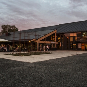 Les mer om kultursenteret som ble åpnet i 1992
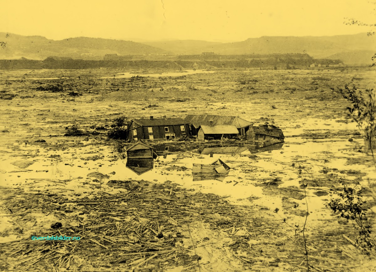

