",
"dlink":"http://maps.google.com/maps?daddr=63.801433,12.349226&t=m&layer=1&doflg=ptk&hl=no&om=0",
"openpopup":"0",
"mapwidth":"640",
"mapwidthunit":"px",
"mapheight":"480",
"marker-createdby":"omlarsen",
"marker-createdon":"2017-05-10 00:00:00",
"marker-updatedby":"omlarsen",
"marker-updatedon":"2017-08-04 00:00:00",
"layerid":["13"],
"layername":"Video",
"layer-createdby":"omlarsen",
"layer-createdon":"2017-03-31 10:29:06",
"layer-updatedby":"omlarsen",
"layer-updatedon":"2017-06-21 01:40:40",
"controlbox":"1",
"overlays_custom":"0",
"overlays_custom2":"0",
"overlays_custom3":"0",
"overlays_custom4":"0",
"wms":"0",
"wms2":"0",
"wms3":"0",
"wms4":"0",
"wms5":"0",
"wms6":"0",
"wms7":"0",
"wms8":"0",
"wms9":"0",
"wms10":"0",
"kml_timestamp":"",
"gpx_url":"",
"gpx_panel":"0",
"mlm_filter":"1",
"mlm_filter_details":""
}},
{
"type":"Feature",
"geometry":
{
"type":"Point",
"coordinates":[11.688048,63.742070]
},
"properties":
{
"markerid":"402",
"layers":["13"],
"requested_layer":["13"],
"markername":"BEVERLIV I TROMSDALEN",
"basemap":"custom_basemap",
"lat":"63.742070",
"lon":"11.688048",
"icon":"video.png",
"zoom":"15",
"iconUrl":"http://verdalsportalen.no/wp-content/uploads/leaflet-maps-marker-icons/video.png",
"address":"",
"text":"
",
"dlink":"http://maps.google.com/maps?daddr=63.742070,11.688048&t=m&layer=1&doflg=ptk&hl=no&om=0",
"openpopup":"0",
"mapwidth":"640",
"mapwidthunit":"px",
"mapheight":"480",
"marker-createdby":"omlarsen",
"marker-createdon":"2017-05-10 00:00:00",
"marker-updatedby":"omlarsen",
"marker-updatedon":"2017-06-27 00:00:00",
"layerid":["13"],
"layername":"Video",
"layer-createdby":"omlarsen",
"layer-createdon":"2017-03-31 10:29:06",
"layer-updatedby":"omlarsen",
"layer-updatedon":"2017-06-21 01:40:40",
"controlbox":"1",
"overlays_custom":"0",
"overlays_custom2":"0",
"overlays_custom3":"0",
"overlays_custom4":"0",
"wms":"0",
"wms2":"0",
"wms3":"0",
"wms4":"0",
"wms5":"0",
"wms6":"0",
"wms7":"0",
"wms8":"0",
"wms9":"0",
"wms10":"0",
"kml_timestamp":"",
"gpx_url":"",
"gpx_panel":"0",
"mlm_filter":"1",
"mlm_filter_details":""
}},
{
"type":"Feature",
"geometry":
{
"type":"Point",
"coordinates":[11.305833,63.745853]
},
"properties":
{
"markerid":"403",
"layers":["13"],
"requested_layer":["13"],
"markername":"Vi sykler opp Levangerelva.",
"basemap":"custom_basemap",
"lat":"63.745853",
"lon":"11.305833",
"icon":"video.png",
"zoom":"13",
"iconUrl":"http://verdalsportalen.no/wp-content/uploads/leaflet-maps-marker-icons/video.png",
"address":"",
"text":"
",
"dlink":"http://maps.google.com/maps?daddr=63.745853,11.305833&t=m&layer=1&doflg=ptk&hl=no&om=0",
"openpopup":"0",
"mapwidth":"640",
"mapwidthunit":"px",
"mapheight":"480",
"marker-createdby":"omlarsen",
"marker-createdon":"2017-05-10 00:00:00",
"marker-updatedby":"omlarsen",
"marker-updatedon":"2017-08-01 00:00:00",
"layerid":["13"],
"layername":"Video",
"layer-createdby":"omlarsen",
"layer-createdon":"2017-03-31 10:29:06",
"layer-updatedby":"omlarsen",
"layer-updatedon":"2017-06-21 01:40:40",
"controlbox":"1",
"overlays_custom":"0",
"overlays_custom2":"0",
"overlays_custom3":"0",
"overlays_custom4":"0",
"wms":"0",
"wms2":"0",
"wms3":"0",
"wms4":"0",
"wms5":"0",
"wms6":"0",
"wms7":"0",
"wms8":"0",
"wms9":"0",
"wms10":"0",
"kml_timestamp":"",
"gpx_url":"",
"gpx_panel":"0",
"mlm_filter":"1",
"mlm_filter_details":""
}},
{
"type":"Feature",
"geometry":
{
"type":"Point",
"coordinates":[11.679050,63.784180]
},
"properties":
{
"markerid":"733",
"layers":["5"],
"requested_layer":["5"],
"markername":"Stav/Reppe",
"basemap":"custom_basemap",
"lat":"63.784180",
"lon":"11.679050",
"icon":"sight-2.png",
"zoom":"17",
"iconUrl":"http://verdalsportalen.no/wp-content/uploads/leaflet-maps-marker-icons/sight-2.png",
"address":"",
"text":"
",
"dlink":"http://maps.google.com/maps?daddr=63.784180,11.679050&t=m&layer=1&doflg=ptk&hl=no&om=0",
"openpopup":"0",
"mapwidth":"640",
"mapwidthunit":"px",
"mapheight":"480",
"marker-createdby":"omlarsen",
"marker-createdon":"2017-05-22 00:00:00",
"marker-updatedby":"omlarsen",
"marker-updatedon":"2017-05-22 00:00:00",
"layerid":["5"],
"layername":"Historiske steder",
"layer-createdby":"omlarsen",
"layer-createdon":"2017-03-28 00:00:00",
"layer-updatedby":"omlarsen",
"layer-updatedon":"2017-06-21 15:09:46",
"controlbox":"1",
"overlays_custom":"0",
"overlays_custom2":"0",
"overlays_custom3":"0",
"overlays_custom4":"0",
"wms":"0",
"wms2":"0",
"wms3":"0",
"wms4":"0",
"wms5":"0",
"wms6":"0",
"wms7":"0",
"wms8":"0",
"wms9":"0",
"wms10":"0",
"kml_timestamp":"",
"gpx_url":"",
"gpx_panel":"0",
"mlm_filter":"1",
"mlm_filter_details":""
}},
{
"type":"Feature",
"geometry":
{
"type":"Point",
"coordinates":[12.068480,63.905300]
},
"properties":
{
"markerid":"720",
"layers":["12"],
"requested_layer":["12"],
"markername":"Malså Gruver",
"basemap":"custom_basemap",
"lat":"63.905300",
"lon":"12.068480",
"icon":"Shelter3.png",
"zoom":"17",
"iconUrl":"http://verdalsportalen.no/wp-content/uploads/leaflet-maps-marker-icons/Shelter3.png",
"address":"",
"text":"
",
"dlink":"http://maps.google.com/maps?daddr=63.905300,12.068480&t=m&layer=1&doflg=ptk&hl=no&om=0",
"openpopup":"0",
"mapwidth":"640",
"mapwidthunit":"px",
"mapheight":"480",
"marker-createdby":"omlarsen",
"marker-createdon":"2017-05-21 00:00:00",
"marker-updatedby":"omlarsen",
"marker-updatedon":"2017-05-21 00:00:00",
"layerid":["12"],
"layername":"Gapahuker og åpne hytter",
"layer-createdby":"omlarsen",
"layer-createdon":"2017-03-31 00:00:00",
"layer-updatedby":"omlarsen",
"layer-updatedon":"2017-08-01 22:00:30",
"controlbox":"1",
"overlays_custom":"0",
"overlays_custom2":"0",
"overlays_custom3":"0",
"overlays_custom4":"0",
"wms":"0",
"wms2":"0",
"wms3":"0",
"wms4":"0",
"wms5":"0",
"wms6":"0",
"wms7":"0",
"wms8":"0",
"wms9":"0",
"wms10":"0",
"kml_timestamp":"",
"gpx_url":"",
"gpx_panel":"9",
"mlm_filter":"1",
"mlm_filter_details":""
}},
{
"type":"Feature",
"geometry":
{
"type":"Point",
"coordinates":[11.922960,63.865840]
},
"properties":
{
"markerid":"721",
"layers":["12"],
"requested_layer":["12"],
"markername":"Høysjøen",
"basemap":"custom_basemap",
"lat":"63.865840",
"lon":"11.922960",
"icon":"Shelter3.png",
"zoom":"17",
"iconUrl":"http://verdalsportalen.no/wp-content/uploads/leaflet-maps-marker-icons/Shelter3.png",
"address":"",
"text":"
",
"dlink":"http://maps.google.com/maps?daddr=63.865840,11.922960&t=m&layer=1&doflg=ptk&hl=no&om=0",
"openpopup":"0",
"mapwidth":"640",
"mapwidthunit":"px",
"mapheight":"480",
"marker-createdby":"omlarsen",
"marker-createdon":"2017-05-21 00:00:00",
"marker-updatedby":"omlarsen",
"marker-updatedon":"2017-05-21 00:00:00",
"layerid":["12"],
"layername":"Gapahuker og åpne hytter",
"layer-createdby":"omlarsen",
"layer-createdon":"2017-03-31 00:00:00",
"layer-updatedby":"omlarsen",
"layer-updatedon":"2017-08-01 22:00:30",
"controlbox":"1",
"overlays_custom":"0",
"overlays_custom2":"0",
"overlays_custom3":"0",
"overlays_custom4":"0",
"wms":"0",
"wms2":"0",
"wms3":"0",
"wms4":"0",
"wms5":"0",
"wms6":"0",
"wms7":"0",
"wms8":"0",
"wms9":"0",
"wms10":"0",
"kml_timestamp":"",
"gpx_url":"",
"gpx_panel":"9",
"mlm_filter":"1",
"mlm_filter_details":""
}},
{
"type":"Feature",
"geometry":
{
"type":"Point",
"coordinates":[12.298160,63.728970]
},
"properties":
{
"markerid":"722",
"layers":["12"],
"requested_layer":["12"],
"markername":"Vassdalstjønna",
"basemap":"custom_basemap",
"lat":"63.728970",
"lon":"12.298160",
"icon":"Shelter3.png",
"zoom":"17",
"iconUrl":"http://verdalsportalen.no/wp-content/uploads/leaflet-maps-marker-icons/Shelter3.png",
"address":"",
"text":"
",
"dlink":"http://maps.google.com/maps?daddr=63.728970,12.298160&t=m&layer=1&doflg=ptk&hl=no&om=0",
"openpopup":"0",
"mapwidth":"640",
"mapwidthunit":"px",
"mapheight":"480",
"marker-createdby":"omlarsen",
"marker-createdon":"2017-05-21 00:00:00",
"marker-updatedby":"omlarsen",
"marker-updatedon":"2017-05-21 00:00:00",
"layerid":["12"],
"layername":"Gapahuker og åpne hytter",
"layer-createdby":"omlarsen",
"layer-createdon":"2017-03-31 00:00:00",
"layer-updatedby":"omlarsen",
"layer-updatedon":"2017-08-01 22:00:30",
"controlbox":"1",
"overlays_custom":"0",
"overlays_custom2":"0",
"overlays_custom3":"0",
"overlays_custom4":"0",
"wms":"0",
"wms2":"0",
"wms3":"0",
"wms4":"0",
"wms5":"0",
"wms6":"0",
"wms7":"0",
"wms8":"0",
"wms9":"0",
"wms10":"0",
"kml_timestamp":"",
"gpx_url":"",
"gpx_panel":"9",
"mlm_filter":"1",
"mlm_filter_details":""
}},
{
"type":"Feature",
"geometry":
{
"type":"Point",
"coordinates":[12.294390,63.685910]
},
"properties":
{
"markerid":"723",
"layers":["12"],
"requested_layer":["12"],
"markername":"Breivatnet Åbofjellet",
"basemap":"custom_basemap",
"lat":"63.685910",
"lon":"12.294390",
"icon":"Shelter3.png",
"zoom":"17",
"iconUrl":"http://verdalsportalen.no/wp-content/uploads/leaflet-maps-marker-icons/Shelter3.png",
"address":"",
"text":"
",
"dlink":"http://maps.google.com/maps?daddr=63.685910,12.294390&t=m&layer=1&doflg=ptk&hl=no&om=0",
"openpopup":"0",
"mapwidth":"640",
"mapwidthunit":"px",
"mapheight":"480",
"marker-createdby":"omlarsen",
"marker-createdon":"2017-05-21 00:00:00",
"marker-updatedby":"omlarsen",
"marker-updatedon":"2017-05-21 00:00:00",
"layerid":["12"],
"layername":"Gapahuker og åpne hytter",
"layer-createdby":"omlarsen",
"layer-createdon":"2017-03-31 00:00:00",
"layer-updatedby":"omlarsen",
"layer-updatedon":"2017-08-01 22:00:30",
"controlbox":"1",
"overlays_custom":"0",
"overlays_custom2":"0",
"overlays_custom3":"0",
"overlays_custom4":"0",
"wms":"0",
"wms2":"0",
"wms3":"0",
"wms4":"0",
"wms5":"0",
"wms6":"0",
"wms7":"0",
"wms8":"0",
"wms9":"0",
"wms10":"0",
"kml_timestamp":"",
"gpx_url":"",
"gpx_panel":"9",
"mlm_filter":"1",
"mlm_filter_details":""
}},
{
"type":"Feature",
"geometry":
{
"type":"Point",
"coordinates":[12.087840,63.630810]
},
"properties":
{
"markerid":"724",
"layers":["12"],
"requested_layer":["12"],
"markername":"Kråksjøen",
"basemap":"custom_basemap",
"lat":"63.630810",
"lon":"12.087840",
"icon":"Shelter3.png",
"zoom":"17",
"iconUrl":"http://verdalsportalen.no/wp-content/uploads/leaflet-maps-marker-icons/Shelter3.png",
"address":"",
"text":"
",
"dlink":"http://maps.google.com/maps?daddr=63.630810,12.087840&t=m&layer=1&doflg=ptk&hl=no&om=0",
"openpopup":"0",
"mapwidth":"640",
"mapwidthunit":"px",
"mapheight":"480",
"marker-createdby":"omlarsen",
"marker-createdon":"2017-05-21 00:00:00",
"marker-updatedby":"omlarsen",
"marker-updatedon":"2017-05-21 00:00:00",
"layerid":["12"],
"layername":"Gapahuker og åpne hytter",
"layer-createdby":"omlarsen",
"layer-createdon":"2017-03-31 00:00:00",
"layer-updatedby":"omlarsen",
"layer-updatedon":"2017-08-01 22:00:30",
"controlbox":"1",
"overlays_custom":"0",
"overlays_custom2":"0",
"overlays_custom3":"0",
"overlays_custom4":"0",
"wms":"0",
"wms2":"0",
"wms3":"0",
"wms4":"0",
"wms5":"0",
"wms6":"0",
"wms7":"0",
"wms8":"0",
"wms9":"0",
"wms10":"0",
"kml_timestamp":"",
"gpx_url":"",
"gpx_panel":"9",
"mlm_filter":"1",
"mlm_filter_details":""
}},
{
"type":"Feature",
"geometry":
{
"type":"Point",
"coordinates":[11.579350,63.728100]
},
"properties":
{
"markerid":"725",
"layers":["12"],
"requested_layer":["12"],
"markername":"Tømmersjøen",
"basemap":"custom_basemap",
"lat":"63.728100",
"lon":"11.579350",
"icon":"Shelter3.png",
"zoom":"17",
"iconUrl":"http://verdalsportalen.no/wp-content/uploads/leaflet-maps-marker-icons/Shelter3.png",
"address":"",
"text":"
",
"dlink":"http://maps.google.com/maps?daddr=63.728100,11.579350&t=m&layer=1&doflg=ptk&hl=no&om=0",
"openpopup":"0",
"mapwidth":"640",
"mapwidthunit":"px",
"mapheight":"480",
"marker-createdby":"omlarsen",
"marker-createdon":"2017-05-21 00:00:00",
"marker-updatedby":"omlarsen",
"marker-updatedon":"2017-05-21 00:00:00",
"layerid":["12"],
"layername":"Gapahuker og åpne hytter",
"layer-createdby":"omlarsen",
"layer-createdon":"2017-03-31 00:00:00",
"layer-updatedby":"omlarsen",
"layer-updatedon":"2017-08-01 22:00:30",
"controlbox":"1",
"overlays_custom":"0",
"overlays_custom2":"0",
"overlays_custom3":"0",
"overlays_custom4":"0",
"wms":"0",
"wms2":"0",
"wms3":"0",
"wms4":"0",
"wms5":"0",
"wms6":"0",
"wms7":"0",
"wms8":"0",
"wms9":"0",
"wms10":"0",
"kml_timestamp":"",
"gpx_url":"",
"gpx_panel":"9",
"mlm_filter":"1",
"mlm_filter_details":""
}},
{
"type":"Feature",
"geometry":
{
"type":"Point",
"coordinates":[11.537180,63.843680]
},
"properties":
{
"markerid":"726",
"layers":["12"],
"requested_layer":["12"],
"markername":"Haukåvatnet",
"basemap":"custom_basemap",
"lat":"63.843680",
"lon":"11.537180",
"icon":"Shelter3.png",
"zoom":"17",
"iconUrl":"http://verdalsportalen.no/wp-content/uploads/leaflet-maps-marker-icons/Shelter3.png",
"address":"",
"text":"
",
"dlink":"http://maps.google.com/maps?daddr=63.843680,11.537180&t=m&layer=1&doflg=ptk&hl=no&om=0",
"openpopup":"0",
"mapwidth":"640",
"mapwidthunit":"px",
"mapheight":"480",
"marker-createdby":"omlarsen",
"marker-createdon":"2017-05-21 00:00:00",
"marker-updatedby":"omlarsen",
"marker-updatedon":"2017-05-21 00:00:00",
"layerid":["12"],
"layername":"Gapahuker og åpne hytter",
"layer-createdby":"omlarsen",
"layer-createdon":"2017-03-31 00:00:00",
"layer-updatedby":"omlarsen",
"layer-updatedon":"2017-08-01 22:00:30",
"controlbox":"1",
"overlays_custom":"0",
"overlays_custom2":"0",
"overlays_custom3":"0",
"overlays_custom4":"0",
"wms":"0",
"wms2":"0",
"wms3":"0",
"wms4":"0",
"wms5":"0",
"wms6":"0",
"wms7":"0",
"wms8":"0",
"wms9":"0",
"wms10":"0",
"kml_timestamp":"",
"gpx_url":"",
"gpx_panel":"9",
"mlm_filter":"1",
"mlm_filter_details":""
}},
{
"type":"Feature",
"geometry":
{
"type":"Point",
"coordinates":[12.283700,63.805170]
},
"properties":
{
"markerid":"727",
"layers":["12"],
"requested_layer":["12"],
"markername":"Stortjønna i Vera",
"basemap":"custom_basemap",
"lat":"63.805170",
"lon":"12.283700",
"icon":"Shelter3.png",
"zoom":"17",
"iconUrl":"http://verdalsportalen.no/wp-content/uploads/leaflet-maps-marker-icons/Shelter3.png",
"address":"",
"text":"
",
"dlink":"http://maps.google.com/maps?daddr=63.805170,12.283700&t=m&layer=1&doflg=ptk&hl=no&om=0",
"openpopup":"0",
"mapwidth":"640",
"mapwidthunit":"px",
"mapheight":"480",
"marker-createdby":"omlarsen",
"marker-createdon":"2017-05-21 00:00:00",
"marker-updatedby":"omlarsen",
"marker-updatedon":"2017-05-21 00:00:00",
"layerid":["12"],
"layername":"Gapahuker og åpne hytter",
"layer-createdby":"omlarsen",
"layer-createdon":"2017-03-31 00:00:00",
"layer-updatedby":"omlarsen",
"layer-updatedon":"2017-08-01 22:00:30",
"controlbox":"1",
"overlays_custom":"0",
"overlays_custom2":"0",
"overlays_custom3":"0",
"overlays_custom4":"0",
"wms":"0",
"wms2":"0",
"wms3":"0",
"wms4":"0",
"wms5":"0",
"wms6":"0",
"wms7":"0",
"wms8":"0",
"wms9":"0",
"wms10":"0",
"kml_timestamp":"",
"gpx_url":"",
"gpx_panel":"9",
"mlm_filter":"1",
"mlm_filter_details":""
}},
{
"type":"Feature",
"geometry":
{
"type":"Point",
"coordinates":[12.029560,63.742720]
},
"properties":
{
"markerid":"728",
"layers":["12"],
"requested_layer":["12"],
"markername":"Kverndalsvollen",
"basemap":"custom_basemap",
"lat":"63.742720",
"lon":"12.029560",
"icon":"Shelter3.png",
"zoom":"17",
"iconUrl":"http://verdalsportalen.no/wp-content/uploads/leaflet-maps-marker-icons/Shelter3.png",
"address":"",
"text":"
",
"dlink":"http://maps.google.com/maps?daddr=63.742720,12.029560&t=m&layer=1&doflg=ptk&hl=no&om=0",
"openpopup":"0",
"mapwidth":"640",
"mapwidthunit":"px",
"mapheight":"480",
"marker-createdby":"omlarsen",
"marker-createdon":"2017-05-21 00:00:00",
"marker-updatedby":"omlarsen",
"marker-updatedon":"2017-05-21 00:00:00",
"layerid":["12"],
"layername":"Gapahuker og åpne hytter",
"layer-createdby":"omlarsen",
"layer-createdon":"2017-03-31 00:00:00",
"layer-updatedby":"omlarsen",
"layer-updatedon":"2017-08-01 22:00:30",
"controlbox":"1",
"overlays_custom":"0",
"overlays_custom2":"0",
"overlays_custom3":"0",
"overlays_custom4":"0",
"wms":"0",
"wms2":"0",
"wms3":"0",
"wms4":"0",
"wms5":"0",
"wms6":"0",
"wms7":"0",
"wms8":"0",
"wms9":"0",
"wms10":"0",
"kml_timestamp":"",
"gpx_url":"",
"gpx_panel":"9",
"mlm_filter":"1",
"mlm_filter_details":""
}},
{
"type":"Feature",
"geometry":
{
"type":"Point",
"coordinates":[11.710870,63.696340]
},
"properties":
{
"markerid":"729",
"layers":["12"],
"requested_layer":["12"],
"markername":"Tortåsvollen",
"basemap":"custom_basemap",
"lat":"63.696340",
"lon":"11.710870",
"icon":"Shelter3.png",
"zoom":"17",
"iconUrl":"http://verdalsportalen.no/wp-content/uploads/leaflet-maps-marker-icons/Shelter3.png",
"address":"",
"text":"
Tortåsvollen. Åpen setervoll. 63.69634 / 11.71087
",
"dlink":"http://maps.google.com/maps?daddr=63.696340,11.710870&t=m&layer=1&doflg=ptk&hl=no&om=0",
"openpopup":"0",
"mapwidth":"640",
"mapwidthunit":"px",
"mapheight":"480",
"marker-createdby":"omlarsen",
"marker-createdon":"2017-05-21 00:00:00",
"marker-updatedby":"omlarsen",
"marker-updatedon":"2017-05-21 00:00:00",
"layerid":["12"],
"layername":"Gapahuker og åpne hytter",
"layer-createdby":"omlarsen",
"layer-createdon":"2017-03-31 00:00:00",
"layer-updatedby":"omlarsen",
"layer-updatedon":"2017-08-01 22:00:30",
"controlbox":"1",
"overlays_custom":"0",
"overlays_custom2":"0",
"overlays_custom3":"0",
"overlays_custom4":"0",
"wms":"0",
"wms2":"0",
"wms3":"0",
"wms4":"0",
"wms5":"0",
"wms6":"0",
"wms7":"0",
"wms8":"0",
"wms9":"0",
"wms10":"0",
"kml_timestamp":"",
"gpx_url":"",
"gpx_panel":"9",
"mlm_filter":"1",
"mlm_filter_details":""
}},
{
"type":"Feature",
"geometry":
{
"type":"Point",
"coordinates":[11.608510,63.720890]
},
"properties":
{
"markerid":"730",
"layers":["12"],
"requested_layer":["12"],
"markername":"Ramsåsvollen",
"basemap":"custom_basemap",
"lat":"63.720890",
"lon":"11.608510",
"icon":"Shelter3.png",
"zoom":"17",
"iconUrl":"http://verdalsportalen.no/wp-content/uploads/leaflet-maps-marker-icons/Shelter3.png",
"address":"",
"text":"
",
"dlink":"http://maps.google.com/maps?daddr=63.720890,11.608510&t=m&layer=1&doflg=ptk&hl=no&om=0",
"openpopup":"0",
"mapwidth":"640",
"mapwidthunit":"px",
"mapheight":"480",
"marker-createdby":"omlarsen",
"marker-createdon":"2017-05-21 00:00:00",
"marker-updatedby":"omlarsen",
"marker-updatedon":"2017-05-21 00:00:00",
"layerid":["12"],
"layername":"Gapahuker og åpne hytter",
"layer-createdby":"omlarsen",
"layer-createdon":"2017-03-31 00:00:00",
"layer-updatedby":"omlarsen",
"layer-updatedon":"2017-08-01 22:00:30",
"controlbox":"1",
"overlays_custom":"0",
"overlays_custom2":"0",
"overlays_custom3":"0",
"overlays_custom4":"0",
"wms":"0",
"wms2":"0",
"wms3":"0",
"wms4":"0",
"wms5":"0",
"wms6":"0",
"wms7":"0",
"wms8":"0",
"wms9":"0",
"wms10":"0",
"kml_timestamp":"",
"gpx_url":"",
"gpx_panel":"9",
"mlm_filter":"1",
"mlm_filter_details":""
}},
{
"type":"Feature",
"geometry":
{
"type":"Point",
"coordinates":[11.982220,63.748680]
},
"properties":
{
"markerid":"731",
"layers":["12"],
"requested_layer":["12"],
"markername":"Kalvdalen i Kverndalen",
"basemap":"custom_basemap",
"lat":"63.748680",
"lon":"11.982220",
"icon":"Shelter3.png",
"zoom":"17",
"iconUrl":"http://verdalsportalen.no/wp-content/uploads/leaflet-maps-marker-icons/Shelter3.png",
"address":"",
"text":"
",
"dlink":"http://maps.google.com/maps?daddr=63.748680,11.982220&t=m&layer=1&doflg=ptk&hl=no&om=0",
"openpopup":"0",
"mapwidth":"640",
"mapwidthunit":"px",
"mapheight":"480",
"marker-createdby":"omlarsen",
"marker-createdon":"2017-05-21 00:00:00",
"marker-updatedby":"omlarsen",
"marker-updatedon":"2017-05-21 00:00:00",
"layerid":["12"],
"layername":"Gapahuker og åpne hytter",
"layer-createdby":"omlarsen",
"layer-createdon":"2017-03-31 00:00:00",
"layer-updatedby":"omlarsen",
"layer-updatedon":"2017-08-01 22:00:30",
"controlbox":"1",
"overlays_custom":"0",
"overlays_custom2":"0",
"overlays_custom3":"0",
"overlays_custom4":"0",
"wms":"0",
"wms2":"0",
"wms3":"0",
"wms4":"0",
"wms5":"0",
"wms6":"0",
"wms7":"0",
"wms8":"0",
"wms9":"0",
"wms10":"0",
"kml_timestamp":"",
"gpx_url":"",
"gpx_panel":"9",
"mlm_filter":"1",
"mlm_filter_details":""
}},
{
"type":"Feature",
"geometry":
{
"type":"Point",
"coordinates":[11.912360,63.716510]
},
"properties":
{
"markerid":"732",
"layers":["12"],
"requested_layer":["12"],
"markername":"Nedenfor Fagerlivollen",
"basemap":"custom_basemap",
"lat":"63.716510",
"lon":"11.912360",
"icon":"Shelter3.png",
"zoom":"17",
"iconUrl":"http://verdalsportalen.no/wp-content/uploads/leaflet-maps-marker-icons/Shelter3.png",
"address":"",
"text":"
",
"dlink":"http://maps.google.com/maps?daddr=63.716510,11.912360&t=m&layer=1&doflg=ptk&hl=no&om=0",
"openpopup":"0",
"mapwidth":"640",
"mapwidthunit":"px",
"mapheight":"480",
"marker-createdby":"omlarsen",
"marker-createdon":"2017-05-21 00:00:00",
"marker-updatedby":"omlarsen",
"marker-updatedon":"2017-05-21 00:00:00",
"layerid":["12"],
"layername":"Gapahuker og åpne hytter",
"layer-createdby":"omlarsen",
"layer-createdon":"2017-03-31 00:00:00",
"layer-updatedby":"omlarsen",
"layer-updatedon":"2017-08-01 22:00:30",
"controlbox":"1",
"overlays_custom":"0",
"overlays_custom2":"0",
"overlays_custom3":"0",
"overlays_custom4":"0",
"wms":"0",
"wms2":"0",
"wms3":"0",
"wms4":"0",
"wms5":"0",
"wms6":"0",
"wms7":"0",
"wms8":"0",
"wms9":"0",
"wms10":"0",
"kml_timestamp":"",
"gpx_url":"",
"gpx_panel":"9",
"mlm_filter":"1",
"mlm_filter_details":""
}},
{
"type":"Feature",
"geometry":
{
"type":"Point",
"coordinates":[12.171750,63.674040]
},
"properties":
{
"markerid":"734",
"layers":["7"],
"requested_layer":["7"],
"markername":"Geilen med Geilsteinen ",
"basemap":"custom_basemap",
"lat":"63.674040",
"lon":"12.171750",
"icon":"blank_black.png",
"zoom":"16",
"iconUrl":"http://verdalsportalen.no/wp-content/uploads/leaflet-maps-marker-icons/blank_black.png",
"address":"",
"text":"
",
"dlink":"http://maps.google.com/maps?daddr=63.674040,12.171750&t=m&layer=1&doflg=ptk&hl=no&om=0",
"openpopup":"0",
"mapwidth":"100",
"mapwidthunit":"%",
"mapheight":"700",
"marker-createdby":"omlarsen",
"marker-createdon":"2017-05-27 00:00:00",
"marker-updatedby":"omlarsen",
"marker-updatedon":"2017-05-27 00:00:00",
"layerid":["7"],
"layername":"Steiner / varder",
"layer-createdby":"omlarsen",
"layer-createdon":"2017-05-26 00:00:00",
"layer-updatedby":"omlarsen",
"layer-updatedon":"2017-11-09 00:44:02",
"controlbox":"1",
"overlays_custom":"0",
"overlays_custom2":"0",
"overlays_custom3":"0",
"overlays_custom4":"0",
"wms":"0",
"wms2":"0",
"wms3":"0",
"wms4":"0",
"wms5":"0",
"wms6":"0",
"wms7":"0",
"wms8":"0",
"wms9":"0",
"wms10":"0",
"kml_timestamp":"",
"gpx_url":"",
"gpx_panel":"0",
"mlm_filter":"1",
"mlm_filter_details":""
}},
{
"type":"Feature",
"geometry":
{
"type":"Point",
"coordinates":[11.808867,63.732095]
},
"properties":
{
"markerid":"736",
"layers":["7"] ,
"requested_layer":["7"],
"markername":"Bumerkerstein",
"basemap":"custom_basemap",
"lat":"63.732095",
"lon":"11.808867",
"icon":"blank_black.png ",
"zoom":"16",
"iconUrl":"http://verdalsportalen.no/wp-content/uploads/leaflet-maps-marker-icons/blank_black.png ",
"address":"",
"text":"
3 Steiner med runer og bumerker.
",
"dlink":"http://maps.google.com/maps?daddr=63.732095,11.808867&t=m&layer=1&doflg=ptk&hl=no&om=0",
"openpopup":"0",
"mapwidth":"640",
"mapwidthunit":"px",
"mapheight":"480",
"marker-createdby":"omlarsen",
"marker-createdon":"2017-05-29 00:00:00",
"marker-updatedby":"omlarsen",
"marker-updatedon":"2017-05-29 00:00:00",
"layerid":["7"],
"layername":"Steiner / varder",
"layer-createdby":"omlarsen",
"layer-createdon":"2017-05-26 00:00:00",
"layer-updatedby":"omlarsen",
"layer-updatedon":"2017-11-09 00:44:02",
"controlbox":"0",
"overlays_custom":"0",
"overlays_custom2":"0",
"overlays_custom3":"0",
"overlays_custom4":"0",
"wms":"0",
"wms2":"0",
"wms3":"0",
"wms4":"0",
"wms5":"0",
"wms6":"0",
"wms7":"0",
"wms8":"0",
"wms9":"0",
"wms10":"0",
"kml_timestamp":"2017-05-29 00:00:00",
"gpx_url":"",
"gpx_panel":"0",
"mlm_filter":"1",
"mlm_filter_details":""
}},
{
"type":"Feature",
"geometry":
{
"type":"Point",
"coordinates":[12.093459,63.651017]
},
"properties":
{
"markerid":"737",
"layers":["7"] ,
"requested_layer":["7"],
"markername":"Inskripsjon Kråksjøvegen",
"basemap":"custom_basemap",
"lat":"63.651017",
"lon":"12.093459",
"icon":"blank_black.png ",
"zoom":"16",
"iconUrl":"http://verdalsportalen.no/wp-content/uploads/leaflet-maps-marker-icons/blank_black.png ",
"address":"",
"text":"
",
"dlink":"http://maps.google.com/maps?daddr=63.651017,12.093459&t=m&layer=1&doflg=ptk&hl=no&om=0",
"openpopup":"0",
"mapwidth":"640",
"mapwidthunit":"px",
"mapheight":"480",
"marker-createdby":"omlarsen",
"marker-createdon":"2017-05-29 00:00:00",
"marker-updatedby":"omlarsen",
"marker-updatedon":"2017-05-29 00:00:00",
"layerid":["7"],
"layername":"Steiner / varder",
"layer-createdby":"omlarsen",
"layer-createdon":"2017-05-26 00:00:00",
"layer-updatedby":"omlarsen",
"layer-updatedon":"2017-11-09 00:44:02",
"controlbox":"1",
"overlays_custom":"0",
"overlays_custom2":"0",
"overlays_custom3":"0",
"overlays_custom4":"0",
"wms":"0",
"wms2":"0",
"wms3":"0",
"wms4":"0",
"wms5":"0",
"wms6":"0",
"wms7":"0",
"wms8":"0",
"wms9":"0",
"wms10":"0",
"kml_timestamp":"2017-05-29 00:00:00",
"gpx_url":"",
"gpx_panel":"0",
"mlm_filter":"1",
"mlm_filter_details":""
}},
{
"type":"Feature",
"geometry":
{
"type":"Point",
"coordinates":[12.136233,63.654546]
},
"properties":
{
"markerid":"738",
"layers":["7"] ,
"requested_layer":["7"],
"markername":"SkriftKongsstuggu",
"basemap":"custom_basemap",
"lat":"63.654546",
"lon":"12.136233",
"icon":"blank_black.png ",
"zoom":"16",
"iconUrl":"http://verdalsportalen.no/wp-content/uploads/leaflet-maps-marker-icons/blank_black.png ",
"address":" ",
"text":"
Inskripsjon i fjellsida.
",
"dlink":"http://maps.google.com/maps?daddr=+&t=m&layer=1&doflg=ptk&hl=no&om=0",
"openpopup":"0",
"mapwidth":"640",
"mapwidthunit":"px",
"mapheight":"480",
"marker-createdby":"omlarsen",
"marker-createdon":"2017-05-29 00:00:00",
"marker-updatedby":"omlarsen",
"marker-updatedon":"2017-05-29 00:00:00",
"layerid":["7"],
"layername":"Steiner / varder",
"layer-createdby":"omlarsen",
"layer-createdon":"2017-05-26 00:00:00",
"layer-updatedby":"omlarsen",
"layer-updatedon":"2017-11-09 00:44:02",
"controlbox":"1",
"overlays_custom":"0",
"overlays_custom2":"0",
"overlays_custom3":"0",
"overlays_custom4":"0",
"wms":"0",
"wms2":"0",
"wms3":"0",
"wms4":"0",
"wms5":"0",
"wms6":"0",
"wms7":"0",
"wms8":"0",
"wms9":"0",
"wms10":"0",
"kml_timestamp":"2017-05-29 00:00:00",
"gpx_url":"",
"gpx_panel":"0",
"mlm_filter":"1",
"mlm_filter_details":""
}},
{
"type":"Feature",
"geometry":
{
"type":"Point",
"coordinates":[11.709510,63.728287]
},
"properties":
{
"markerid":"16",
"layers":["7"],
"requested_layer":["7"],
"markername":"Krona",
"basemap":"custom_basemap",
"lat":"63.728287",
"lon":"11.709510",
"icon":"blank_black.png",
"zoom":"17",
"iconUrl":"http://verdalsportalen.no/wp-content/uploads/leaflet-maps-marker-icons/blank_black.png",
"address":"",
"text":"
",
"dlink":"http://maps.google.com/maps?daddr=63.728287,11.709510&t=m&layer=1&doflg=ptk&hl=no&om=0",
"openpopup":"1",
"mapwidth":"640",
"mapwidthunit":"px",
"mapheight":"480",
"marker-createdby":"omlarsen",
"marker-createdon":"2017-05-30 00:00:00",
"marker-updatedby":"omlarsen",
"marker-updatedon":"2017-08-04 00:00:00",
"layerid":["7"],
"layername":"Steiner / varder",
"layer-createdby":"omlarsen",
"layer-createdon":"2017-05-26 00:00:00",
"layer-updatedby":"omlarsen",
"layer-updatedon":"2017-11-09 00:44:02",
"controlbox":"1",
"overlays_custom":"0",
"overlays_custom2":"0",
"overlays_custom3":"0",
"overlays_custom4":"0",
"wms":"0",
"wms2":"0",
"wms3":"0",
"wms4":"0",
"wms5":"0",
"wms6":"0",
"wms7":"0",
"wms8":"0",
"wms9":"0",
"wms10":"0",
"kml_timestamp":"2017-05-30 00:00:00",
"gpx_url":"",
"gpx_panel":"0",
"mlm_filter":"1",
"mlm_filter_details":""
}},
{
"type":"Feature",
"geometry":
{
"type":"Point",
"coordinates":[11.946531,63.813215]
},
"properties":
{
"markerid":"14",
"layers":["7"],
"requested_layer":["7"],
"markername":"Inskripsjon Skansbakkan",
"basemap":"custom_basemap",
"lat":"63.813215",
"lon":"11.946531",
"icon":"blank_black.png",
"zoom":"15",
"iconUrl":"http://verdalsportalen.no/wp-content/uploads/leaflet-maps-marker-icons/blank_black.png",
"address":"",
"text":"
",
"dlink":"http://maps.google.com/maps?daddr=63.813215,11.946531&t=m&layer=1&doflg=ptk&hl=no&om=0",
"openpopup":"0",
"mapwidth":"640",
"mapwidthunit":"px",
"mapheight":"480",
"marker-createdby":"omlarsen",
"marker-createdon":"2017-05-30 00:00:00",
"marker-updatedby":"omlarsen",
"marker-updatedon":"2019-07-02 02:05:25",
"layerid":["7"],
"layername":"Steiner / varder",
"layer-createdby":"omlarsen",
"layer-createdon":"2017-05-26 00:00:00",
"layer-updatedby":"omlarsen",
"layer-updatedon":"2017-11-09 00:44:02",
"controlbox":"1",
"overlays_custom":"0",
"overlays_custom2":"0",
"overlays_custom3":"0",
"overlays_custom4":"0",
"wms":"0",
"wms2":"0",
"wms3":"0",
"wms4":"0",
"wms5":"0",
"wms6":"0",
"wms7":"0",
"wms8":"0",
"wms9":"0",
"wms10":"0",
"kml_timestamp":"2017-05-30 00:00:00",
"gpx_url":"http://%20",
"gpx_panel":"0",
"mlm_filter":"1",
"mlm_filter_details":""
}},
{
"type":"Feature",
"geometry":
{
"type":"Point",
"coordinates":[11.808558,63.685460]
},
"properties":
{
"markerid":"739",
"layers":["7"],
"requested_layer":["7"],
"markername":"Merkestein Tverrå",
"basemap":"custom_basemap",
"lat":"63.685460",
"lon":"11.808558",
"icon":"blank_black.png ",
"zoom":"16",
"iconUrl":"http://verdalsportalen.no/wp-content/uploads/leaflet-maps-marker-icons/blank_black.png ",
"address":"",
"text":"
",
"dlink":"http://maps.google.com/maps?daddr=63.685460,11.808558&t=m&layer=1&doflg=ptk&hl=no&om=0",
"openpopup":"0",
"mapwidth":"640",
"mapwidthunit":"px",
"mapheight":"480",
"marker-createdby":"omlarsen",
"marker-createdon":"2017-05-30 00:00:00",
"marker-updatedby":"omlarsen",
"marker-updatedon":"2017-05-30 00:00:00",
"layerid":["7"],
"layername":"Steiner / varder",
"layer-createdby":"omlarsen",
"layer-createdon":"2017-05-26 00:00:00",
"layer-updatedby":"omlarsen",
"layer-updatedon":"2017-11-09 00:44:02",
"controlbox":"1",
"overlays_custom":"0",
"overlays_custom2":"0",
"overlays_custom3":"0",
"overlays_custom4":"0",
"wms":"0",
"wms2":"0",
"wms3":"0",
"wms4":"0",
"wms5":"0",
"wms6":"0",
"wms7":"0",
"wms8":"0",
"wms9":"0",
"wms10":"0",
"kml_timestamp":"2017-05-30 00:00:00",
"gpx_url":"",
"gpx_panel":"0",
"mlm_filter":"1",
"mlm_filter_details":""
}},
{
"type":"Feature",
"geometry":
{
"type":"Point",
"coordinates":[12.254643,63.841479]
},
"properties":
{
"markerid":"20",
"layers":["7"],
"requested_layer":["7"],
"markername":"Parnasstuggu",
"basemap":"custom_basemap",
"lat":"63.841479",
"lon":"12.254643",
"icon":"blank_black.png",
"zoom":"16",
"iconUrl":"http://verdalsportalen.no/wp-content/uploads/leaflet-maps-marker-icons/blank_black.png",
"address":"",
"text":"
",
"dlink":"http://maps.google.com/maps?daddr=63.841479,12.254643&t=m&layer=1&doflg=ptk&hl=no&om=0",
"openpopup":"0",
"mapwidth":"640",
"mapwidthunit":"px",
"mapheight":"480",
"marker-createdby":"omlarsen",
"marker-createdon":"2017-05-30 00:00:00",
"marker-updatedby":"omlarsen",
"marker-updatedon":"2017-05-30 00:00:00",
"layerid":["7"],
"layername":"Steiner / varder",
"layer-createdby":"omlarsen",
"layer-createdon":"2017-05-26 00:00:00",
"layer-updatedby":"omlarsen",
"layer-updatedon":"2017-11-09 00:44:02",
"controlbox":"1",
"overlays_custom":"0",
"overlays_custom2":"0",
"overlays_custom3":"0",
"overlays_custom4":"0",
"wms":"0",
"wms2":"0",
"wms3":"0",
"wms4":"0",
"wms5":"0",
"wms6":"0",
"wms7":"0",
"wms8":"0",
"wms9":"0",
"wms10":"0",
"kml_timestamp":"2017-05-30 00:00:00",
"gpx_url":"",
"gpx_panel":"0",
"mlm_filter":"1",
"mlm_filter_details":""
}},
{
"type":"Feature",
"geometry":
{
"type":"Point",
"coordinates":[12.033355,63.698467]
},
"properties":
{
"markerid":"23",
"layers":["7"],
"requested_layer":["7"],
"markername":"Spjeldberget",
"basemap":"custom_basemap",
"lat":"63.698467",
"lon":"12.033355",
"icon":"blank_black.png",
"zoom":"16",
"iconUrl":"http://verdalsportalen.no/wp-content/uploads/leaflet-maps-marker-icons/blank_black.png",
"address":"",
"text":"
",
"dlink":"http://maps.google.com/maps?daddr=63.698467,12.033355&t=m&layer=1&doflg=ptk&hl=no&om=0",
"openpopup":"0",
"mapwidth":"640",
"mapwidthunit":"px",
"mapheight":"480",
"marker-createdby":"omlarsen",
"marker-createdon":"2017-05-30 00:00:00",
"marker-updatedby":"omlarsen",
"marker-updatedon":"2017-05-30 00:00:00",
"layerid":["7"],
"layername":"Steiner / varder",
"layer-createdby":"omlarsen",
"layer-createdon":"2017-05-26 00:00:00",
"layer-updatedby":"omlarsen",
"layer-updatedon":"2017-11-09 00:44:02",
"controlbox":"1",
"overlays_custom":"0",
"overlays_custom2":"0",
"overlays_custom3":"0",
"overlays_custom4":"0",
"wms":"0",
"wms2":"0",
"wms3":"0",
"wms4":"0",
"wms5":"0",
"wms6":"0",
"wms7":"0",
"wms8":"0",
"wms9":"0",
"wms10":"0",
"kml_timestamp":"2017-05-30 00:00:00",
"gpx_url":"",
"gpx_panel":"0",
"mlm_filter":"1",
"mlm_filter_details":""
}},
{
"type":"Feature",
"geometry":
{
"type":"Point",
"coordinates":[12.207399,63.719298]
},
"properties":
{
"markerid":"25",
"layers":["7"],
"requested_layer":["7"],
"markername":"Gustav Olsa Koia",
"basemap":"custom_basemap",
"lat":"63.719298",
"lon":"12.207399",
"icon":"blank_black.png ",
"zoom":"16",
"iconUrl":"http://verdalsportalen.no/wp-content/uploads/leaflet-maps-marker-icons/blank_black.png ",
"address":"",
"text":"
",
"dlink":"http://maps.google.com/maps?daddr=63.719298,12.207399&t=m&layer=1&doflg=ptk&hl=no&om=0",
"openpopup":"0",
"mapwidth":"640",
"mapwidthunit":"px",
"mapheight":"480",
"marker-createdby":"omlarsen",
"marker-createdon":"2017-05-30 00:00:00",
"marker-updatedby":"omlarsen",
"marker-updatedon":"2017-05-30 00:00:00",
"layerid":["7"],
"layername":"Steiner / varder",
"layer-createdby":"omlarsen",
"layer-createdon":"2017-05-26 00:00:00",
"layer-updatedby":"omlarsen",
"layer-updatedon":"2017-11-09 00:44:02",
"controlbox":"1",
"overlays_custom":"0",
"overlays_custom2":"0",
"overlays_custom3":"0",
"overlays_custom4":"0",
"wms":"0",
"wms2":"0",
"wms3":"0",
"wms4":"0",
"wms5":"0",
"wms6":"0",
"wms7":"0",
"wms8":"0",
"wms9":"0",
"wms10":"0",
"kml_timestamp":"2017-05-30 00:00:00",
"gpx_url":"",
"gpx_panel":"0",
"mlm_filter":"1",
"mlm_filter_details":""
}},
{
"type":"Feature",
"geometry":
{
"type":"Point",
"coordinates":[11.530302,63.862843]
},
"properties":
{
"markerid":"740",
"layers":["7"],
"requested_layer":["7"],
"markername":"Gjeterstenen Marsteinvola",
"basemap":"custom_basemap",
"lat":"63.862843",
"lon":"11.530302",
"icon":"blank_black.png ",
"zoom":"11",
"iconUrl":"http://verdalsportalen.no/wp-content/uploads/leaflet-maps-marker-icons/blank_black.png ",
"address":"",
"text":"
",
"dlink":"http://maps.google.com/maps?daddr=63.862843,11.530302&t=m&layer=1&doflg=ptk&hl=no&om=0",
"openpopup":"0",
"mapwidth":"640",
"mapwidthunit":"px",
"mapheight":"480",
"marker-createdby":"omlarsen",
"marker-createdon":"2017-05-30 00:00:00",
"marker-updatedby":"omlarsen",
"marker-updatedon":"2017-05-30 00:00:00",
"layerid":["7"],
"layername":"Steiner / varder",
"layer-createdby":"omlarsen",
"layer-createdon":"2017-05-26 00:00:00",
"layer-updatedby":"omlarsen",
"layer-updatedon":"2017-11-09 00:44:02",
"controlbox":"1",
"overlays_custom":"0",
"overlays_custom2":"0",
"overlays_custom3":"0",
"overlays_custom4":"0",
"wms":"0",
"wms2":"0",
"wms3":"0",
"wms4":"0",
"wms5":"0",
"wms6":"0",
"wms7":"0",
"wms8":"0",
"wms9":"0",
"wms10":"0",
"kml_timestamp":"2017-05-30 00:00:00",
"gpx_url":"http://x",
"gpx_panel":"0",
"mlm_filter":"1",
"mlm_filter_details":""
}},
{
"type":"Feature",
"geometry":
{
"type":"Point",
"coordinates":[11.462624,63.855526]
},
"properties":
{
"markerid":"744",
"layers":["12"],
"requested_layer":["12"],
"markername":"Finnheimen",
"basemap":"custom_basemap",
"lat":"63.855526",
"lon":"11.462624",
"icon":"Shelter3.png",
"zoom":"16",
"iconUrl":"http://verdalsportalen.no/wp-content/uploads/leaflet-maps-marker-icons/Shelter3.png",
"address":"",
"text":"
",
"dlink":"http://maps.google.com/maps?daddr=63.855526,11.462624&t=m&layer=1&doflg=ptk&hl=no&om=0",
"openpopup":"0",
"mapwidth":"640",
"mapwidthunit":"px",
"mapheight":"480",
"marker-createdby":"omlarsen",
"marker-createdon":"2017-06-01 00:00:00",
"marker-updatedby":"omlarsen",
"marker-updatedon":"2017-07-03 00:00:00",
"layerid":["12"],
"layername":"Gapahuker og åpne hytter",
"layer-createdby":"omlarsen",
"layer-createdon":"2017-03-31 00:00:00",
"layer-updatedby":"omlarsen",
"layer-updatedon":"2017-08-01 22:00:30",
"controlbox":"1",
"overlays_custom":"0",
"overlays_custom2":"0",
"overlays_custom3":"0",
"overlays_custom4":"0",
"wms":"0",
"wms2":"0",
"wms3":"0",
"wms4":"0",
"wms5":"0",
"wms6":"0",
"wms7":"0",
"wms8":"0",
"wms9":"0",
"wms10":"0",
"kml_timestamp":"2017-06-01 00:00:00",
"gpx_url":"",
"gpx_panel":"0",
"mlm_filter":"1",
"mlm_filter_details":""
}},
{
"type":"Feature",
"geometry":
{
"type":"Point",
"coordinates":[11.526274,63.772873]
},
"properties":
{
"markerid":"759",
"layers":["7"],
"requested_layer":["7"],
"markername":"Bauta Vinne kirke",
"basemap":"custom_basemap",
"lat":"63.772873",
"lon":"11.526274",
"icon":"blank_black.png",
"zoom":"17",
"iconUrl":"http://verdalsportalen.no/wp-content/uploads/leaflet-maps-marker-icons/blank_black.png",
"address":"",
"text":"
",
"dlink":"http://maps.google.com/maps?daddr=63.772873,11.526274&t=m&layer=1&doflg=ptk&hl=no&om=0",
"openpopup":"0",
"mapwidth":"640",
"mapwidthunit":"px",
"mapheight":"480",
"marker-createdby":"omlarsen",
"marker-createdon":"2017-06-14 00:00:00",
"marker-updatedby":"omlarsen",
"marker-updatedon":"2017-06-20 00:00:00",
"layerid":["7"],
"layername":"Steiner / varder",
"layer-createdby":"omlarsen",
"layer-createdon":"2017-05-26 00:00:00",
"layer-updatedby":"omlarsen",
"layer-updatedon":"2017-11-09 00:44:02",
"controlbox":"1",
"overlays_custom":"0",
"overlays_custom2":"0",
"overlays_custom3":"0",
"overlays_custom4":"0",
"wms":"0",
"wms2":"0",
"wms3":"0",
"wms4":"0",
"wms5":"0",
"wms6":"0",
"wms7":"0",
"wms8":"0",
"wms9":"0",
"wms10":"0",
"kml_timestamp":"",
"gpx_url":"",
"gpx_panel":"0",
"mlm_filter":"1",
"mlm_filter_details":""
}},
{
"type":"Feature",
"geometry":
{
"type":"Point",
"coordinates":[11.716014,63.751520]
},
"properties":
{
"markerid":"760",
"layers":["7"],
"requested_layer":["7"],
"markername":"Visborgstøtta",
"basemap":"custom_basemap",
"lat":"63.751520",
"lon":"11.716014",
"icon":"blank_black.png",
"zoom":"18",
"iconUrl":"http://verdalsportalen.no/wp-content/uploads/leaflet-maps-marker-icons/blank_black.png",
"address":"",
"text":"
Gps-posisjon: 63.751520 / 11.716014
",
"dlink":"http://maps.google.com/maps?daddr=63.751520,11.716014&t=m&layer=1&doflg=ptk&hl=no&om=0",
"openpopup":"0",
"mapwidth":"640",
"mapwidthunit":"px",
"mapheight":"480",
"marker-createdby":"omlarsen",
"marker-createdon":"2017-06-14 00:00:00",
"marker-updatedby":"kadillan",
"marker-updatedon":"2017-08-10 00:00:00",
"layerid":["7"],
"layername":"Steiner / varder",
"layer-createdby":"omlarsen",
"layer-createdon":"2017-05-26 00:00:00",
"layer-updatedby":"omlarsen",
"layer-updatedon":"2017-11-09 00:44:02",
"controlbox":"1",
"overlays_custom":"0",
"overlays_custom2":"0",
"overlays_custom3":"0",
"overlays_custom4":"0",
"wms":"0",
"wms2":"0",
"wms3":"0",
"wms4":"0",
"wms5":"0",
"wms6":"0",
"wms7":"0",
"wms8":"0",
"wms9":"0",
"wms10":"0",
"kml_timestamp":"",
"gpx_url":"",
"gpx_panel":"0",
"mlm_filter":"1",
"mlm_filter_details":""
}},
{
"type":"Feature",
"geometry":
{
"type":"Point",
"coordinates":[11.953962,63.664799]
},
"properties":
{
"markerid":"762",
"layers":["12"],
"requested_layer":["12"],
"markername":"Risvatnet",
"basemap":"custom_basemap",
"lat":"63.664799",
"lon":"11.953962",
"icon":"Shelter3.png",
"zoom":"16",
"iconUrl":"http://verdalsportalen.no/wp-content/uploads/leaflet-maps-marker-icons/Shelter3.png",
"address":"",
"text":"
Risvatnet
Gps-posisjon:63.66424/11.95415
",
"dlink":"http://maps.google.com/maps?daddr=63.664799,11.953962&t=m&layer=1&doflg=ptk&hl=no&om=0",
"openpopup":"0",
"mapwidth":"640",
"mapwidthunit":"px",
"mapheight":"480",
"marker-createdby":"omlarsen",
"marker-createdon":"2017-06-14 00:00:00",
"marker-updatedby":"omlarsen",
"marker-updatedon":"2017-07-04 00:00:00",
"layerid":["12"],
"layername":"Gapahuker og åpne hytter",
"layer-createdby":"omlarsen",
"layer-createdon":"2017-03-31 00:00:00",
"layer-updatedby":"omlarsen",
"layer-updatedon":"2017-08-01 22:00:30",
"controlbox":"1",
"overlays_custom":"0",
"overlays_custom2":"0",
"overlays_custom3":"0",
"overlays_custom4":"0",
"wms":"0",
"wms2":"0",
"wms3":"0",
"wms4":"0",
"wms5":"0",
"wms6":"0",
"wms7":"0",
"wms8":"0",
"wms9":"0",
"wms10":"0",
"kml_timestamp":"",
"gpx_url":"",
"gpx_panel":"0",
"mlm_filter":"1",
"mlm_filter_details":""
}},
{
"type":"Feature",
"geometry":
{
"type":"Point",
"coordinates":[11.977840,63.636660]
},
"properties":
{
"markerid":"763",
"layers":["12"],
"requested_layer":["12"],
"markername":"Bjartnestjønna",
"basemap":"custom_basemap",
"lat":"63.636660",
"lon":"11.977840",
"icon":"Shelter3.png",
"zoom":"11",
"iconUrl":"http://verdalsportalen.no/wp-content/uploads/leaflet-maps-marker-icons/Shelter3.png",
"address":"",
"text":"
Bjartnestjønna
Gps-posisjon: 63.63666/11.97784
",
"dlink":"http://maps.google.com/maps?daddr=63.636660,11.977840&t=m&layer=1&doflg=ptk&hl=no&om=0",
"openpopup":"0",
"mapwidth":"640",
"mapwidthunit":"px",
"mapheight":"480",
"marker-createdby":"omlarsen",
"marker-createdon":"2017-06-14 00:00:00",
"marker-updatedby":"omlarsen",
"marker-updatedon":"2017-06-14 00:00:00",
"layerid":["12"],
"layername":"Gapahuker og åpne hytter",
"layer-createdby":"omlarsen",
"layer-createdon":"2017-03-31 00:00:00",
"layer-updatedby":"omlarsen",
"layer-updatedon":"2017-08-01 22:00:30",
"controlbox":"1",
"overlays_custom":"0",
"overlays_custom2":"0",
"overlays_custom3":"0",
"overlays_custom4":"0",
"wms":"0",
"wms2":"0",
"wms3":"0",
"wms4":"0",
"wms5":"0",
"wms6":"0",
"wms7":"0",
"wms8":"0",
"wms9":"0",
"wms10":"0",
"kml_timestamp":"",
"gpx_url":"",
"gpx_panel":"0",
"mlm_filter":"1",
"mlm_filter_details":""
}},
{
"type":"Feature",
"geometry":
{
"type":"Point",
"coordinates":[11.480030,63.862910]
},
"properties":
{
"markerid":"764",
"layers":["12"],
"requested_layer":["12"],
"markername":"Floåsen",
"basemap":"custom_basemap",
"lat":"63.862910",
"lon":"11.480030",
"icon":"Shelter3.png",
"zoom":"11",
"iconUrl":"http://verdalsportalen.no/wp-content/uploads/leaflet-maps-marker-icons/Shelter3.png",
"address":"",
"text":"
Floåsen
Gps-posisjon: 63.8629/11.48003
",
"dlink":"http://maps.google.com/maps?daddr=63.862910,11.480030&t=m&layer=1&doflg=ptk&hl=no&om=0",
"openpopup":"0",
"mapwidth":"640",
"mapwidthunit":"px",
"mapheight":"480",
"marker-createdby":"omlarsen",
"marker-createdon":"2017-06-14 00:00:00",
"marker-updatedby":"omlarsen",
"marker-updatedon":"2017-06-14 00:00:00",
"layerid":["12"],
"layername":"Gapahuker og åpne hytter",
"layer-createdby":"omlarsen",
"layer-createdon":"2017-03-31 00:00:00",
"layer-updatedby":"omlarsen",
"layer-updatedon":"2017-08-01 22:00:30",
"controlbox":"1",
"overlays_custom":"0",
"overlays_custom2":"0",
"overlays_custom3":"0",
"overlays_custom4":"0",
"wms":"0",
"wms2":"0",
"wms3":"0",
"wms4":"0",
"wms5":"0",
"wms6":"0",
"wms7":"0",
"wms8":"0",
"wms9":"0",
"wms10":"0",
"kml_timestamp":"",
"gpx_url":"",
"gpx_panel":"0",
"mlm_filter":"1",
"mlm_filter_details":""
}},
{
"type":"Feature",
"geometry":
{
"type":"Point",
"coordinates":[11.510240,63.870620]
},
"properties":
{
"markerid":"765",
"layers":["12"],
"requested_layer":["12"],
"markername":"Stubbsetertjønna",
"basemap":"custom_basemap",
"lat":"63.870620",
"lon":"11.510240",
"icon":"Shelter3.png",
"zoom":"11",
"iconUrl":"http://verdalsportalen.no/wp-content/uploads/leaflet-maps-marker-icons/Shelter3.png",
"address":"",
"text":"
Stubbsetertjønna
Gps-posisjon: 63.87062/11.51024
",
"dlink":"http://maps.google.com/maps?daddr=63.870620,11.510240&t=m&layer=1&doflg=ptk&hl=no&om=0",
"openpopup":"0",
"mapwidth":"640",
"mapwidthunit":"px",
"mapheight":"480",
"marker-createdby":"omlarsen",
"marker-createdon":"2017-06-14 00:00:00",
"marker-updatedby":"omlarsen",
"marker-updatedon":"2017-06-14 00:00:00",
"layerid":["12"],
"layername":"Gapahuker og åpne hytter",
"layer-createdby":"omlarsen",
"layer-createdon":"2017-03-31 00:00:00",
"layer-updatedby":"omlarsen",
"layer-updatedon":"2017-08-01 22:00:30",
"controlbox":"1",
"overlays_custom":"0",
"overlays_custom2":"0",
"overlays_custom3":"0",
"overlays_custom4":"0",
"wms":"0",
"wms2":"0",
"wms3":"0",
"wms4":"0",
"wms5":"0",
"wms6":"0",
"wms7":"0",
"wms8":"0",
"wms9":"0",
"wms10":"0",
"kml_timestamp":"",
"gpx_url":"",
"gpx_panel":"0",
"mlm_filter":"1",
"mlm_filter_details":""
}},
{
"type":"Feature",
"geometry":
{
"type":"Point",
"coordinates":[11.726530,63.801890]
},
"properties":
{
"markerid":"766",
"layers":["12"],
"requested_layer":["12"],
"markername":"Leirsjøen",
"basemap":"custom_basemap",
"lat":"63.801890",
"lon":"11.726530",
"icon":"Shelter3.png",
"zoom":"11",
"iconUrl":"http://verdalsportalen.no/wp-content/uploads/leaflet-maps-marker-icons/Shelter3.png",
"address":"",
"text":"
Leirsjøen
Gps-posisjon: 63.80189/11.72653
",
"dlink":"http://maps.google.com/maps?daddr=63.801890,11.726530&t=m&layer=1&doflg=ptk&hl=no&om=0",
"openpopup":"0",
"mapwidth":"640",
"mapwidthunit":"px",
"mapheight":"480",
"marker-createdby":"omlarsen",
"marker-createdon":"2017-06-14 00:00:00",
"marker-updatedby":"omlarsen",
"marker-updatedon":"2017-06-14 00:00:00",
"layerid":["12"],
"layername":"Gapahuker og åpne hytter",
"layer-createdby":"omlarsen",
"layer-createdon":"2017-03-31 00:00:00",
"layer-updatedby":"omlarsen",
"layer-updatedon":"2017-08-01 22:00:30",
"controlbox":"1",
"overlays_custom":"0",
"overlays_custom2":"0",
"overlays_custom3":"0",
"overlays_custom4":"0",
"wms":"0",
"wms2":"0",
"wms3":"0",
"wms4":"0",
"wms5":"0",
"wms6":"0",
"wms7":"0",
"wms8":"0",
"wms9":"0",
"wms10":"0",
"kml_timestamp":"",
"gpx_url":"",
"gpx_panel":"0",
"mlm_filter":"1",
"mlm_filter_details":""
}},
{
"type":"Feature",
"geometry":
{
"type":"Point",
"coordinates":[11.536330,63.842940]
},
"properties":
{
"markerid":"767",
"layers":["12"],
"requested_layer":["12"],
"markername":"Haukåvatnet",
"basemap":"custom_basemap",
"lat":"63.842940",
"lon":"11.536330",
"icon":"Shelter3.png",
"zoom":"11",
"iconUrl":"http://verdalsportalen.no/wp-content/uploads/leaflet-maps-marker-icons/Shelter3.png",
"address":"",
"text":"
Haukåvatnet
Gps-posisjon: 63.84294/11.53633
",
"dlink":"http://maps.google.com/maps?daddr=63.842940,11.536330&t=m&layer=1&doflg=ptk&hl=no&om=0",
"openpopup":"0",
"mapwidth":"640",
"mapwidthunit":"px",
"mapheight":"480",
"marker-createdby":"omlarsen",
"marker-createdon":"2017-06-14 00:00:00",
"marker-updatedby":"omlarsen",
"marker-updatedon":"2017-06-14 00:00:00",
"layerid":["12"],
"layername":"Gapahuker og åpne hytter",
"layer-createdby":"omlarsen",
"layer-createdon":"2017-03-31 00:00:00",
"layer-updatedby":"omlarsen",
"layer-updatedon":"2017-08-01 22:00:30",
"controlbox":"1",
"overlays_custom":"0",
"overlays_custom2":"0",
"overlays_custom3":"0",
"overlays_custom4":"0",
"wms":"0",
"wms2":"0",
"wms3":"0",
"wms4":"0",
"wms5":"0",
"wms6":"0",
"wms7":"0",
"wms8":"0",
"wms9":"0",
"wms10":"0",
"kml_timestamp":"",
"gpx_url":"",
"gpx_panel":"0",
"mlm_filter":"1",
"mlm_filter_details":""
}},
{
"type":"Feature",
"geometry":
{
"type":"Point",
"coordinates":[11.632120,63.842330]
},
"properties":
{
"markerid":"768",
"layers":["12"],
"requested_layer":["12"],
"markername":"Lundselva",
"basemap":"custom_basemap",
"lat":"63.842330",
"lon":"11.632120",
"icon":"Shelter3.png",
"zoom":"11",
"iconUrl":"http://verdalsportalen.no/wp-content/uploads/leaflet-maps-marker-icons/Shelter3.png",
"address":"",
"text":"
Lundselva
Gps-posisjon: 63.84233/11.63212
",
"dlink":"http://maps.google.com/maps?daddr=63.842330,11.632120&t=m&layer=1&doflg=ptk&hl=no&om=0",
"openpopup":"0",
"mapwidth":"640",
"mapwidthunit":"px",
"mapheight":"480",
"marker-createdby":"omlarsen",
"marker-createdon":"2017-06-14 00:00:00",
"marker-updatedby":"omlarsen",
"marker-updatedon":"2017-06-14 00:00:00",
"layerid":["12"],
"layername":"Gapahuker og åpne hytter",
"layer-createdby":"omlarsen",
"layer-createdon":"2017-03-31 00:00:00",
"layer-updatedby":"omlarsen",
"layer-updatedon":"2017-08-01 22:00:30",
"controlbox":"1",
"overlays_custom":"0",
"overlays_custom2":"0",
"overlays_custom3":"0",
"overlays_custom4":"0",
"wms":"0",
"wms2":"0",
"wms3":"0",
"wms4":"0",
"wms5":"0",
"wms6":"0",
"wms7":"0",
"wms8":"0",
"wms9":"0",
"wms10":"0",
"kml_timestamp":"",
"gpx_url":"",
"gpx_panel":"0",
"mlm_filter":"1",
"mlm_filter_details":""
}},
{
"type":"Feature",
"geometry":
{
"type":"Point",
"coordinates":[11.524600,63.792575]
},
"properties":
{
"markerid":"769",
"layers":["7"],
"requested_layer":["7"],
"markername":"Klüversteinen på Bjartnes",
"basemap":"custom_basemap",
"lat":"63.792575",
"lon":"11.524600",
"icon":"blank_black.png",
"zoom":"18",
"iconUrl":"http://verdalsportalen.no/wp-content/uploads/leaflet-maps-marker-icons/blank_black.png",
"address":"",
"text":"
",
"dlink":"http://maps.google.com/maps?daddr=63.792575,11.524600&t=m&layer=1&doflg=ptk&hl=no&om=0",
"openpopup":"0",
"mapwidth":"640",
"mapwidthunit":"px",
"mapheight":"480",
"marker-createdby":"omlarsen",
"marker-createdon":"2017-06-18 00:00:00",
"marker-updatedby":"omlarsen",
"marker-updatedon":"2017-06-18 00:00:00",
"layerid":["7"],
"layername":"Steiner / varder",
"layer-createdby":"omlarsen",
"layer-createdon":"2017-05-26 00:00:00",
"layer-updatedby":"omlarsen",
"layer-updatedon":"2017-11-09 00:44:02",
"controlbox":"1",
"overlays_custom":"0",
"overlays_custom2":"0",
"overlays_custom3":"0",
"overlays_custom4":"0",
"wms":"0",
"wms2":"0",
"wms3":"0",
"wms4":"0",
"wms5":"0",
"wms6":"0",
"wms7":"0",
"wms8":"0",
"wms9":"0",
"wms10":"0",
"kml_timestamp":"",
"gpx_url":"",
"gpx_panel":"0",
"mlm_filter":"1",
"mlm_filter_details":""
}},
{
"type":"Feature",
"geometry":
{
"type":"Point",
"coordinates":[11.641391,63.838063]
},
"properties":
{
"markerid":"770",
"layers":["7"],
"requested_layer":["7"],
"markername":"Gravlund for Klüver på Bunes.",
"basemap":"custom_basemap",
"lat":"63.838063",
"lon":"11.641391",
"icon":"blank_black.png",
"zoom":"18",
"iconUrl":"http://verdalsportalen.no/wp-content/uploads/leaflet-maps-marker-icons/blank_black.png",
"address":"",
"text":"
",
"dlink":"http://maps.google.com/maps?daddr=63.838063,11.641391&t=m&layer=1&doflg=ptk&hl=no&om=0",
"openpopup":"1",
"mapwidth":"640",
"mapwidthunit":"px",
"mapheight":"480",
"marker-createdby":"omlarsen",
"marker-createdon":"2017-06-18 00:00:00",
"marker-updatedby":"omlarsen",
"marker-updatedon":"2017-06-18 00:00:00",
"layerid":["7"],
"layername":"Steiner / varder",
"layer-createdby":"omlarsen",
"layer-createdon":"2017-05-26 00:00:00",
"layer-updatedby":"omlarsen",
"layer-updatedon":"2017-11-09 00:44:02",
"controlbox":"1",
"overlays_custom":"0",
"overlays_custom2":"0",
"overlays_custom3":"0",
"overlays_custom4":"0",
"wms":"0",
"wms2":"0",
"wms3":"0",
"wms4":"0",
"wms5":"0",
"wms6":"0",
"wms7":"0",
"wms8":"0",
"wms9":"0",
"wms10":"0",
"kml_timestamp":"",
"gpx_url":"",
"gpx_panel":"0",
"mlm_filter":"1",
"mlm_filter_details":""
}},
{
"type":"Feature",
"geometry":
{
"type":"Point",
"coordinates":[11.565599,63.798592]
},
"properties":
{
"markerid":"771",
"layers":["42"],
"requested_layer":["42"],
"markername":"Stiklastadir",
"basemap":"custom_basemap",
"lat":"63.798592",
"lon":"11.565599",
"icon":"Stekkstad.png",
"zoom":"16",
"iconUrl":"http://verdalsportalen.no/wp-content/uploads/leaflet-maps-marker-icons/Stekkstad.png",
"address":"",
"text":"
",
"dlink":"http://maps.google.com/maps?daddr=63.798592,11.565599&t=m&layer=1&doflg=ptk&hl=no&om=0",
"openpopup":"0",
"mapwidth":"800",
"mapwidthunit":"px",
"mapheight":"600",
"marker-createdby":"omlarsen",
"marker-createdon":"2017-06-23 00:00:00",
"marker-updatedby":"omlarsen",
"marker-updatedon":"2017-06-28 00:00:00",
"layerid":["42"],
"layername":"Rundt om på Stiklestad",
"layer-createdby":"omlarsen",
"layer-createdon":"2017-06-22 00:59:44",
"layer-updatedby":"omlarsen",
"layer-updatedon":"2020-09-08 11:38:59",
"controlbox":"1",
"overlays_custom":"0",
"overlays_custom2":"0",
"overlays_custom3":"0",
"overlays_custom4":"0",
"wms":"0",
"wms2":"0",
"wms3":"0",
"wms4":"0",
"wms5":"0",
"wms6":"0",
"wms7":"0",
"wms8":"0",
"wms9":"0",
"wms10":"0",
"kml_timestamp":"",
"gpx_url":"",
"gpx_panel":"0",
"mlm_filter":"1",
"mlm_filter_details":""
}},
{
"type":"Feature",
"geometry":
{
"type":"Point",
"coordinates":[11.570299,63.796891]
},
"properties":
{
"markerid":"772",
"layers":["49","42"],
"requested_layer":["42"],
"markername":"Stiklestad kirke",
"basemap":"custom_basemap",
"lat":"63.796891",
"lon":"11.570299",
"icon":"Church.png ",
"zoom":"16",
"iconUrl":"http://verdalsportalen.no/wp-content/uploads/leaflet-maps-marker-icons/Church.png ",
"address":"",
"text":"
",
"dlink":"http://maps.google.com/maps?daddr=63.796891,11.570299&t=m&layer=1&doflg=ptk&hl=no&om=0",
"openpopup":"0",
"mapwidth":"800",
"mapwidthunit":"px",
"mapheight":"600",
"marker-createdby":"omlarsen",
"marker-createdon":"2017-06-23 00:00:00",
"marker-updatedby":"omlarsen",
"marker-updatedon":"2017-06-29 00:00:00",
"layerid":["49", "42"],
"layername":"Kirkene i Verdal",
"layer-createdby":"omlarsen",
"layer-createdon":"2017-09-14 12:15:38",
"layer-updatedby":"omlarsen",
"layer-updatedon":"2017-09-14 12:18:18",
"controlbox":"1",
"overlays_custom":"0",
"overlays_custom2":"0",
"overlays_custom3":"0",
"overlays_custom4":"0",
"wms":"0",
"wms2":"0",
"wms3":"0",
"wms4":"0",
"wms5":"0",
"wms6":"0",
"wms7":"0",
"wms8":"0",
"wms9":"0",
"wms10":"0",
"kml_timestamp":"",
"gpx_url":"",
"gpx_panel":"0",
"mlm_filter":"1",
"mlm_filter_details":""
}},
{
"type":"Feature",
"geometry":
{
"type":"Point",
"coordinates":[11.562574,63.795897]
},
"properties":
{
"markerid":"773",
"layers":["42"],
"requested_layer":["42"],
"markername":"Stiklestad nasjonale kultursenter",
"basemap":"custom_basemap",
"lat":"63.795897",
"lon":"11.562574",
"icon":"Stekkstad.png",
"zoom":"17",
"iconUrl":"http://verdalsportalen.no/wp-content/uploads/leaflet-maps-marker-icons/Stekkstad.png",
"address":"",
"text":"
",
"dlink":"http://maps.google.com/maps?daddr=63.795897,11.562574&t=m&layer=1&doflg=ptk&hl=no&om=0",
"openpopup":"0",
"mapwidth":"800",
"mapwidthunit":"px",
"mapheight":"700",
"marker-createdby":"omlarsen",
"marker-createdon":"2017-06-23 00:00:00",
"marker-updatedby":"omlarsen",
"marker-updatedon":"2017-06-27 00:00:00",
"layerid":["42"],
"layername":"Rundt om på Stiklestad",
"layer-createdby":"omlarsen",
"layer-createdon":"2017-06-22 00:59:44",
"layer-updatedby":"omlarsen",
"layer-updatedon":"2020-09-08 11:38:59",
"controlbox":"1",
"overlays_custom":"0",
"overlays_custom2":"0",
"overlays_custom3":"0",
"overlays_custom4":"0",
"wms":"0",
"wms2":"0",
"wms3":"0",
"wms4":"0",
"wms5":"0",
"wms6":"0",
"wms7":"0",
"wms8":"0",
"wms9":"0",
"wms10":"0",
"kml_timestamp":"",
"gpx_url":"",
"gpx_panel":"0",
"mlm_filter":"1",
"mlm_filter_details":""
}},
{
"type":"Feature",
"geometry":
{
"type":"Point",
"coordinates":[11.563175,63.795295]
},
"properties":
{
"markerid":"774",
"layers":["42"],
"requested_layer":["42"],
"markername":"Stiklestad hotell",
"basemap":"custom_basemap",
"lat":"63.795295",
"lon":"11.563175",
"icon":"Stekkstad.png",
"zoom":"17",
"iconUrl":"http://verdalsportalen.no/wp-content/uploads/leaflet-maps-marker-icons/Stekkstad.png",
"address":"",
"text":"
",
"dlink":"http://maps.google.com/maps?daddr=63.795295,11.563175&t=m&layer=1&doflg=ptk&hl=no&om=0",
"openpopup":"0",
"mapwidth":"800",
"mapwidthunit":"px",
"mapheight":"700",
"marker-createdby":"omlarsen",
"marker-createdon":"2017-06-24 00:00:00",
"marker-updatedby":"omlarsen",
"marker-updatedon":"2017-06-24 00:00:00",
"layerid":["42"],
"layername":"Rundt om på Stiklestad",
"layer-createdby":"omlarsen",
"layer-createdon":"2017-06-22 00:59:44",
"layer-updatedby":"omlarsen",
"layer-updatedon":"2020-09-08 11:38:59",
"controlbox":"1",
"overlays_custom":"0",
"overlays_custom2":"0",
"overlays_custom3":"0",
"overlays_custom4":"0",
"wms":"0",
"wms2":"0",
"wms3":"0",
"wms4":"0",
"wms5":"0",
"wms6":"0",
"wms7":"0",
"wms8":"0",
"wms9":"0",
"wms10":"0",
"kml_timestamp":"",
"gpx_url":"",
"gpx_panel":"0",
"mlm_filter":"1",
"mlm_filter_details":""
}},
{
"type":"Feature",
"geometry":
{
"type":"Point",
"coordinates":[11.569655,63.798071]
},
"properties":
{
"markerid":"775",
"layers":["42"],
"requested_layer":["42"],
"markername":"Telthuset",
"basemap":"custom_basemap",
"lat":"63.798071",
"lon":"11.569655",
"icon":"Stekkstad.png",
"zoom":"17",
"iconUrl":"http://verdalsportalen.no/wp-content/uploads/leaflet-maps-marker-icons/Stekkstad.png",
"address":"",
"text":"
",
"dlink":"http://maps.google.com/maps?daddr=63.798071,11.569655&t=m&layer=1&doflg=ptk&hl=no&om=0",
"openpopup":"0",
"mapwidth":"800",
"mapwidthunit":"px",
"mapheight":"700",
"marker-createdby":"omlarsen",
"marker-createdon":"2017-06-24 00:00:00",
"marker-updatedby":"omlarsen",
"marker-updatedon":"2017-06-28 00:00:00",
"layerid":["42"],
"layername":"Rundt om på Stiklestad",
"layer-createdby":"omlarsen",
"layer-createdon":"2017-06-22 00:59:44",
"layer-updatedby":"omlarsen",
"layer-updatedon":"2020-09-08 11:38:59",
"controlbox":"1",
"overlays_custom":"0",
"overlays_custom2":"0",
"overlays_custom3":"0",
"overlays_custom4":"0",
"wms":"0",
"wms2":"0",
"wms3":"0",
"wms4":"0",
"wms5":"0",
"wms6":"0",
"wms7":"0",
"wms8":"0",
"wms9":"0",
"wms10":"0",
"kml_timestamp":"",
"gpx_url":"",
"gpx_panel":"0",
"mlm_filter":"1",
"mlm_filter_details":""
}},
{
"type":"Feature",
"geometry":
{
"type":"Point",
"coordinates":[11.564645,63.797081]
},
"properties":
{
"markerid":"776",
"layers":["42"],
"requested_layer":["42"],
"markername":"Molåna",
"basemap":"custom_basemap",
"lat":"63.797081",
"lon":"11.564645",
"icon":"Stekkstad.png",
"zoom":"17",
"iconUrl":"http://verdalsportalen.no/wp-content/uploads/leaflet-maps-marker-icons/Stekkstad.png",
"address":"",
"text":"
",
"dlink":"http://maps.google.com/maps?daddr=63.797081,11.564645&t=m&layer=1&doflg=ptk&hl=no&om=0",
"openpopup":"0",
"mapwidth":"800",
"mapwidthunit":"px",
"mapheight":"700",
"marker-createdby":"omlarsen",
"marker-createdon":"2017-06-24 00:00:00",
"marker-updatedby":"omlarsen",
"marker-updatedon":"2017-06-24 00:00:00",
"layerid":["42"],
"layername":"Rundt om på Stiklestad",
"layer-createdby":"omlarsen",
"layer-createdon":"2017-06-22 00:59:44",
"layer-updatedby":"omlarsen",
"layer-updatedon":"2020-09-08 11:38:59",
"controlbox":"1",
"overlays_custom":"0",
"overlays_custom2":"0",
"overlays_custom3":"0",
"overlays_custom4":"0",
"wms":"0",
"wms2":"0",
"wms3":"0",
"wms4":"0",
"wms5":"0",
"wms6":"0",
"wms7":"0",
"wms8":"0",
"wms9":"0",
"wms10":"0",
"kml_timestamp":"",
"gpx_url":"",
"gpx_panel":"0",
"mlm_filter":"1",
"mlm_filter_details":""
}},
{
"type":"Feature",
"geometry":
{
"type":"Point",
"coordinates":[11.583817,63.791121]
},
"properties":
{
"markerid":"777",
"layers":["42"],
"requested_layer":["42"],
"markername":"Hegstadmarka",
"basemap":"custom_basemap",
"lat":"63.791121",
"lon":"11.583817",
"icon":"sight-2.png",
"zoom":"16",
"iconUrl":"http://verdalsportalen.no/wp-content/uploads/leaflet-maps-marker-icons/sight-2.png",
"address":"",
"text":"
Hegstadmarka
I de sentrale delene av Verdalen er det registrert over 750 gravhauger.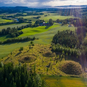
Mange av dem er uvanlig store, og fleire ligger i nærheten av Stiklestad. 2 km nord for Stiklestad ligger gravfeltet Hallemsmarka med til sammen 80 hauger, og 1,5 km østover ligger Hegstadmarka med monumentale storhauger og fem hustufter.
Øystein walberg forteller om Hegstad.",
"dlink":"http://maps.google.com/maps?daddr=63.791121,11.583817&t=m&layer=1&doflg=ptk&hl=no&om=0",
"openpopup":"0",
"mapwidth":"800",
"mapwidthunit":"px",
"mapheight":"700",
"marker-createdby":"omlarsen",
"marker-createdon":"2017-06-24 00:00:00",
"marker-updatedby":"omlarsen",
"marker-updatedon":"2017-06-29 00:00:00",
"layerid":["42"],
"layername":"Rundt om på Stiklestad",
"layer-createdby":"omlarsen",
"layer-createdon":"2017-06-22 00:59:44",
"layer-updatedby":"omlarsen",
"layer-updatedon":"2020-09-08 11:38:59",
"controlbox":"1",
"overlays_custom":"0",
"overlays_custom2":"0",
"overlays_custom3":"0",
"overlays_custom4":"0",
"wms":"0",
"wms2":"0",
"wms3":"0",
"wms4":"0",
"wms5":"0",
"wms6":"0",
"wms7":"0",
"wms8":"0",
"wms9":"0",
"wms10":"0",
"kml_timestamp":"",
"gpx_url":"",
"gpx_panel":"0",
"mlm_filter":"1",
"mlm_filter_details":""
}},
{
"type":"Feature",
"geometry":
{
"type":"Point",
"coordinates":[11.567187,63.810193]
},
"properties":
{
"markerid":"778",
"layers":["42"],
"requested_layer":["42"],
"markername":"Hallemsmarka",
"basemap":"custom_basemap",
"lat":"63.810193",
"lon":"11.567187",
"icon":"sight-2.png",
"zoom":"15",
"iconUrl":"http://verdalsportalen.no/wp-content/uploads/leaflet-maps-marker-icons/sight-2.png",
"address":"",
"text":"
",
"dlink":"http://maps.google.com/maps?daddr=63.810193,11.567187&t=m&layer=1&doflg=ptk&hl=no&om=0",
"openpopup":"0",
"mapwidth":"800",
"mapwidthunit":"px",
"mapheight":"700",
"marker-createdby":"omlarsen",
"marker-createdon":"2017-06-24 00:00:00",
"marker-updatedby":"omlarsen",
"marker-updatedon":"2017-06-29 00:00:00",
"layerid":["42"],
"layername":"Rundt om på Stiklestad",
"layer-createdby":"omlarsen",
"layer-createdon":"2017-06-22 00:59:44",
"layer-updatedby":"omlarsen",
"layer-updatedon":"2020-09-08 11:38:59",
"controlbox":"1",
"overlays_custom":"0",
"overlays_custom2":"0",
"overlays_custom3":"0",
"overlays_custom4":"0",
"wms":"0",
"wms2":"0",
"wms3":"0",
"wms4":"0",
"wms5":"0",
"wms6":"0",
"wms7":"0",
"wms8":"0",
"wms9":"0",
"wms10":"0",
"kml_timestamp":"",
"gpx_url":"",
"gpx_panel":"0",
"mlm_filter":"1",
"mlm_filter_details":""
}},
{
"type":"Feature",
"geometry":
{
"type":"Point",
"coordinates":[11.601477,63.790717]
},
"properties":
{
"markerid":"779",
"layers":["42"],
"requested_layer":["42"],
"markername":"Verdalsraset",
"basemap":"custom_basemap",
"lat":"63.790717",
"lon":"11.601477",
"icon":"sight-2.png",
"zoom":"14",
"iconUrl":"http://verdalsportalen.no/wp-content/uploads/leaflet-maps-marker-icons/sight-2.png",
"address":"",
"text":"
",
"dlink":"http://maps.google.com/maps?daddr=63.790717,11.601477&t=m&layer=1&doflg=ptk&hl=no&om=0",
"openpopup":"0",
"mapwidth":"800",
"mapwidthunit":"px",
"mapheight":"700",
"marker-createdby":"omlarsen",
"marker-createdon":"2017-06-24 00:00:00",
"marker-updatedby":"omlarsen",
"marker-updatedon":"2017-06-29 00:00:00",
"layerid":["42"],
"layername":"Rundt om på Stiklestad",
"layer-createdby":"omlarsen",
"layer-createdon":"2017-06-22 00:59:44",
"layer-updatedby":"omlarsen",
"layer-updatedon":"2020-09-08 11:38:59",
"controlbox":"1",
"overlays_custom":"0",
"overlays_custom2":"0",
"overlays_custom3":"0",
"overlays_custom4":"0",
"wms":"0",
"wms2":"0",
"wms3":"0",
"wms4":"0",
"wms5":"0",
"wms6":"0",
"wms7":"0",
"wms8":"0",
"wms9":"0",
"wms10":"0",
"kml_timestamp":"",
"gpx_url":"",
"gpx_panel":"0",
"mlm_filter":"1",
"mlm_filter_details":""
}},
{
"type":"Feature",
"geometry":
{
"type":"Point",
"coordinates":[11.564575,63.797308]
},
"properties":
{
"markerid":"811",
"layers":["42"],
"requested_layer":["42"],
"markername":"Lyngsburet",
"basemap":"custom_basemap",
"lat":"63.797308",
"lon":"11.564575",
"icon":"Stekkstad.png",
"zoom":"18",
"iconUrl":"http://verdalsportalen.no/wp-content/uploads/leaflet-maps-marker-icons/Stekkstad.png",
"address":"",
"text":"
",
"dlink":"http://maps.google.com/maps?daddr=63.797308,11.564575&t=m&layer=1&doflg=ptk&hl=no&om=0",
"openpopup":"0",
"mapwidth":"800",
"mapwidthunit":"px",
"mapheight":"600",
"marker-createdby":"omlarsen",
"marker-createdon":"2017-06-28 00:00:00",
"marker-updatedby":"omlarsen",
"marker-updatedon":"2017-06-28 00:00:00",
"layerid":["42"],
"layername":"Rundt om på Stiklestad",
"layer-createdby":"omlarsen",
"layer-createdon":"2017-06-22 00:59:44",
"layer-updatedby":"omlarsen",
"layer-updatedon":"2020-09-08 11:38:59",
"controlbox":"1",
"overlays_custom":"0",
"overlays_custom2":"0",
"overlays_custom3":"0",
"overlays_custom4":"0",
"wms":"0",
"wms2":"0",
"wms3":"0",
"wms4":"0",
"wms5":"0",
"wms6":"0",
"wms7":"0",
"wms8":"0",
"wms9":"0",
"wms10":"0",
"kml_timestamp":"",
"gpx_url":"",
"gpx_panel":"0",
"mlm_filter":"1",
"mlm_filter_details":""
}},
{
"type":"Feature",
"geometry":
{
"type":"Point",
"coordinates":[11.564773,63.797398]
},
"properties":
{
"markerid":"812",
"layers":["42"],
"requested_layer":["42"],
"markername":"Kongsstuggu",
"basemap":"custom_basemap",
"lat":"63.797398",
"lon":"11.564773",
"icon":"Stekkstad.png",
"zoom":"17",
"iconUrl":"http://verdalsportalen.no/wp-content/uploads/leaflet-maps-marker-icons/Stekkstad.png",
"address":"",
"text":"
",
"dlink":"http://maps.google.com/maps?daddr=63.797398,11.564773&t=m&layer=1&doflg=ptk&hl=no&om=0",
"openpopup":"0",
"mapwidth":"800",
"mapwidthunit":"px",
"mapheight":"600",
"marker-createdby":"omlarsen",
"marker-createdon":"2017-06-28 00:00:00",
"marker-updatedby":"omlarsen",
"marker-updatedon":"2017-06-28 00:00:00",
"layerid":["42"],
"layername":"Rundt om på Stiklestad",
"layer-createdby":"omlarsen",
"layer-createdon":"2017-06-22 00:59:44",
"layer-updatedby":"omlarsen",
"layer-updatedon":"2020-09-08 11:38:59",
"controlbox":"1",
"overlays_custom":"0",
"overlays_custom2":"0",
"overlays_custom3":"0",
"overlays_custom4":"0",
"wms":"0",
"wms2":"0",
"wms3":"0",
"wms4":"0",
"wms5":"0",
"wms6":"0",
"wms7":"0",
"wms8":"0",
"wms9":"0",
"wms10":"0",
"kml_timestamp":"",
"gpx_url":"",
"gpx_panel":"0",
"mlm_filter":"1",
"mlm_filter_details":""
}},
{
"type":"Feature",
"geometry":
{
"type":"Point",
"coordinates":[11.564189,63.797337]
},
"properties":
{
"markerid":"813",
"layers":["42"],
"requested_layer":["42"],
"markername":"Snekkarstuggu",
"basemap":"custom_basemap",
"lat":"63.797337",
"lon":"11.564189",
"icon":"Stekkstad.png",
"zoom":"18",
"iconUrl":"http://verdalsportalen.no/wp-content/uploads/leaflet-maps-marker-icons/Stekkstad.png",
"address":"",
"text":"
",
"dlink":"http://maps.google.com/maps?daddr=63.797337,11.564189&t=m&layer=1&doflg=ptk&hl=no&om=0",
"openpopup":"0",
"mapwidth":"800",
"mapwidthunit":"px",
"mapheight":"600",
"marker-createdby":"omlarsen",
"marker-createdon":"2017-06-28 00:00:00",
"marker-updatedby":"omlarsen",
"marker-updatedon":"2017-06-28 00:00:00",
"layerid":["42"],
"layername":"Rundt om på Stiklestad",
"layer-createdby":"omlarsen",
"layer-createdon":"2017-06-22 00:59:44",
"layer-updatedby":"omlarsen",
"layer-updatedon":"2020-09-08 11:38:59",
"controlbox":"1",
"overlays_custom":"0",
"overlays_custom2":"0",
"overlays_custom3":"0",
"overlays_custom4":"0",
"wms":"0",
"wms2":"0",
"wms3":"0",
"wms4":"0",
"wms5":"0",
"wms6":"0",
"wms7":"0",
"wms8":"0",
"wms9":"0",
"wms10":"0",
"kml_timestamp":"",
"gpx_url":"",
"gpx_panel":"0",
"mlm_filter":"1",
"mlm_filter_details":""
}},
{
"type":"Feature",
"geometry":
{
"type":"Point",
"coordinates":[11.566562,63.797944]
},
"properties":
{
"markerid":"814",
"layers":["42"],
"requested_layer":["42"],
"markername":"Bjønnmelburet",
"basemap":"custom_basemap",
"lat":"63.797944",
"lon":"11.566562",
"icon":"Stekkstad.png",
"zoom":"20",
"iconUrl":"http://verdalsportalen.no/wp-content/uploads/leaflet-maps-marker-icons/Stekkstad.png",
"address":"",
"text":"
",
"dlink":"http://maps.google.com/maps?daddr=63.797944,11.566562&t=m&layer=1&doflg=ptk&hl=no&om=0",
"openpopup":"0",
"mapwidth":"800",
"mapwidthunit":"px",
"mapheight":"600",
"marker-createdby":"omlarsen",
"marker-createdon":"2017-06-28 00:00:00",
"marker-updatedby":"omlarsen",
"marker-updatedon":"2017-06-28 00:00:00",
"layerid":["42"],
"layername":"Rundt om på Stiklestad",
"layer-createdby":"omlarsen",
"layer-createdon":"2017-06-22 00:59:44",
"layer-updatedby":"omlarsen",
"layer-updatedon":"2020-09-08 11:38:59",
"controlbox":"1",
"overlays_custom":"0",
"overlays_custom2":"0",
"overlays_custom3":"0",
"overlays_custom4":"0",
"wms":"0",
"wms2":"0",
"wms3":"0",
"wms4":"0",
"wms5":"0",
"wms6":"0",
"wms7":"0",
"wms8":"0",
"wms9":"0",
"wms10":"0",
"kml_timestamp":"",
"gpx_url":"",
"gpx_panel":"0",
"mlm_filter":"1",
"mlm_filter_details":""
}},
{
"type":"Feature",
"geometry":
{
"type":"Point",
"coordinates":[11.564870,63.797443]
},
"properties":
{
"markerid":"815",
"layers":["42"],
"requested_layer":["42"],
"markername":"Ådalsvollburet",
"basemap":"custom_basemap",
"lat":"63.797443",
"lon":"11.564870",
"icon":"Stekkstad.png",
"zoom":"18",
"iconUrl":"http://verdalsportalen.no/wp-content/uploads/leaflet-maps-marker-icons/Stekkstad.png",
"address":"",
"text":"
",
"dlink":"http://maps.google.com/maps?daddr=63.797443,11.564870&t=m&layer=1&doflg=ptk&hl=no&om=0",
"openpopup":"0",
"mapwidth":"800",
"mapwidthunit":"px",
"mapheight":"600",
"marker-createdby":"omlarsen",
"marker-createdon":"2017-06-28 00:00:00",
"marker-updatedby":"omlarsen",
"marker-updatedon":"2017-06-28 00:00:00",
"layerid":["42"],
"layername":"Rundt om på Stiklestad",
"layer-createdby":"omlarsen",
"layer-createdon":"2017-06-22 00:59:44",
"layer-updatedby":"omlarsen",
"layer-updatedon":"2020-09-08 11:38:59",
"controlbox":"1",
"overlays_custom":"0",
"overlays_custom2":"0",
"overlays_custom3":"0",
"overlays_custom4":"0",
"wms":"0",
"wms2":"0",
"wms3":"0",
"wms4":"0",
"wms5":"0",
"wms6":"0",
"wms7":"0",
"wms8":"0",
"wms9":"0",
"wms10":"0",
"kml_timestamp":"",
"gpx_url":"",
"gpx_panel":"0",
"mlm_filter":"1",
"mlm_filter_details":""
}},
{
"type":"Feature",
"geometry":
{
"type":"Point",
"coordinates":[11.565224,63.797390]
},
"properties":
{
"markerid":"816",
"layers":["42"],
"requested_layer":["42"],
"markername":"Levringslåven",
"basemap":"custom_basemap",
"lat":"63.797390",
"lon":"11.565224",
"icon":"Stekkstad.png",
"zoom":"18",
"iconUrl":"http://verdalsportalen.no/wp-content/uploads/leaflet-maps-marker-icons/Stekkstad.png",
"address":"",
"text":"
",
"dlink":"http://maps.google.com/maps?daddr=63.797390,11.565224&t=m&layer=1&doflg=ptk&hl=no&om=0",
"openpopup":"0",
"mapwidth":"800",
"mapwidthunit":"px",
"mapheight":"600",
"marker-createdby":"omlarsen",
"marker-createdon":"2017-06-28 00:00:00",
"marker-updatedby":"omlarsen",
"marker-updatedon":"2017-06-28 00:00:00",
"layerid":["42"],
"layername":"Rundt om på Stiklestad",
"layer-createdby":"omlarsen",
"layer-createdon":"2017-06-22 00:59:44",
"layer-updatedby":"omlarsen",
"layer-updatedon":"2020-09-08 11:38:59",
"controlbox":"1",
"overlays_custom":"0",
"overlays_custom2":"0",
"overlays_custom3":"0",
"overlays_custom4":"0",
"wms":"0",
"wms2":"0",
"wms3":"0",
"wms4":"0",
"wms5":"0",
"wms6":"0",
"wms7":"0",
"wms8":"0",
"wms9":"0",
"wms10":"0",
"kml_timestamp":"",
"gpx_url":"",
"gpx_panel":"0",
"mlm_filter":"1",
"mlm_filter_details":""
}},
{
"type":"Feature",
"geometry":
{
"type":"Point",
"coordinates":[11.567155,63.797528]
},
"properties":
{
"markerid":"817",
"layers":["42"],
"requested_layer":["42"],
"markername":"Smia og tørkhuset",
"basemap":"custom_basemap",
"lat":"63.797528",
"lon":"11.567155",
"icon":"Stekkstad.png",
"zoom":"18",
"iconUrl":"http://verdalsportalen.no/wp-content/uploads/leaflet-maps-marker-icons/Stekkstad.png",
"address":"",
"text":"
",
"dlink":"http://maps.google.com/maps?daddr=63.797528,11.567155&t=m&layer=1&doflg=ptk&hl=no&om=0",
"openpopup":"0",
"mapwidth":"800",
"mapwidthunit":"px",
"mapheight":"600",
"marker-createdby":"omlarsen",
"marker-createdon":"2017-06-28 00:00:00",
"marker-updatedby":"omlarsen",
"marker-updatedon":"2017-06-28 00:00:00",
"layerid":["42"],
"layername":"Rundt om på Stiklestad",
"layer-createdby":"omlarsen",
"layer-createdon":"2017-06-22 00:59:44",
"layer-updatedby":"omlarsen",
"layer-updatedon":"2020-09-08 11:38:59",
"controlbox":"1",
"overlays_custom":"0",
"overlays_custom2":"0",
"overlays_custom3":"0",
"overlays_custom4":"0",
"wms":"0",
"wms2":"0",
"wms3":"0",
"wms4":"0",
"wms5":"0",
"wms6":"0",
"wms7":"0",
"wms8":"0",
"wms9":"0",
"wms10":"0",
"kml_timestamp":"",
"gpx_url":"",
"gpx_panel":"0",
"mlm_filter":"1",
"mlm_filter_details":""
}},
{
"type":"Feature",
"geometry":
{
"type":"Point",
"coordinates":[11.563974,63.797268]
},
"properties":
{
"markerid":"818",
"layers":["42"],
"requested_layer":["42"],
"markername":"Kverna",
"basemap":"custom_basemap",
"lat":"63.797268",
"lon":"11.563974",
"icon":"Stekkstad.png",
"zoom":"18",
"iconUrl":"http://verdalsportalen.no/wp-content/uploads/leaflet-maps-marker-icons/Stekkstad.png",
"address":"",
"text":"
",
"dlink":"http://maps.google.com/maps?daddr=63.797268,11.563974&t=m&layer=1&doflg=ptk&hl=no&om=0",
"openpopup":"0",
"mapwidth":"800",
"mapwidthunit":"px",
"mapheight":"600",
"marker-createdby":"omlarsen",
"marker-createdon":"2017-06-28 00:00:00",
"marker-updatedby":"omlarsen",
"marker-updatedon":"2017-06-28 00:00:00",
"layerid":["42"],
"layername":"Rundt om på Stiklestad",
"layer-createdby":"omlarsen",
"layer-createdon":"2017-06-22 00:59:44",
"layer-updatedby":"omlarsen",
"layer-updatedon":"2020-09-08 11:38:59",
"controlbox":"1",
"overlays_custom":"0",
"overlays_custom2":"0",
"overlays_custom3":"0",
"overlays_custom4":"0",
"wms":"0",
"wms2":"0",
"wms3":"0",
"wms4":"0",
"wms5":"0",
"wms6":"0",
"wms7":"0",
"wms8":"0",
"wms9":"0",
"wms10":"0",
"kml_timestamp":"",
"gpx_url":"",
"gpx_panel":"0",
"mlm_filter":"1",
"mlm_filter_details":""
}},
{
"type":"Feature",
"geometry":
{
"type":"Point",
"coordinates":[11.567783,63.797626]
},
"properties":
{
"markerid":"819",
"layers":["42"],
"requested_layer":["42"],
"markername":"Husmannsplassen",
"basemap":"custom_basemap",
"lat":"63.797626",
"lon":"11.567783",
"icon":"Stekkstad.png",
"zoom":"18",
"iconUrl":"http://verdalsportalen.no/wp-content/uploads/leaflet-maps-marker-icons/Stekkstad.png",
"address":"",
"text":"
",
"dlink":"http://maps.google.com/maps?daddr=63.797626,11.567783&t=m&layer=1&doflg=ptk&hl=no&om=0",
"openpopup":"0",
"mapwidth":"800",
"mapwidthunit":"px",
"mapheight":"600",
"marker-createdby":"omlarsen",
"marker-createdon":"2017-06-28 00:00:00",
"marker-updatedby":"omlarsen",
"marker-updatedon":"2017-06-28 00:00:00",
"layerid":["42"],
"layername":"Rundt om på Stiklestad",
"layer-createdby":"omlarsen",
"layer-createdon":"2017-06-22 00:59:44",
"layer-updatedby":"omlarsen",
"layer-updatedon":"2020-09-08 11:38:59",
"controlbox":"1",
"overlays_custom":"0",
"overlays_custom2":"0",
"overlays_custom3":"0",
"overlays_custom4":"0",
"wms":"0",
"wms2":"0",
"wms3":"0",
"wms4":"0",
"wms5":"0",
"wms6":"0",
"wms7":"0",
"wms8":"0",
"wms9":"0",
"wms10":"0",
"kml_timestamp":"",
"gpx_url":"",
"gpx_panel":"0",
"mlm_filter":"1",
"mlm_filter_details":""
}},
{
"type":"Feature",
"geometry":
{
"type":"Point",
"coordinates":[11.565696,63.797971]
},
"properties":
{
"markerid":"820",
"layers":["42"],
"requested_layer":["42"],
"markername":"Bakeri og krambu",
"basemap":"custom_basemap",
"lat":"63.797971",
"lon":"11.565696",
"icon":"Stekkstad.png",
"zoom":"18",
"iconUrl":"http://verdalsportalen.no/wp-content/uploads/leaflet-maps-marker-icons/Stekkstad.png",
"address":"",
"text":"
",
"dlink":"http://maps.google.com/maps?daddr=63.797971,11.565696&t=m&layer=1&doflg=ptk&hl=no&om=0",
"openpopup":"0",
"mapwidth":"800",
"mapwidthunit":"px",
"mapheight":"600",
"marker-createdby":"omlarsen",
"marker-createdon":"2017-06-28 00:00:00",
"marker-updatedby":"omlarsen",
"marker-updatedon":"2017-06-28 00:00:00",
"layerid":["42"],
"layername":"Rundt om på Stiklestad",
"layer-createdby":"omlarsen",
"layer-createdon":"2017-06-22 00:59:44",
"layer-updatedby":"omlarsen",
"layer-updatedon":"2020-09-08 11:38:59",
"controlbox":"1",
"overlays_custom":"0",
"overlays_custom2":"0",
"overlays_custom3":"0",
"overlays_custom4":"0",
"wms":"0",
"wms2":"0",
"wms3":"0",
"wms4":"0",
"wms5":"0",
"wms6":"0",
"wms7":"0",
"wms8":"0",
"wms9":"0",
"wms10":"0",
"kml_timestamp":"",
"gpx_url":"",
"gpx_panel":"0",
"mlm_filter":"1",
"mlm_filter_details":""
}},
{
"type":"Feature",
"geometry":
{
"type":"Point",
"coordinates":[11.566930,63.797443]
},
"properties":
{
"markerid":"821",
"layers":["42"],
"requested_layer":["42"],
"markername":"Badstua",
"basemap":"custom_basemap",
"lat":"63.797443",
"lon":"11.566930",
"icon":"Stekkstad.png",
"zoom":"18",
"iconUrl":"http://verdalsportalen.no/wp-content/uploads/leaflet-maps-marker-icons/Stekkstad.png",
"address":"",
"text":"
",
"dlink":"http://maps.google.com/maps?daddr=63.797443,11.566930&t=m&layer=1&doflg=ptk&hl=no&om=0",
"openpopup":"0",
"mapwidth":"800",
"mapwidthunit":"px",
"mapheight":"600",
"marker-createdby":"omlarsen",
"marker-createdon":"2017-06-28 00:00:00",
"marker-updatedby":"omlarsen",
"marker-updatedon":"2017-06-28 00:00:00",
"layerid":["42"],
"layername":"Rundt om på Stiklestad",
"layer-createdby":"omlarsen",
"layer-createdon":"2017-06-22 00:59:44",
"layer-updatedby":"omlarsen",
"layer-updatedon":"2020-09-08 11:38:59",
"controlbox":"1",
"overlays_custom":"0",
"overlays_custom2":"0",
"overlays_custom3":"0",
"overlays_custom4":"0",
"wms":"0",
"wms2":"0",
"wms3":"0",
"wms4":"0",
"wms5":"0",
"wms6":"0",
"wms7":"0",
"wms8":"0",
"wms9":"0",
"wms10":"0",
"kml_timestamp":"",
"gpx_url":"",
"gpx_panel":"0",
"mlm_filter":"1",
"mlm_filter_details":""
}},
{
"type":"Feature",
"geometry":
{
"type":"Point",
"coordinates":[11.565235,63.795754]
},
"properties":
{
"markerid":"822",
"layers":["42"],
"requested_layer":["42"],
"markername":"Olavshaugen",
"basemap":"custom_basemap",
"lat":"63.795754",
"lon":"11.565235",
"icon":"Stekkstad.png",
"zoom":"17",
"iconUrl":"http://verdalsportalen.no/wp-content/uploads/leaflet-maps-marker-icons/Stekkstad.png",
"address":"",
"text":"
",
"dlink":"http://maps.google.com/maps?daddr=63.795754,11.565235&t=m&layer=1&doflg=ptk&hl=no&om=0",
"openpopup":"0",
"mapwidth":"800",
"mapwidthunit":"px",
"mapheight":"600",
"marker-createdby":"omlarsen",
"marker-createdon":"2017-06-28 00:00:00",
"marker-updatedby":"omlarsen",
"marker-updatedon":"2017-06-28 00:00:00",
"layerid":["42"],
"layername":"Rundt om på Stiklestad",
"layer-createdby":"omlarsen",
"layer-createdon":"2017-06-22 00:59:44",
"layer-updatedby":"omlarsen",
"layer-updatedon":"2020-09-08 11:38:59",
"controlbox":"1",
"overlays_custom":"0",
"overlays_custom2":"0",
"overlays_custom3":"0",
"overlays_custom4":"0",
"wms":"0",
"wms2":"0",
"wms3":"0",
"wms4":"0",
"wms5":"0",
"wms6":"0",
"wms7":"0",
"wms8":"0",
"wms9":"0",
"wms10":"0",
"kml_timestamp":"",
"gpx_url":"",
"gpx_panel":"0",
"mlm_filter":"1",
"mlm_filter_details":""
}},
{
"type":"Feature",
"geometry":
{
"type":"Point",
"coordinates":[11.564720,63.796593]
},
"properties":
{
"markerid":"823",
"layers":["42"],
"requested_layer":["42"],
"markername":"St. Olavs kapell",
"basemap":"custom_basemap",
"lat":"63.796593",
"lon":"11.564720",
"icon":"Stekkstad.png",
"zoom":"17",
"iconUrl":"http://verdalsportalen.no/wp-content/uploads/leaflet-maps-marker-icons/Stekkstad.png",
"address":"",
"text":"
",
"dlink":"http://maps.google.com/maps?daddr=63.796593,11.564720&t=m&layer=1&doflg=ptk&hl=no&om=0",
"openpopup":"0",
"mapwidth":"800",
"mapwidthunit":"px",
"mapheight":"600",
"marker-createdby":"omlarsen",
"marker-createdon":"2017-06-28 00:00:00",
"marker-updatedby":"omlarsen",
"marker-updatedon":"2017-06-29 00:00:00",
"layerid":["42"],
"layername":"Rundt om på Stiklestad",
"layer-createdby":"omlarsen",
"layer-createdon":"2017-06-22 00:59:44",
"layer-updatedby":"omlarsen",
"layer-updatedon":"2020-09-08 11:38:59",
"controlbox":"1",
"overlays_custom":"0",
"overlays_custom2":"0",
"overlays_custom3":"0",
"overlays_custom4":"0",
"wms":"0",
"wms2":"0",
"wms3":"0",
"wms4":"0",
"wms5":"0",
"wms6":"0",
"wms7":"0",
"wms8":"0",
"wms9":"0",
"wms10":"0",
"kml_timestamp":"",
"gpx_url":"",
"gpx_panel":"0",
"mlm_filter":"1",
"mlm_filter_details":""
}},
{
"type":"Feature",
"geometry":
{
"type":"Point",
"coordinates":[11.562145,63.797687]
},
"properties":
{
"markerid":"824",
"layers":["42"],
"requested_layer":["42"],
"markername":"Hellige Olavs kapell",
"basemap":"custom_basemap",
"lat":"63.797687",
"lon":"11.562145",
"icon":"Stekkstad.png",
"zoom":"17",
"iconUrl":"http://verdalsportalen.no/wp-content/uploads/leaflet-maps-marker-icons/Stekkstad.png",
"address":"",
"text":"
",
"dlink":"http://maps.google.com/maps?daddr=63.797687,11.562145&t=m&layer=1&doflg=ptk&hl=no&om=0",
"openpopup":"0",
"mapwidth":"800",
"mapwidthunit":"px",
"mapheight":"600",
"marker-createdby":"omlarsen",
"marker-createdon":"2017-06-28 00:00:00",
"marker-updatedby":"omlarsen",
"marker-updatedon":"2017-06-29 00:00:00",
"layerid":["42"],
"layername":"Rundt om på Stiklestad",
"layer-createdby":"omlarsen",
"layer-createdon":"2017-06-22 00:59:44",
"layer-updatedby":"omlarsen",
"layer-updatedon":"2020-09-08 11:38:59",
"controlbox":"1",
"overlays_custom":"0",
"overlays_custom2":"0",
"overlays_custom3":"0",
"overlays_custom4":"0",
"wms":"0",
"wms2":"0",
"wms3":"0",
"wms4":"0",
"wms5":"0",
"wms6":"0",
"wms7":"0",
"wms8":"0",
"wms9":"0",
"wms10":"0",
"kml_timestamp":"",
"gpx_url":"",
"gpx_panel":"0",
"mlm_filter":"1",
"mlm_filter_details":""
}},
{
"type":"Feature",
"geometry":
{
"type":"Point",
"coordinates":[11.564199,63.796967]
},
"properties":
{
"markerid":"825",
"layers":["42"],
"requested_layer":["42"],
"markername":"Leikarstua",
"basemap":"custom_basemap",
"lat":"63.796967",
"lon":"11.564199",
"icon":"Stekkstad.png",
"zoom":"18",
"iconUrl":"http://verdalsportalen.no/wp-content/uploads/leaflet-maps-marker-icons/Stekkstad.png",
"address":"",
"text":"
",
"dlink":"http://maps.google.com/maps?daddr=63.796967,11.564199&t=m&layer=1&doflg=ptk&hl=no&om=0",
"openpopup":"0",
"mapwidth":"800",
"mapwidthunit":"px",
"mapheight":"600",
"marker-createdby":"omlarsen",
"marker-createdon":"2017-06-28 00:00:00",
"marker-updatedby":"omlarsen",
"marker-updatedon":"2017-06-28 00:00:00",
"layerid":["42"],
"layername":"Rundt om på Stiklestad",
"layer-createdby":"omlarsen",
"layer-createdon":"2017-06-22 00:59:44",
"layer-updatedby":"omlarsen",
"layer-updatedon":"2020-09-08 11:38:59",
"controlbox":"1",
"overlays_custom":"0",
"overlays_custom2":"0",
"overlays_custom3":"0",
"overlays_custom4":"0",
"wms":"0",
"wms2":"0",
"wms3":"0",
"wms4":"0",
"wms5":"0",
"wms6":"0",
"wms7":"0",
"wms8":"0",
"wms9":"0",
"wms10":"0",
"kml_timestamp":"",
"gpx_url":"",
"gpx_panel":"0",
"mlm_filter":"1",
"mlm_filter_details":""
}},
{
"type":"Feature",
"geometry":
{
"type":"Point",
"coordinates":[11.565878,63.798327]
},
"properties":
{
"markerid":"826",
"layers":["42"],
"requested_layer":["42"],
"markername":"Gjesteloftet",
"basemap":"custom_basemap",
"lat":"63.798327",
"lon":"11.565878",
"icon":"Stekkstad.png",
"zoom":"17",
"iconUrl":"http://verdalsportalen.no/wp-content/uploads/leaflet-maps-marker-icons/Stekkstad.png",
"address":"",
"text":"
",
"dlink":"http://maps.google.com/maps?daddr=63.798327,11.565878&t=m&layer=1&doflg=ptk&hl=no&om=0",
"openpopup":"0",
"mapwidth":"800",
"mapwidthunit":"px",
"mapheight":"600",
"marker-createdby":"omlarsen",
"marker-createdon":"2017-06-28 00:00:00",
"marker-updatedby":"omlarsen",
"marker-updatedon":"2017-06-28 00:00:00",
"layerid":["42"],
"layername":"Rundt om på Stiklestad",
"layer-createdby":"omlarsen",
"layer-createdon":"2017-06-22 00:59:44",
"layer-updatedby":"omlarsen",
"layer-updatedon":"2020-09-08 11:38:59",
"controlbox":"1",
"overlays_custom":"0",
"overlays_custom2":"0",
"overlays_custom3":"0",
"overlays_custom4":"0",
"wms":"0",
"wms2":"0",
"wms3":"0",
"wms4":"0",
"wms5":"0",
"wms6":"0",
"wms7":"0",
"wms8":"0",
"wms9":"0",
"wms10":"0",
"kml_timestamp":"",
"gpx_url":"",
"gpx_panel":"0",
"mlm_filter":"1",
"mlm_filter_details":""
}},
{
"type":"Feature",
"geometry":
{
"type":"Point",
"coordinates":[11.565750,63.796890]
},
"properties":
{
"markerid":"827",
"layers":["42"],
"requested_layer":["42"],
"markername":"Spelamfiet",
"basemap":"custom_basemap",
"lat":"63.796890",
"lon":"11.565750",
"icon":"Stekkstad.png",
"zoom":"17",
"iconUrl":"http://verdalsportalen.no/wp-content/uploads/leaflet-maps-marker-icons/Stekkstad.png",
"address":"",
"text":"
",
"dlink":"http://maps.google.com/maps?daddr=63.796890,11.565750&t=m&layer=1&doflg=ptk&hl=no&om=0",
"openpopup":"0",
"mapwidth":"800",
"mapwidthunit":"px",
"mapheight":"600",
"marker-createdby":"omlarsen",
"marker-createdon":"2017-06-28 00:00:00",
"marker-updatedby":"omlarsen",
"marker-updatedon":"2017-06-28 00:00:00",
"layerid":["42"],
"layername":"Rundt om på Stiklestad",
"layer-createdby":"omlarsen",
"layer-createdon":"2017-06-22 00:59:44",
"layer-updatedby":"omlarsen",
"layer-updatedon":"2020-09-08 11:38:59",
"controlbox":"1",
"overlays_custom":"0",
"overlays_custom2":"0",
"overlays_custom3":"0",
"overlays_custom4":"0",
"wms":"0",
"wms2":"0",
"wms3":"0",
"wms4":"0",
"wms5":"0",
"wms6":"0",
"wms7":"0",
"wms8":"0",
"wms9":"0",
"wms10":"0",
"kml_timestamp":"",
"gpx_url":"",
"gpx_panel":"0",
"mlm_filter":"1",
"mlm_filter_details":""
}},
{
"type":"Feature",
"geometry":
{
"type":"Point",
"coordinates":[11.566887,63.797029]
},
"properties":
{
"markerid":"828",
"layers":["42"],
"requested_layer":["42"],
"markername":"Rytterstatuen",
"basemap":"custom_basemap",
"lat":"63.797029",
"lon":"11.566887",
"icon":"Stekkstad.png",
"zoom":"17",
"iconUrl":"http://verdalsportalen.no/wp-content/uploads/leaflet-maps-marker-icons/Stekkstad.png",
"address":"",
"text":"
",
"dlink":"http://maps.google.com/maps?daddr=63.797029,11.566887&t=m&layer=1&doflg=ptk&hl=no&om=0",
"openpopup":"0",
"mapwidth":"800",
"mapwidthunit":"px",
"mapheight":"600",
"marker-createdby":"omlarsen",
"marker-createdon":"2017-06-28 00:00:00",
"marker-updatedby":"omlarsen",
"marker-updatedon":"2017-06-28 00:00:00",
"layerid":["42"],
"layername":"Rundt om på Stiklestad",
"layer-createdby":"omlarsen",
"layer-createdon":"2017-06-22 00:59:44",
"layer-updatedby":"omlarsen",
"layer-updatedon":"2020-09-08 11:38:59",
"controlbox":"1",
"overlays_custom":"0",
"overlays_custom2":"0",
"overlays_custom3":"0",
"overlays_custom4":"0",
"wms":"0",
"wms2":"0",
"wms3":"0",
"wms4":"0",
"wms5":"0",
"wms6":"0",
"wms7":"0",
"wms8":"0",
"wms9":"0",
"wms10":"0",
"kml_timestamp":"",
"gpx_url":"",
"gpx_panel":"0",
"mlm_filter":"1",
"mlm_filter_details":""
}},
{
"type":"Feature",
"geometry":
{
"type":"Point",
"coordinates":[11.567284,63.798137]
},
"properties":
{
"markerid":"829",
"layers":["42"],
"requested_layer":["42"],
"markername":"Gjersinghuset",
"basemap":"custom_basemap",
"lat":"63.798137",
"lon":"11.567284",
"icon":"Stekkstad.png",
"zoom":"16",
"iconUrl":"http://verdalsportalen.no/wp-content/uploads/leaflet-maps-marker-icons/Stekkstad.png",
"address":"",
"text":"
",
"dlink":"http://maps.google.com/maps?daddr=63.798137,11.567284&t=m&layer=1&doflg=ptk&hl=no&om=0",
"openpopup":"0",
"mapwidth":"800",
"mapwidthunit":"px",
"mapheight":"600",
"marker-createdby":"omlarsen",
"marker-createdon":"2017-06-28 00:00:00",
"marker-updatedby":"omlarsen",
"marker-updatedon":"2019-09-05 00:00:00",
"layerid":["42"],
"layername":"Rundt om på Stiklestad",
"layer-createdby":"omlarsen",
"layer-createdon":"2017-06-22 00:59:44",
"layer-updatedby":"omlarsen",
"layer-updatedon":"2020-09-08 11:38:59",
"controlbox":"1",
"overlays_custom":"0",
"overlays_custom2":"0",
"overlays_custom3":"0",
"overlays_custom4":"0",
"wms":"0",
"wms2":"0",
"wms3":"0",
"wms4":"0",
"wms5":"0",
"wms6":"0",
"wms7":"0",
"wms8":"0",
"wms9":"0",
"wms10":"0",
"kml_timestamp":"",
"gpx_url":"",
"gpx_panel":"0",
"mlm_filter":"1",
"mlm_filter_details":""
}},
{
"type":"Feature",
"geometry":
{
"type":"Point",
"coordinates":[11.565578,63.797607]
},
"properties":
{
"markerid":"830",
"layers":["42"],
"requested_layer":["42"],
"markername":"Hermannshuset",
"basemap":"custom_basemap",
"lat":"63.797607",
"lon":"11.565578",
"icon":"Stekkstad.png",
"zoom":"17",
"iconUrl":"http://verdalsportalen.no/wp-content/uploads/leaflet-maps-marker-icons/Stekkstad.png",
"address":"",
"text":"
Hermannshuset
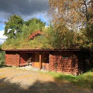 Les om åpninga av Hermannshuset
",
"dlink":"http://maps.google.com/maps?daddr=63.797607,11.565578&t=m&layer=1&doflg=ptk&hl=no&om=0",
"openpopup":"0",
"mapwidth":"800",
"mapwidthunit":"px",
"mapheight":"600",
"marker-createdby":"omlarsen",
"marker-createdon":"2017-06-28 00:00:00",
"marker-updatedby":"omlarsen",
"marker-updatedon":"2017-06-28 00:00:00",
"layerid":["42"],
"layername":"Rundt om på Stiklestad",
"layer-createdby":"omlarsen",
"layer-createdon":"2017-06-22 00:59:44",
"layer-updatedby":"omlarsen",
"layer-updatedon":"2020-09-08 11:38:59",
"controlbox":"1",
"overlays_custom":"0",
"overlays_custom2":"0",
"overlays_custom3":"0",
"overlays_custom4":"0",
"wms":"0",
"wms2":"0",
"wms3":"0",
"wms4":"0",
"wms5":"0",
"wms6":"0",
"wms7":"0",
"wms8":"0",
"wms9":"0",
"wms10":"0",
"kml_timestamp":"",
"gpx_url":"",
"gpx_panel":"0",
"mlm_filter":"1",
"mlm_filter_details":""
}},
{
"type":"Feature",
"geometry":
{
"type":"Point",
"coordinates":[11.566308,63.798033]
},
"properties":
{
"markerid":"831",
"layers":["42"],
"requested_layer":["42"],
"markername":"Almoåsstuggu",
"basemap":"custom_basemap",
"lat":"63.798033",
"lon":"11.566308",
"icon":"Stekkstad.png",
"zoom":"17",
"iconUrl":"http://verdalsportalen.no/wp-content/uploads/leaflet-maps-marker-icons/Stekkstad.png",
"address":"",
"text":"
",
"dlink":"http://maps.google.com/maps?daddr=63.798033,11.566308&t=m&layer=1&doflg=ptk&hl=no&om=0",
"openpopup":"0",
"mapwidth":"800",
"mapwidthunit":"px",
"mapheight":"600",
"marker-createdby":"omlarsen",
"marker-createdon":"2017-06-28 00:00:00",
"marker-updatedby":"omlarsen",
"marker-updatedon":"2017-06-28 00:00:00",
"layerid":["42"],
"layername":"Rundt om på Stiklestad",
"layer-createdby":"omlarsen",
"layer-createdon":"2017-06-22 00:59:44",
"layer-updatedby":"omlarsen",
"layer-updatedon":"2020-09-08 11:38:59",
"controlbox":"1",
"overlays_custom":"0",
"overlays_custom2":"0",
"overlays_custom3":"0",
"overlays_custom4":"0",
"wms":"0",
"wms2":"0",
"wms3":"0",
"wms4":"0",
"wms5":"0",
"wms6":"0",
"wms7":"0",
"wms8":"0",
"wms9":"0",
"wms10":"0",
"kml_timestamp":"",
"gpx_url":"",
"gpx_panel":"0",
"mlm_filter":"1",
"mlm_filter_details":""
}},
{
"type":"Feature",
"geometry":
{
"type":"Point",
"coordinates":[11.569730,63.798450]
},
"properties":
{
"markerid":"832",
"layers":["42"],
"requested_layer":["42"],
"markername":"Moksneslåna",
"basemap":"custom_basemap",
"lat":"63.798450",
"lon":"11.569730",
"icon":"Stekkstad.png",
"zoom":"17",
"iconUrl":"http://verdalsportalen.no/wp-content/uploads/leaflet-maps-marker-icons/Stekkstad.png",
"address":"",
"text":"
",
"dlink":"http://maps.google.com/maps?daddr=63.798450,11.569730&t=m&layer=1&doflg=ptk&hl=no&om=0",
"openpopup":"0",
"mapwidth":"800",
"mapwidthunit":"px",
"mapheight":"600",
"marker-createdby":"omlarsen",
"marker-createdon":"2017-06-28 00:00:00",
"marker-updatedby":"omlarsen",
"marker-updatedon":"2017-06-29 00:00:00",
"layerid":["42"],
"layername":"Rundt om på Stiklestad",
"layer-createdby":"omlarsen",
"layer-createdon":"2017-06-22 00:59:44",
"layer-updatedby":"omlarsen",
"layer-updatedon":"2020-09-08 11:38:59",
"controlbox":"1",
"overlays_custom":"0",
"overlays_custom2":"0",
"overlays_custom3":"0",
"overlays_custom4":"0",
"wms":"0",
"wms2":"0",
"wms3":"0",
"wms4":"0",
"wms5":"0",
"wms6":"0",
"wms7":"0",
"wms8":"0",
"wms9":"0",
"wms10":"0",
"kml_timestamp":"",
"gpx_url":"",
"gpx_panel":"0",
"mlm_filter":"1",
"mlm_filter_details":""
}},
{
"type":"Feature",
"geometry":
{
"type":"Point",
"coordinates":[11.570224,63.798251]
},
"properties":
{
"markerid":"833",
"layers":["42"],
"requested_layer":["42"],
"markername":"Prestegårdsburet",
"basemap":"custom_basemap",
"lat":"63.798251",
"lon":"11.570224",
"icon":"Stekkstad.png",
"zoom":"17",
"iconUrl":"http://verdalsportalen.no/wp-content/uploads/leaflet-maps-marker-icons/Stekkstad.png",
"address":"",
"text":"
Prestegårdsburet
",
"dlink":"http://maps.google.com/maps?daddr=63.798251,11.570224&t=m&layer=1&doflg=ptk&hl=no&om=0",
"openpopup":"0",
"mapwidth":"800",
"mapwidthunit":"px",
"mapheight":"600",
"marker-createdby":"omlarsen",
"marker-createdon":"2017-06-28 00:00:00",
"marker-updatedby":"omlarsen",
"marker-updatedon":"2017-06-28 00:00:00",
"layerid":["42"],
"layername":"Rundt om på Stiklestad",
"layer-createdby":"omlarsen",
"layer-createdon":"2017-06-22 00:59:44",
"layer-updatedby":"omlarsen",
"layer-updatedon":"2020-09-08 11:38:59",
"controlbox":"1",
"overlays_custom":"0",
"overlays_custom2":"0",
"overlays_custom3":"0",
"overlays_custom4":"0",
"wms":"0",
"wms2":"0",
"wms3":"0",
"wms4":"0",
"wms5":"0",
"wms6":"0",
"wms7":"0",
"wms8":"0",
"wms9":"0",
"wms10":"0",
"kml_timestamp":"",
"gpx_url":"",
"gpx_panel":"0",
"mlm_filter":"1",
"mlm_filter_details":""
}},
{
"type":"Feature",
"geometry":
{
"type":"Point",
"coordinates":[11.566941,63.797832]
},
"properties":
{
"markerid":"834",
"layers":["42"],
"requested_layer":["42"],
"markername":"Vegvokterboligen",
"basemap":"custom_basemap",
"lat":"63.797832",
"lon":"11.566941",
"icon":"Stekkstad.png",
"zoom":"17",
"iconUrl":"http://verdalsportalen.no/wp-content/uploads/leaflet-maps-marker-icons/Stekkstad.png",
"address":"",
"text":"
",
"dlink":"http://maps.google.com/maps?daddr=63.797832,11.566941&t=m&layer=1&doflg=ptk&hl=no&om=0",
"openpopup":"0",
"mapwidth":"800",
"mapwidthunit":"px",
"mapheight":"600",
"marker-createdby":"omlarsen",
"marker-createdon":"2017-06-28 00:00:00",
"marker-updatedby":"omlarsen",
"marker-updatedon":"2019-09-12 00:00:00",
"layerid":["42"],
"layername":"Rundt om på Stiklestad",
"layer-createdby":"omlarsen",
"layer-createdon":"2017-06-22 00:59:44",
"layer-updatedby":"omlarsen",
"layer-updatedon":"2020-09-08 11:38:59",
"controlbox":"1",
"overlays_custom":"0",
"overlays_custom2":"0",
"overlays_custom3":"0",
"overlays_custom4":"0",
"wms":"0",
"wms2":"0",
"wms3":"0",
"wms4":"0",
"wms5":"0",
"wms6":"0",
"wms7":"0",
"wms8":"0",
"wms9":"0",
"wms10":"0",
"kml_timestamp":"",
"gpx_url":"",
"gpx_panel":"0",
"mlm_filter":"1",
"mlm_filter_details":""
}},
{
"type":"Feature",
"geometry":
{
"type":"Point",
"coordinates":[11.568813,63.797817]
},
"properties":
{
"markerid":"835",
"layers":["42"],
"requested_layer":["42"],
"markername":"Strådalssaga",
"basemap":"custom_basemap",
"lat":"63.797817",
"lon":"11.568813",
"icon":"Stekkstad.png",
"zoom":"18",
"iconUrl":"http://verdalsportalen.no/wp-content/uploads/leaflet-maps-marker-icons/Stekkstad.png",
"address":"",
"text":"
",
"dlink":"http://maps.google.com/maps?daddr=63.797817,11.568813&t=m&layer=1&doflg=ptk&hl=no&om=0",
"openpopup":"0",
"mapwidth":"800",
"mapwidthunit":"px",
"mapheight":"600",
"marker-createdby":"omlarsen",
"marker-createdon":"2017-06-28 00:00:00",
"marker-updatedby":"omlarsen",
"marker-updatedon":"2017-06-28 00:00:00",
"layerid":["42"],
"layername":"Rundt om på Stiklestad",
"layer-createdby":"omlarsen",
"layer-createdon":"2017-06-22 00:59:44",
"layer-updatedby":"omlarsen",
"layer-updatedon":"2020-09-08 11:38:59",
"controlbox":"1",
"overlays_custom":"0",
"overlays_custom2":"0",
"overlays_custom3":"0",
"overlays_custom4":"0",
"wms":"0",
"wms2":"0",
"wms3":"0",
"wms4":"0",
"wms5":"0",
"wms6":"0",
"wms7":"0",
"wms8":"0",
"wms9":"0",
"wms10":"0",
"kml_timestamp":"",
"gpx_url":"",
"gpx_panel":"0",
"mlm_filter":"1",
"mlm_filter_details":""
}},
{
"type":"Feature",
"geometry":
{
"type":"Point",
"coordinates":[11.568775,63.797964]
},
"properties":
{
"markerid":"836",
"layers":["42"],
"requested_layer":["42"],
"markername":"Jamtløene",
"basemap":"custom_basemap",
"lat":"63.797964",
"lon":"11.568775",
"icon":"Stekkstad.png",
"zoom":"18",
"iconUrl":"http://verdalsportalen.no/wp-content/uploads/leaflet-maps-marker-icons/Stekkstad.png",
"address":"",
"text":"
",
"dlink":"http://maps.google.com/maps?daddr=63.797964,11.568775&t=m&layer=1&doflg=ptk&hl=no&om=0",
"openpopup":"0",
"mapwidth":"800",
"mapwidthunit":"px",
"mapheight":"600",
"marker-createdby":"omlarsen",
"marker-createdon":"2017-06-28 00:00:00",
"marker-updatedby":"omlarsen",
"marker-updatedon":"2017-06-28 00:00:00",
"layerid":["42"],
"layername":"Rundt om på Stiklestad",
"layer-createdby":"omlarsen",
"layer-createdon":"2017-06-22 00:59:44",
"layer-updatedby":"omlarsen",
"layer-updatedon":"2020-09-08 11:38:59",
"controlbox":"1",
"overlays_custom":"0",
"overlays_custom2":"0",
"overlays_custom3":"0",
"overlays_custom4":"0",
"wms":"0",
"wms2":"0",
"wms3":"0",
"wms4":"0",
"wms5":"0",
"wms6":"0",
"wms7":"0",
"wms8":"0",
"wms9":"0",
"wms10":"0",
"kml_timestamp":"",
"gpx_url":"",
"gpx_panel":"0",
"mlm_filter":"1",
"mlm_filter_details":""
}},
{
"type":"Feature",
"geometry":
{
"type":"Point",
"coordinates":[11.568459,63.797915]
},
"properties":
{
"markerid":"837",
"layers":["42"],
"requested_layer":["42"],
"markername":"Gapahukene",
"basemap":"custom_basemap",
"lat":"63.797915",
"lon":"11.568459",
"icon":"Stekkstad.png",
"zoom":"18",
"iconUrl":"http://verdalsportalen.no/wp-content/uploads/leaflet-maps-marker-icons/Stekkstad.png",
"address":"",
"text":"
Gapahukene
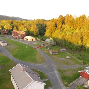
",
"dlink":"http://maps.google.com/maps?daddr=63.797915,11.568459&t=m&layer=1&doflg=ptk&hl=no&om=0",
"openpopup":"0",
"mapwidth":"800",
"mapwidthunit":"px",
"mapheight":"600",
"marker-createdby":"omlarsen",
"marker-createdon":"2017-06-28 00:00:00",
"marker-updatedby":"omlarsen",
"marker-updatedon":"2017-06-28 00:00:00",
"layerid":["42"],
"layername":"Rundt om på Stiklestad",
"layer-createdby":"omlarsen",
"layer-createdon":"2017-06-22 00:59:44",
"layer-updatedby":"omlarsen",
"layer-updatedon":"2020-09-08 11:38:59",
"controlbox":"1",
"overlays_custom":"0",
"overlays_custom2":"0",
"overlays_custom3":"0",
"overlays_custom4":"0",
"wms":"0",
"wms2":"0",
"wms3":"0",
"wms4":"0",
"wms5":"0",
"wms6":"0",
"wms7":"0",
"wms8":"0",
"wms9":"0",
"wms10":"0",
"kml_timestamp":"",
"gpx_url":"",
"gpx_panel":"0",
"mlm_filter":"1",
"mlm_filter_details":""
}},
{
"type":"Feature",
"geometry":
{
"type":"Point",
"coordinates":[11.567268,63.797867]
},
"properties":
{
"markerid":"838",
"layers":["42"],
"requested_layer":["42"],
"markername":"Uthuset til vegvokterboligen",
"basemap":"custom_basemap",
"lat":"63.797867",
"lon":"11.567268",
"icon":"Stekkstad.png",
"zoom":"17",
"iconUrl":"http://verdalsportalen.no/wp-content/uploads/leaflet-maps-marker-icons/Stekkstad.png",
"address":"",
"text":"
Uthuset til vegvokterboligen
Uthuset er en rekonstruksjon av en gammel uthusbygning fra Vemundvik ved Namsos. Utvendige mål er 11,7×5,7m. Materialene er delvis fra uthuset på Vaterholmen og en gammel låve på Hallem ved Stiklestad. Taksteinen er fra den gamle prestegårdslåna i Vuku og ei gammel masstue fra Stuskin. I uthuset hadde vegvokterfamiliene buskapen sin, som oftest ei ku, en gris og noen høner. Tunet ved vegvokterboligen fikk litt ny form i 1999. Da vart det oppsatt gjerde med grinder og det vart laga en stokkbekk og ei vassbrye for hest.
",
"dlink":"http://maps.google.com/maps?daddr=63.797867,11.567268&t=m&layer=1&doflg=ptk&hl=no&om=0",
"openpopup":"0",
"mapwidth":"800",
"mapwidthunit":"px",
"mapheight":"600",
"marker-createdby":"omlarsen",
"marker-createdon":"2017-06-28 00:00:00",
"marker-updatedby":"omlarsen",
"marker-updatedon":"2017-06-28 00:00:00",
"layerid":["42"],
"layername":"Rundt om på Stiklestad",
"layer-createdby":"omlarsen",
"layer-createdon":"2017-06-22 00:59:44",
"layer-updatedby":"omlarsen",
"layer-updatedon":"2020-09-08 11:38:59",
"controlbox":"1",
"overlays_custom":"0",
"overlays_custom2":"0",
"overlays_custom3":"0",
"overlays_custom4":"0",
"wms":"0",
"wms2":"0",
"wms3":"0",
"wms4":"0",
"wms5":"0",
"wms6":"0",
"wms7":"0",
"wms8":"0",
"wms9":"0",
"wms10":"0",
"kml_timestamp":"",
"gpx_url":"",
"gpx_panel":"0",
"mlm_filter":"1",
"mlm_filter_details":""
}},
{
"type":"Feature",
"geometry":
{
"type":"Point",
"coordinates":[11.567971,63.797808]
},
"properties":
{
"markerid":"839",
"layers":["42"],
"requested_layer":["42"],
"markername":"Jernvinneanlegget",
"basemap":"custom_basemap",
"lat":"63.797808",
"lon":"11.567971",
"icon":"Stekkstad.png",
"zoom":"18",
"iconUrl":"http://verdalsportalen.no/wp-content/uploads/leaflet-maps-marker-icons/Stekkstad.png",
"address":"",
"text":"
",
"dlink":"http://maps.google.com/maps?daddr=63.797808,11.567971&t=m&layer=1&doflg=ptk&hl=no&om=0",
"openpopup":"0",
"mapwidth":"800",
"mapwidthunit":"px",
"mapheight":"600",
"marker-createdby":"omlarsen",
"marker-createdon":"2017-06-28 00:00:00",
"marker-updatedby":"omlarsen",
"marker-updatedon":"2017-06-28 00:00:00",
"layerid":["42"],
"layername":"Rundt om på Stiklestad",
"layer-createdby":"omlarsen",
"layer-createdon":"2017-06-22 00:59:44",
"layer-updatedby":"omlarsen",
"layer-updatedon":"2020-09-08 11:38:59",
"controlbox":"1",
"overlays_custom":"0",
"overlays_custom2":"0",
"overlays_custom3":"0",
"overlays_custom4":"0",
"wms":"0",
"wms2":"0",
"wms3":"0",
"wms4":"0",
"wms5":"0",
"wms6":"0",
"wms7":"0",
"wms8":"0",
"wms9":"0",
"wms10":"0",
"kml_timestamp":"",
"gpx_url":"",
"gpx_panel":"0",
"mlm_filter":"1",
"mlm_filter_details":""
}},
{
"type":"Feature",
"geometry":
{
"type":"Point",
"coordinates":[11.566013,63.797979]
},
"properties":
{
"markerid":"840",
"layers":["42"],
"requested_layer":["42"],
"markername":"Melkrampa",
"basemap":"custom_basemap",
"lat":"63.797979",
"lon":"11.566013",
"icon":"Stekkstad.png",
"zoom":"18",
"iconUrl":"http://verdalsportalen.no/wp-content/uploads/leaflet-maps-marker-icons/Stekkstad.png",
"address":"",
"text":"
Vegvesengarasjen
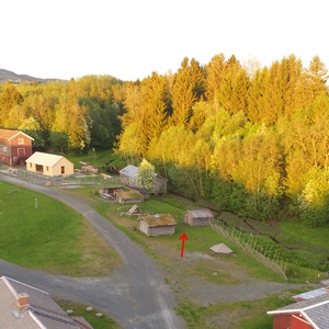
",
"dlink":"http://maps.google.com/maps?daddr=63.797979,11.566013&t=m&layer=1&doflg=ptk&hl=no&om=0",
"openpopup":"0",
"mapwidth":"800",
"mapwidthunit":"px",
"mapheight":"600",
"marker-createdby":"omlarsen",
"marker-createdon":"2017-06-28 00:00:00",
"marker-updatedby":"omlarsen",
"marker-updatedon":"2017-06-28 00:00:00",
"layerid":["42"],
"layername":"Rundt om på Stiklestad",
"layer-createdby":"omlarsen",
"layer-createdon":"2017-06-22 00:59:44",
"layer-updatedby":"omlarsen",
"layer-updatedon":"2020-09-08 11:38:59",
"controlbox":"1",
"overlays_custom":"0",
"overlays_custom2":"0",
"overlays_custom3":"0",
"overlays_custom4":"0",
"wms":"0",
"wms2":"0",
"wms3":"0",
"wms4":"0",
"wms5":"0",
"wms6":"0",
"wms7":"0",
"wms8":"0",
"wms9":"0",
"wms10":"0",
"kml_timestamp":"",
"gpx_url":"",
"gpx_panel":"0",
"mlm_filter":"1",
"mlm_filter_details":""
}},
{
"type":"Feature",
"geometry":
{
"type":"Point",
"coordinates":[11.566361,63.797896]
},
"properties":
{
"markerid":"841",
"layers":["42"],
"requested_layer":["42"],
"markername":"Uthus",
"basemap":"custom_basemap",
"lat":"63.797896",
"lon":"11.566361",
"icon":"Stekkstad.png",
"zoom":"18",
"iconUrl":"http://verdalsportalen.no/wp-content/uploads/leaflet-maps-marker-icons/Stekkstad.png",
"address":"",
"text":"
Uthuset
",
"dlink":"http://maps.google.com/maps?daddr=63.797896,11.566361&t=m&layer=1&doflg=ptk&hl=no&om=0",
"openpopup":"0",
"mapwidth":"800",
"mapwidthunit":"px",
"mapheight":"600",
"marker-createdby":"omlarsen",
"marker-createdon":"2017-06-28 00:00:00",
"marker-updatedby":"omlarsen",
"marker-updatedon":"2017-06-28 00:00:00",
"layerid":["42"],
"layername":"Rundt om på Stiklestad",
"layer-createdby":"omlarsen",
"layer-createdon":"2017-06-22 00:59:44",
"layer-updatedby":"omlarsen",
"layer-updatedon":"2020-09-08 11:38:59",
"controlbox":"1",
"overlays_custom":"0",
"overlays_custom2":"0",
"overlays_custom3":"0",
"overlays_custom4":"0",
"wms":"0",
"wms2":"0",
"wms3":"0",
"wms4":"0",
"wms5":"0",
"wms6":"0",
"wms7":"0",
"wms8":"0",
"wms9":"0",
"wms10":"0",
"kml_timestamp":"",
"gpx_url":"",
"gpx_panel":"0",
"mlm_filter":"1",
"mlm_filter_details":""
}},
{
"type":"Feature",
"geometry":
{
"type":"Point",
"coordinates":[11.566603,63.798054]
},
"properties":
{
"markerid":"842",
"layers":["42"],
"requested_layer":["42"],
"markername":"Masstua",
"basemap":"custom_basemap",
"lat":"63.798054",
"lon":"11.566603",
"icon":"Stekkstad.png",
"zoom":"18",
"iconUrl":"http://verdalsportalen.no/wp-content/uploads/leaflet-maps-marker-icons/Stekkstad.png",
"address":"",
"text":"
Masstua
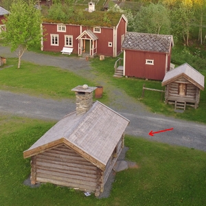
",
"dlink":"http://maps.google.com/maps?daddr=63.798054,11.566603&t=m&layer=1&doflg=ptk&hl=no&om=0",
"openpopup":"0",
"mapwidth":"800",
"mapwidthunit":"px",
"mapheight":"600",
"marker-createdby":"omlarsen",
"marker-createdon":"2017-06-28 00:00:00",
"marker-updatedby":"omlarsen",
"marker-updatedon":"2017-06-28 00:00:00",
"layerid":["42"],
"layername":"Rundt om på Stiklestad",
"layer-createdby":"omlarsen",
"layer-createdon":"2017-06-22 00:59:44",
"layer-updatedby":"omlarsen",
"layer-updatedon":"2020-09-08 11:38:59",
"controlbox":"1",
"overlays_custom":"0",
"overlays_custom2":"0",
"overlays_custom3":"0",
"overlays_custom4":"0",
"wms":"0",
"wms2":"0",
"wms3":"0",
"wms4":"0",
"wms5":"0",
"wms6":"0",
"wms7":"0",
"wms8":"0",
"wms9":"0",
"wms10":"0",
"kml_timestamp":"",
"gpx_url":"",
"gpx_panel":"0",
"mlm_filter":"1",
"mlm_filter_details":""
}},
{
"type":"Feature",
"geometry":
{
"type":"Point",
"coordinates":[11.569194,63.797943]
},
"properties":
{
"markerid":"843",
"layers":["42"],
"requested_layer":["42"],
"markername":"Lager / utstilling",
"basemap":"custom_basemap",
"lat":"63.797943",
"lon":"11.569194",
"icon":"Stekkstad.png",
"zoom":"18",
"iconUrl":"http://verdalsportalen.no/wp-content/uploads/leaflet-maps-marker-icons/Stekkstad.png",
"address":"",
"text":"
Lager / utstilling
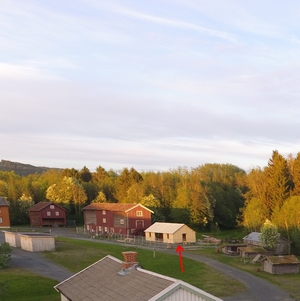
",
"dlink":"http://maps.google.com/maps?daddr=63.797943,11.569194&t=m&layer=1&doflg=ptk&hl=no&om=0",
"openpopup":"0",
"mapwidth":"800",
"mapwidthunit":"px",
"mapheight":"600",
"marker-createdby":"omlarsen",
"marker-createdon":"2017-06-28 00:00:00",
"marker-updatedby":"omlarsen",
"marker-updatedon":"2017-06-28 00:00:00",
"layerid":["42"],
"layername":"Rundt om på Stiklestad",
"layer-createdby":"omlarsen",
"layer-createdon":"2017-06-22 00:59:44",
"layer-updatedby":"omlarsen",
"layer-updatedon":"2020-09-08 11:38:59",
"controlbox":"1",
"overlays_custom":"0",
"overlays_custom2":"0",
"overlays_custom3":"0",
"overlays_custom4":"0",
"wms":"0",
"wms2":"0",
"wms3":"0",
"wms4":"0",
"wms5":"0",
"wms6":"0",
"wms7":"0",
"wms8":"0",
"wms9":"0",
"wms10":"0",
"kml_timestamp":"",
"gpx_url":"",
"gpx_panel":"0",
"mlm_filter":"1",
"mlm_filter_details":""
}},
{
"type":"Feature",
"geometry":
{
"type":"Point",
"coordinates":[11.566705,63.797900]
},
"properties":
{
"markerid":"844",
"layers":["42"],
"requested_layer":["42"],
"markername":"Stabburet til vegvokterboligen",
"basemap":"custom_basemap",
"lat":"63.797900",
"lon":"11.566705",
"icon":"Stekkstad.png",
"zoom":"18",
"iconUrl":"http://verdalsportalen.no/wp-content/uploads/leaflet-maps-marker-icons/Stekkstad.png",
"address":"",
"text":"
LStabburet til vegvokterboligen
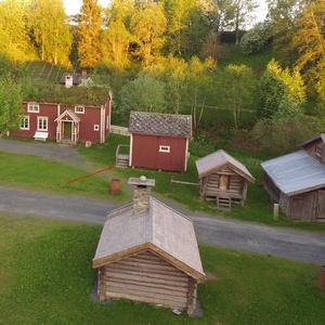
",
"dlink":"http://maps.google.com/maps?daddr=63.797900,11.566705&t=m&layer=1&doflg=ptk&hl=no&om=0",
"openpopup":"0",
"mapwidth":"800",
"mapwidthunit":"px",
"mapheight":"600",
"marker-createdby":"omlarsen",
"marker-createdon":"2017-06-28 00:00:00",
"marker-updatedby":"omlarsen",
"marker-updatedon":"2017-06-28 00:00:00",
"layerid":["42"],
"layername":"Rundt om på Stiklestad",
"layer-createdby":"omlarsen",
"layer-createdon":"2017-06-22 00:59:44",
"layer-updatedby":"omlarsen",
"layer-updatedon":"2020-09-08 11:38:59",
"controlbox":"1",
"overlays_custom":"0",
"overlays_custom2":"0",
"overlays_custom3":"0",
"overlays_custom4":"0",
"wms":"0",
"wms2":"0",
"wms3":"0",
"wms4":"0",
"wms5":"0",
"wms6":"0",
"wms7":"0",
"wms8":"0",
"wms9":"0",
"wms10":"0",
"kml_timestamp":"",
"gpx_url":"",
"gpx_panel":"0",
"mlm_filter":"1",
"mlm_filter_details":""
}},
{
"type":"Feature",
"geometry":
{
"type":"Point",
"coordinates":[11.560739,63.797872]
},
"properties":
{
"markerid":"845",
"layers":["42"],
"requested_layer":["42"],
"markername":"Slagstedet",
"basemap":"custom_basemap",
"lat":"63.797872",
"lon":"11.560739",
"icon":"Stekkstad.png",
"zoom":"17",
"iconUrl":"http://verdalsportalen.no/wp-content/uploads/leaflet-maps-marker-icons/Stekkstad.png",
"address":"",
"text":"
",
"dlink":"http://maps.google.com/maps?daddr=63.797872,11.560739&t=m&layer=1&doflg=ptk&hl=no&om=0",
"openpopup":"0",
"mapwidth":"800",
"mapwidthunit":"px",
"mapheight":"600",
"marker-createdby":"omlarsen",
"marker-createdon":"2017-06-28 00:00:00",
"marker-updatedby":"omlarsen",
"marker-updatedon":"2017-06-29 00:00:00",
"layerid":["42"],
"layername":"Rundt om på Stiklestad",
"layer-createdby":"omlarsen",
"layer-createdon":"2017-06-22 00:59:44",
"layer-updatedby":"omlarsen",
"layer-updatedon":"2020-09-08 11:38:59",
"controlbox":"1",
"overlays_custom":"0",
"overlays_custom2":"0",
"overlays_custom3":"0",
"overlays_custom4":"0",
"wms":"0",
"wms2":"0",
"wms3":"0",
"wms4":"0",
"wms5":"0",
"wms6":"0",
"wms7":"0",
"wms8":"0",
"wms9":"0",
"wms10":"0",
"kml_timestamp":"",
"gpx_url":"",
"gpx_panel":"0",
"mlm_filter":"1",
"mlm_filter_details":""
}},
{
"type":"Feature",
"geometry":
{
"type":"Point",
"coordinates":[11.521826,63.796594]
},
"properties":
{
"markerid":"846",
"layers":["42"],
"requested_layer":["42"],
"markername":"Kirka på Haug.",
"basemap":"custom_basemap",
"lat":"63.796594",
"lon":"11.521826",
"icon":"sight-2.png",
"zoom":"17",
"iconUrl":"http://verdalsportalen.no/wp-content/uploads/leaflet-maps-marker-icons/sight-2.png",
"address":"",
"text":"
",
"dlink":"http://maps.google.com/maps?daddr=63.796594,11.521826&t=m&layer=1&doflg=ptk&hl=no&om=0",
"openpopup":"0",
"mapwidth":"800",
"mapwidthunit":"px",
"mapheight":"700",
"marker-createdby":"omlarsen",
"marker-createdon":"2017-06-24 00:00:00",
"marker-updatedby":"omlarsen",
"marker-updatedon":"2017-06-29 00:00:00",
"layerid":["42"],
"layername":"Rundt om på Stiklestad",
"layer-createdby":"omlarsen",
"layer-createdon":"2017-06-22 00:59:44",
"layer-updatedby":"omlarsen",
"layer-updatedon":"2020-09-08 11:38:59",
"controlbox":"1",
"overlays_custom":"0",
"overlays_custom2":"0",
"overlays_custom3":"0",
"overlays_custom4":"0",
"wms":"0",
"wms2":"0",
"wms3":"0",
"wms4":"0",
"wms5":"0",
"wms6":"0",
"wms7":"0",
"wms8":"0",
"wms9":"0",
"wms10":"0",
"kml_timestamp":"",
"gpx_url":"",
"gpx_panel":"0",
"mlm_filter":"1",
"mlm_filter_details":""
}},
{
"type":"Feature",
"geometry":
{
"type":"Point",
"coordinates":[11.480270,63.759200]
},
"properties":
{
"markerid":"848",
"layers":["7"],
"requested_layer":["7"],
"markername":"Rambowski-steinen",
"basemap":"googleLayer_satellite",
"lat":"63.759200",
"lon":"11.480270",
"icon":"blank_black.png",
"zoom":"18",
"iconUrl":"http://verdalsportalen.no/wp-content/uploads/leaflet-maps-marker-icons/blank_black.png",
"address":"",
"text":"
Rambowskisteinen.
Gps-posisjon: 63.759200 / 11.480270
",
"dlink":"http://maps.google.com/maps?daddr=63.759200,11.480270&t=m&layer=1&doflg=ptk&hl=no&om=0",
"openpopup":"1",
"mapwidth":"800",
"mapwidthunit":"px",
"mapheight":"600",
"marker-createdby":"omlarsen",
"marker-createdon":"2017-07-08 00:00:00",
"marker-updatedby":"omlarsen",
"marker-updatedon":"2017-07-09 00:00:00",
"layerid":["7"],
"layername":"Steiner / varder",
"layer-createdby":"omlarsen",
"layer-createdon":"2017-05-26 00:00:00",
"layer-updatedby":"omlarsen",
"layer-updatedon":"2017-11-09 00:44:02",
"controlbox":"1",
"overlays_custom":"0",
"overlays_custom2":"0",
"overlays_custom3":"0",
"overlays_custom4":"0",
"wms":"0",
"wms2":"0",
"wms3":"0",
"wms4":"0",
"wms5":"0",
"wms6":"0",
"wms7":"0",
"wms8":"0",
"wms9":"0",
"wms10":"0",
"kml_timestamp":"",
"gpx_url":"http://verdalsportalen.no/Gps_spor/Rambowski-steinen.gpx",
"gpx_panel":"1",
"mlm_filter":"1",
"mlm_filter_details":""
}},
{
"type":"Feature",
"geometry":
{
"type":"Point",
"coordinates":[11.515260,63.796550]
},
"properties":
{
"markerid":"849",
"layers":["5"],
"requested_layer":["5"],
"markername":"",
"basemap":"custom_basemap",
"lat":"63.796550",
"lon":"11.515260",
"icon":"sight-2.png",
"zoom":"15",
"iconUrl":"http://verdalsportalen.no/wp-content/uploads/leaflet-maps-marker-icons/sight-2.png",
"address":"",
"text":"
",
"dlink":"http://maps.google.com/maps?daddr=63.796550,11.515260&t=m&layer=1&doflg=ptk&hl=no&om=0",
"openpopup":"0",
"mapwidth":"800",
"mapwidthunit":"px",
"mapheight":"600",
"marker-createdby":"omlarsen",
"marker-createdon":"2017-07-10 01:38:15",
"marker-updatedby":"omlarsen",
"marker-updatedon":"2017-07-10 01:38:16",
"layerid":["5"],
"layername":"Historiske steder",
"layer-createdby":"omlarsen",
"layer-createdon":"2017-03-28 00:00:00",
"layer-updatedby":"omlarsen",
"layer-updatedon":"2017-06-21 15:09:46",
"controlbox":"1",
"overlays_custom":"0",
"overlays_custom2":"0",
"overlays_custom3":"0",
"overlays_custom4":"0",
"wms":"0",
"wms2":"0",
"wms3":"0",
"wms4":"0",
"wms5":"0",
"wms6":"0",
"wms7":"0",
"wms8":"0",
"wms9":"0",
"wms10":"0",
"kml_timestamp":"",
"gpx_url":"",
"gpx_panel":"0",
"mlm_filter":"1",
"mlm_filter_details":""
}},
{
"type":"Feature",
"geometry":
{
"type":"Point",
"coordinates":[11.712112,63.749649]
},
"properties":
{
"markerid":"894",
"layers":["5"],
"requested_layer":["5"],
"markername":"Stene skanse",
"basemap":"googleLayer_satellite",
"lat":"63.749649",
"lon":"11.712112",
"icon":"sight-2.png",
"zoom":"13",
"iconUrl":"http://verdalsportalen.no/wp-content/uploads/leaflet-maps-marker-icons/sight-2.png",
"address":"",
"text":"
",
"dlink":"http://maps.google.com/maps?daddr=63.749649,11.712112&t=m&layer=1&doflg=ptk&hl=no&om=0",
"openpopup":"0",
"mapwidth":"640",
"mapwidthunit":"px",
"mapheight":"480",
"marker-createdby":"omlarsen",
"marker-createdon":"2017-07-26 00:00:00",
"marker-updatedby":"omlarsen",
"marker-updatedon":"2017-07-26 00:00:00",
"layerid":["5"],
"layername":"Historiske steder",
"layer-createdby":"omlarsen",
"layer-createdon":"2017-03-28 00:00:00",
"layer-updatedby":"omlarsen",
"layer-updatedon":"2017-06-21 15:09:46",
"controlbox":"1",
"overlays_custom":"0",
"overlays_custom2":"0",
"overlays_custom3":"0",
"overlays_custom4":"0",
"wms":"0",
"wms2":"0",
"wms3":"0",
"wms4":"0",
"wms5":"0",
"wms6":"0",
"wms7":"0",
"wms8":"0",
"wms9":"0",
"wms10":"0",
"kml_timestamp":"",
"gpx_url":"",
"gpx_panel":"0",
"mlm_filter":"1",
"mlm_filter_details":""
}},
{
"type":"Feature",
"geometry":
{
"type":"Point",
"coordinates":[11.526310,63.772853]
},
"properties":
{
"markerid":"902",
"layers":["47","7"],
"requested_layer":["7"],
"markername":"Gravhaug og stein i Vinne.",
"basemap":"custom_basemap",
"lat":"63.772853",
"lon":"11.526310",
"icon":"letter_g.png",
"zoom":"14",
"iconUrl":"http://verdalsportalen.no/wp-content/uploads/leaflet-maps-marker-icons/letter_g.png",
"address":"",
"text":"
Gps-posisjon: 63.772853 / 11.526310

",
"dlink":"http://maps.google.com/maps?daddr=63.772853,11.526310&t=m&layer=1&doflg=ptk&hl=no&om=0",
"openpopup":"0",
"mapwidth":"800",
"mapwidthunit":"px",
"mapheight":"600",
"marker-createdby":"omlarsen",
"marker-createdon":"2017-07-29 00:00:00",
"marker-updatedby":"omlarsen",
"marker-updatedon":"2017-07-30 00:00:00",
"layerid":["47", "7"],
"layername":"Steiner / varder",
"layer-createdby":"omlarsen",
"layer-createdon":"2017-05-26 00:00:00",
"layer-updatedby":"omlarsen",
"layer-updatedon":"2017-11-09 00:44:02",
"controlbox":"1",
"overlays_custom":"0",
"overlays_custom2":"0",
"overlays_custom3":"0",
"overlays_custom4":"0",
"wms":"0",
"wms2":"0",
"wms3":"0",
"wms4":"0",
"wms5":"0",
"wms6":"0",
"wms7":"0",
"wms8":"0",
"wms9":"0",
"wms10":"0",
"kml_timestamp":"",
"gpx_url":"",
"gpx_panel":"0",
"mlm_filter":"1",
"mlm_filter_details":""
}},
{
"type":"Feature",
"geometry":
{
"type":"Point",
"coordinates":[11.526310,63.772853]
},
"properties":
{
"markerid":"902",
"layers":["47","7"],
"requested_layer":["7"],
"markername":"Gravhaug og stein i Vinne.",
"basemap":"custom_basemap",
"lat":"63.772853",
"lon":"11.526310",
"icon":"letter_g.png",
"zoom":"14",
"iconUrl":"http://verdalsportalen.no/wp-content/uploads/leaflet-maps-marker-icons/letter_g.png",
"address":"",
"text":"
Gps-posisjon: 63.772853 / 11.526310
",
"dlink":"http://maps.google.com/maps?daddr=63.772853,11.526310&t=m&layer=1&doflg=ptk&hl=no&om=0",
"openpopup":"0",
"mapwidth":"800",
"mapwidthunit":"px",
"mapheight":"600",
"marker-createdby":"omlarsen",
"marker-createdon":"2017-07-29 00:00:00",
"marker-updatedby":"omlarsen",
"marker-updatedon":"2017-07-30 00:00:00",
"layerid":["47", "7"],
"layername":"Gravhauger",
"layer-createdby":"omlarsen",
"layer-createdon":"2017-07-29 13:32:01",
"layer-updatedby":"omlarsen",
"layer-updatedon":"2017-07-29 18:29:10",
"controlbox":"1",
"overlays_custom":"0",
"overlays_custom2":"0",
"overlays_custom3":"0",
"overlays_custom4":"0",
"wms":"0",
"wms2":"0",
"wms3":"0",
"wms4":"0",
"wms5":"0",
"wms6":"0",
"wms7":"0",
"wms8":"0",
"wms9":"0",
"wms10":"0",
"kml_timestamp":"",
"gpx_url":"",
"gpx_panel":"0",
"mlm_filter":"1",
"mlm_filter_details":""
}},
{
"type":"Feature",
"geometry":
{
"type":"Point",
"coordinates":[11.619050,63.762240]
},
"properties":
{
"markerid":"908",
"layers":["6"],
"requested_layer":["6"],
"markername":"Lysthaugen",
"basemap":"custom_basemap ",
"lat":"63.762240",
"lon":"11.619050",
"icon":"Utsiktspunkt.png",
"zoom":"16",
"iconUrl":"http://verdalsportalen.no/wp-content/uploads/leaflet-maps-marker-icons/Utsiktspunkt.png",
"address":"",
"text":"
Utsiktspunkt til nordre side av område for Verdalsraser. Siktepunkter til enkelte gårder.
Gps-posisjon: 63.76224 / 11.61905
Turistattraksjon.
",
"dlink":"http://maps.google.com/maps?daddr=63.762240,11.619050&t=m&layer=1&doflg=ptk&hl=no&om=0",
"openpopup":"0",
"mapwidth":"640",
"mapwidthunit":"px",
"mapheight":"480",
"marker-createdby":"kadillan",
"marker-createdon":"2017-07-30 00:00:00",
"marker-updatedby":"kadillan",
"marker-updatedon":"2017-07-30 00:00:00",
"layerid":["6"],
"layername":"Utsiktspunkt",
"layer-createdby":"oml",
"layer-createdon":"2017-06-01 00:00:00",
"layer-updatedby":"omlarsen",
"layer-updatedon":"2017-06-01 00:00:00",
"controlbox":"1",
"overlays_custom":"0",
"overlays_custom2":"0",
"overlays_custom3":"0",
"overlays_custom4":"0",
"wms":"0",
"wms2":"0",
"wms3":"0",
"wms4":"0",
"wms5":"0",
"wms6":"0",
"wms7":"0",
"wms8":"0",
"wms9":"0",
"wms10":"0",
"kml_timestamp":"2017-07-30 00:00:00",
"gpx_url":"",
"gpx_panel":"0",
"mlm_filter":"1",
"mlm_filter_details":""
}},
{
"type":"Feature",
"geometry":
{
"type":"Point",
"coordinates":[11.769330,63.769540]
},
"properties":
{
"markerid":"907",
"layers":["6"],
"requested_layer":["6"],
"markername":"Tomtberget",
"basemap":"custom_basemap ",
"lat":"63.769540",
"lon":"11.769330",
"icon":"Utsiktspunkt.png",
"zoom":"16",
"iconUrl":"http://verdalsportalen.no/wp-content/uploads/leaflet-maps-marker-icons/Utsiktspunkt.png",
"address":"",
"text":"
Tomtberget
Gps-posisjon: 63.76954 / 11.76933
Utsikt utover Vuku og nedover bøgda. Adkomst via Årstadbakkan over Gretehella, eller via Sagmoen. (Bratt).
",
"dlink":"http://maps.google.com/maps?daddr=63.769540,11.769330&t=m&layer=1&doflg=ptk&hl=no&om=0",
"openpopup":"0",
"mapwidth":"640",
"mapwidthunit":"px",
"mapheight":"480",
"marker-createdby":"kadillan",
"marker-createdon":"2017-07-30 00:00:00",
"marker-updatedby":"kadillan",
"marker-updatedon":"2017-07-30 00:00:00",
"layerid":["6"],
"layername":"Utsiktspunkt",
"layer-createdby":"oml",
"layer-createdon":"2017-06-01 00:00:00",
"layer-updatedby":"omlarsen",
"layer-updatedon":"2017-06-01 00:00:00",
"controlbox":"1",
"overlays_custom":"0",
"overlays_custom2":"0",
"overlays_custom3":"0",
"overlays_custom4":"0",
"wms":"0",
"wms2":"0",
"wms3":"0",
"wms4":"0",
"wms5":"0",
"wms6":"0",
"wms7":"0",
"wms8":"0",
"wms9":"0",
"wms10":"0",
"kml_timestamp":"2017-07-30 00:00:00",
"gpx_url":"",
"gpx_panel":"0",
"mlm_filter":"1",
"mlm_filter_details":""
}},
{
"type":"Feature",
"geometry":
{
"type":"Point",
"coordinates":[11.631660,63.794850]
},
"properties":
{
"markerid":"909",
"layers":["6"],
"requested_layer":["6"],
"markername":"Gjermstadhøgda",
"basemap":"custom_basemap ",
"lat":"63.794850",
"lon":"11.631660",
"icon":"Utsiktspunkt.png",
"zoom":"16",
"iconUrl":"http://verdalsportalen.no/wp-content/uploads/leaflet-maps-marker-icons/Utsiktspunkt.png",
"address":"",
"text":"
Utsiktspunkt til søndre deler av område for Verdalsraset. Siktepunkter til enkelte gårder.
Gps-posisjon: 63.79485 / 11.63166
Turistattraksjon.
",
"dlink":"http://maps.google.com/maps?daddr=63.794850,11.631660&t=m&layer=1&doflg=ptk&hl=no&om=0",
"openpopup":"0",
"mapwidth":"640",
"mapwidthunit":"px",
"mapheight":"480",
"marker-createdby":"kadillan",
"marker-createdon":"2017-07-30 00:00:00",
"marker-updatedby":"kadillan",
"marker-updatedon":"2017-07-30 00:00:00",
"layerid":["6"],
"layername":"Utsiktspunkt",
"layer-createdby":"oml",
"layer-createdon":"2017-06-01 00:00:00",
"layer-updatedby":"omlarsen",
"layer-updatedon":"2017-06-01 00:00:00",
"controlbox":"1",
"overlays_custom":"0",
"overlays_custom2":"0",
"overlays_custom3":"0",
"overlays_custom4":"0",
"wms":"0",
"wms2":"0",
"wms3":"0",
"wms4":"0",
"wms5":"0",
"wms6":"0",
"wms7":"0",
"wms8":"0",
"wms9":"0",
"wms10":"0",
"kml_timestamp":"2017-07-30 00:00:00",
"gpx_url":"",
"gpx_panel":"0",
"mlm_filter":"1",
"mlm_filter_details":""
}},
{
"type":"Feature",
"geometry":
{
"type":"Point",
"coordinates":[11.571180,63.636320]
},
"properties":
{
"markerid":"910",
"layers":["7"],
"requested_layer":["7"],
"markername":"Sofiesteinen",
"basemap":"custom_basemap ",
"lat":"63.636320",
"lon":"11.571180",
"icon":"blank_black.png ",
"zoom":"16",
"iconUrl":"http://verdalsportalen.no/wp-content/uploads/leaflet-maps-marker-icons/blank_black.png ",
"address":"",
"text":"
",
"dlink":"http://maps.google.com/maps?daddr=63.636320,11.571180&t=m&layer=1&doflg=ptk&hl=no&om=0",
"openpopup":"0",
"mapwidth":"640",
"mapwidthunit":"px",
"mapheight":"480",
"marker-createdby":"kadillan",
"marker-createdon":"2017-07-30 00:00:00",
"marker-updatedby":"kadillan",
"marker-updatedon":"2017-07-31 00:00:00",
"layerid":["7"],
"layername":"Steiner / varder",
"layer-createdby":"omlarsen",
"layer-createdon":"2017-05-26 00:00:00",
"layer-updatedby":"omlarsen",
"layer-updatedon":"2017-11-09 00:44:02",
"controlbox":"1",
"overlays_custom":"0",
"overlays_custom2":"0",
"overlays_custom3":"0",
"overlays_custom4":"0",
"wms":"0",
"wms2":"0",
"wms3":"0",
"wms4":"0",
"wms5":"0",
"wms6":"0",
"wms7":"0",
"wms8":"0",
"wms9":"0",
"wms10":"0",
"kml_timestamp":"2017-07-30 00:00:00",
"gpx_url":"",
"gpx_panel":"0",
"mlm_filter":"1",
"mlm_filter_details":""
}},
{
"type":"Feature",
"geometry":
{
"type":"Point",
"coordinates":[11.608569,63.638530]
},
"properties":
{
"markerid":"911",
"layers":["7"],
"requested_layer":["7"],
"markername":"Sigurdsteinen",
"basemap":"custom_basemap",
"lat":"63.638530",
"lon":"11.608569",
"icon":"blank_black.png",
"zoom":"16",
"iconUrl":"http://verdalsportalen.no/wp-content/uploads/leaflet-maps-marker-icons/blank_black.png",
"address":"",
"text":"
Gps-posisjon: 63.638530 / 11.608569
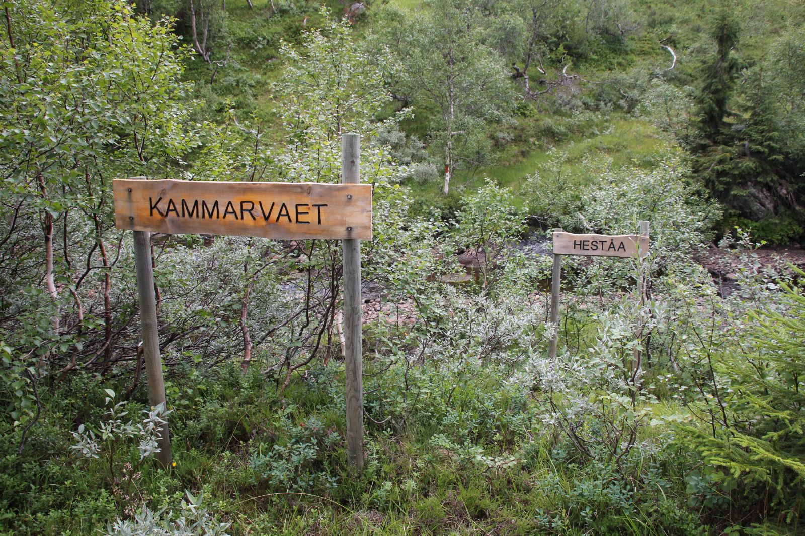 Minnestein over gjetergutten Sigurd Guddingsmo.
 Sigurd Sefaniasen Guddingsmo (1892-1907) var gjeter på Leirfall-fera. Denne sommeren gikk han også for presten i Stiklestad kirke og skulle konfirmeres samme høst. Den turen en gang per uke tok ca 17 timer! Da ulykken skjedde hadde det regnet kraftig i området i 2 døgn og elver og bekker var flomstore. På veg innover var han innom i Buran hvor han ble advart mot å fortsette turen. Sigurd trosset advarslene og fortsatte mot Leirfall-fera. Da han skulle krysse Heståa ved Kammarvaet, har det gått galt og Sigurd ble tatt av vannmassene og ført med strømmen nedover Salthammerfossan og ble funnet noen dager senere ute på myrene mot Reinssjøen.
I Nordre Trondhjems Amtstidende av 12. august 1907 kan en lese: "Liget var sterkt forslaaet da hele elvebunden nedover er opfyldt af store stene. Liget var ført med strømmen en temmelig lang strekning".
Les om avdukinga av steinen her. ",
"dlink":"http://maps.google.com/maps?daddr=63.638530,11.608569&t=m&layer=1&doflg=ptk&hl=no&om=0",
"openpopup":"0",
"mapwidth":"640",
"mapwidthunit":"px",
"mapheight":"480",
"marker-createdby":"kadillan",
"marker-createdon":"2017-07-30 00:00:00",
"marker-updatedby":"omlarsen",
"marker-updatedon":"2018-06-20 00:00:00",
"layerid":["7"],
"layername":"Steiner / varder",
"layer-createdby":"omlarsen",
"layer-createdon":"2017-05-26 00:00:00",
"layer-updatedby":"omlarsen",
"layer-updatedon":"2017-11-09 00:44:02",
"controlbox":"1",
"overlays_custom":"0",
"overlays_custom2":"0",
"overlays_custom3":"0",
"overlays_custom4":"0",
"wms":"0",
"wms2":"0",
"wms3":"0",
"wms4":"0",
"wms5":"0",
"wms6":"0",
"wms7":"0",
"wms8":"0",
"wms9":"0",
"wms10":"0",
"kml_timestamp":"2017-07-30 00:00:00",
"gpx_url":"",
"gpx_panel":"0",
"mlm_filter":"1",
"mlm_filter_details":""
}},
{
"type":"Feature",
"geometry":
{
"type":"Point",
"coordinates":[11.696440,63.753590]
},
"properties":
{
"markerid":"912",
"layers":["7"],
"requested_layer":["7"],
"markername":"Dragonen på Levring",
"basemap":"custom_basemap ",
"lat":"63.753590",
"lon":"11.696440",
"icon":"blank_black.png",
"zoom":"16",
"iconUrl":"http://verdalsportalen.no/wp-content/uploads/leaflet-maps-marker-icons/blank_black.png",
"address":"",
"text":"

br />
Minnestein etter Stor-Ingvald, som falt her i slaget mot Karolinerne i 1718. Gps-posisjon: 63.75359 / 11.69644
Minnesmerke.
",
"dlink":"http://maps.google.com/maps?daddr=63.753590,11.696440&t=m&layer=1&doflg=ptk&hl=no&om=0",
"openpopup":"0",
"mapwidth":"640",
"mapwidthunit":"px",
"mapheight":"480",
"marker-createdby":"kadillan",
"marker-createdon":"2017-07-30 00:00:00",
"marker-updatedby":"kadillan",
"marker-updatedon":"2017-07-30 00:00:00",
"layerid":["7"],
"layername":"Steiner / varder",
"layer-createdby":"omlarsen",
"layer-createdon":"2017-05-26 00:00:00",
"layer-updatedby":"omlarsen",
"layer-updatedon":"2017-11-09 00:44:02",
"controlbox":"1",
"overlays_custom":"0",
"overlays_custom2":"0",
"overlays_custom3":"0",
"overlays_custom4":"0",
"wms":"0",
"wms2":"0",
"wms3":"0",
"wms4":"0",
"wms5":"0",
"wms6":"0",
"wms7":"0",
"wms8":"0",
"wms9":"0",
"wms10":"0",
"kml_timestamp":"2017-07-30 00:00:00",
"gpx_url":"",
"gpx_panel":"0",
"mlm_filter":"1",
"mlm_filter_details":""
}},
{
"type":"Feature",
"geometry":
{
"type":"Point",
"coordinates":[11.769130,63.736060]
},
"properties":
{
"markerid":"913",
"layers":["7"],
"requested_layer":["7"],
"markername":"Ole Skavhaug",
"basemap":"custom_basemap ",
"lat":"63.736060",
"lon":"11.769130",
"icon":"blank_black.png",
"zoom":"16",
"iconUrl":"http://verdalsportalen.no/wp-content/uploads/leaflet-maps-marker-icons/blank_black.png",
"address":"",
"text":"
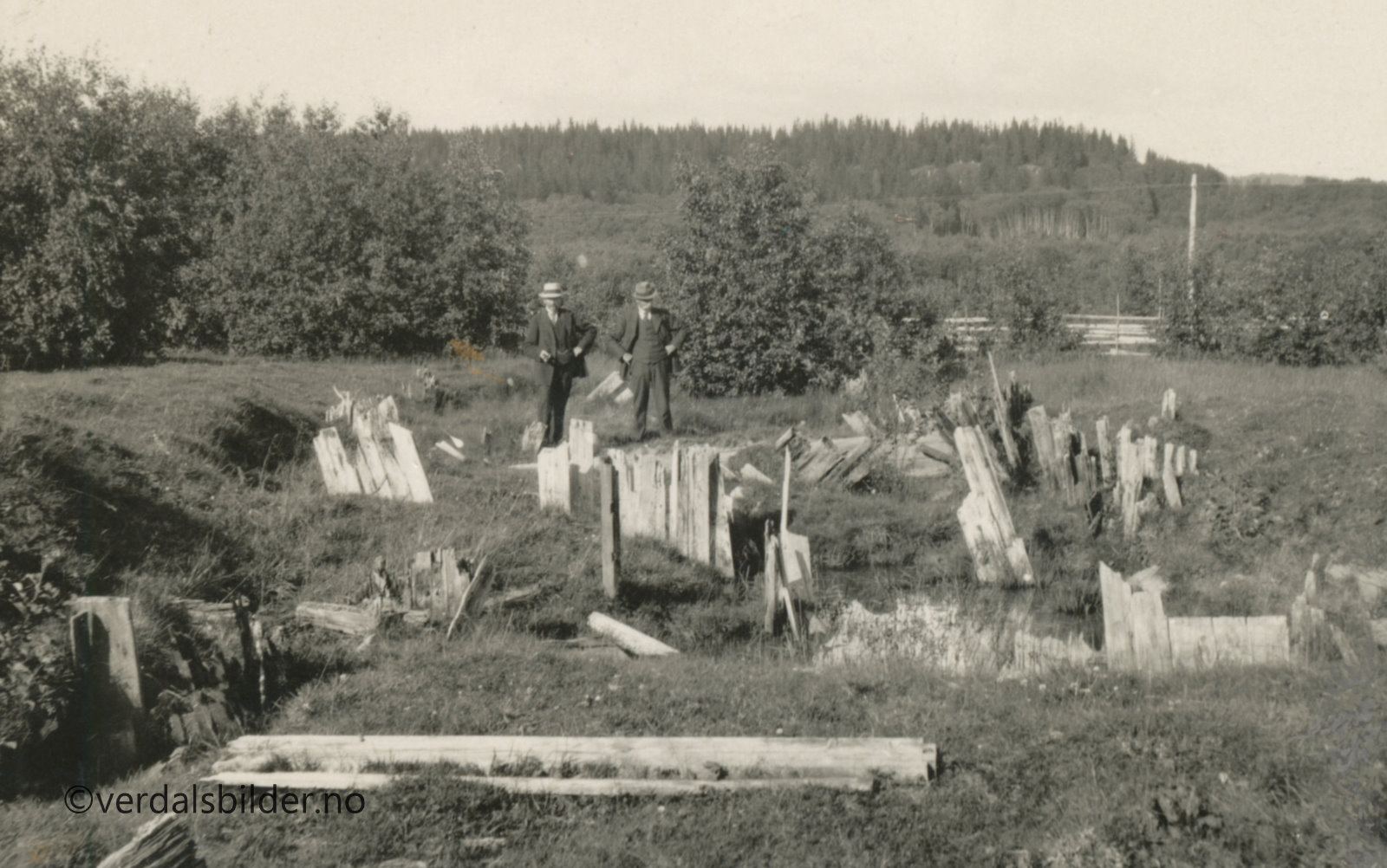
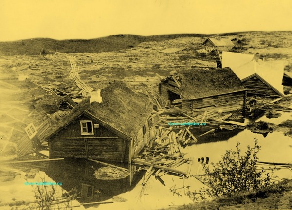


 Bautasteinen på Eide står i dag på en gravrøys, like ved veien. Deler av røysa er forsvunnet, sikkert ved bygging av veien. En del av haugens opprinnelig byggemateriale er nok også blitt en del av åkeren rundt. Men på dette høydedraget har det tidligere ligget flere gravanlegg – til dels store, om vi skal tro de skriftlige kildene. Om steinen på Eide sier Gerhard Schøning (1774) at den står «på en liten Høi«, og at steinen var flyttet fra en annen haug og til det sted den da hadde. Men det er nok mer sannsynlig at steinen står på sin opprinnelige plass.


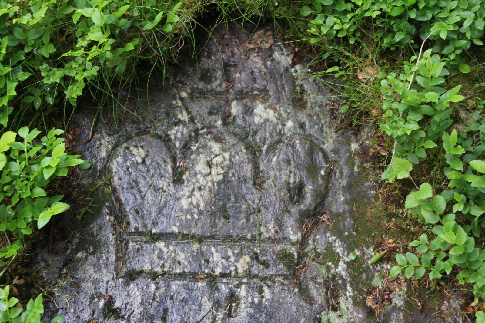
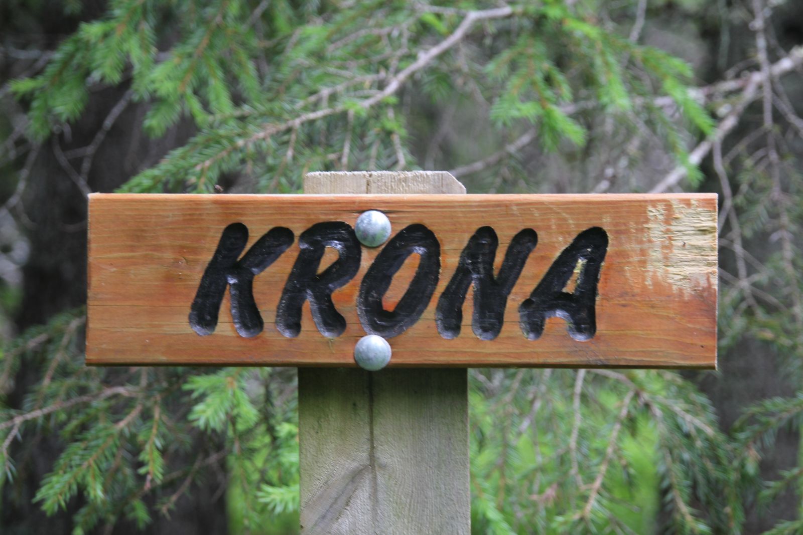
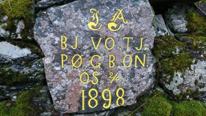
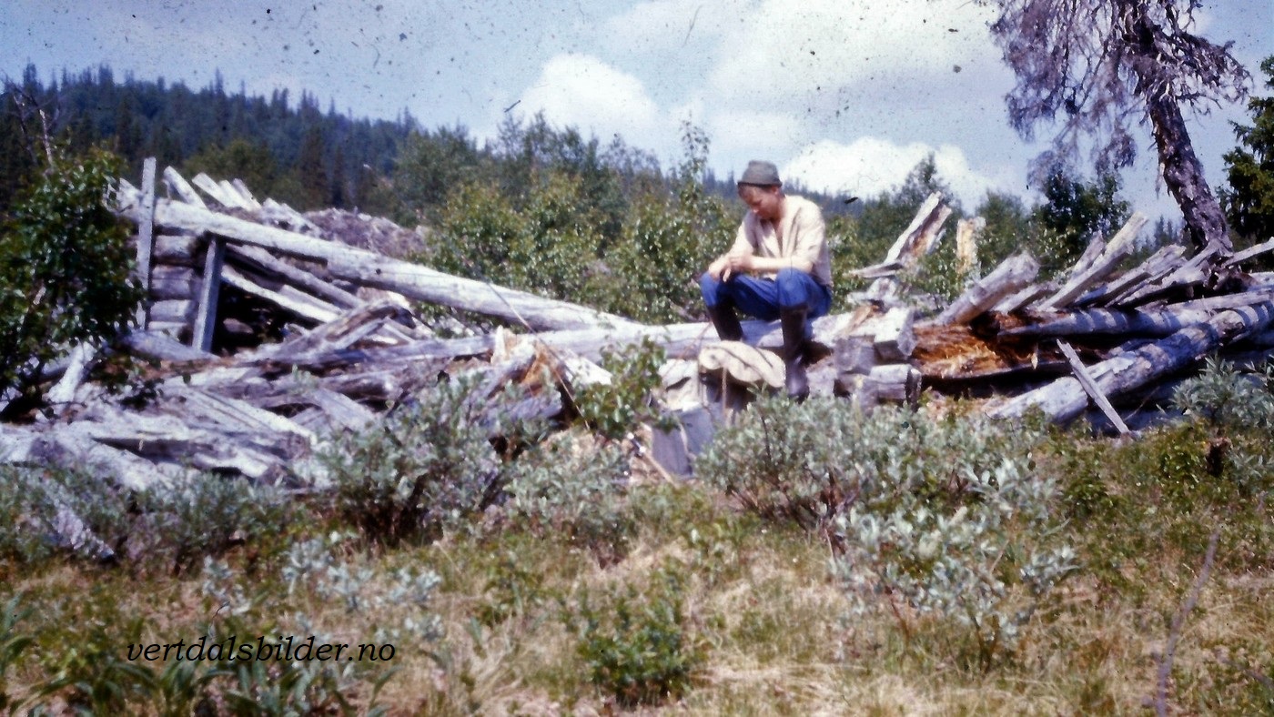
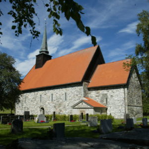
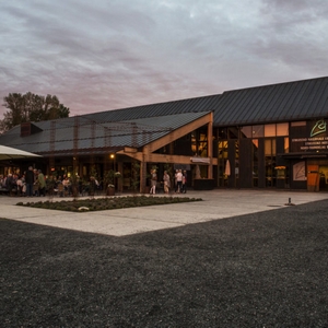 Les mer om kultursenteret som ble åpnet i 1992
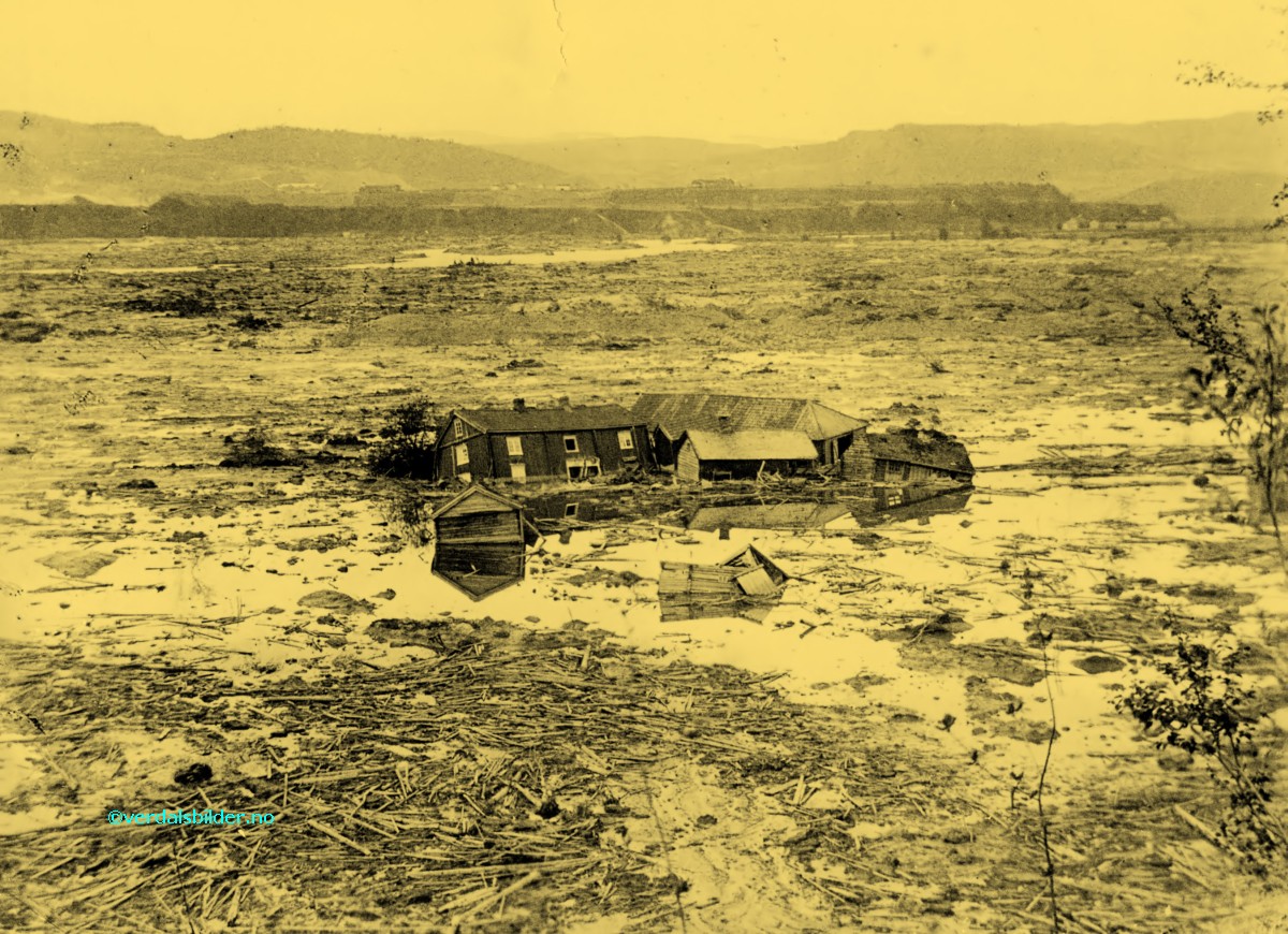
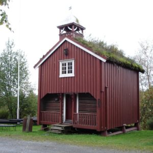
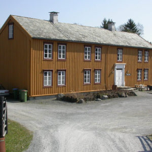
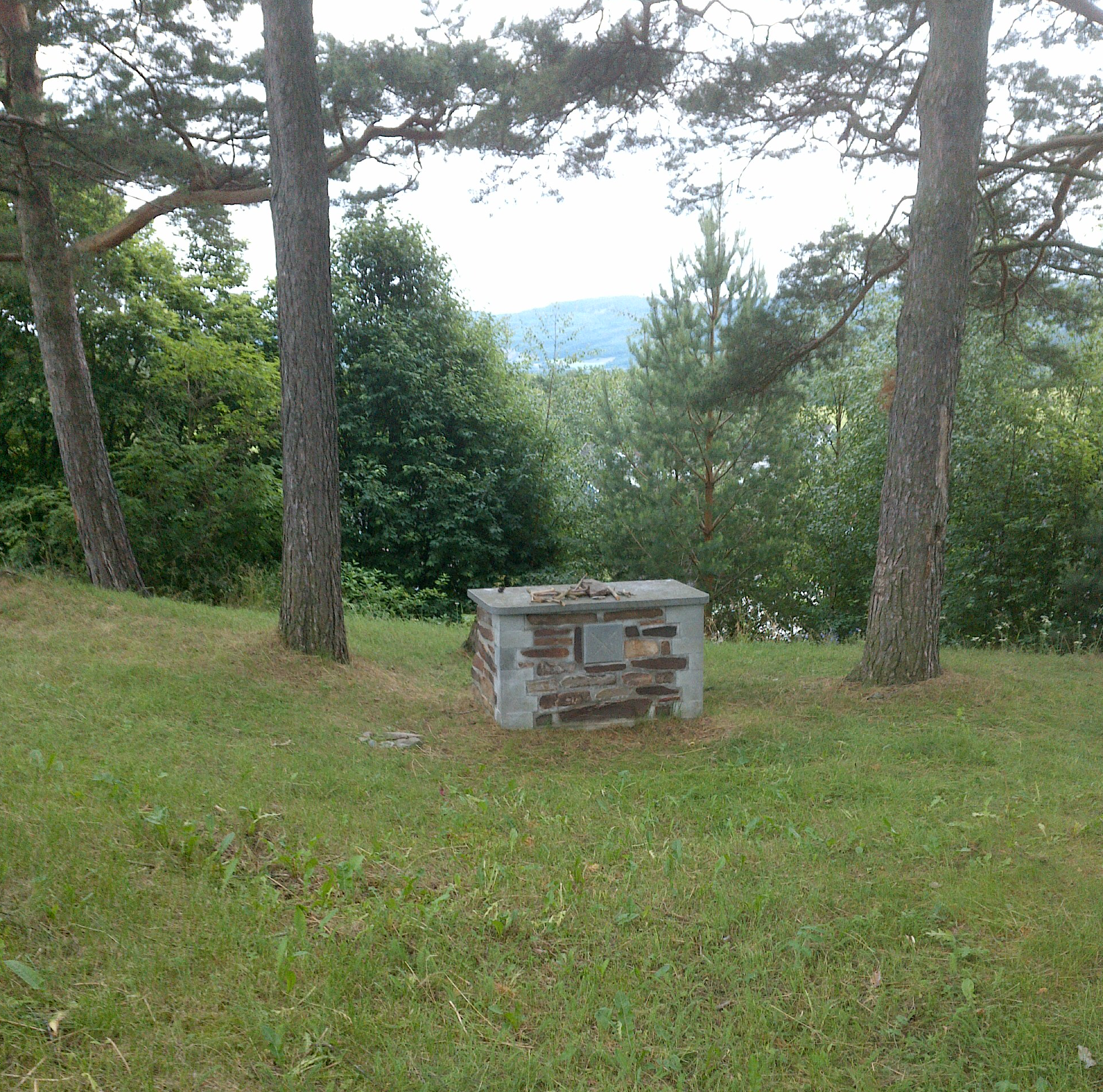
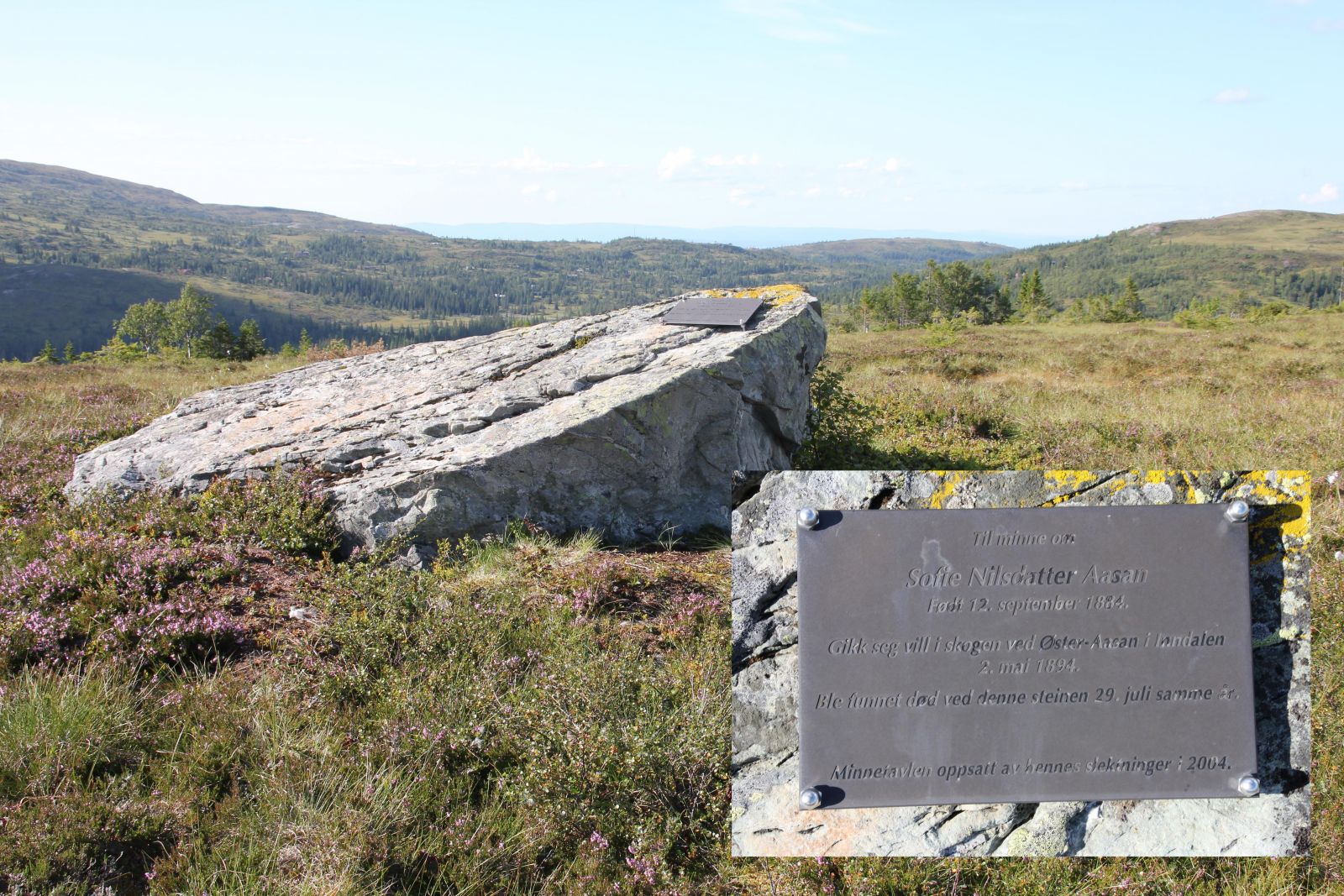
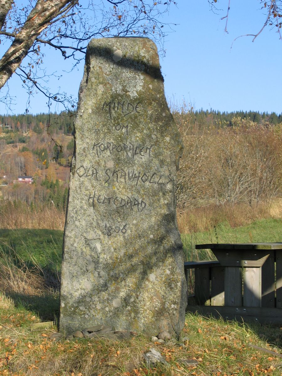
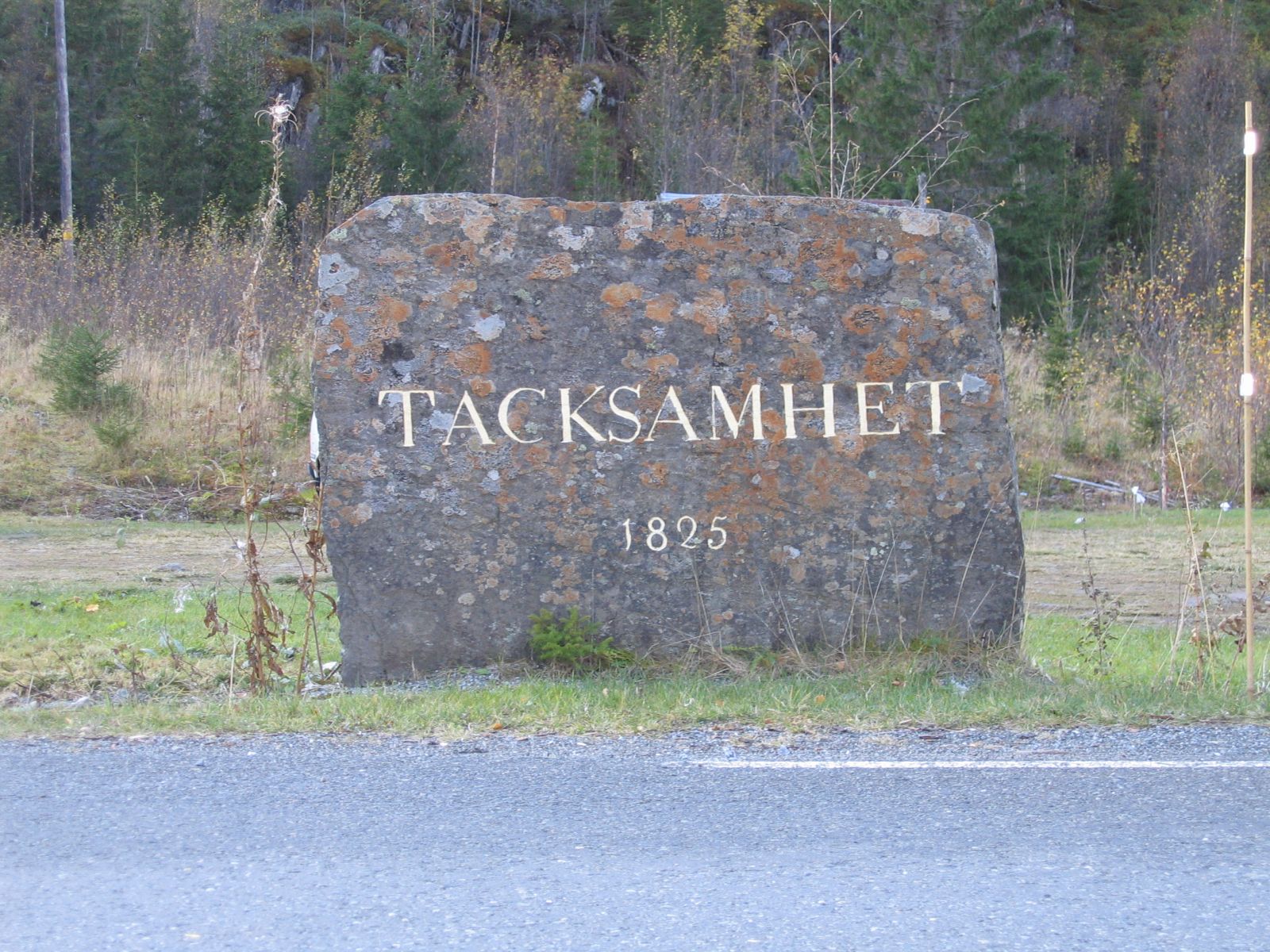
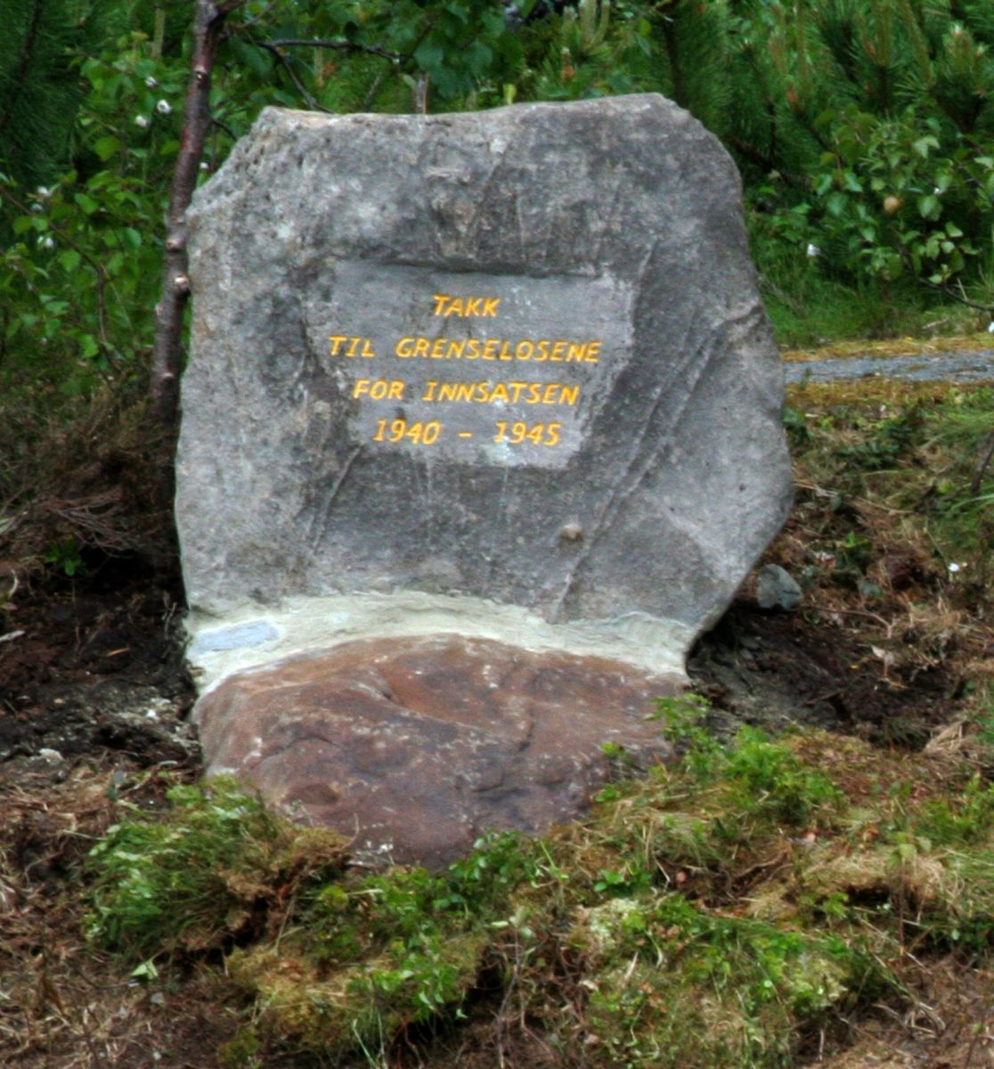

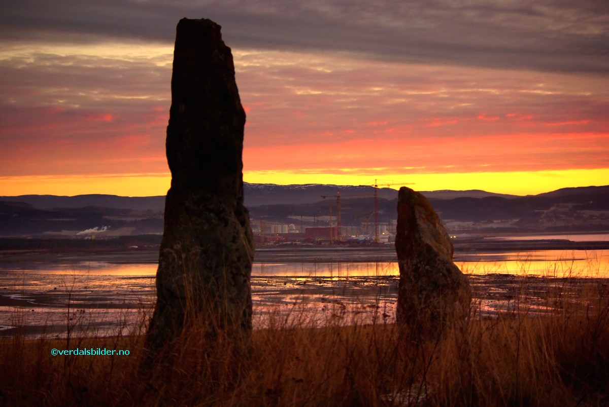
.jpg "Bjønnhiet i Grensklompen- Klikk for stort bilde")

- Klikk for stort bilde")

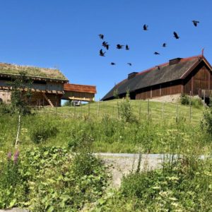
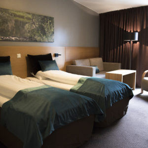
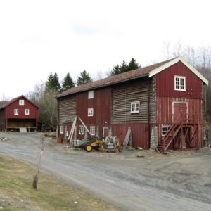
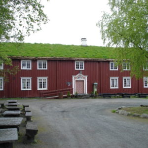
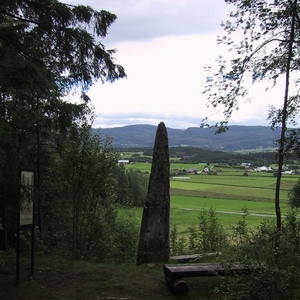
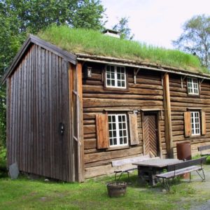
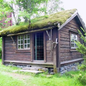

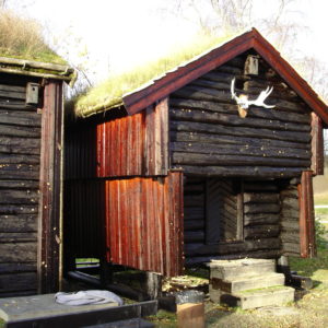
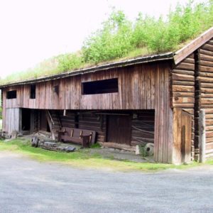
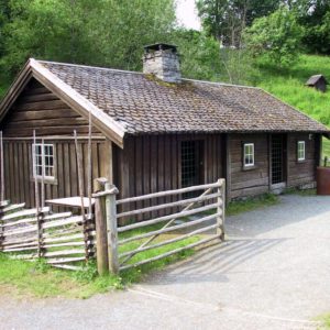
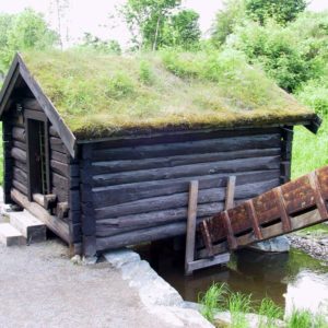
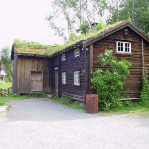
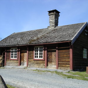
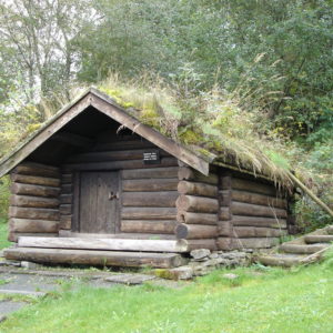
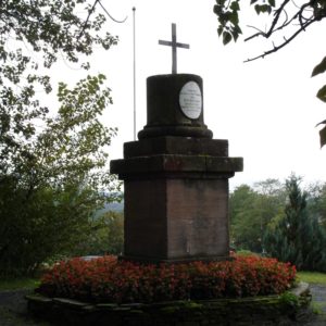
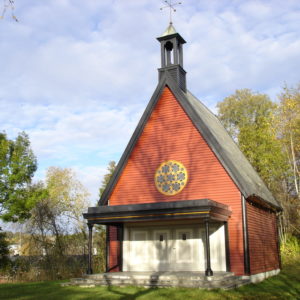
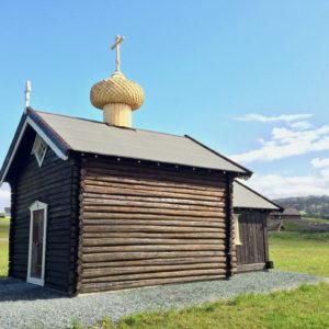
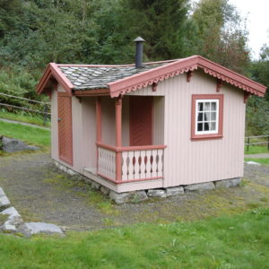
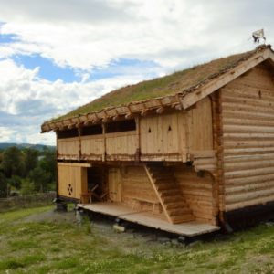

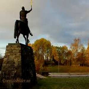
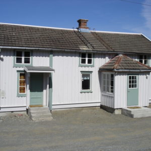
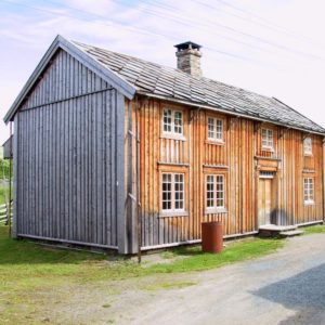
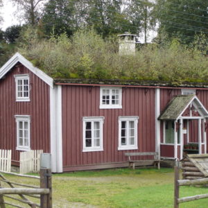
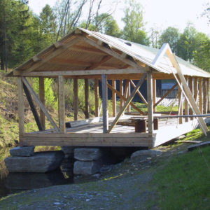
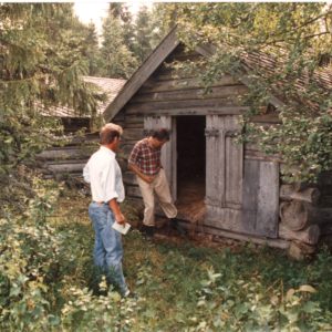
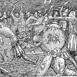

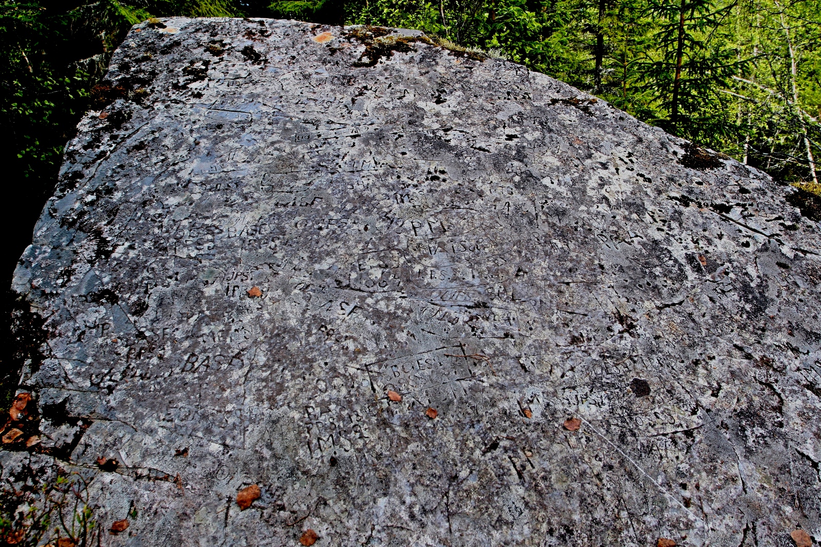
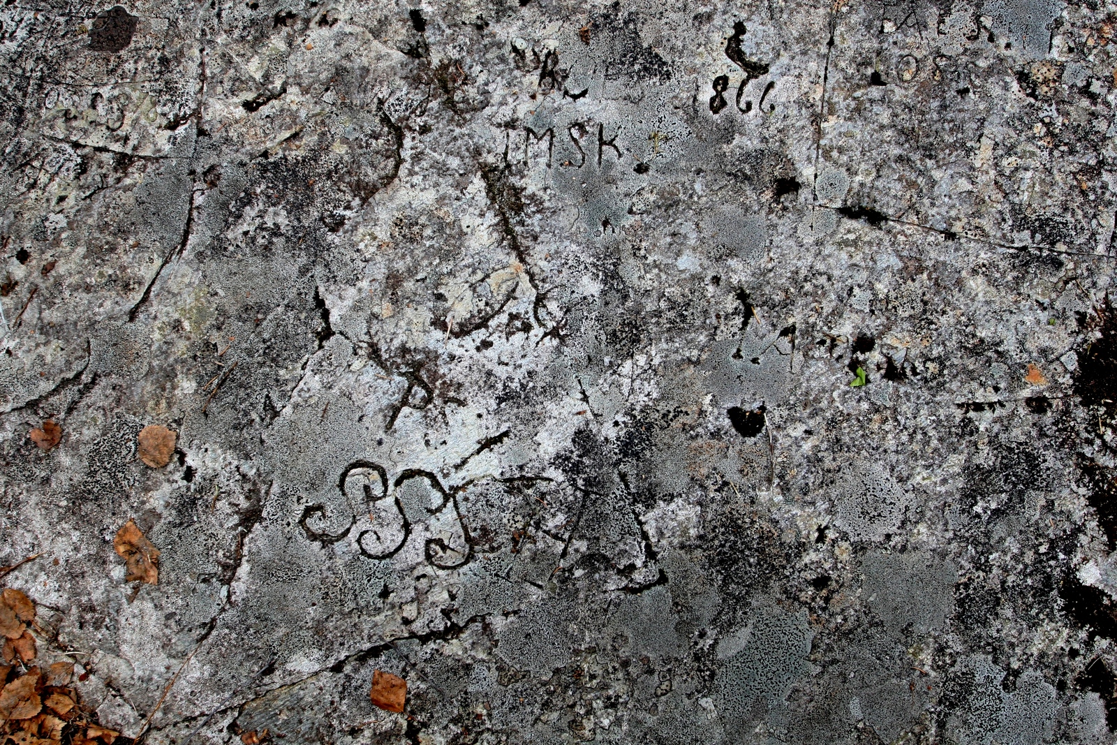
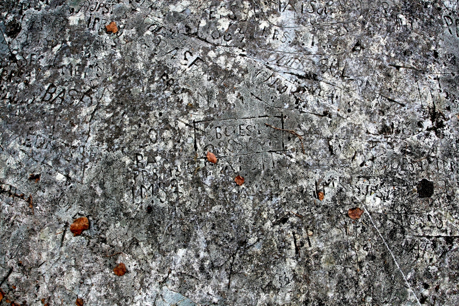
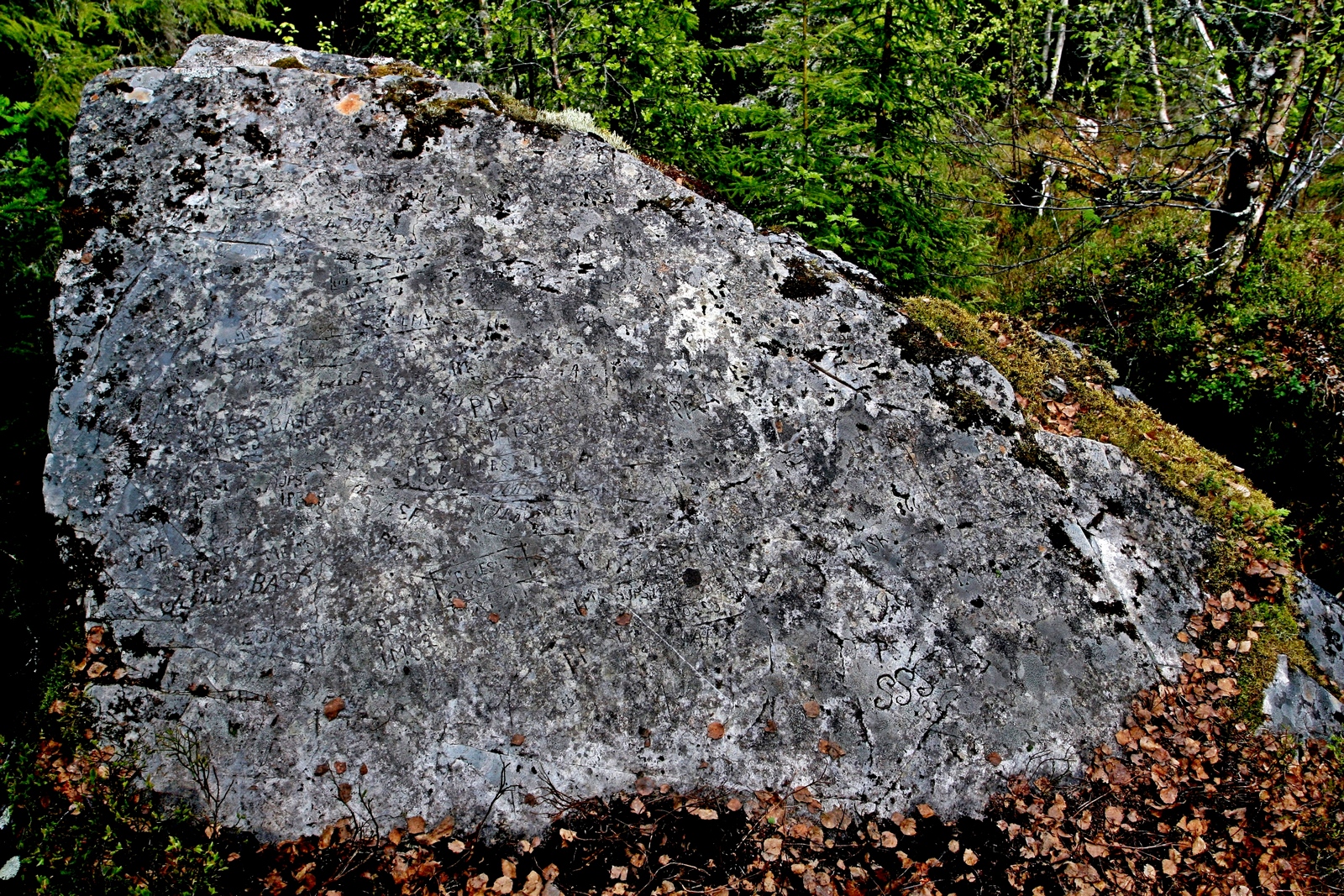
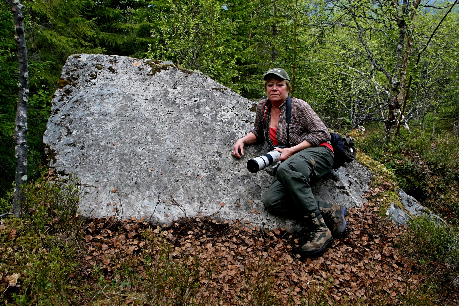
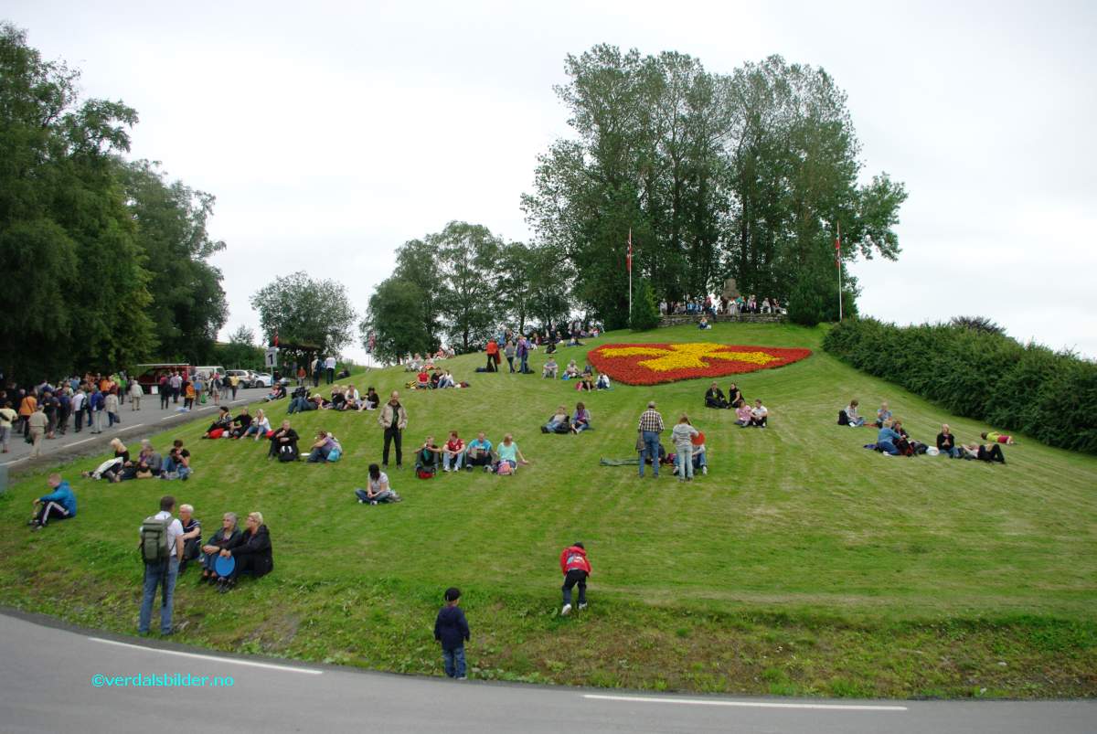
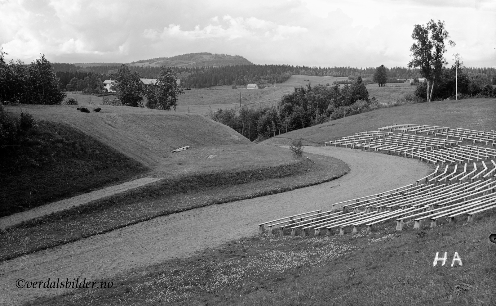
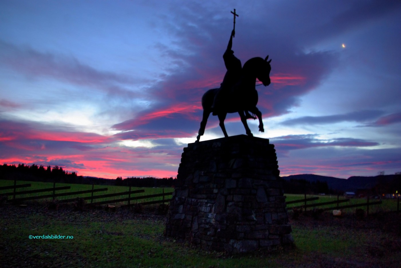